












Strategic assessment of the expansion of Chinese forward aviation infrastructure, the emergence of an interconnected South China Sea operating network, and the implications for surveillance, military persistence, maritime access and regional strategic stability.
Scope: This assessment examines developments verified or reported through 26 October 2026, concentrating on Antelope Reef, Hainan Island, the Paracel and Spratly Islands, their connections to the wider Indo-Pacific security environment, and the potential evolution of China’s operational posture through 2031.
Executive Summary — Bottom Line Up Front
Principal judgment. China’s development of a fifth major South China Sea airfield at Antelope Reef represents a potentially significant expansion of its forward military infrastructure, but its strategic effect will depend on the transformation of aviation access into sustained, integrated operational capacity.
Satellite reporting establishes approximately 5.9 square kilometres of reclaimed land and construction consistent with a major runway. The planned landing surface has been estimated at approximately 2,700 metres, potentially extending to 3,000 metres including overruns.
The existing network comprises Woody Island in the Paracels and Fiery Cross, Subi and Mischief reefs in the Spratlys. Antelope Reef would add a second major airfield within the Paracel group, increasing China’s geographical options for aviation and maritime-support activity.
The principal consequences would arise through stronger connections between Hainan, the Paracels and the Spratlys; a wider distribution of aircraft operating locations; potentially denser intelligence, surveillance and reconnaissance coverage; and greater flexibility in sustaining regional deployments.
The central limitation is operational readiness. A constructed runway does not establish the availability of fuel storage, maintenance systems, aircraft shelters, secure communications, mission support or reliable resupply.
Projections of runway paving during the first half of 2027 and an initial aircraft landing around mid-2027 are assessments by external observers, not confirmed Chinese milestones.
The strategic risk for other regional actors is a progressive change in the balance of surveillance, access and operational persistence, rather than an immediate or demonstrable transfer of military superiority.
Net assessment: Confidence is high that China is developing additional major aviation infrastructure; moderate that a completed Antelope facility would improve forward-operating flexibility; and presently limited regarding the scale, timing and military readiness of future deployments.
China’s Fifth South China Sea Airfield: How Antelope Reef Could Change the Balance of Power in the Indo-Pacific
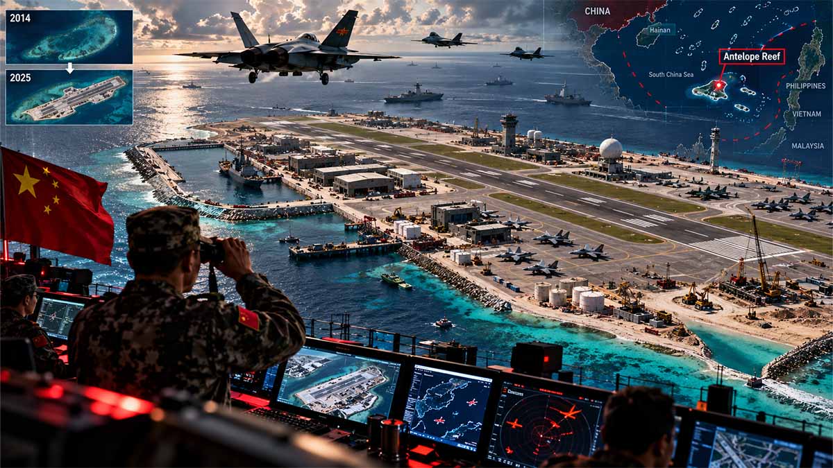
China is constructing a fifth major airfield in the South China Sea, but the strategic consequence is not another runway. It is the gradual conversion of contested maritime geography into a permanent system of aviation facilities, surveillance infrastructure and military logistics. At Antelope Reef in the Paracel Islands, approximately 5.9 square kilometres of reclaimed land are being prepared for a runway of roughly 2,700 metres. Satellite evidence published between August and October 2026 points to continuing construction, with initial aviation use projected for 2027. Beijing is expanding an infrastructure network that already stretches from Hainan through the Paracels to three major artificial-island bases in the Spratlys. The decisive question is whether this fifth installation will merely accommodate aircraft or give China a more persistent capacity to observe, support and contest military activity across the South China Sea.
Five Airfields Are Becoming a System of Military Presence
China already operates four major airfields across the South China Sea. Woody Island, in the Paracels, possesses a runway of approximately 2,700 metres. Farther south, Fiery Cross Reef, Subi Reef and Mischief Reef each have runways of approximately 3,000 metres. Antelope Reef would add a second major aviation location within the Paracels, strengthening the northern component of an infrastructure system whose southern facilities are already equipped for military and maritime-support functions.
The scale of the new construction is substantial. On 19 March 2026, the Center for Strategic and International Studies’ Asia Maritime Transparency Initiative estimated that China had reclaimed approximately 1,490 acres, or 6.03 square kilometres, at Antelope Reef. Its assessment of 14 August used a slightly lower measurement of 1,458 acres, equivalent to 5.9 square kilometres. Both figures place the development in the physical category of China’s largest South China Sea installations. Woody Island occupies approximately 890 acres, while Mischief Reef was measured at about 1,504 acres.
The project is therefore not simply a landing strip built on a remote reef. It is the creation of a large offshore platform capable of accommodating several categories of permanent infrastructure. Land area does not measure military readiness, but it determines how much physical development an installation can potentially support.
Antelope lies approximately 162 nautical miles from Sanya Port on Hainan and 216 nautical miles from Da Nang in Vietnam. Those distances do not establish aircraft response times or surveillance coverage. They do, however, identify the installation’s geographical importance: China is enlarging its permanent presence within an archipelago that it controls but whose sovereignty remains contested by Vietnam and Taiwan.
For Beijing, the benefit of another airfield is not necessarily a greater maximum operating range for individual aircraft. It is the ability to distribute activities among more locations, reduce dependence on particular facilities and potentially maintain selected operations closer to the areas in which they are needed.
The Runway Is Visible; the Military Base Is Not Yet Complete
Satellite observations show the distinction between China’s construction ambitions and its demonstrated capabilities. On 14 August 2026, CSIS identified approximately 4,300 feet of prepared runway alignment along the northwestern edge of Antelope Reef. The apparent width was consistent with the approximately 180-foot dimensions of China’s established major South China Sea airstrips. The imagery also identified foundations measuring roughly 200 by 200 feet that might accommodate a substantial aviation-support structure.
Commercial imagery collected by Vantor on 25 September and examined by Reuters on 2 October documented further grading, construction aggregates, compaction equipment and maritime deliveries through a newly built wharf. Analysis reported by Japan’s Asahi Shimbun on 25 October, based on work by DeepDive, indicated a prospective runway of approximately 2,700 metres, extending toward 3,000 metres when safety overruns are included. Those overruns cannot automatically be counted as usable runway.
External estimates suggest that paving might be completed during the first half of 2027 and an initial aircraft landing could occur around mid-2027. Neither milestone has been confirmed by Chinese authorities.
More importantly, a runway does not constitute a fully functioning military airbase. Sustained combat aviation requires fuel distribution, aircraft servicing, maintenance personnel, sheltered facilities, communications, spare parts and dependable resupply. Reuters reported in October that open-source analyst Ben Lewis had not identified construction consistent with the fuel and ammunition storage expected at a mature military installation of Antelope’s projected scale.
The distinction determines how the project should be valued militarily. A transport aircraft might eventually land at Antelope without the facility being capable of sustaining fighter deployments. An occasional reconnaissance flight would not establish permanent surveillance coverage. A completed hangar would not prove the readiness of aircraft assigned to it.
China’s earlier island construction demonstrates why these distinctions matter. A CSIS assessment published in December 2017 documented approximately 72 acres of additional construction across major Chinese South China Sea installations, including hangars, storage facilities and technical infrastructure. The original runways were only one stage in a wider process of developing operationally useful bases.
Antelope’s potential value will depend on whether China repeats that functional development, not merely whether its new runway reaches the projected length.
Surveillance Infrastructure Could Matter More Than Additional Fighters
China’s established island network has already evolved beyond aviation infrastructure. In December 2025, CSIS documented at least six fixed antenna-array areas installed during 2023 and 2024 across Fiery Cross, Subi and Mischief reefs. The assessment also identified equipment arrangements associated with possible electronic-warfare and surveillance functions, alongside two matching radomes completed at Subi Reef in early 2025.
These observations are significant because the ability to maintain military presence depends on information as well as aircraft. Additional collection sites may improve the continuity of maritime observation, allow information to be compared across different locations and support decisions concerning the movement of vessels and aircraft.
The operational mechanism is more demanding than merely extending radar coverage. Detection must be followed by identification, interpretation, communication and the availability of an appropriate response. A sensor-equipped installation can improve awareness without necessarily making forces capable of intervening more quickly.
Antelope could eventually strengthen the northern part of this surveillance architecture if China installs relevant equipment and demonstrates its integration with existing systems. No verified observation available through 26 October establishes that such capabilities are already operational there.
The importance of this wider infrastructure is illustrated by Chinese maritime militia activity. CSIS estimated an average monitored presence of 241 vessels per day in 2025, compared with 232 in 2024, across 12 observed South China Sea reefs. The increase was approximately 3.9%. Mischief and Whitsun reefs accounted for nearly half of the monitored presence, while Fiery Cross experienced a sharp decline from approximately 32 vessels per day in 2024 to almost none observed in 2025.
These figures reveal a differentiated maritime system. Fixed installations do not necessarily host identical forces or perform identical functions. They may support wider activity while vessels concentrate elsewhere.
An integrated Antelope facility could potentially add logistical and surveillance flexibility to this system. That would make China’s maritime presence more difficult to assess through ship numbers alone. But it would not establish continuous monitoring, guaranteed interception capability or uncontested control over surrounding waters.
China’s Physical Control Is Expanding Faster Than the Legal Settlement
Antelope’s construction has an immediate diplomatic consequence because China exercises physical control over the Paracels while Vietnam continues to claim sovereignty over the archipelago. On 21 March 2026, Vietnam’s Ministry of Foreign Affairs expressly rejected Chinese activities at Hai Sam Reef, the Vietnamese name for Antelope, without Hanoi’s permission.
The expansion therefore reinforces a contradiction at the centre of the South China Sea dispute: China can make its occupied positions materially more permanent without resolving the legal disagreements surrounding them.
Under Article 121 of the United Nations Convention on the Law of the Sea, the maritime status of a naturally formed feature depends on its original characteristics. Artificial reclamation cannot independently generate maritime entitlements that the original feature does not possess. Article 60 separately establishes that artificial islands do not acquire the legal status of natural islands or generate territorial seas of their own within the regime to which that article applies.
The 12 July 2016 South China Sea arbitral award clarified important questions concerning maritime entitlements and particular Chinese activities. It did not determine sovereignty over the Paracel Islands. The construction of Antelope must consequently be distinguished from both the specific findings of that arbitration and the unresolved territorial claims.
The legal confrontation remains active. On 12 July 2026, the tenth anniversary of the award, China’s Ministry of Foreign Affairs again rejected the tribunal’s conclusions and reaffirmed Beijing’s claims. Its statement responded to positions advanced by fourteen countries, including the United States, the Philippines, Australia, Japan, Italy, Germany and the United Kingdom.
Diplomacy has continued alongside construction. ASEAN and China held senior-official meetings in January and May 2026, followed by a Joint Working Group meeting in Manila on 19–21 August, as negotiations toward a South China Sea Code of Conduct continued. No completed, binding Code of Conduct emerged from those meetings in the record examined.
The institutional consequence is clear: infrastructure development is proceeding while the rules governing competing activities remain disputed. A new runway cannot settle those disagreements. It may nevertheless increase China’s practical ability to maintain a presence where they arise.
The Regional Balance Is Not Changing Equally for Every State
Vietnam faces the most direct geographical consequences from Antelope because the development is occurring within the Paracels. Additional Chinese aviation or surveillance capacity there could complicate Hanoi’s operating environment if the installation becomes fully functional.
The Philippines confronts a different problem farther south, where existing Chinese Spratly facilities already feature in maritime and aviation incidents. On 7 September 2026, according to the Philippine Coast Guard, an unarmed Philippine maritime-surveillance aircraft received radio challenges and encountered flare discharges associated with Chinese positions at Subi and Mischief reefs. The incident illustrates the potential for encounters involving established island infrastructure to create immediate safety and diplomatic risks.
These tensions operate within a wider security framework. The United States–Philippines Bilateral Defense Guidelines of 3 May 2023 reaffirmed that the 1951 Mutual Defense Treaty applies to armed attacks on either country’s armed forces, aircraft and public vessels, including coast-guard vessels, within the treaty’s applicable geographical scope. Washington and Manila reiterated their commitments in March 2025.
Japan and Australia participate in a wider pattern of security coordination. On 31 May 2025, the defence ministers of Australia, Japan, the Philippines and the United States issued a joint statement expressing concern about destabilising conduct in the East and South China seas.
These arrangements do not mean that China’s fifth airfield will trigger an allied military response. They establish that Beijing’s infrastructure expansion is occurring within a region where other governments have defence capabilities, political commitments and institutional mechanisms for coordination.
Nor does an additional Chinese base automatically create an effective capacity to exclude foreign forces. Detection is different from interception; interception is different from access denial; and the presence of an operating base does not establish survivability during a military confrontation.
The balance will depend on the interaction between Chinese operating capacity and the ability of other states to maintain lawful activity, exchange reliable information and manage encounters without uncontrolled escalation.
For European governments, the significance is principally legal and geopolitical. Italy, Germany and the United Kingdom were among the states identified in China’s July 2026 response concerning the arbitral award. France has distinct Indo-Pacific interests and responsibilities, but should not be assigned participation in that particular declaration without supporting evidence. None of these positions creates an identical military obligation for the four governments or a separate European Union defence commitment in the South China Sea.
By 2028, the Cost Will Be Measured in Operating Freedom
Over the next 12–24 months, through October 2028, Antelope Reef will provide an increasingly important test of whether China’s infrastructure expansion is translating into demonstrable military capability. A first landing would establish aviation access. Repeated aircraft movements, fuel and maintenance infrastructure, continuing maritime resupply and operational surveillance equipment would indicate a more consequential transformation.
The three outcomes should not be confused. Antelope might initially function as a limited staging location. It could subsequently develop into a sustained aviation-support installation. More significantly, it might become an integrated element of China’s wider intelligence and maritime operating network. Each outcome would impose different requirements on neighbouring states.
For Vietnam, the cost of inadequate preparation would be greater difficulty documenting and responding to Chinese activity around the Paracels. For the Philippines, the immediate burden remains the management of contested maritime encounters and the credibility of its security arrangements. For the United States and its partners, the cost would arise from operating in an environment where Chinese surveillance and forward-support capacity may become more persistent. For China, the additional infrastructure brings continuing logistical obligations and the risk that stronger forward presence produces more frequent confrontation.
None of these consequences can yet be assigned a defensible financial value or translated into a quantified reduction in military response time. The necessary operational data are not public.
The strategic change is nevertheless identifiable: China is accumulating the infrastructure required to make its South China Sea presence more permanent, more distributed and potentially harder to disrupt. The completion of Antelope Reef will not, by itself, establish Chinese dominance. But if the installation becomes operationally integrated with Hainan, Woody Island and the three major Spratly airfields, the practical burden of maintaining regional access and maritime awareness could increase for other states.
By October 2028, the decisive measure will not be whether China possesses five major runways. It will be whether the fifth has become a functioning part of a military system capable of sustaining operations that previously depended on fewer locations. Governments that mistake construction for completed capability risk overreacting; those that disregard the cumulative effects of operational integration risk discovering the new balance only after their freedom of action has narrowed.
Navigational Index — Three Strategic Pillars
Pillar I — The Physical and Institutional Architecture of China’s South China Sea Expansion
- Chapter 1. Antelope Reef: Satellite Evidence, Land Reclamation and the Emerging Fifth Airfield
- Chapter 2. From Hainan to the Spratlys: Infrastructure Geography, Sovereignty Disputes and the Militarisation of Artificial Islands
Pillar II — Operational Integration and the Changing Air-Maritime Balance
- Chapter 3. Forward Aviation, Aircraft Support and the Requirements of Sustained Military Operations
- Chapter 4. Maritime ISR, Early Warning, Operational Connectivity and Distributed Network Resilience
- Chapter 5. Regional Military Access, Crisis Response and the Strategic Consequences for Indo-Pacific Actors
Pillar III — Strategic Risk, Institutional Responses and the 2027–2031 Outlook
- Chapter 6. Legal Contestation, Regional Security Relationships and the Risks of Escalation
- Chapter 7. Construction Scenarios, Operational-Maturity Indicators and the Five-Year Strategic Outlook
- Chapter 8. Policy Options, Intelligence Priorities and Final Net Strategic Assessment
Master Abstract — The Emergence of an Interconnected Air-Maritime Infrastructure System
The construction of a major airfield at Antelope Reef should be interpreted within the progressive transformation of China’s South China Sea installations from physically dispersed territorial outposts into a potentially interconnected system of aviation, maritime logistics, surveillance and military-support facilities. The strategic significance of this transition lies in its capacity to change how and where Chinese forces operate, how consistently they maintain awareness of regional activity, and how rapidly they can translate information into an operational response. Unlike a purely quantitative addition to the existing inventory of runways, a new airfield located within the Paracels could enhance the flexibility of a network that already connects the northern South China Sea with forward installations in the Spratlys. Its potential contribution would be conditional on the development of the supporting infrastructure needed to sustain military activity rather than simply accommodate aircraft movements.
The most defensible interpretation of the evidence available through 26 October 2026 is that China is undertaking substantial construction consistent with a new major aviation facility, but has not publicly demonstrated that Antelope Reef is an operational military airbase. The CSIS Asia Maritime Transparency Initiative assessment of 14 August 2026 documented the emerging runway alignment, substantial reclamation and preparatory infrastructure. Reuters reporting of 2 October 2026, drawing on Vantor imagery from 25 September, identified continuing grading, construction-material accumulation and compaction activity. The subsequent analysis reported by Japan’s Asahi Shimbun on 25 October, attributed to the imagery-analysis organisation DeepDive, indicated a probable runway length of approximately 2,700 metres, with an overall alignment approaching 3,000 metres when overruns are included. The first two sources were directly inspected, while the Asahi findings were corroborated through DeepDive’s acknowledgement of the publication and contemporary reporting; the underlying Asahi article was not independently accessible.
These observations establish a physical development trajectory but do not resolve the principal military questions. Runway length provides only a preliminary indication of which aircraft categories might eventually be accommodated. It does not establish aircraft availability, basing decisions, fuel capacity, maintenance arrangements, operational tempo or effective command integration. A forward military airfield acquires its greatest strategic value when its aviation infrastructure is supported by reliable maritime supply, ground handling, secure communications, repair capacity and arrangements for exchanging operational information with other military facilities. Consequently, the eventual significance of Antelope Reef must be evaluated through the interaction of infrastructure maturity, logistical sustainability and network integration.
This distinction is especially important because China’s existing South China Sea installations already demonstrate the relevance of infrastructure beyond the runway itself. The December 2025 AMTI analysis identified further intelligence, surveillance, reconnaissance and electronic-warfare infrastructure at Fiery Cross, Subi and Mischief reefs, including additional antenna installations and radomes. These observations support the conclusion that the network’s development has involved surveillance and electromagnetic capabilities as well as aviation infrastructure. They do not establish that the same equipment has been installed or commissioned at Antelope Reef. China’s Spratly ISR and EW Upgrades — CSIS Asia Maritime Transparency Initiative — Dec 2025.
The operational implications for the wider Indo-Pacific would emerge through several interconnected mechanisms. Additional forward operating locations could support more distributed aviation deployments, reduce dependence on individual facilities and create alternative staging opportunities. A more extensive surveillance network could improve the geographical continuity of monitoring activities, while better-supported aircraft operations might increase the persistence of Chinese presence in contested areas. Such changes could narrow the practical operating flexibility of regional claimants and extra-regional naval and air forces by increasing the likelihood that their activities are observed, challenged or accompanied. These consequences would not necessarily imply uncontested Chinese control: the effectiveness of the network would remain dependent on supporting systems, operational readiness, coordination, geography and the actions of other states.
The distinction between military capability and political authority must also remain explicit. Physical construction does not settle disputes over sovereignty or maritime entitlements. China controls the Paracel Islands, while Vietnam and Taiwan maintain competing claims. The expansion of infrastructure can strengthen the practical capacity to exercise control or challenge other actors without resolving the underlying legal disputes. The strategic assessment must therefore distinguish the growing capacity to sustain a presence from any claim that such presence confers lawful jurisdiction over surrounding maritime areas.
The decisive 2027–2031 question is whether Antelope Reef becomes primarily an occasional aviation and logistical staging facility or develops into a mature, integrated forward-operating base. Both outcomes would expand China’s infrastructural options, but they would have different implications for regional surveillance, operational persistence and crisis response. The evidence supports an assessment of expanding physical capacity with potentially significant network effects; it does not presently support a quantified increase in sortie generation, surveillance range, interception performance or wartime survivability.
Key Evidence Table — Verified Baseline and Evidentiary Limits
The table separates established infrastructure characteristics, observations of construction and forward-looking estimates. Figures attributed to satellite interpretation retain the status of analytical measurements rather than official engineering specifications.
| Indicator | Value / status | Reference date | Definition and scope | Issuer / evidence origin | Exact source |
|---|---|---|---|---|---|
| Woody Island airfield | Approximately 2,700 m runway; operational | Baseline to Oct 2026 | Existing major Paracel aviation facility | AMTI; contextual reporting | CSIS AMTI — Aug 2026 |
| Fiery Cross Reef airfield | Approximately 3,000 m runway; operational | Baseline to Oct 2026 | Spratly aviation facility | AMTI | CSIS AMTI — Aug 2026 |
| Subi Reef airfield | Approximately 3,000 m runway; operational | Baseline to Oct 2026 | Spratly aviation facility | AMTI | CSIS AMTI — Aug 2026 |
| Mischief Reef airfield | Approximately 3,000 m runway; operational | Baseline to Oct 2026 | Spratly aviation facility | AMTI | CSIS AMTI — Aug 2026 |
| Antelope Reef reclamation | Approximately 5.9 km²; 1,458 acres in August assessment | 14 Aug 2026 | Satellite-derived landmass measurement | CSIS AMTI | Runway Assessment — Aug 2026 |
| Antelope Reef database figure | 1,490 acres | Available Oct 2026 | Separately published total reclamation measurement; different from August article | CSIS AMTI | Antelope Reef Feature Record |
| Initial apparent runway preparation | About 4,300 ft of worked alignment; width consistent with about 180 ft | 14 Aug 2026 | Preparatory earthworks, not completed paved runway | CSIS AMTI | Runway Assessment — Aug 2026 |
| Further construction activity | Grading, material accumulation, compaction and maritime deliveries | Imagery: 25 Sep 2026; reporting: 2 Oct 2026 | Continued runway-related construction | Vantor imagery; Reuters | Reuters — Oct 2026 |
| Antelope Reef projected runway | Approximately 2,700 m; about 3,000 m including overruns | Reported 25 Oct 2026 | Projected dimensions; not an official completed-runway specification | DeepDive, reported by Asahi Shimbun | DeepDive Publication Notice — Oct 2026 |
| Antelope Reef completion | Paving possible in first half of 2027; initial landing around mid-2027 | Estimate published 2 Oct 2026 | Expert projection, not confirmed schedule | Ben Lewis / Reuters | Reuters — Oct 2026 |
| Fuel and ammunition infrastructure | Required supporting facilities not yet established by cited observations | 2 Oct 2026 | Publicly observable evidence remains insufficient | Ben Lewis / Reuters | Reuters — Oct 2026 |
| Existing Spratly ISR/EW development | Additional antenna arrays, vehicle-support areas and radomes documented | Dec 2025 | Evidence of network capabilities beyond runways, not evidence of Antelope installations | CSIS AMTI | ISR and EW Upgrades — Dec 2025 |
Two quantitative distinctions warrant particular attention. First, the August measurement of 1,458 acres is approximately 5.90 square kilometres, while the separate feature-database value of 1,490 acres is approximately 6.03 square kilometres. The difference should be retained rather than silently averaged; the available records do not establish whether it reflects measurement boundaries, updating or a different observation basis. Second, a projected 2,700-metre landing surface must not be described as a verified 3,000-metre usable runway merely because safety overruns extend the overall construction alignment.
The difference between a runway that is physically present and one that is operationally available is equally consequential. The established operational status of China’s four existing major airfields does not imply identical readiness or mission-support capacity at all four sites, while Antelope Reef remains in an earlier developmental category.
Competing Development Pathways — What the Fifth Airfield Could Actually Change
The available evidence supports three distinct but potentially overlapping development pathways. They are not mutually exclusive explanations of China’s intentions, nor is the public record sufficient to assign numerical probabilities. Their analytical purpose is to identify what additional observations would distinguish a completed aviation facility from a genuinely consequential expansion of China’s military operating network.
A forward aviation-access facility without full basing capacity
Under the first pathway, Antelope Reef becomes an additional location for aircraft landing, temporary deployment, diversion and logistical staging, while retaining substantial dependence on other installations for maintenance, fuel provision and comprehensive mission support.
This pathway would nevertheless have operational value. It could increase the number of locations available to Chinese aircraft and improve flexibility in planning deployments across the northern South China Sea. Aircraft would not necessarily need to be permanently stationed at Antelope for the airfield to contribute to the wider system.
Its limitations would be substantial. Without dependable on-site replenishment, servicing and protected aircraft facilities, the installation would be unable to sustain the intensity or continuity associated with an established forward military airbase. The completed runway would expand options without necessarily generating a commensurate increase in persistent operational presence.
The evidence currently supports construction toward this level of capability, but not its completion.
A mature dual-use logistics and aviation-support installation
The second pathway would involve progressive development of fuel arrangements, aircraft parking, maintenance infrastructure, maritime resupply, communications and other support facilities, enabling recurring aviation and maritime activity.
This would represent a more substantial military development because it would transform the site from an additional physical landing location into a functioning element of China’s forward-support architecture. The relevance would extend beyond the aircraft using the runway. A sufficiently developed installation could also support maritime surveillance, communications and logistical activities that contribute to the persistence of naval and other maritime operations.
The available evidence of wharf infrastructure, construction-material deliveries and possible hangar preparation is compatible with such a trajectory, but does not establish that it has been adopted or completed.
China’s publicly reported civilian rationale, encompassing meteorological and maritime research functions, remains an alternative account of intended use. Civilian and military functions are not necessarily exclusive, particularly when infrastructure can support several forms of aviation and maritime activity. Nevertheless, the physical dimensions of the projected runway and the resemblance to existing Chinese installations warrant continued examination of its potential military application. Attribution of intentions must remain separate from the observation of construction.
An integrated node in a persistent air-maritime surveillance and operating network
The third pathway is strategically the most consequential. Under this development, Antelope Reef would not merely accommodate aircraft or support occasional operations; it would become a functional node connected to other Chinese airfields, maritime-support facilities, surveillance installations and military command arrangements.
The significance would arise from network effects. A wider distribution of operating locations could improve flexibility and resilience; appropriately equipped surveillance sites and deployed aircraft could contribute to more continuous observation; and improved logistical support could enable Chinese military and maritime-security forces to sustain operations over longer periods.
The established development of ISR and electronic-warfare infrastructure at the Spratly outposts makes this pathway analytically credible. It does not demonstrate that equivalent systems are already present at Antelope or that the future installation has an assigned role within an integrated command architecture.
This third pathway would represent the most important strategic transformation, but it is not yet an established operational outcome.
The distinction matters because otherwise the assessment would attribute the full capabilities of a future military network to an unfinished construction project.
The appropriate judgment is therefore that China is expanding the physical foundations from which a stronger operational network could emerge. The extent of that emergence remains contingent on observable developments.
Principal Intelligence Gaps and Strategic Watch Indicators
The most consequential uncertainty concerns the relationship between infrastructure completion and operational maturity.
The projected construction schedule provides an initial monitoring horizon, particularly during the first half of 2027, but visible runway paving would answer only one question. Satellite observations establishing a continuous paved surface and completed runway markings would strengthen the assessment of progress toward aviation use. Documented aircraft landings would establish actual use, though not necessarily recurring operations or permanent basing. Repeated aircraft activity accompanied by identifiable servicing facilities and sustained logistical deliveries would provide stronger evidence of operational maturity.
The second gap concerns the supporting aviation infrastructure. The current record does not establish the capacity or completion status of fuel storage, aircraft maintenance facilities, shelters or ammunition-support arrangements at Antelope Reef. Future high-resolution imagery could clarify the physical development of these facilities, although imagery alone may remain insufficient to determine their internal functions, capacity or actual readiness.
The third gap concerns surveillance and communications. No verified observation in the reviewed record establishes that Antelope already possesses an operational ISR or electronic-warfare capability comparable to the systems analysed at Fiery Cross, Subi and Mischief reefs. Future identification of radar installations, antenna arrays or other communications infrastructure would change the assessment of the site’s likely operational role. A more consequential threshold would be evidence that such systems were not merely installed but operationally connected to existing maritime and air-surveillance arrangements.
The fourth gap concerns logistics and sustainment. Maritime deliveries observed during construction establish the availability of a transport channel but not its capacity to sustain military operations. Evidence of permanent supply infrastructure, recurring replenishment activity and associated support facilities would strengthen the judgment that Antelope is evolving toward a persistent forward-operating role. Conversely, an extended period in which the runway is completed but supporting infrastructure remains limited would weaken expectations of rapid military integration.
The final gap concerns the relationship between Chinese infrastructure development and the actions of other regional actors. A stronger Chinese operating network could impose additional surveillance and response burdens on nearby states, but its effect would depend partly on whether those states improve their own maritime awareness, coordination and operational resilience. The geographical position of Chinese installations alone cannot establish changes in the overall regional balance without examining the availability and effectiveness of competing capabilities.
These gaps define a practical distinction between three kinds of evidence: completed infrastructure, demonstrated operations and sustained operational performance. Confidence in assessments of China’s future posture should increase only when observations move progressively across those categories.
Strategic Relationship Visualisation — Infrastructure, Integration and Operational Consequences
The verified record supports a qualitative relationship scheme linking China’s existing airfield network, the emerging Antelope facility, the supporting infrastructure necessary for integration and the possible operational consequences. It does not support a quantitative chart of aircraft coverage, response times, surveillance radii or sortie generation.
The following WordPress component therefore represents functional relationships, not geographical distances or confirmed military data links. The solid relationships identify the established geography of existing installations; the conditional relationships identify functions that would depend on future infrastructure and demonstrated operational integration.
China’s South China Sea Airfield Network
Verified infrastructure baseline and conditional pathways to operational integration | 26 October 2026
Hainan Island
Potential rear-area connection for distributed forward operations.
Paracel Islands
Spratly Islands
Potential network-level effects
Additional staging and alternative operating-location options.
Potentially more persistent ISR collection if aircraft and sensing systems are deployed and integrated.
Reduced reliance on individual locations where usable alternatives and sufficient logistics exist.
Solid blue panels identify existing operating geography and airfield infrastructure. The amber dashed panel identifies Antelope Reef as an uncompleted facility. The lower panel illustrates conditional analytical effects, not established Chinese operational assignments or confirmed data links.
Sources: CSIS AMTI, 14 August 2026; Reuters, 2 October 2026; DeepDive, 25 October 2026; CSIS AMTI, 2 December 2025.
Principal Assessment — The Strategic Direction of China’s Aviation Expansion
The decisive implication of Antelope Reef is that China’s investment in South China Sea infrastructure is expanding from the improvement of existing major installations toward the creation of additional operating locations within an already militarised regional architecture. The new project may increase the flexibility of Chinese deployments even before it becomes capable of supporting a fully developed military aviation presence. Over a longer horizon, the addition of appropriate logistical, surveillance and command-support systems could allow China to improve the continuity of operations connecting Hainan, the Paracels and the Spratlys.
The network effect is especially important because air and maritime influence in the South China Sea cannot be assessed solely by the maximum reach of individual aircraft or vessels. Operational influence depends on whether forces can be present when needed, whether they receive timely information, whether their activities can be sustained and whether operating locations remain available during periods of increased tension. Additional infrastructure has the potential to strengthen each of these functions, but only when the supporting systems are operationally mature.
For regional coastal states, this creates a possible evolution in the relationship between surveillance, warning and response. A more persistent Chinese presence could increase the frequency with which regional maritime and aviation activity is detected or encountered. It could also permit Chinese forces to operate from a wider selection of locations, potentially complicating the planning assumptions of other actors. Nevertheless, the effect on warning and response timelines remains conditional, and no credible quantitative reduction can be established from the reviewed construction evidence.
For extra-regional actors, including the United States and its security partners, the potential consequence is a progressively more infrastructure-intensive operating environment. Additional Chinese forward facilities may increase surveillance opportunities and make sustained regional presence more demanding. This is not equivalent to an established ability to deny access to the South China Sea, nor does the fifth airfield independently alter the legal freedoms of navigation and overflight. It would instead contribute to the accumulation of Chinese operating options that other military forces must consider when assessing their ability to maintain presence during routine operations or periods of confrontation.
Legal and operational assessments must remain separate. The territorial claims involving the Paracels remain contested, and no amount of new construction independently settles them. Conversely, the absence of an agreed sovereignty settlement does not prevent China from developing infrastructure on territory it physically controls. The strategic problem for other states therefore lies in the potential divergence between contested legal authority and China’s growing practical capacity to maintain a presence.
The most consequential policy implication is the need to distinguish the observable expansion of China’s physical infrastructure from the future emergence of operational capabilities that are not yet demonstrated. Overestimating Antelope Reef’s readiness could distort threat assessments and operational planning. Underestimating the cumulative effects of geographically distributed and increasingly interconnected facilities could be equally misleading.
As of 26 October 2026, the construction of Antelope Reef supports a clear assessment of expanding Chinese forward-aviation infrastructure, but not a conclusion that a fifth fully functioning military airbase has entered service. The principal strategic change lies in the possibility that this new installation will strengthen an existing network whose value derives from persistence, information collection, logistical connectivity and distributed operating options. Its eventual military significance will be determined not by the completion of the runway alone, but by whether China converts the reclaimed reef into an integrated and sustainable operational node.
CHINA’S FIFTH SOUTH CHINA SEA AIRFIELD
Antelope Reef and the Transformation of Regional Air-Maritime Power. A comparative assessment of existing runway infrastructure, emerging reclamation works, aviation readiness, intelligence and surveillance integration, and the conditional development of a distributed Chinese operating network across the South China Sea.
3D Runway Length Comparison
Four existing major airfields are compared with the projected Antelope Reef landing surface. Runway overruns are excluded from the main comparison because they are not automatically usable runway length.
Hainan–Paracels–Spratlys: The Distributed Airfield Network
China’s forward aviation infrastructure spans mainland support geography and island installations across the northern and southern South China Sea. Geographic grouping is established; the degree of operational integration is not independently demonstrated by the existence of runways alone.
HAINAN ISLAND
Mainland support geography
PARACEL ISLANDS
Northern forward aviation geography
SPRATLY ISLANDS
Southern forward aviation geography
3D Military Airbase Readiness Architecture
A completed runway is only one part of an operational military airbase. These six functional blocks distinguish visible construction from the supporting requirements for sustained aviation and maritime activity. They are not readiness scores.
RUNWAY AND AVIATION SURFACE
Satellite observations support substantial runway-related preparation. A completed usable landing surface has not yet been demonstrated.
MARITIME ACCESS AND RESUPPLY
Wharf infrastructure and maritime delivery of construction materials are documented. Sustained military resupply capacity remains unestablished.
AVIATION FUEL INFRASTRUCTURE
Public observations do not yet demonstrate the storage and distribution infrastructure necessary for sustained aircraft activity.
MAINTENANCE AND AIRCRAFT SHELTERS
Preparatory structures have been interpreted as potentially consistent with aviation support. Completed maintenance capacity is unverified.
ISR AND EARLY-WARNING INTEGRATION
Surveillance developments are documented at existing Spratly installations. Comparable operational systems at Antelope Reef are not established.
SUSTAINED AVIATION OPERATIONS
Repeated aircraft deployments, servicing, mission support and sustained military activity have not been demonstrated at Antelope Reef.
Satellite Observations and Conditional 2027 Milestones
The sequence separates dated observations from reported technical interpretations and future projections.
AMTI Assessment
Approximately 5.9 km² of reclamation and grading consistent with a major runway alignment were documented.
Satellite Imagery / Reuters
Additional grading, compaction, construction materials and maritime deliveries were reported.
Asahi / DeepDive Analysis
Reported runway interpretation: approximately 2,700 metres, with an overall alignment approaching 3,000 metres including overruns.
External Projection
Possible paving completion and initial aircraft landing. Neither is a confirmed milestone or proof of operational readiness.
Airfield Infrastructure, Status and Strategic Interpretation
The comparative table preserves the distinction between operating airfields, runway construction and future military capabilities.
| Installation | Geography | Runway | Status as of Oct 2026 | Network significance | Evidence qualification |
|---|---|---|---|---|---|
| Woody Island | Paracels | ~2,700 m | Operational | Existing northern forward aviation location | Runway status does not quantify sortie capacity |
| Fiery Cross Reef | Spratlys | ~3,000 m | Operational | Southern aviation infrastructure and established ISR development | No assumed aircraft inventory or readiness rate |
| Subi Reef | Spratlys | ~3,000 m | Operational | Southern aviation infrastructure and established ISR development | No assumed aircraft inventory or readiness rate |
| Mischief Reef | Spratlys | ~3,000 m | Operational | Southern aviation infrastructure and established ISR development | No assumed aircraft inventory or readiness rate |
| Antelope Reef | Paracels | ~2,700 m projected usable length | Under construction | Potential additional northern operating location and network redundancy | Operational integration and sustained basing remain unverified |
Comparative figures are approximate. The chart and table do not establish usable take-off distance under specific conditions, aircraft compatibility, fuel availability, sortie-generation rates or wartime resilience.
From a Fifth Runway to the Regional Operational Balance
The decisive analytical issue is how new infrastructure could affect Chinese operational options. These mechanisms are conditional and do not indicate already achieved capabilities.
A completed runway could provide an additional aircraft landing and staging location in the Paracels.
Fuel, servicing, maintenance and resupply arrangements could convert episodic access into recurring operational support.
Deployed surveillance systems and effective information exchange could contribute to more continuous situational awareness.
Greater persistence, distributed operating options and improved surveillance could alter other actors’ freedom of action.
Infrastructure Expansion Is Established. Operational Transformation Remains Conditional.
Antelope Reef represents an expansion in the physical foundations of China’s South China Sea aviation network. Its potential strategic value arises from complementing Woody Island in the Paracels and increasing the range of operating options within a geographically distributed infrastructure system extending toward the Spratlys.
The decisive future indicators are runway completion, supporting fuel and maintenance infrastructure, maritime sustainment, communications and surveillance integration, and demonstrated recurring aircraft operations. Without these elements, physical construction should not be equated with sustained military capability.
The central strategic risk is a progressive improvement in China’s ability to observe, support and sustain forward operations, rather than an immediate transformation of the regional military balance.
PILLAR I — THE PHYSICAL AND INSTITUTIONAL ARCHITECTURE OF CHINA’S SOUTH CHINA SEA EXPANSION
Information cut-off: 26 October 2026 | Assessment horizon: 2027–2031
Chapter 1. Antelope Reef: Satellite Evidence, Land Reclamation and the Emerging Fifth Airfield
The Physical Transformation of Antelope Reef and the Strategic Significance of New Land Creation
China’s construction activity at Antelope Reef represents one of the most consequential recent physical transformations of its occupied positions in the South China Sea. The significance of the project is not confined to the prospective addition of an aviation installation. It lies in the deliberate conversion of a previously limited reef outpost into a substantially enlarged artificial landmass capable of accommodating infrastructure of a scale previously associated primarily with China’s major established military positions. By 26 October 2026, the available evidence establishes a substantial reclamation programme, progressive preparation of an apparent runway alignment, construction-related maritime infrastructure and the early development of supporting facilities. It does not establish the completion of a fully functioning aviation base. This distinction provides the central analytical foundation for assessing the project: Beijing has materially expanded the physical possibilities of Antelope Reef, while the degree to which those possibilities have been converted into sustained military capacity remains dependent on subsequent construction, equipment installation and operational use.
Antelope Reef, identified in Chinese records as Lingyang Jiao and in Vietnamese as Đá Hải Sâm, is located within the Crescent group in the southwestern Paracel Islands. The CSIS Asia Maritime Transparency Initiative identifies the feature at approximately 16°27′45″ N, 111°35′20″ E. Its position is significant because it occupies a part of the northern South China Sea already subject to established Chinese administrative and security activity, rather than an isolated location requiring the creation of an entirely new regional presence. AMTI’s March 2026 geographical assessment placed the reef approximately 162 nautical miles from Sanya Port in Hainan and 216 nautical miles from Da Nang in Vietnam. Those measurements are geographical reference distances rather than operational aviation ranges, and they cannot independently establish aircraft endurance, response times or military coverage. Nevertheless, they reveal a basic geographical characteristic: Antelope is located within a maritime space where Chinese infrastructure development and Vietnamese territorial interests are directly juxtaposed. Antelope Reef — CSIS Asia Maritime Transparency Initiative — feature record; Antelope Reef Could Now Be the Largest Island in the South China Sea — CSIS AMTI — March 2026.
The scale of China’s land reclamation is particularly important because it changes the range of infrastructure that can physically be accommodated at the installation. In its assessment of 19 March 2026, AMTI used commercial satellite imagery from Vantor to estimate approximately 1,490 acres, equivalent to roughly 6.03 square kilometres, of reclaimed land. This was already greater than the approximately 890 acres attributed to Woody Island and close to the 1,504 acres reported for Mischief Reef, China’s largest established artificial-island outpost by the comparison used in that analysis. The numerical relationship is revealing: the reported Antelope landmass was approximately 67% larger than Woody Island’s, while falling just 14 acres short of Mischief Reef’s reported area. These figures do not establish equivalence in construction quality, usable building area or military capacity, because reclaimed land varies in configuration, stability, access and the demands imposed by subsequent engineering. They do, however, establish that Antelope had already entered the physical size category associated with China’s most substantial South China Sea installations. The description of Antelope as a relatively minor reef outpost had therefore ceased to represent the engineering reality visible in early 2026. Antelope Reef Could Now Be the Largest Island in the South China Sea — CSIS AMTI — March 2026.
The subsequent August assessment introduced a numerical discrepancy that must be preserved rather than concealed. AMTI’s 14 August publication described the landmass as measuring 1,458 acres, or approximately 5.90 square kilometres, and stated that the major reclamation and dredging operations appeared complete at the time of the imagery reviewed. The corresponding feature database continued to display 1,490 acres. The March and August figures therefore differ by 32 acres, approximately 0.13 square kilometres. Because the smaller estimate appears in the later dated analytical article, the discrepancy cannot responsibly be interpreted as evidence of a straightforward increase or decrease in reclaimed land. Differences in the imagery used, the delineation of shorelines, the inclusion of partially reclaimed margins or later database maintenance could potentially explain the divergence, but none of those explanations is independently established by the published record. The defensible conclusion is that both figures identify a landmass of approximately six square kilometres, while the precise reconciled measurement remains unresolved. Treating 5.9 square kilometres as the dated August estimate and approximately 6.03 square kilometres as the separate AMTI database figure preserves the distinction between documented observation and unsupported numerical reconciliation. Is a New Chinese Runway Taking Flight at Antelope Reef? — CSIS AMTI — August 2026; Antelope Reef — CSIS AMTI — feature record.
The relationship between reclamation and subsequent construction explains why the dimensions of the new landmass matter. Artificial-island development does not merely create space on which buildings can be placed. It establishes the physical geometry within which runways, roads, maritime facilities, storage installations, accommodation, utilities and other permanent infrastructure must coexist. Each category of infrastructure competes for usable ground and imposes distinct technical requirements. Aviation surfaces require sufficiently continuous and appropriately prepared alignments; port facilities require suitable waterside access; buildings and support facilities require foundations, roads and utility connections; and the entire installation remains dependent on reliable maritime deliveries. Consequently, the size of Antelope Reef should not be treated as an independently sufficient measure of military value. The important consideration is the interaction between total reclaimed area, the arrangement of usable surfaces, coastal access and the sequencing of permanent construction. AMTI’s March assessment identified an extended straight northwestern edge, while the August assessment documented earthworks consistent with exploiting that geometry for a runway. The sequence supports the interpretation that the configuration of the reclaimed landmass is related to the anticipated aviation role, although the public imagery cannot establish the complete underlying engineering design.
The Satellite Evidence: From Reclamation to Runway Preparation
The construction chronology is sufficiently developed to distinguish several stages without imposing a completed-project narrative on incomplete evidence. AMTI reported that major dredging at Antelope Reef began in October 2025. Its March 2026 examination documented extensive reclamation, preliminary construction and the appearance of more than 50 small grey-roofed structures and a helipad near the lagoon entrance. It also identified foundations for a larger structure measuring approximately 100 by 60 yards in the southern part of the lagoon, where several jetties had emerged. These observations are important because they establish that the development was not confined to filling a reef with sand or constructing a single prospective runway. China had already begun creating the working infrastructure needed to maintain a substantial construction site, accommodate personnel, receive materials and establish a more durable presence. The functions of individual structures cannot all be determined from satellite appearance; some could be temporary construction facilities rather than permanent installations. Their collective significance is that a small outpost had become an extensive engineering programme with simultaneous activity across different parts of the reef. Antelope Reef Could Now Be the Largest Island in the South China Sea — CSIS AMTI — March 2026.
The 14 August 2026 imagery marked a more specific change in the evidentiary record. AMTI identified work along the northwestern edge of the reclaimed landmass that it interpreted as the likely beginning of runway construction. The alignment was consistent with the approximately 180-foot width of China’s existing major South China Sea airstrips. The visibly worked section extended approximately 4,300 feet, or 1.31 kilometres, at that stage. The surrounding geography appeared capable of accommodating a substantially longer straight runway alignment, while other earthmoving farther north suggested preparations to extend construction along the edge. Importantly, the assessment explicitly recorded that concrete or other paving material had not yet been laid. The evidence therefore supported identification of probable runway preparation, not a completed runway. A graded surface whose dimensions resemble aviation infrastructure is strong evidence of intended function when considered with surrounding works, but it remains a different evidentiary category from a certified operating surface or an airfield shown to receive aircraft. Is a New Chinese Runway Taking Flight at Antelope Reef? — CSIS AMTI — August 2026.
The same August imagery provided additional information about the development of supporting structures. AMTI identified excavation adjacent to the expected runway alignment corresponding to a foundation approximately 200 by 200 feet, dimensions resembling those of larger hangars at existing Chinese South China Sea airstrips. The shape and location made an aviation-support purpose plausible, but the observation cannot demonstrate that the planned structure would ultimately be an aircraft hangar, let alone specify its capacity, protected functions or operational availability. The imagery also showed an administrative area at the eastern tip of the reef, south of the channel entering the lagoon, where buildings, green areas and paved parking were progressively replacing the appearance of a temporary frontier construction site. Two concrete-production plants had appeared during late spring near different edges of the lagoon. Those facilities are consequential because the transition from reclamation to permanent construction requires a continuous supply of construction materials; concrete-production capacity located close to the building sites can support multiple infrastructure projects without establishing what their eventual military functions will be. These findings were documented directly in AMTI’s dated assessment. Is a New Chinese Runway Taking Flight at Antelope Reef? — CSIS AMTI — August 2026.
The satellite evidence available from September reinforces the conclusion that work had advanced beyond initial site shaping. Commercial imagery collected by Vantor on 25 September 2026 and examined in reporting published by Reuters on 2 October 2026 showed continuing land grading, accumulations of gravel and concrete, compaction equipment and construction-related maritime deliveries. Reuters described a loaded gravel barge approaching the newly built wharf. These observations matter because they connect the emerging aviation surface to the practical process of constructing and supporting infrastructure on reclaimed ground. The movement of materials through maritime facilities, followed by their preparation and placement across the reclaimed area, indicates the existence of an organised construction supply chain. It does not demonstrate that the same facilities are already capable of sustaining military aircraft or naval deployments. The distinction is especially important because construction logistics and military operational logistics have different performance requirements: a wharf capable of receiving building materials is not automatically equivalent to a fully developed naval replenishment facility, just as the ability to stockpile construction aggregates does not demonstrate the availability of aviation fuel or maintenance equipment. Chinese Work Gathering Pace on Antelope Reef in South China Sea, Latest Satellite Images Show — Reuters — October 2026.
The most recent analytical material considered in this chapter was reported on 25 October 2026, when Japan’s Asahi Shimbun published findings based on satellite-image analysis by DeepDive. The organisation itself acknowledged the publication of its analysis, confirming the relationship between the research provider and the Japanese newspaper. Contemporary reporting attributed to the assessment identified a prospective principal runway length of approximately 2,700 metres, with a total alignment approaching 3,000 metres when overruns are included. It also described land near the runway that appeared to have been levelled for an aircraft parking apron. The evidence is consistent with a major aviation installation but must retain its precise attribution. DeepDive’s notice confirms publication of the analysis; the detailed runway dimensions are available through reporting on the Asahi findings rather than through a directly inspected technical report containing the complete underlying measurements. The exact usable runway length, the final engineering configuration and the readiness of the proposed apron therefore remain projected characteristics, not confirmed specifications of a completed airfield. DeepDive Analysis Published in Asahi Shimbun — DeepDive — October 2026; Construction of 3,000-Meter-Class Runway on Artificial Island in South China Sea Spotted — The Asia Business Daily — October 2026.
This distinction between the measured alignment and its usable aviation component has implications beyond terminology. The length of a runway and the length of an alignment that includes overruns are different technical quantities. Safety overruns cannot automatically be added to operational runway length to infer take-off performance, landing performance or aircraft compatibility. Moreover, the ability of a given aircraft to operate from an airfield depends on variables not provided in the available Antelope record, including pavement characteristics, loading, available ground services and operational conditions. Claims that a projected long runway could potentially accommodate transport or surveillance aircraft should therefore be understood as broad assessments of possible design suitability, not proof of future deployments. The same caution applies even more strongly to assumptions about aircraft permanently based at the facility. No open-source evidence examined for this chapter establishes a Chinese decision to station specific aviation units at Antelope Reef, and no aircraft inventory should be inferred from the physical appearance of an unfinished runway.
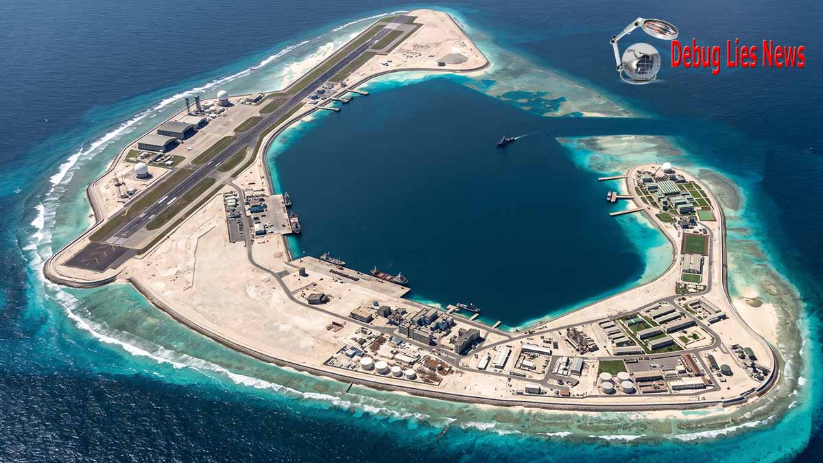
Notice: This image is a computer-generated 3D realistic visual reconstruction created and owned by debuglies.com © 2026. All rights reserved.
The visualization reconstructs the completed land reclamation, strategic airstrip infrastructure, and port facilities at Antelope Reef (Paracel Islands / South China Sea; China: Lingyang Jiao, 羚羊礁; Vietnam: Đá Hải Sâm). Based on satellite analysis and open-source intelligence monitoring, the rendering illustrates the ~1,490-acre reclaimed atoll perimeter, internal lagoon access channel, hangars, and operational runway configuration in true proportions.
- Visual Concept & 3D Reconstruction: debuglies.com
- Primary Source Material & Satellite Tracking: CSIS / AMTI / Vantor
- Geographic Coordinates: 16° 27′ 45″ N, 111° 35′ 20″ E
- Usage Terms: Any unauthorized reproduction, commercial distribution, or use without prior written consent and formal attribution to debuglies.com is strictly prohibited.
The Engineering Architecture: Surface Preparation, Maritime Access and Permanent Construction
A major analytical limitation in satellite-based infrastructure assessments is the difference between visually identifiable construction and the less visible engineering systems needed to make that construction durable. The imagery examined during 2026 establishes extensive earthmoving, apparent runway preparation, construction staging areas, maritime access and growing permanent-looking structures. It does not provide a complete engineering assessment of the reclaimed substrate, pavement strength, foundation design, drainage, utility capacity or long-term maintenance requirements. These elements are relevant because the transformation of reef material into a stable aviation installation requires far more than the creation of a sufficiently long flat surface. An airfield intended for recurring use must be capable of maintaining its operating surfaces, accommodating aircraft ground movements and preserving access to essential support facilities over time. Without engineering drawings, construction specifications or validated operating observations, the public record cannot quantify these characteristics or establish when they will satisfy military requirements.
The lagoon and maritime access deserve particular attention within Chapter 1 because they explain how a large reclaimed installation can be physically built and maintained. AMTI’s March assessment argued that Antelope’s lagoon offered substantially greater spatial potential than the harbours available at several other positions in the Crescent group. That observation supports the interpretation that the reef’s ultimate infrastructure role may extend beyond aviation. A large lagoon potentially offers space for port-related facilities, sheltered operations and logistical activity, but its usefulness depends on channel characteristics, quay construction, dredged depths, approaches and completed support installations. The reviewed record does not justify deriving a verified naval berthing capacity or assigning particular classes of vessels to the facility. It establishes a substantial maritime-infrastructure opportunity and documentary evidence that maritime construction access had become functional. The conversion of that opportunity into sustained naval or coast-guard support would require further visible construction and operational confirmation. Antelope Reef Could Now Be the Largest Island in the South China Sea — CSIS AMTI — March 2026; Chinese Work Gathering Pace on Antelope Reef in South China Sea, Latest Satellite Images Show — Reuters — October 2026.
The permanent infrastructure programme also requires electricity, water, communications, accommodation and facilities capable of sustaining personnel over extended periods. These functions are not interchangeable with their construction-stage equivalents. Temporary generators or concrete-production facilities, for example, may contribute to the development of an outpost without constituting its mature utility system. Equally, construction accommodation cannot be assumed to provide the support arrangements required for permanent military aviation operations. AMTI’s observation of administrative development and temporary industrial facilities is therefore best understood as evidence of organisational and physical progression rather than proof of final operational configuration. The distinction has an important consequence for intelligence assessment: apparently rapid surface construction can coexist with substantial uncertainty concerning the pace of internal systems installation. An unfinished airfield may appear increasingly complete from above while still lacking important elements of operational functionality.
The evidence available in early October also identified an absence of publicly observed excavation consistent with the fuel and ammunition storage that analysts would expect at a mature military facility of this scale. Reuters attributed this assessment to open-source specialist Ben Lewis. This finding should not be converted into an assertion that such infrastructure definitively does not exist or will not be installed. It indicates that its existence was not demonstrated in the imagery considered by the analyst. Some infrastructure may be constructed later, located differently from initial expectations or require more detailed inspection to identify. What matters for the present assessment is the absence of sufficient evidence to elevate projected basing capacity into an established military capability. The observation also helps distinguish Antelope from the established large outposts at which the combination of aviation infrastructure, support facilities and surveillance systems has developed over a longer period. Chinese Work Gathering Pace on Antelope Reef in South China Sea, Latest Satellite Images Show — Reuters — October 2026.
Quantitative Evidence: Dimensions, Comparisons and Measurement Boundaries
The numerical record provides a more precise account of the project when quantities are kept within their proper definitions. Antelope’s reclaimed area is a surface measurement; runway length is a linear dimension; a prospective apron is an observed area of ground preparation; and maritime facilities represent physical access infrastructure. None directly measures the availability of aircraft, the quality of logistics, the volume of surveillance information or the readiness of military forces. Combining these heterogeneous quantities into an arbitrary readiness score would create false precision. They are better compared as separate categories of physical evidence.
| Infrastructure indicator | Documented or reported value | Evidence date | Analytical significance | Qualification |
|---|---|---|---|---|
| Antelope Reef geographical position | 16°27′45″ N, 111°35′20″ E | AMTI feature record | Locates the development within the Crescent group | Geographic reference, not a claimed operational reach |
| Approximate distance to Sanya Port | 162 nautical miles | March 2026 | Northern geographical relationship with Hainan | Published geographical measurement |
| Approximate distance to Da Nang | 216 nautical miles | March 2026 | Proximity to Vietnam’s coastal interests | Not an aircraft or maritime response-time estimate |
| Antelope reclaimed land, March assessment | 1,490 acres / approximately 6.03 km² | 19 March 2026 | Scale of completed or ongoing reclamation | Satellite-derived estimate |
| Antelope reclaimed land, August assessment | 1,458 acres / approximately 5.90 km² | 14 August 2026 | Later dated landmass estimate | Not numerically reconciled with March/database figure |
| Woody Island reported land area | Approximately 890 acres / 3.60 km² | March 2026 comparison | Established large Paracel outpost baseline | Total area is not equivalent to military usable area |
| Mischief Reef reported land area | Approximately 1,504 acres / 6.09 km² | March 2026 comparison | Reference for largest established Chinese artificial-island outpost | Comparison depends on AMTI’s measurement basis |
| Apparent runway preparation | Approximately 4,300 ft / 1.31 km | 14 August 2026 | Length of visibly worked alignment | Not a completed runway |
| Apparent runway width | Approximately 180 ft / 54.9 m | 14 August 2026 | Consistent with dimensions at established Chinese airfields | Identification by satellite interpretation |
| Adjacent possible hangar foundation | Approximately 200 × 200 ft | 14 August 2026 | Potential aviation-support structure | Function not verified |
| Prospective runway length | Approximately 2,700 m | Reported 25 October 2026 | Possible usable aviation surface | Projected, not commissioned |
| Alignment including overruns | Approximately 3,000 m | Reported 25 October 2026 | Overall prospective construction length | Overruns must not be counted automatically as usable runway |
| Construction progress | Grading, aggregates, concrete and compaction | Images of 25 September 2026 | Continued physical development | Does not demonstrate operating readiness |
The land-area comparisons originate from Antelope Reef Could Now Be the Largest Island in the South China Sea — CSIS AMTI — March 2026. The August engineering observations are recorded in Is a New Chinese Runway Taking Flight at Antelope Reef? — CSIS AMTI — August 2026. The October runway estimate is attributed through DeepDive — October 2026 and the corresponding Asahi-based reporting — October 2026.
The comparison highlights a physical feature of Antelope Reef that a simple count of runways would obscure. The reclaimed landmass is already comparable in area to the largest established Chinese outposts, while the proposed runway would occupy only one component of that land. The remaining spatial configuration could accommodate substantial additional infrastructure, subject to engineering requirements and decisions that cannot yet be observed. This is why the project’s development must be followed through successive construction stages rather than judged entirely by the eventual runway length. A long runway constructed on an otherwise austere installation would represent a different outcome from a broadly developed island with extensive aviation, maritime, utility and support infrastructure.
Construction Chronology, Forecast Discipline and the Evidence Required to Establish Completion
The distinction between observed progress and forecast completion becomes especially important when assessing the 2027 development horizon. Reuters reported in October that Ben Lewis considered paving during the first half of 2027 and a possible initial aircraft landing around mid-2027 plausible, drawing on analogies with the construction of earlier Chinese island bases. Such a projection is analytically useful because it identifies a period during which observable developments might become decisive. It is not a construction commitment issued by the Chinese government, a verified contractual milestone or an independently validated engineering schedule. The assessment could change if work accelerates, if construction is interrupted, if supporting systems progress more slowly than the runway, or if the completed surface is initially used only for limited aircraft movements. Those possibilities do not justify inventing new completion dates or probabilities. They demonstrate why schedule assessment must remain tied to observable evidence.
A first aircraft landing would itself resolve only part of the uncertainty. It would establish that an aircraft had used the facility under the conditions of that event. It would not prove that the site could support repeated combat aircraft activity, maintain aircraft for extended periods or function independently of established mainland and island bases. A more mature aviation installation would be indicated by recurring aircraft movements, completion of support facilities and documented operational activity consistent with sustained use. The order in which those developments occur cannot be determined from the present record. It is therefore methodologically inappropriate to infer that permanent basing, aviation fuel storage or complete maintenance infrastructure will necessarily be available by the date of an initial landing.
Three observations would materially alter the present assessment. The first would be unambiguous documentation of a completed and usable runway, replacing the present interpretation of construction alignments with evidence of aviation access. The second would be visible development of substantial support infrastructure, including facilities credibly associated with recurring aircraft servicing and replenishment. The third would be demonstrated and repeated use of the airfield, establishing that the physical infrastructure had begun supporting actual aviation activity. None of these observations alone would establish the complete wartime performance of the base, but together they would provide a significantly stronger basis for assessing its peacetime operating maturity. The central challenge is not an absence of evidence that a major project exists; it is the present gap between evidence of construction and evidence of sustained operational capability.
Key Judgments — Chapter 1
The evidence available through 26 October 2026 supports a high-confidence judgment that China has transformed Antelope Reef into a major reclaimed island and is constructing infrastructure consistent with a substantial aviation facility. Its approximate six-square-kilometre landmass places it in the physical size category of China’s largest South China Sea outposts, while the emerging runway alignment and continued construction activity strengthen the interpretation that major aviation infrastructure is a principal component of the development. The sequence from October 2025 dredging through March reclamation, August runway preparation and September construction activity demonstrates continuity of physical development. The more recent October analysis provides a plausible prospective runway configuration but does not transform that configuration into a confirmed engineering specification or operational milestone.
The decisive limitation is that physical construction does not establish sustained military readiness. The current record does not demonstrate completed aviation fuel infrastructure, maintenance arrangements, permanent aircraft deployments, operational surveillance integration or verified recurring aircraft operations at Antelope Reef. The public evidence is therefore sufficient to identify a major emerging airfield but insufficient to characterise the installation as a fifth operational military airbase. The difference between those judgments must be preserved throughout subsequent assessments.
What Would Change the Assessment
A verified completion of the runway, supported by subsequent aircraft movements, would materially increase confidence that Antelope had entered an initial aviation-use phase. Evidence of completed fuel, maintenance, communications and maritime-support installations would strengthen the judgment that China intended to develop a sustained forward-operating facility. Conversely, a substantial delay in surface construction, an absence of supporting infrastructure after the first landing, or continued reliance on temporary construction facilities would weaken expectations of rapid operational maturation. The 2027 milestones reported by outside specialists should remain monitoring indicators rather than assumed outcomes.
Open Official Record
The most consequential missing records are an authoritative engineering plan for the completed airfield, an official construction and commissioning schedule, validated specifications for the proposed runway and aviation-support facilities, and evidence establishing the intended permanent functions of the installation. The reviewed official public record does not resolve these questions. The satellite record provides substantial independent evidence of construction, but cannot replace those documents or establish non-visible operating requirements.
Chapter 2. From Hainan to the Spratlys: Infrastructure Geography, Sovereignty Disputes and the Militarisation of Artificial Islands
The Geography of China’s South China Sea Infrastructure: Territorial Control and the Construction of a Permanent Maritime Presence
The strategic importance of China’s expanding South China Sea infrastructure arises from the relationship between geography, territorial administration and the progressive establishment of permanent facilities on features whose sovereignty or surrounding maritime entitlements remain contested. China has not merely developed isolated airfields. It has established an extensive pattern of physical occupation, land reclamation, administrative organisation and military-related construction across different island groups, giving its regional presence a durability that cannot be understood solely through the number of operational runways. Within this architecture, Hainan provides mainland depth, the Paracel Islands form an established northern area of Chinese occupation and administrative activity, and the Spratly installations represent a separate southern geography of heavily developed artificial-island positions. The addition of Antelope Reef must be interpreted against this distribution of infrastructure, but without assuming that geographical continuity amounts to complete military command integration.
The Paracels occupy a distinctive position within this arrangement because China exercises physical control over the island group while Vietnam and Taiwan maintain competing sovereignty claims. Chinese control of the group dates from 1974, following the confrontation in which Chinese forces displaced the remaining South Vietnamese presence. That historical change in control established the practical conditions under which Beijing subsequently developed administrative and military facilities, but did not resolve the competing claims to sovereignty. Vietnam’s continuing position is explicit. In a statement issued on 21 March 2026, Foreign Ministry spokesperson Pham Thu Hang identified Antelope Reef by its Vietnamese name, Hai Sam, and reaffirmed Hanoi’s claim to sovereignty over the Paracels, rejecting Chinese activities conducted there without Vietnamese permission. This statement is especially relevant because it refers directly to the location under construction, rather than simply repeating a general position on the South China Sea. Statement of the Spokesperson of the Ministry of Foreign Affairs of Viet Nam on Activities at Hai Sam Reef — Ministry of Foreign Affairs of Viet Nam — March 2026.
Woody Island demonstrates how physical occupation can develop into a combined administrative and military infrastructure presence. AMTI’s March 2026 assessment identifies Woody as the location of an established air and naval base and of Sansha’s municipal administration, through which China organises administrative functions associated with its South China Sea island claims. The reported land area of approximately 890 acres gives an indication of the scale of the existing installation, but its importance extends beyond surface area. Woody Island functions as an established location for governance, infrastructure maintenance and military-related activity within the Paracels. The emerging Antelope development therefore occurs within an island group where China has already invested in permanent facilities and administrative organisation. This differentiates it from the initial creation of an isolated outpost: the new landmass potentially enlarges a pre-existing system of Chinese-controlled locations, although the extent to which administrative and military functions will be distributed between Woody and Antelope remains unannounced. Antelope Reef Could Now Be the Largest Island in the South China Sea — CSIS AMTI — March 2026.
The relationship with Hainan is similarly structural rather than reducible to a simple distance measurement. Hainan is Chinese mainland territory with established military and maritime infrastructure, while the Paracels provide forward territory under Chinese physical administration. This creates a geographical hierarchy in which mainland facilities and offshore installations occupy different positions within China’s overall maritime posture. Antelope Reef could enlarge the capacity of the offshore tier, but the available public record does not establish that it has been assigned a particular organisational relationship with Hainan-based military units or that specific assets will be transferred there. The distinction is important for analysing the evolution of China’s posture: the expansion of physical infrastructure changes the locations available for future military and administrative decisions, whereas changes in actual military deployments require separate evidence. The construction of Antelope should thus be understood as a potential enlargement of China’s permanent offshore infrastructure, not as proof of a particular reallocation of forces.
The southern Spratly installations introduce a different geographical and legal setting. Fiery Cross Reef, Subi Reef and Mischief Reef are the principal Chinese-developed Spratly positions possessing major runways, while China’s wider Spratly presence includes additional occupied and developed features. The development of these southern installations made it possible for China to establish substantial aviation and other supporting facilities in an area geographically separated from the Paracels. Their physical position gives the broader Chinese infrastructure system a north-south distribution, but the legal status of individual features and surrounding waters differs. These differences matter because a uniform description of the installations as Chinese territory would obscure the distinction between occupation, sovereignty claims and maritime entitlements under international law. The network is physically connected by China’s ability to use and supply its occupied locations; it is not legally unified by the mere existence of Chinese facilities.
The Evolution from Artificial-Island Construction to Infrastructure Militarisation
The militarisation of China’s South China Sea installations is best understood as a cumulative development process in which land reclamation creates space for increasingly complex infrastructure rather than as a single event identifiable with the appearance of an airstrip. The original physical transformation of reefs expands the area available for buildings, transport and utility systems. Subsequent construction adds more permanent facilities, while later upgrades can alter the technological functions performed by the installation without requiring another major increase in land area. The distinction between successive stages is essential because it explains how artificial islands can remain strategically significant after large-scale reclamation has ended. Their functions can evolve through installation of new sensors, communications equipment, storage facilities and other systems, even where the outline of the landmass changes little.
AMTI’s assessment published on 2 December 2025 provides evidence of precisely this process at the established Spratly positions. It identified additional infrastructure at Fiery Cross, Mischief and Subi reefs associated with signals intelligence, electronic warfare and defensive functions. At least six paved areas containing fixed monopole antenna arrays were installed across the three outposts during 2023 and 2024. AMTI described associated vehicle groupings carrying equipment that appeared related to sensing or communications functions and observed arrangements resembling known categories of Chinese mobile electronic-warfare equipment. The report specifically cautioned that identifying individual systems remained difficult even with aerial photography. This qualification is important: the visible geometry, antenna configuration and vehicle arrangements supported an assessment of probable function but did not establish precise equipment models or performance characteristics. China’s Spratly ISR and EW Upgrades — CSIS Asia Maritime Transparency Initiative — December 2025.
The same assessment documented differences among the installations that prevent an overly standardised interpretation of the network. At Mischief Reef, AMTI identified a group of five vehicles positioned on linked pads near a fixed antenna array, with construction observations suggesting a physical connection between elements of the installation. At Subi Reef, the report noted activity associated with the development of antenna-related areas and a covered structure completed during 2025 near one of the equipment groupings. The report also identified two matching radomes completed at Subi Reef in early 2025, comparable in appearance to pairs previously present at Fiery Cross and Mischief since 2017. These radomes were interpreted as potentially contributing to geographically overlapping intelligence and surveillance functions. The observations demonstrate a pattern of technological enhancement that occurred after the creation of the principal aviation infrastructure. They do not permit a definitive reconstruction of the equipment’s technical performance, the data it collects or its command arrangements. China’s Spratly ISR and EW Upgrades — CSIS AMTI — December 2025.
The evidence nonetheless reveals a material change in the character of the established island installations. A runway allows aircraft to use a location under suitable conditions, whereas surveillance and communications facilities may perform functions independently of aircraft stationed there. The addition of antenna arrays, radomes and associated support structures therefore represents a distinct category of infrastructure investment. It can increase the range of activities that an island outpost is equipped to support, although the effectiveness of each system remains dependent on its specifications and operational integration. This is why the physical development of Antelope should not be assessed by assuming that its eventual configuration will automatically reproduce the Spratly installations. Their histories provide relevant analogies, but analogies are not evidence of completed facilities at a different location. Antelope’s final infrastructure composition remains to be established through its own observations.
The development of permanent facilities also changes the political durability of occupation. A temporary presence requires fewer fixed commitments than a location containing extensive buildings, utilities, port facilities and other infrastructure. As the complexity of an installation grows, it becomes more deeply embedded in administrative and logistical arrangements, creating practical dependencies that can encourage continued maintenance, investment and institutional use. Such a development does not confer legal sovereignty, but it changes the material characteristics of effective control. An occupied reef with substantial permanent infrastructure is a different object of territorial administration and diplomatic contestation from an undeveloped feature. The creation of the Antelope landmass should therefore be understood as part of a broader process in which China increases the physical permanence of its occupied South China Sea positions, irrespective of the ultimate allocation of individual facilities between civilian and military functions.
The Institutional Significance of Sansha and the Civil-Military Character of Offshore Infrastructure
The expansion of China’s artificial-island infrastructure cannot be separated from the administrative arrangements through which Beijing asserts and exercises authority in the South China Sea. Sansha’s municipal administration on Woody Island illustrates how civilian government functions can exist alongside military and maritime-security installations within the same territorial framework. Administrative offices, accommodation, public facilities and transport infrastructure can contribute to the permanence of an occupied position without themselves constituting offensive military capabilities. Conversely, civilian uses do not exclude parallel security or military functions. The analytical challenge is to distinguish the documented purpose of specific infrastructure from the wider institutional environment in which it is built.
This distinction is particularly relevant to Antelope Reef because public reporting has described a Chinese civilian and scientific explanation for activity on the reef, including possible meteorological and maritime research functions. Reuters reported that China had not publicly acknowledged the project as a new military base. Such statements must be treated as official or state-associated positions rather than independent proof of the facility’s ultimate role. A large runway, maritime-access infrastructure and permanent structures may be compatible with several categories of activity, including civil aviation support, scientific operations, logistics and military use. Whether Antelope will become primarily military, primarily civilian or institutionally mixed cannot be established conclusively from present construction observations. The project’s physical characteristics justify scrutiny of possible military uses, but they do not eliminate the need for attribution and evidence of actual operational activity. Chinese Work Gathering Pace on Antelope Reef in South China Sea, Latest Satellite Images Show — Reuters — October 2026.
The potential coexistence of different functions creates an institutional consideration that is often obscured by the term militarisation. Maritime-security facilities, scientific stations, administrative installations and conventional military infrastructure can all contribute to a state’s continuing physical presence, but they have different legal, organisational and operational characteristics. A coast-guard facility is not automatically a naval combat installation; a communications station is not necessarily an electronic-warfare unit; and an aviation runway is not necessarily a permanent combat aircraft base. At the same time, the development of common utilities, transport links and maritime access can create infrastructure that supports more than one function. The capacity for such shared use gives permanent offshore facilities strategic relevance even before particular military assignments are publicly demonstrated.
For Antelope, this means that the significance of reclamation extends beyond the immediate identification of structures. The new landmass provides China with additional space in which future functions could be differentiated, expanded or reassigned. That observation supports an assessment of increasing institutional flexibility, rather than a prediction that any particular agency or unit will occupy a specified part of the island. The practical policy challenge for other regional actors is that the development of civilian infrastructure can establish a permanent presence that subsequently supports additional security activity, while the apparent presence of military-related facilities need not exclude continuing civilian administration. Open-source assessments must resist collapsing these categories into a single unqualified conclusion.
Sovereignty, Maritime Entitlements and the Legal Limits of Artificial-Island Construction
The legal context of China’s expansion requires a distinction between territorial sovereignty, maritime entitlements, physical control and the legal status of artificially constructed installations. These are separate questions, and the development of extensive infrastructure does not resolve them through its own existence. China’s administration of the Paracels establishes a factual condition of control, but the sovereignty dispute involving Vietnam and Taiwan remains unresolved. The Spratlys present additional complexity because different features have distinct natural characteristics and lie within a maritime environment subject to overlapping claims and determinations concerning the application of the United Nations Convention on the Law of the Sea. The construction of an airfield can materially change the capacity to maintain a presence on a feature without changing the legal rules that determine whether the original natural formation qualifies as an island, a rock or a low-tide elevation.
Article 121 of UNCLOS defines an island as a naturally formed area of land, surrounded by water, which remains above water at high tide. It also distinguishes rocks incapable of sustaining human habitation or economic life of their own from islands capable of generating the broader maritime entitlements specified by the Convention. This distinction matters because a large artificial landmass cannot be assumed to have the maritime entitlements of a naturally formed island simply because reclamation has made it physically substantial. The relevant legal inquiry concerns the natural feature and the applicable rules, not the size of the subsequent engineering project. The six-square-kilometre scale of Antelope Reef therefore has substantial infrastructure significance but cannot independently determine the maritime zones associated with the original reef. The AMTI feature database describes Antelope as a rock/island, but that database classification is not equivalent to a binding international adjudication of its legal status or entitlements. United Nations Convention on the Law of the Sea, Article 121 — United Nations; Antelope Reef — CSIS Asia Maritime Transparency Initiative — feature record.
Article 60 of UNCLOS, which addresses artificial islands, installations and structures in the exclusive economic zone, further establishes that artificial islands do not possess the legal status of islands and do not generate a territorial sea of their own. Article 60 also provides rules concerning construction, jurisdiction and safety zones, including a general maximum safety-zone breadth of 500 metres, subject to the exceptions specified by the Convention. These provisions must be applied within their proper jurisdictional context. Article 60 does not mean that every artificial extension of an existing natural island is governed identically to a freestanding installation in another state’s exclusive economic zone. Nor does it determine sovereignty over a disputed natural feature. The legally decisive distinction remains between the status of the original formation, the entitlements associated with it, the applicable maritime jurisdiction and the artificial structures subsequently created. It would therefore be incorrect to suggest either that China’s reclamation automatically creates new territorial waters or that the legal position of every Chinese-built South China Sea installation is identical. United Nations Convention on the Law of the Sea, Article 60 — United Nations.
The 2016 South China Sea arbitration provides an important legal reference but must not be assigned a territorial-sovereignty function that the tribunal did not exercise. The arbitration initiated by the Philippines addressed questions concerning maritime entitlements, the classification of certain maritime features and the lawfulness of particular Chinese activities under UNCLOS. It did not adjudicate the competing claims to sovereignty over the Paracel Islands. Among its findings, the tribunal determined that Mischief Reef and Second Thomas Shoal are low-tide elevations incapable of generating maritime zones of their own, and that the relevant Spratly high-tide features considered under Article 121 did not possess the capacity to generate exclusive economic zones or continental shelves. It also addressed the legality of Chinese construction and other conduct in particular maritime areas. These determinations are important for understanding why the physical scale of the Spratly installations cannot be treated as creating new legal entitlements. They cannot, however, be transposed mechanically to Antelope Reef as though the tribunal had examined that feature and resolved its sovereignty or natural classification. The South China Sea Arbitration, Award of 12 July 2016 — Permanent Court of Arbitration, official award; Reports of International Arbitral Awards, Volume XXXIII — United Nations Office of Legal Affairs.
China’s official position remains opposed to the arbitral award. In a statement dated 12 July 2026, marking the tenth anniversary of the ruling, the Chinese Ministry of Foreign Affairs reaffirmed its sovereignty claims over the South China Sea island groups, including the Xisha and Nansha archipelagos, and reiterated its rejection of the arbitration’s conclusions. The statement responded to a joint position issued by the United States, the Philippines, Australia, Canada, several European states, Japan and New Zealand. China’s declaration is a first-party record of its diplomatic and legal position, not an independent determination that its interpretation prevails under international law. Equally, the legal conclusions of the arbitral tribunal must be described within their established jurisdiction and scope rather than expanded into issues the tribunal did not decide. The distinction between the position of an interested government and the operative findings of a competent tribunal is essential to any institutional assessment of the dispute. Statement of the Ministry of Foreign Affairs of the People’s Republic of China on the South China Sea Arbitration Award — Ministry of Foreign Affairs of China — July 2026.
Vietnam’s official response to Antelope Reef is unusually direct. On 21 March 2026, Hanoi reaffirmed that the Paracels, including Hai Sam Reef, fall within territory over which Vietnam claims sovereignty and characterised foreign activities conducted there without its permission as unlawful. Vietnam’s position was subsequently reinforced in statements concerning wider South China Sea activities, including maritime rights and fishing restrictions. The significance is not that diplomatic protest has prevented construction; the satellite record demonstrates that substantial work has continued. Rather, the statements establish that China’s expanding physical control and Vietnam’s legal and diplomatic non-acceptance are developing simultaneously. This divergence creates a persistent institutional problem: infrastructure may become increasingly permanent even while its legitimacy remains contested by another claimant. For Hanoi, the issue is therefore not only the potential aviation function of the new installation but also the consolidation of a Chinese-controlled physical presence at a specifically claimed feature. Statement on Hai Sam Reef — Ministry of Foreign Affairs of Viet Nam — March 2026; Vietnam Calls on China to Respect Sovereignty over Hoang Sa — Ministry of Foreign Affairs of Viet Nam — May 2026.
The resulting legal landscape makes it necessary to avoid two opposing analytical errors. The first is to interpret China’s effective control and construction activity as sufficient proof of uncontested legal sovereignty. The second is to assume that unresolved sovereignty necessarily limits China’s present ability to administer and develop facilities it physically occupies. International legal claims and practical capacity can evolve in different directions. The resulting tension is one of the principal institutional characteristics of the South China Sea disputes: the accumulation of infrastructure may strengthen the durability of factual control without producing a corresponding resolution of the underlying legal disagreement.
Comparative Institutional Architecture: Paracel and Spratly Infrastructure Are Not Legally or Functionally Identical
China’s principal South China Sea installations should not be grouped into a uniform category without distinguishing their geographic, institutional and legal characteristics. The Paracel facilities operate within an island group under consolidated Chinese physical control but contested sovereignty. The Spratly facilities are located in a more geographically dispersed environment, in which the legal treatment of particular natural features and the maritime zones surrounding them has been the subject of specific international adjudication. The distinction matters because infrastructure at two superficially similar artificial islands can have different implications for claims of jurisdiction, the position of other coastal states and the interpretation of international law.
| Dimension | Hainan | Woody Island | Antelope Reef | Fiery Cross Reef | Subi Reef | Mischief Reef |
|---|---|---|---|---|---|---|
| Geographic setting | Chinese mainland island province | Paracels | Southwestern Paracels | Spratlys | Spratlys | Spratlys |
| Physical-control context | Chinese sovereign territory | Chinese control; sovereignty contested | Chinese control; sovereignty contested | Chinese-occupied Spratly position | Chinese-occupied Spratly position | Chinese-occupied Spratly position |
| Principal infrastructure role examined | Mainland support and administrative geography | Established major aviation and maritime facilities | Major reclamation and emerging airfield | Established major airfield and additional support installations | Established major airfield and additional support installations | Established major airfield and additional support installations |
| Major runway status | Not part of the four-airfield comparison | Operational, approximately 2,700 m | Projected, approximately 2,700 m usable length | Operational, approximately 3,000 m | Operational, approximately 3,000 m | Operational, approximately 3,000 m |
| Institutional characteristic | Mainland governmental and military infrastructure | Sansha administration and established offshore facilities | Developing permanent installation | Established southern occupied outpost | Established southern occupied outpost | Established southern occupied outpost |
| Documented subsequent technical development | Not assessed in this chapter | Established infrastructure baseline | Construction-stage facilities | ISR/EW-related upgrades identified | ISR/EW-related upgrades identified | ISR/EW-related upgrades identified |
| Principal legal issue | No sovereignty dispute over Hainan considered here | Competing claims to Paracel sovereignty | Competing claims to Paracel sovereignty and applicable maritime entitlements | Contested sovereignty and maritime entitlements | Low-tide-elevation status addressed in the 2016 arbitration | Low-tide-elevation status and associated maritime jurisdiction addressed in the 2016 arbitration |
| Important analytical limit | No implied basing assignment to Antelope | Operational runway does not quantify readiness | No demonstrated permanent military aviation capability | Technical installations do not establish quantified performance | Natural legal status cannot be altered by reclamation | Artificial construction cannot create maritime entitlements inconsistent with UNCLOS |
The infrastructure comparison is supported by CSIS AMTI’s Antelope Reef assessment — August 2026 and its Spratly ISR/EW assessment — December 2025. The legal distinctions draw on the 2016 South China Sea Arbitration — Permanent Court of Arbitration and the UNCLOS provisions on artificial islands and naturally formed islands — United Nations.
This comparison illustrates why Antelope cannot be assessed simply by placing another runway symbol on a South China Sea map. Its location within the Paracels, its relationship to the established Sansha administrative geography and its unusually large reclaimed landmass create a different institutional context from the original development of the major Spratly outposts. Equally, the existence of comparable runway lengths does not establish uniform military capabilities across the installations. The relevant common denominator is China’s continuing investment in offshore infrastructure, while the geographic, legal and functional differences determine how that infrastructure affects particular aspects of the regional environment.
The Strategic Consequences of Institutional Permanence and the Limits of Territorial Consolidation
The infrastructure trajectory from Hainan through the Paracels to the Spratlys indicates that China’s South China Sea posture is being reinforced through the cumulative construction and improvement of permanent facilities. This is different from a temporary deployment pattern in which ships or aircraft enter an area and subsequently return to distant bases without leaving behind substantial additional infrastructure. Permanent offshore facilities create a continuing physical presence that may be used for administrative, scientific, maritime-security or military functions, depending on their installed systems and assigned operators. Their development can therefore affect the circumstances under which China exercises control even before measurable changes in aircraft activity or naval deployments become evident. The central institutional consequence is the growing durability of China’s infrastructure footprint and the increasing number of locations at which it can maintain an organised presence.
For the Paracels, Antelope’s development may represent a particularly important extension of the existing physical infrastructure system because the reef’s reclaimed surface is larger than that attributed to Woody Island and approaches the scale of Mischief Reef. The consequence is not that Antelope will necessarily displace Woody as the principal administrative or military location in the Paracels. No evidence supports such a transfer. Rather, the construction establishes the physical possibility of a more distributed arrangement within the island group. Existing functions could remain concentrated at Woody, while Antelope develops complementary facilities; alternatively, new activities could be introduced without reducing the established roles of other locations. The precise distribution of responsibilities remains an unresolved institutional question. What is established is that China is substantially enlarging the physical infrastructure available within a contested archipelago that it already controls.
The distinction between consolidation and uncontested sovereignty remains fundamental. China can strengthen the infrastructure through which it administers occupied locations, but that process does not extinguish the diplomatic or legal positions of other claimants. Vietnam’s explicit objections in March 2026 demonstrate that Antelope’s development is being contested as a matter of territorial authority even before completion of the runway. China’s July 2026 statement on the wider maritime disputes demonstrates, in turn, that Beijing continues to maintain a legal interpretation sharply at odds with the arbitral conclusions accepted by other governments. The interaction of these positions creates a situation in which the installation’s future administrative and military functions may become more permanent without a corresponding reduction in the underlying dispute. That divergence is analytically important because investments in permanent infrastructure can alter the practical circumstances of negotiation and crisis management while leaving legal disagreements unresolved. Statement on Activities at Hai Sam Reef — Ministry of Foreign Affairs of Viet Nam — March 2026; Statement on the South China Sea Arbitration Award — Ministry of Foreign Affairs of China — July 2026.
The construction of another substantial installation also illustrates a broader feature of China’s infrastructure strategy: the capacity to expand existing positions without requiring a publicly declared decision to establish an entirely new overseas military base. Antelope is located on a feature already occupied by China, while the visible work is being undertaken within the broader framework of Chinese control of the Paracels. This creates a different political and logistical setting from an attempt to establish a new installation in territory administered by another state. The distinction does not resolve legality or remove diplomatic opposition, but it helps explain the practical continuity of construction. The site’s development reflects an enlargement of an existing occupied position rather than the acquisition of a new foreign host-nation agreement. That institutional characteristic is central to understanding why artificial-island construction can proceed independently of formal recognition by other claimants.
The southern installations reveal an additional dimension of permanence. The December 2025 AMTI findings show that substantial infrastructure can undergo technological enhancement years after its original construction. New antenna arrays, radomes, communications-related structures and other support facilities can be introduced within established sites without reproducing the earlier scale of reclamation. In institutional terms, this means that the completion of major earthworks should not be interpreted as the conclusion of infrastructure development. Offshore installations can remain subjects of recurring investment, maintenance and functional adaptation. Consequently, even if Antelope’s main reclamation phase has concluded and its runway is eventually completed, its longer-term role could continue to evolve through subsequent construction. The record supports the possibility of such a developmental sequence; it does not support an assumption that Antelope will acquire the same equipment or institutional functions as the established Spratly sites. China’s Spratly ISR and EW Upgrades — CSIS AMTI — December 2025.
The geographic and institutional consequences must ultimately be evaluated together. The Paracels and Spratlys are not interchangeable operating environments, and mainland infrastructure on Hainan cannot be treated as functionally identical to facilities constructed on reclaimed reefs. Their combination nevertheless provides China with a geographically distributed set of occupied and developed positions that can be maintained, expanded and potentially assigned complementary functions. Antelope would add a substantial new physical installation within this structure. Its significance is therefore not limited to aviation capacity; it also reflects China’s continued ability to alter the physical geography of the South China Sea through large-scale engineering and to embed those alterations within established patterns of territorial administration and infrastructure development.
The Broader Institutional Balance: What Physical Expansion Changes and What It Cannot Settle
China’s artificial-island construction creates a persistent distinction between the material capacity to exercise authority and the internationally contested legal basis for that authority. On the material side, permanent infrastructure allows a state to establish personnel, facilities, communications, transport arrangements and administrative activities at geographically dispersed locations. On the legal side, sovereignty and maritime entitlements remain governed by the applicable rules of international law and the unresolved claims of the parties concerned. The interaction is particularly visible at Antelope Reef because the scale of reclamation is substantial, construction is continuing, and Vietnam has expressly contested the activities at that specific feature.
For regional diplomacy, this creates a consequential asymmetry between the pace of physical development and the pace of legal or political resolution. Construction can proceed through identifiable engineering stages, with new facilities becoming progressively more permanent. Territorial disputes, by contrast, may remain unresolved during the same period. The continuation of infrastructure development does not legally determine the outcome of the dispute, but it can change the physical conditions against which future diplomatic and security decisions must be made. This is why Antelope Reef should be assessed as part of the institutional architecture of territorial consolidation rather than as an isolated technical project.
At the same time, the available evidence does not justify the conclusion that expanding infrastructure necessarily produces comprehensive regional control. Effective control of an occupied feature, the ability to maintain military or administrative installations on it, and the capacity to regulate activities across surrounding maritime areas are different propositions. The first may be demonstrated through physical occupation and administration; the second through completed infrastructure and documented operations; and the third requires separate assessment of legal authority, actual capabilities and the actions of other states. A new airfield can contribute to future operational options without establishing an uncontested right or practical ability to control the surrounding sea.
This distinction becomes especially relevant when examining China’s stated positions and those of other governments. Beijing maintains sovereignty and maritime claims that remain disputed by regional states and that, in important respects, conflict with the 2016 arbitral award. Vietnam maintains its sovereignty claim over the Paracels and rejects Chinese construction at Antelope Reef. These positions are not resolved by satellite imagery, which can document physical changes but cannot independently adjudicate title. Conversely, legal and diplomatic statements cannot negate the evidence of substantial construction. A credible strategic assessment must therefore preserve both dimensions: the documented growth of Chinese infrastructure and the continuing absence of a mutually accepted legal settlement.
Key Judgments — Chapter 2
The development of Antelope Reef should be understood as a significant extension of China’s permanent physical infrastructure within the Paracel Islands, rather than merely as the addition of a potential fifth airfield. Its large reclaimed landmass, location within the Crescent group and relationship to established Chinese-administered positions create the conditions for a more extensive and differentiated offshore presence. This development forms part of a wider trajectory in which China’s South China Sea facilities have evolved from occupied geographical features into increasingly complex sites combining administrative, logistical, aviation and surveillance-related infrastructure.
The established Spratly outposts demonstrate that the significance of these installations can continue to develop after the principal reclamation works have ended. AMTI’s December 2025 observations of additional ISR and electronic-warfare-related infrastructure provide concrete evidence of continuing technological investment at Fiery Cross, Subi and Mischief reefs. These findings support the broader assessment that China’s offshore infrastructure system is evolving, but they do not establish the eventual equipment configuration at Antelope.
The legal context remains contested. China’s physical control of the Paracels does not resolve Vietnam’s or Taiwan’s competing sovereignty claims. Artificial land reclamation does not independently create maritime entitlements under UNCLOS, and the 2016 South China Sea arbitration must be interpreted within its actual jurisdiction rather than treated as an adjudication of Paracel sovereignty. The principal institutional development is therefore the increasing permanence of Chinese infrastructure under conditions of continuing legal disagreement.
What Would Change the Assessment
The assessment of Antelope’s institutional role would change materially if China published a definitive administrative designation for the installation, identified its principal operating authorities, assigned permanent institutional functions, or demonstrated a redistribution of activities between Antelope and Woody Island. Such evidence would clarify whether the new installation is intended primarily to supplement existing Paracel facilities or to acquire a more autonomous administrative and operational role.
The wider assessment of infrastructure militarisation would also change if verified observations demonstrated that Antelope had acquired permanent technical facilities comparable to those documented at the major Spratly outposts. That development would strengthen the judgment that China is extending beyond the creation of additional land and aviation surfaces toward a more technologically developed offshore infrastructure system. Conversely, prolonged emphasis on civilian buildings and limited aviation-support infrastructure would support a narrower assessment of its near-term military role.
A material change in the legal assessment would require relevant new international legal instruments, an applicable binding adjudication, or an agreement among the parties capable of altering the present framework. Unilateral construction activity and unilateral diplomatic statements do not, by themselves, produce such a settlement.
Open Official Record
The principal unresolved institutional records concern Antelope Reef’s formal administrative status, the allocation of responsibilities among Chinese civilian and security authorities, its permanent infrastructure programme, and any official decision assigning long-term aviation or maritime-support functions. On the legal side, the available record does not provide an agreed settlement of Paracel sovereignty or a binding adjudication of Antelope Reef’s specific natural status and resulting maritime entitlements. These gaps are consequential because the physical characteristics of a developing installation and its legal or institutional authority cannot be inferred from one another.
The net assessment of Pillar I is that China is creating an increasingly substantial and permanent infrastructure presence across its South China Sea positions, while the military functions and legal status of individual installations must remain analytically distinct. Antelope Reef is a particularly important new example of this process because it combines large-scale recent reclamation, emerging major aviation infrastructure and direct territorial contestation. The material evidence establishes a significant transformation of the occupied feature. It does not yet establish the final distribution of military functions or resolve the sovereign claims associated with it.
The following pillar will therefore examine the separate operational question: under what conditions can this expanding infrastructure architecture materially change the persistence, flexibility, resilience and situational awareness of Chinese air and maritime forces? That question requires analysis of military employment and integration rather than further repetition of the physical construction record or the territorial claims already established in Pillar I.
PILLAR II — OPERATIONAL INTEGRATION AND THE CHANGING AIR-MARITIME BALANCE
Chapter 3. Forward Aviation, Aircraft Support and the Requirements of Sustained Military Operations
The Decisive Operational Threshold: Converting Aviation Infrastructure into Sustained Military Presence
The strategic importance of China’s emerging airfield at Antelope Reef will be determined by its contribution to the sustained employment of military and maritime-security forces rather than by its physical availability as an additional landing location. This distinction is fundamental to the assessment of contemporary military infrastructure in the South China Sea, where the construction of extensive artificial-island facilities has progressively altered the practical conditions under which China can maintain forward deployments. An airfield can extend the geographical distribution of aviation access without necessarily increasing the number of available aircraft, their readiness, the volume of missions they can conduct or the persistence of their operations. Conversely, an appropriately supported airfield can increase the operational utility of existing aircraft by providing alternative locations for staging, maintenance, replenishment and mission preparation. The decisive transmission mechanism is therefore the conversion of nominal infrastructure capacity into usable military activity. Applied to Antelope Reef, this means that the prospective fifth major airfield should be evaluated as an addition to China’s operating-location choices, with its eventual contribution to military effectiveness remaining conditional on the completion and availability of supporting systems.
The existing Chinese positions provide an important empirical basis for understanding this mechanism. The United States Department of Defense’s 2025 Annual Report to Congress on Military and Security Developments Involving the People’s Republic of China, published in December 2025 and addressing developments through 2024, assessed that China’s established South China Sea facilities had already contributed to more flexible and persistent military and paramilitary activity. The report attributed this development to the combination of airfields, berthing infrastructure and resupply facilities rather than to runway construction considered independently. It recorded Chinese use of its occupied outposts to support air patrols, naval deployments and coast-guard operations and assessed that these installations had improved China’s ability to detect and challenge activities by other claimants. The report also identified China’s seven Spratly outposts and more than 3,200 acres of occupied land across those positions as of 2024, alongside anti-ship and anti-aircraft systems, jamming equipment and aviation infrastructure at the three largest developed bases. These are assessments by the United States defence establishment and must be attributed accordingly; nevertheless, they provide a relevant institutional evaluation of the operational functions already performed by China’s established infrastructure. 2025 Annual Report to Congress: Military and Security Developments Involving the People’s Republic of China — United States Department of Defense — December 2025.
The analytical importance of this precedent is that the relationship between forward bases and sustained military presence has already been demonstrated at other Chinese positions, although the exact magnitude of the resulting performance improvements is not publicly established. The ability to support recurring maritime patrols or air operations closer to the relevant area creates different operating conditions from those prevailing when forces depend entirely on more distant mainland installations. It may allow some activities to be supported locally, provide alternatives during routine disruption and reduce dependence on a single forward location. These potential benefits do not require every outpost to possess identical equipment or host the same forces. They depend instead on the availability of functional infrastructure and on the ability of military organisations to allocate personnel, equipment and supplies across the network. The existence of this broader Chinese experience makes an operational role for Antelope plausible, but it does not demonstrate that the new facility is already capable of reproducing the functions of Woody Island or the major Spratly bases.
The operational record of Woody Island is particularly instructive because it illustrates the difference between occasional aircraft deployment, the demonstrated use of a runway by particular aircraft categories and permanent basing. In its review of Chinese construction and deployments during 2017, the CSIS Asia Maritime Transparency Initiative documented the presence of J-11B fighters in exercises associated with Woody Island, alongside satellite observations of aircraft identified as Y-8 transport or reconnaissance platforms. Earlier imagery had identified J-11 aircraft, helicopters and a possible BZK-005 unmanned surveillance aircraft. These observations establish that China’s established forward airfields have supported deployments involving different aircraft categories. They do not establish that each observed platform was permanently stationed at the island or that equivalent deployments will occur at Antelope. The distinction between demonstrated historical aircraft access and a future basing assumption is important because airfield compatibility and sustained operations are different questions. A Constructive Year for Chinese Base Building — CSIS Asia Maritime Transparency Initiative — December 2017; An Accounting of China’s Deployments to the Spratly Islands — CSIS Asia Maritime Transparency Initiative — May 2018.
The prospective Antelope airfield must consequently be assessed through a hierarchy of operational maturity. At the lowest level, a completed and usable runway would establish the possibility of aircraft arrivals and departures under suitable conditions. At a more developed level, ground handling, parking, replenishment and temporary support could permit recurring visits and staging activities. A further level would require maintenance, sustained fuel availability, accommodation, mission-support functions and effective integration with command arrangements. Permanent or recurring military aviation deployments would provide stronger evidence of developed operational capacity, although even these would not establish performance under conditions of sustained disruption or armed conflict. At the highest level, the facility would have to contribute reliably to continuing operations while maintaining the services needed to support its assigned missions. The available evidence does not justify assigning Antelope to any completed operating category, because as of 26 October 2026 the new runway remains under construction. The hierarchy is an analytical framework for interpreting future observations, not a claim that a specific Chinese development schedule has been identified.
Aircraft Categories, Mission Differentiation and the Limits of Runway-Based Capability Assessments
The possible aviation functions of Antelope Reef encompass several distinct categories of military activity, each with different support demands and implications for China’s wider posture. Combat aircraft, military transports and airborne surveillance platforms cannot be treated as interchangeable simply because a runway of substantial length might eventually accommodate them. Fighter operations depend on the ability to support mission preparation, aircraft servicing, technical personnel and recurring replenishment. Transport aircraft may contribute to the movement of personnel and material, but their usefulness depends on cargo handling, ground access and the ability of the receiving installation to absorb and distribute supplies. Surveillance aircraft require appropriate mission systems and arrangements for transmitting, receiving and exploiting the information collected. A projected runway can establish preliminary physical plausibility for several types of operation, but it does not determine their feasibility under actual operating conditions or reveal the Chinese military’s intentions.
The previous development of Woody Island and the Spratly airfields demonstrates why future aircraft employment should be assessed in terms of observed deployments rather than inferred inventories. AMTI’s historical documentation identified J-10 and J-11 fighter deployments to Woody Island and noted the appearance of Y-8 aircraft, while its assessment of the larger Spratly hangars considered their potential suitability for aircraft in comparable categories. The evidentiary boundary lies between the observed aircraft at an established base and a future deployment that analysts consider technically possible elsewhere. Hangar dimensions may indicate what a structure could accommodate, but they do not demonstrate that an aircraft has been assigned to it. Similarly, the presence of a runway does not show whether the installation can support repeated combat missions or whether aircraft using it would remain dependent on servicing at other locations. An Accounting of China’s Deployments to the Spratly Islands — CSIS AMTI — May 2018.
For Antelope, the most defensible interpretation is that an appropriately completed major runway could increase China’s flexibility to accommodate different aviation activities, provided the eventual engineering characteristics and ground services are compatible with the aircraft concerned. The construction record does not establish the necessary pavement performance, available ground-support systems or permanent operating arrangements. Any claim that the facility would support a particular number of fighter aircraft, daily sorties, transport rotations or surveillance missions would therefore introduce performance data not supplied by the evidence. Even approximate calculations based on nominal runway length would be inadequate, because the operative constraints may lie elsewhere in the airfield system. Operational assessment must focus on the documented availability of relevant functions, not extrapolate performance from a single physical dimension.
The distinction between sustained fighter activity and transport access is particularly consequential. An aircraft may be able to land, unload personnel or supplies and depart without the installation possessing the infrastructure needed for prolonged deployment. The ability to replenish and service combat aircraft repeatedly is a more demanding requirement, involving the availability of appropriate personnel, equipment and mission support. An airfield that initially supports occasional transport movements could later develop the capacity for recurring combat aviation activity, but the latter outcome would require additional evidence. It would be equally incorrect to assume that an early transport landing demonstrates full fighter-operating capability or that the absence of permanent fighter aircraft means the airfield has no practical military utility. The functional question is what the installation can reliably support, for how long and with what degree of dependence on other locations.
Surveillance platforms introduce another dimension because their operational value is not confined to physically carrying equipment into an area. Information collected by aircraft must be available to the organisations that can interpret it and decide whether to act. A forward airfield may support aircraft staging or servicing, but the strategic benefit of airborne surveillance depends on mission availability, collection quality, information processing, communications and operational coordination. These functions may be distributed across several installations rather than located entirely at the airfield from which an aircraft departs. Consequently, the potential integration of Antelope into an air-surveillance architecture cannot be established solely from observed aviation construction. Chapter 4 examines the information architecture separately, while the present chapter identifies the aviation-support functions necessary to sustain the aircraft that might contribute to it.
The Logistics of Forward Aviation: Fuel, Maintenance, Personnel and Maritime Sustainment
Logistical sustainability is the central constraint separating a usable forward runway from a mature military airbase. Aircraft operations consume supplies and require recurring servicing, while the continued availability of the installation depends on personnel, equipment, utilities and material support. On an offshore artificial island, these dependencies are particularly visible because many essential inputs must be delivered through established maritime or aviation channels. The availability of a port or runway can facilitate deliveries, but the existence of transport access does not establish the volume, reliability or operational suitability of the logistics system. An installation may be capable of receiving substantial construction materials while lacking the facilities needed to support aviation activity at a recurring tempo.
Fuel availability is a defining requirement. Aircraft may be able to visit a site with limited permanent support, but recurring operations require reliable arrangements for receiving, storing and distributing fuel. The specific infrastructure may differ according to the assigned function of the installation, and its capacity cannot be inferred from the length of a runway or the overall size of reclaimed land. Reuters reported on 2 October 2026 that open-source analyst Ben Lewis had not yet identified signs of the excavation he would expect for ammunition and fuel storage at a base of Antelope’s projected scale. This observation creates an important evidentiary limitation. It does not establish that storage infrastructure will never be built, that no supplies are available or that future operations are impossible. It means the public satellite record reviewed at that date did not demonstrate a critical element of mature military aviation support. Chinese Work Gathering Pace on Antelope Reef in South China Sea, Latest Satellite Images Show — Reuters — October 2026.
Maintenance requirements create a separate dependency. Aircraft that can land at a forward installation may still require technical work elsewhere, particularly if the location lacks appropriate personnel, spare parts or servicing facilities. The ability to perform limited ground handling should not be treated as equivalent to the capacity to sustain deployed aircraft through an extended operating period. Sheltered parking and maintenance facilities may improve the practicality of repeated operations, but the availability of such structures must be demonstrated rather than assumed. This is relevant to Antelope because the site’s prospective hangar-related construction remains an interpreted feature, not a verified completed maintenance installation. Even if future imagery establishes that substantial aviation shelters have been completed, their existence would not reveal the operational readiness of aircraft using them or the adequacy of the personnel and material support available.
Personnel support is another frequently underestimated element of remote-base operations. A permanent or recurring aviation mission requires technical, administrative and logistical functions that extend beyond flight crews. Accommodation, power, communications, medical support and other essential services influence how long personnel can remain and whether an installation can function without frequent external assistance. The presence of buildings does not prove the availability of these services at a particular standard. Moreover, a forward base may remain dependent on mainland resources even when it supports recurring operations. Complete logistical independence is neither a necessary condition for military usefulness nor something that should be inferred from the existence of permanent infrastructure. The more defensible test is whether support arrangements are sufficient for the missions actually observed.
The maritime dimension is inseparable from this assessment because the supply of an offshore installation depends on physical access and a sustained delivery system. A useful operational precedent comes from AMTI’s documentation of the earlier development of Fiery Cross, Subi and Mischief reefs. Its December 2017 survey identified approximately 72 acres, or 290,000 square metres, of new construction-related building coverage across the three major Spratly bases and several Paracel locations during that year’s development. At Fiery Cross, approximately 27 acres, or 110,000 square metres, of construction were documented, including large hangars, buried storage installations and additional support structures. At Subi Reef, the corresponding figure was approximately 24 acres, or 95,000 square metres. The report identified storage, shelter and technical infrastructure developed after the large-scale reclamation phase. These historical observations illustrate the breadth of additional work that may be required to convert a major reclaimed airfield into a more comprehensive operating installation. They are not a construction budget, a military-readiness measure or a forecast of the facilities that China will necessarily build at Antelope. A Constructive Year for Chinese Base Building — CSIS AMTI — December 2017.
A further distinction concerns the relationship between peacetime sustainment and resilience under hostile conditions. An installation may support repeated flights and regular resupply during ordinary operations while remaining vulnerable to interruptions affecting its access routes, essential services or concentrated infrastructure. Distributed facilities can reduce dependence on a single operating location, but they also create additional support obligations. In assessing Antelope, greater geographical distribution should therefore be treated as a potential source of flexibility rather than automatic proof of resilience. The operational value of redundancy depends on whether alternative installations are available, can accommodate the relevant aircraft and possess sufficient capacity to assume additional functions when required. That condition is more demanding than simply counting airfields.
Operational-Maturity Matrix: Distinguishing Access, Sustained Support and Demonstrated Readiness
The following table identifies the evidentiary thresholds separating different levels of military aviation functionality. It is a qualitative assessment framework rather than a representation of a Chinese construction plan or a numerical rating of Antelope’s readiness.
| Operational function | Evidence needed to establish capability | What can be inferred from infrastructure alone | What remains unproven at Antelope, October 2026 | Consequence if subsequently demonstrated |
|---|---|---|---|---|
| Initial aviation access | Completed runway and documented aircraft use | Physical suitability may become plausible | Completed usable runway and actual landings | Additional landing and staging option |
| Aircraft parking and handling | Completed apron, ground equipment and observed aircraft servicing | Parking space may be identifiable | Recurring ground-handling capability | More practical aircraft visits and temporary deployments |
| Fuel replenishment | Identifiable storage/distribution facilities and operational evidence | Possible storage structures may be recognised | Reliable aviation fuel availability and capacity | Support for recurring aircraft activity |
| Maintenance support | Completed facilities, equipment and observed servicing | Hangar size may indicate possible aircraft compatibility | Sustained maintenance capability | Greater ability to maintain aircraft locally |
| Transport and cargo operations | Demonstrated unloading, handling and onward distribution | Wharf and apron capacity may suggest future suitability | Repeated aviation logistics operations | More flexible movement of personnel and material |
| Combat-aircraft support | Documented fighter operations and mission-support activity | Runway length alone is insufficient | Fighter assignment, servicing and repeated missions | Expansion of forward combat-aviation options |
| Surveillance-aircraft support | Documented relevant aircraft operations and information-support arrangements | A suitable runway may permit visits | Operational surveillance deployments and data integration | Potentially more persistent observation activities |
| Sustained base operations | Recurring missions backed by functioning utilities and supply arrangements | Permanent buildings may indicate development | Demonstrated continuing military aviation activity | More credible persistent forward presence |
| Distributed operational resilience | Evidence of functional alternatives and the ability to reallocate activity | Geographic dispersion can be observed | Demonstrated transferability of military functions | Reduced dependence on individual bases, subject to spare capacity |
The documentary basis for distinguishing observed aviation deployments from infrastructure compatibility is provided by An Accounting of China’s Deployments to the Spratly Islands — CSIS AMTI — May 2018. The development of extensive support facilities at established Chinese outposts is documented in A Constructive Year for Chinese Base Building — CSIS AMTI — December 2017. The present uncertainty concerning Antelope’s essential support infrastructure is recorded in Reuters — October 2026.
The matrix demonstrates why an assessment based solely on runway completion would produce an incomplete account of military capability. The construction of an aviation surface satisfies a preliminary physical requirement, while the generation of sustained operations depends on several additional functions that are not reducible to one another. A base may satisfy some of these requirements and remain deficient in others, producing a mixture of useful capabilities and important operational constraints. It is therefore more defensible to describe the specific functions demonstrated at an installation than to assign it a generalised operational-readiness category unsupported by observed activity.
Forward Aviation and the Wider Relationship Between Mainland Support and Offshore Bases
The development of multiple offshore locations creates an opportunity for more flexible allocation of aviation support functions between mainland and island installations. Hainan, Woody Island and the existing Spratly airfields occupy different geographical positions, and their potential contributions to Chinese aviation activity cannot be evaluated as identical. Mainland facilities may provide an extensive rear-area support environment, while forward installations can place selected functions closer to maritime areas of concern. The value of a distributed arrangement depends on the availability of support at each location and the practical ability to move personnel, equipment and aircraft between them. Antelope would enlarge the range of physical locations potentially available within this system, but the public evidence does not establish a new operational command structure or a specific transfer of functions from Woody Island.
The central strategic advantage of distributed aviation infrastructure is not necessarily an increase in maximum aircraft performance. It is the possible improvement of operating flexibility: aircraft may have more options for staging, temporary deployment, diversion or support, and commanders may be less dependent on a single geographically concentrated installation. Such flexibility can have value during routine operations and periods of uncertainty, but the extent of the advantage depends on whether each location provides suitable conditions for the intended activity. An additional austere airfield and an additional mature forward-operating base represent markedly different contributions. This is why the completion of Antelope’s proposed runway would be an important infrastructure milestone without constituting sufficient evidence of an equivalent increase in China’s available military air power.
The practical limitations are equally important. Distributed basing may increase the number of sites requiring supplies, security, maintenance and personnel. It may also create a more complex system of coordinating military activity across separated locations. If essential services remain concentrated at a small number of established bases, the addition of further landing surfaces may improve access but leave crucial operational dependencies unchanged. Resilience would become more credible only if the distribution of infrastructure were accompanied by effective redundancy in supporting functions. The future value of Antelope consequently depends on whether it becomes an operationally useful addition to the existing network or remains a facility whose more demanding military activities still require support from elsewhere.
Key Judgments — Chapter 3
The most defensible judgment is that Antelope Reef could improve China’s forward aviation flexibility, but the magnitude of any resulting change in sustained military operations cannot be established from the construction record available through 26 October 2026. Historical evidence from Woody Island and the major Spratly installations demonstrates that China’s existing offshore facilities have supported combat aircraft, transport-related activity and wider military and maritime-security operations. The development of those sites also demonstrates that substantial support infrastructure is required beyond the initial completion of an airstrip.
The decisive distinction is between aircraft access, recurring aircraft support and sustained military operating capacity. These functions are related but not equivalent. The construction of a fifth major runway could enlarge China’s available operating geography, while the addition of appropriate maintenance, replenishment and logistical systems could convert that access into greater operational persistence. The present public record does not demonstrate that Antelope has reached those later stages.
What Would Change the Assessment
The most consequential indicators would be documented aircraft operations, demonstrated aviation replenishment and maintenance activity, completed mission-support infrastructure and evidence that the installation can support recurring deployments. These developments would strengthen confidence in Antelope’s contribution to sustained military operations. Conversely, prolonged dependence on other bases for essential aircraft services would limit the degree to which its completion could be interpreted as a major improvement in forward operating capacity.
Open Official Record
The principal unavailable records concern verified runway operating specifications, permanent aviation-support arrangements, aircraft assignment decisions, logistics capacity, maintenance capability and operational command responsibilities. Without them, calculations of sortie generation, base capacity, aircraft readiness or wartime endurance would introduce unsupported precision.
Chapter 4. Maritime ISR, Early Warning, Operational Connectivity and Distributed Network Resilience
From Individual Sensors to a Persistent Maritime Intelligence Architecture
The most consequential operational implication of China’s expanding South China Sea infrastructure may ultimately arise not from the additional aircraft that an airfield could accommodate, but from the ability of a geographically distributed network to collect, process and exploit information about maritime and aerial activity. Intelligence, surveillance and reconnaissance—ISR—are the foundations through which physical presence can be translated into situational awareness and subsequently into operational decisions. A network capable of observing developments across separated maritime areas, comparing observations from different systems and delivering relevant information to decision-makers offers advantages that cannot be measured by the number of runways alone. The important distinction is between the existence of additional observation opportunities and the establishment of a reliable intelligence architecture. A new airfield can support aircraft that collect information, while permanent installations may accommodate sensors and communications facilities. Neither function automatically establishes an integrated system capable of maintaining a continuous and accurate operational picture.
The existing Chinese outposts provide evidence that this distinction is more than theoretical. In December 2025, the CSIS Asia Maritime Transparency Initiative published a detailed review of new surveillance and electronic-warfare-related infrastructure at Fiery Cross, Mischief and Subi reefs. The imagery documented at least six paved antenna-array areas installed between 2023 and 2024, each containing fixed monopole antennas oriented outward toward the surrounding sea. These installations appeared associated with groups of vehicles carrying communications or sensing equipment. AMTI reported that the configuration resembled categories of Chinese mobile electronic-warfare equipment, while explicitly recognising that individual equipment identification remained difficult even with aerial photography. The importance of this evidence is not that it establishes the technical specifications or effective range of the systems. It demonstrates that China has continued to invest in infrastructure designed to support activities in the electromagnetic domain across its established southern outposts, extending their potential functions beyond aviation and basic maritime support. China’s Spratly ISR and EW Upgrades — CSIS Asia Maritime Transparency Initiative — December 2025.
A more differentiated picture emerges from the configuration of individual sites. At Mischief Reef, AMTI documented a grouping of five vehicles on linked platforms, positioned close to a fixed antenna array, with evidence of excavation during construction suggesting a physical connection between facilities. Elsewhere on Mischief, a circular concrete installation measuring approximately 50 yards in diameter incorporated seven smaller platforms and was interpreted as potentially suitable for the deployment of mobile electronic-warfare or direction-finding equipment. At Subi Reef, additional equipment-related structures and connections to previously developed areas suggested continuing integration of new facilities into the outpost. These observations are material because they reveal investment in the physical arrangements needed to support technical systems, not merely the presence of isolated antennas. Nevertheless, the configuration of concrete pads, equipment vehicles and buried connections cannot establish the exact nature of the information collected, the equipment’s effectiveness or the degree of real-time coordination with other installations. Such matters would require technical evidence beyond the available satellite record. China’s Spratly ISR and EW Upgrades — CSIS AMTI — December 2025.
The development of radome installations provides another example of potential network-level effects. AMTI identified two matching radomes completed at Subi Reef in early 2025, comparable in design to paired structures already present at Fiery Cross and Mischief since 2017. Their physical arrangement, including smaller associated antennas, was interpreted as consistent with directionally organised surveillance or communications functions. The repetition of comparable infrastructure at geographically separate installations supports an assessment that China is pursuing functional commonality within the established Spratly network. It does not demonstrate that the systems possess identical performance characteristics, that their observations are fused automatically or that their coverage is continuous under all conditions. The strategic significance lies in the infrastructure pattern: multiple sites can provide opportunities for complementary observation, subject to sensor characteristics and communications arrangements. China’s Spratly ISR and EW Upgrades — CSIS AMTI — December 2025.
Antelope Reef introduces a potential geographical extension to this existing architecture, but the distinction between established equipment and projected future capability must be preserved. A major aviation installation in the Paracels could support surveillance aircraft or the future construction of permanent observation facilities, thereby creating additional collection opportunities within the northern South China Sea. Whether those opportunities would improve coverage depends on the installation of appropriate systems, their operating characteristics and their connection to existing networks. The public evidence does not establish that Antelope already possesses comparable ISR or electronic-warfare installations. It would therefore be premature to calculate any increase in radar range or claim the elimination of particular surveillance gaps. The correct analytical formulation is conditional: if Antelope acquires suitable sensing and communications infrastructure, it could contribute to a more geographically distributed architecture whose existing southern components already show evidence of technological development.
Detection, Identification and Operational Decision-Making: The Limits of Early-Warning Claims
Early warning is frequently discussed as though it were synonymous with sensor coverage, but the two concepts require careful separation. Detecting an object is not equivalent to identifying it correctly, determining its significance, transmitting a reliable report or generating an appropriate operational response. An effective early-warning system depends on a sequence of functions involving observation, interpretation, communication and decision-making. Additional sensors may improve the probability that relevant activity is observed, while overlapping observation opportunities may assist in corroborating reports or maintaining awareness when individual systems are unavailable. The resulting operational benefit, however, depends on whether the information can be processed and delivered to the appropriate authorities in time to influence decisions.
This distinction is particularly important in the South China Sea, where maritime-security operations, civilian shipping, coast-guard patrols and military activity can occur within the same broad geographical environment. A more extensive surveillance architecture may allow Chinese authorities to maintain better awareness of activity around occupied installations and contested maritime areas. It does not automatically establish the identity, intentions or legal status of every observed vessel or aircraft. Nor does improved detection necessarily reduce the response time of a military unit if that unit is unavailable, geographically distant or subject to other operational constraints. The relationship between situational awareness and military effect therefore contains several distinct stages, each of which must function sufficiently well for the overall system to provide a practical advantage.
An official Philippine account dated 10 September 2026 illustrates the operational relationship between surveillance, communication and physical encounters. The Philippine Coast Guard reported that on 7 September 2026, an unarmed coast-guard aircraft conducting a maritime-domain-awareness flight over the Kalayaan Island Group received radio challenges from Chinese forces at Subi Reef and was subjected to flare discharges. According to the Philippine statement, Chinese forces at Mischief Reef subsequently repeated similar actions, while the Philippine aircraft continued its reported surveillance activity. This is an attributed account by an involved government agency rather than an independently reconstructed engagement, and it does not establish the technical systems used to detect or track the aircraft. Its significance lies in the documented sequence of an operating aircraft, communication from established Chinese positions and a contested aerial encounter involving more than one installation. It demonstrates the practical relevance of geographically dispersed facilities to interactions with other states, without permitting the inference of a specific integrated sensor-to-response chain. PLA Fires Flares at Unarmed PCG Aircraft During Maritime Domain Awareness Flight over Kalayaan Island Group — Philippine Coast Guard, published by Philippine Information Agency — September 2026.
The implications for early warning extend beyond China. Other coastal states must also maintain awareness of movements near their maritime interests, assess the nature of encounters and determine how to respond without allowing incomplete information to produce unnecessary escalation. The presence of additional Chinese surveillance opportunities could increase the frequency with which regional activities are detected or challenged. Yet the effectiveness of the coastal states’ own surveillance systems, their communications arrangements and their ability to share information with relevant partners could offset some of the practical advantages associated with Chinese infrastructure expansion. The resulting intelligence balance cannot be established by mapping Chinese installations alone. It depends on the relative performance and organisational effectiveness of several surveillance systems, many of whose operational characteristics are not available in the public record.
The available evidence supports a directional assessment of expanding Chinese ISR infrastructure, but not a quantified assessment of early-warning performance. No reliable public basis has been established for calculating how many minutes an Antelope-based system might add to detection timelines, what proportion of maritime traffic could be observed continuously, or how much faster Chinese aircraft or vessels could respond to a particular event. Such calculations would require verified sensor characteristics, operating locations, availability, processing arrangements and response-force readiness. Without those inputs, numerical estimates would create an appearance of precision unsupported by the evidence.
Electronic Warfare and the Competition for Control of the Electromagnetic Environment
The development of electronic-warfare-related infrastructure adds a further dimension to China’s military posture because modern maritime and air operations depend on the ability to use the electromagnetic spectrum for communications, navigation, sensing and information exchange. Electronic warfare encompasses activities intended to detect, exploit, protect or interfere with electromagnetic emissions. Infrastructure suitable for electronic-warfare equipment can therefore contribute to military operations in ways not directly observable through the movement of aircraft or vessels. The strategic significance of such systems depends on their actual technical characteristics and employment, but their physical distribution can reveal the importance assigned to the electromagnetic domain within a wider operating architecture.
AMTI’s December 2025 observations are relevant because they documented repeated equipment arrangements across major Spratly installations. Fixed antenna arrays and associated vehicle groups provide evidence of facilities that analysts consider consistent with sensing, communications or electronic-warfare functions. The report’s interpretation should remain attributed: visual similarities to known equipment categories do not establish that a particular installation possesses a specific jamming capability or that its systems are operational at all times. Nevertheless, the construction of multiple comparable facilities indicates continuing Chinese investment in the infrastructure supporting electromagnetic-domain operations. This is an important qualitative development because improvements in awareness and communication can contribute to the effectiveness of other military and maritime-security activities without requiring additional visible aircraft or warships. China’s Spratly ISR and EW Upgrades — CSIS AMTI — December 2025.
The countervailing force is that technologically complex sensing and communications systems also create dependencies. They require power, maintenance, functioning connections and technical support. Their use may be affected by interference, equipment failure or interruptions to the systems through which information is distributed. A geographically distributed network can provide alternative observation opportunities, but its effectiveness still depends on the quality of the components and their coordination. The existence of several technically equipped locations is therefore not equivalent to guaranteed uninterrupted surveillance or communications. Antelope could contribute to this architecture if suitable systems were installed, but it would also introduce additional technical and logistical obligations associated with their operation.
The distinction between a system’s physical installation and its combat effectiveness is particularly important. Satellite imagery may show radomes, antenna arrays or vehicle shelters, while leaving the equipment’s internal configuration and operational status unknown. Even documented operation during peacetime would not establish performance during a contested military encounter. Public assessments should therefore distinguish infrastructure likely intended for electronic functions from verified electronic effects. Attributing a specific capability to an unidentified antenna installation would risk overstating what the evidence can support.
Maritime Domain Awareness and the Relationship Between Fixed Infrastructure and Persistent Vessel Presence
A forward surveillance architecture acquires additional strategic relevance when considered alongside the maritime forces whose activities it may support. China’s coast guard, navy and maritime militia perform different functions, yet their presence can contribute to the broader pattern of Chinese activity around contested features. Fixed installations may assist in communications, observation and logistical support, while vessels provide mobile presence that cannot be substituted entirely by sensors. The relationship is complementary rather than interchangeable: additional information can help maritime units understand developments, but maritime influence still depends on actual ships, personnel and operational decisions.
The most recent comprehensive open-source militia dataset examined in this assessment provides a quantitative illustration of persistent Chinese maritime activity. In a report published on 23 February 2026, AMTI estimated an average of 241 Chinese maritime militia vessels per day during 2025, compared with 232 in 2024, across its monitored South China Sea features. The difference represents an increase of nine vessels, approximately 3.9% relative to the preceding year’s estimate. The study covered 12 reefs and relied on repeated commercial satellite observations, with counts taken an average of four times per month at each feature and estimates between observation dates generated through interpolation. The figures therefore describe a monitored and modelled pattern of vessel presence, not a complete real-time inventory of every Chinese maritime militia vessel in the South China Sea. This methodological qualification is important because the precision of the published average should not be confused with continuous direct observation. All Together Now: China’s Militia in 2025 — CSIS Asia Maritime Transparency Initiative — February 2026.
The geographical distribution of those vessels is more informative than the aggregate increase alone. AMTI identified Mischief Reef and Whitsun Reef as major concentrations of observed maritime militia activity, together accounting for nearly half of the monitored presence. Mischief Reef recorded several peaks exceeding 200 vessels, while Fiery Cross Reef experienced a marked decline from an average of approximately 32 vessels per day in 2024 to almost no observable militia presence in 2025. This variation demonstrates that the presence of substantial fixed infrastructure does not produce an identical pattern of maritime deployment at every installation. Facilities can serve different functions within a wider system, and vessel concentrations can shift according to changing priorities. The data therefore support an interpretation of geographically differentiated maritime activity rather than a simple relationship between the size of an airfield and the number of vessels operating nearby. All Together Now: China’s Militia in 2025 — CSIS AMTI — February 2026.
The implications for Antelope follow from this differentiation. A new forward installation might ultimately support maritime activity through communications, observation, replenishment or other facilities, but none of those functions requires an assumption that the reef will host a fixed number of patrol vessels or militia craft. The existing Chinese pattern shows that infrastructure can support wider maritime activity without every installation performing the same role. It also demonstrates the importance of distinguishing a vessel’s presence at a monitored reef from its employment elsewhere. Observed concentrations may reflect sheltering, logistical convenience, organisational requirements or broader deployment patterns that cannot all be resolved from satellite counts alone.
The relationship between fixed infrastructure and operational presence is thus best understood as a set of enabling possibilities. An installation that supports communications and maritime resupply may improve the practicality of maintaining vessels in nearby operating areas. A surveillance facility may contribute information relevant to those activities. An airfield may support aircraft that assist maritime awareness. Whether these functions are combined at Antelope remains an open question, but the established Chinese network provides evidence that different outposts can contribute complementary forms of support to a wider maritime presence.
The Quantitative ISR and Maritime-Presence Record
| Indicator | Documented value or status | Reference period | Evidence type | Operational interpretation | Limitation |
|---|---|---|---|---|---|
| Fixed antenna-array areas at major Spratly outposts | At least 6 | Installed 2023–2024 | Satellite-image interpretation | Distributed infrastructure suitable for sensing or EW-related functions | Exact equipment and performance unverified |
| Vehicles at identified Mischief-linked facility | 5 | Reported December 2025 | Satellite-image observation | Dedicated equipment grouping associated with antenna infrastructure | Exact operational function uncertain |
| Circular installation at Mischief | Approximately 50 yards in diameter | Constructed 2023 | Satellite-image observation | Possible flexible technical-equipment deployment area | Function inferred, not demonstrated |
| Platforms within circular installation | 7 | Constructed 2023 | Satellite-image observation | Distinct positions for possible deployable equipment | No verified equipment assignment |
| Matching new radomes at Subi | 2 | Completed early 2025 | Satellite-image observation | Potential contribution to distributed sensing architecture | Internal systems and coverage unknown |
| Existing comparable radome pairs | Present at Fiery Cross and Mischief since 2017 | Historical comparison | Satellite observations | Possible common infrastructure approach | Does not prove integrated real-time operation |
| Average monitored maritime militia presence | 232 vessels/day | 2024 | Satellite-derived estimate | Extensive recurring vessel presence | Monitored-feature sample and interpolation |
| Average monitored maritime militia presence | 241 vessels/day | 2025 | Satellite-derived estimate | Higher monitored presence in 2025 | Not a continuous total-fleet count |
| Year-on-year change | +9 vessels/day; approximately +3.9% | 2024–2025 | Calculated from published figures | Modest aggregate growth in monitored presence | Method-dependent estimate |
| Reefs in 2025 militia dataset | 12 | 2025 | Defined observation universe | Broader monitoring coverage | Not complete geographical coverage |
| Approximate observation frequency | 4 times per month per feature | 2025 | Methodology reported by AMTI | Repeated but non-continuous observation | Intervening values interpolated |
| Mischief Reef militia peaks | Four peaks above 200 vessels | 2025 | Satellite-derived time series | Significant concentration at a particular facility | Not evidence of permanent basing for every vessel |
| Fiery Cross militia average | Approximately 32 vessels/day | 2024 | Satellite-derived estimate | Previously material local concentration | Different from 2025 observed pattern |
| Fiery Cross militia presence | Almost none observed | 2025 | Satellite-derived estimate | Major change in local distribution | Does not establish disappearance of supporting infrastructure |
| Antelope Reef operational ISR systems | Not established by reviewed evidence | 26 October 2026 | Collection gap | Potential future network role | No verified performance or integration |
The technical-infrastructure observations are drawn from China’s Spratly ISR and EW Upgrades — CSIS AMTI — December 2025, while the maritime-presence measurements derive from All Together Now: China’s Militia in 2025 — CSIS AMTI — February 2026. The calculated 3.9% change uses the reported 232 and 241 daily-average values and is rounded to one decimal place; it is not an independently observed performance measure.
These figures reveal two distinct features of China’s maritime architecture. First, the technical infrastructure at major artificial-island positions has continued to evolve after the original airfields were completed. Second, the physical deployment of maritime militia vessels is geographically uneven and can shift substantially from one feature to another. The combination supports a more sophisticated interpretation of the network: fixed installations may provide distributed supporting functions, while mobile forces are allocated according to different requirements. The existence of a fifth airfield would add another possible component to this structure without predetermining its technical role or the pattern of forces that might use it.
Distributed Network Resilience: Redundancy, Concentration and the Limits of Geographic Expansion
The contribution of Antelope Reef to network resilience depends on more than the creation of another physical location. A distributed network can become more resilient when functions previously dependent on a single site can be performed elsewhere. That requires sufficient infrastructure compatibility, usable communications and the availability of personnel, equipment and supplies. If two airfields offer physically similar runways but only one has the necessary fuel, maintenance or communications capacity, their practical substitutability may be limited. Likewise, several surveillance installations may provide overlapping observation opportunities without providing full redundancy if they depend on common communications or processing arrangements. The existence of additional nodes is therefore a necessary but not sufficient condition for greater network resilience.
This distinction matters in both peacetime and crisis conditions. During routine operations, alternative sites may help accommodate maintenance, weather-related disruption or changing mission demands. Under more demanding conditions, the distribution of functions may reduce dependence on individual installations, but the system must still maintain the supply and communications arrangements on which those locations rely. Adding a new outpost increases geographical distribution while also creating additional infrastructure to maintain and protect. The net result cannot be assumed positive in every operational circumstance. Resilience depends on the relationship between alternative capacity and additional dependency.
China’s established South China Sea infrastructure demonstrates the potential value of differentiated facilities, but public records do not establish a complete map of shared operational dependencies. The repeated development of comparable technical installations at the major Spratly bases suggests an interest in geographically distributed functions. The historical presence of aircraft at Woody Island and major airfields in the Spratlys establishes multiple potential aviation locations. Neither observation proves that all sites can assume one another’s functions or that information and logistics can be redistributed without interruption. These are precisely the capabilities that a mature network-resilience assessment would need to establish.
Antelope would be consequential if it provided a genuinely usable alternative within the northern South China Sea rather than merely additional infrastructure requiring support from existing bases. Its contribution could be greater still if it eventually supported functions that were previously concentrated elsewhere. However, any projection of improved resilience must be conditioned on the development of those capabilities. The public record supports the direction of expanding geographical distribution, not a quantified improvement in system survivability or operating continuity.
Key Judgments — Chapter 4
China’s established Spratly installations exhibit continuing investment in sensing, communications and electronic-warfare-related infrastructure, while satellite-derived maritime-presence data demonstrate extensive and geographically differentiated Chinese militia activity. Together, these observations support the conclusion that China’s South China Sea posture depends on a combination of permanent facilities, information functions and mobile maritime presence. They do not demonstrate a fully integrated or continuously effective operational network across every installation.
Antelope Reef could strengthen the northern component of this architecture if suitable sensing, communications and aviation-support capabilities were installed and connected to existing systems. Its potential contribution lies in additional observation opportunities, distributed infrastructure and greater flexibility in sustaining selected activities. No defensible public calculation currently establishes an associated increase in surveillance range, detection probability, early-warning time or operational resilience.
What Would Change the Assessment
The judgment would strengthen if imagery or authoritative reporting demonstrated completed surveillance and communications systems at Antelope, repeated activity by relevant surveillance aircraft or reliable evidence of operational information exchange between installations. It would weaken if the site developed primarily as an aviation-access facility without substantial technical infrastructure. More precise assessment of network resilience would require evidence that essential functions can be redistributed between locations, rather than simply showing that similar structures exist.
Open Official Record
The critical unavailable information concerns sensor specifications, equipment readiness, communications architecture, operational data-sharing arrangements, electronic-warfare capabilities and the degree of redundancy among Chinese installations. The public record does not establish these factors at the level necessary to calculate the network’s actual surveillance performance or resilience under disruption.
Chapter 5. Regional Military Access, Crisis Response and the Strategic Consequences for Indo-Pacific Actors
The Changing Conditions of Regional Access: From Geographic Presence to Operational Contestation
The expansion of China’s forward infrastructure in the South China Sea has implications for the regional military balance because it affects the conditions under which other states can maintain their own maritime and aerial presence, exercise sovereign rights, conduct military activities and respond to encounters in disputed areas. The relevant strategic development is not necessarily the acquisition of a decisive Chinese military advantage over every other regional actor. It is the possibility that an increasingly extensive Chinese network can observe more activity, support more persistent deployments and create additional opportunities to challenge or accompany the operations of other states. In this sense, the practical balance of access is influenced by the interaction of surveillance, logistical endurance, forward operating locations and the political willingness to use them. Antelope Reef may contribute to that interaction, but the strength and timing of its effects will depend on capabilities that have not yet been demonstrated at the new installation.
Access must be understood in two different senses. The first is legal: the rights and obligations established by international law, including the applicable rules governing navigation, overflight and maritime entitlements. The second is operational: the practical ability of ships and aircraft to conduct activities in the presence of other forces that may monitor, challenge or interfere with them. Physical infrastructure does not independently change the legal content of navigational freedoms, but it can affect the operational environment in which those freedoms are exercised. An additional forward aviation location might eventually improve China’s capacity to sustain surveillance or aircraft deployments, but that does not establish a legal entitlement to exclude other states from areas where international law permits their activities. Confusing these two dimensions would risk treating increased military capacity as equivalent to lawful jurisdiction.
The established Chinese outposts already demonstrate why this distinction matters. Their continuing use to support maritime and aviation activity has been assessed by the United States Department of Defense as contributing to Beijing’s ability to detect and challenge operations by other South China Sea claimants. The report’s specific discussion of Mischief Reef described support for Chinese naval, coast-guard and maritime militia responses to Philippine activities near Second Thomas and Sabina shoals during 2024. The importance of this evidence lies in the operational relationship between permanent installations and activity at other maritime locations. It does not show that every encounter was directed from a particular base, nor does it establish the performance of individual military systems. It supports the narrower conclusion that forward infrastructure forms part of the environment enabling persistent Chinese presence and a wider choice of responses. 2025 Annual Report to Congress: Military and Security Developments Involving the People’s Republic of China — United States Department of Defense — December 2025.
The addition of Antelope would be relevant to this established pattern without necessarily reproducing it in an identical geographical setting. Its position in the Paracels places it in a different area from the principal Philippine-China maritime confrontations associated with the southern Spratlys. The most immediate potential implications would therefore concern the northern South China Sea, the surrounding approaches to Hainan and activities involving states operating near the Paracels. A broader effect on the South China Sea as a whole would require evidence that Antelope was providing capabilities that support operations beyond its immediate geographical surroundings. The distinction between local geographic effects and theatre-wide effects is essential: infrastructure located in one sector may contribute to a wider network, but its ability to influence distant events is not established merely by its inclusion in that network.
Vietnam: The Most Directly Exposed Territorial Claimant
Vietnam has the most immediate territorial interest in the development of Antelope Reef because the installation lies within the Paracel Islands, over which Hanoi maintains a sovereignty claim. The implications for Vietnam are therefore more direct than those for actors concerned primarily with the southern Spratlys or with the South China Sea as a component of wider Indo-Pacific security. A more developed Chinese installation within the Paracels could provide additional facilities for activities in a maritime area where Chinese physical control and Vietnamese legal claims remain in opposition. The resulting strategic issue is not simply the presence of another runway; it is the possibility that China’s already established local infrastructure advantage becomes more extensive and better supported.
Vietnam’s exposure should be assessed across territorial security, maritime access, surveillance and crisis management. An operational Antelope airfield could potentially provide additional Chinese aviation access within the Paracels, while associated maritime facilities might contribute to local logistical support. If suitable surveillance systems were also installed, the facility could increase observation opportunities relevant to activities in the surrounding area. These are conditional operational effects rather than established capabilities. They would be consequential because Vietnam must conduct its own maritime activities and protect its interests in an environment where China already maintains physical control of the archipelago. The construction of a substantial additional installation could therefore complicate the practical conditions of Vietnamese activity without altering the underlying sovereignty dispute.
The contrast between physical infrastructure and legal contestation has already appeared in Vietnam’s diplomatic response to Antelope, examined in Pillar I. The operational question is different: whether additional Chinese infrastructure would materially change the likelihood, frequency or character of encounters. That would depend on whether aircraft and maritime forces actually use the new installation, what information it can provide and how Chinese authorities employ the resulting capabilities. A substantial but operationally immature airfield would have a different effect from a mature installation supporting recurring surveillance and maritime activity. The evidence available through October 2026 does not establish the latter outcome.
The broader military context also contains relevant developments beyond Antelope. The United States Department of Defense’s December 2025 assessment reported that China had upgraded infrastructure on Triton Island in the Paracels, including a system it characterised as a new counter-stealth radar. The Pentagon assessed that the installation could improve Chinese monitoring of aerial activity in the region and referred to Triton’s position approximately 135 nautical miles east of Vietnam. This is a United States government assessment of a Chinese installation’s potential function, not a verified measurement of its detection performance. It nonetheless reinforces the importance of distinguishing Antelope’s prospective aviation role from surveillance capabilities that other Paracel positions may already provide. The strategic issue for Vietnam is therefore an accumulation of different infrastructure functions within the archipelago, rather than a single airfield serving as the sole source of Chinese regional awareness. 2025 Annual Report to Congress: Military and Security Developments Involving the People’s Republic of China — United States Department of Defense — December 2025.
Vietnam’s strategic options must also be understood within the wider pattern of regional infrastructure development. Hanoi has undertaken substantial land reclamation and construction at several of its own occupied Spratly positions, as documented in earlier AMTI assessments and noted in the Pentagon’s 2025 report. However, the expansion of Vietnamese land area should not be assumed to provide surveillance, aviation or electronic capabilities equivalent to those developed by China. Construction scale and technical capability are different variables. The principal policy implication is that effective maritime-domain awareness, the ability to maintain persistent presence and the capacity to manage encounters safely depend on more than physical reclamation. Antelope would add pressure to those requirements if it eventually supported recurring Chinese operations.
The Philippines: Persistent Maritime Confrontation and the Importance of Surveillance-Response Interactions
The Philippines faces a different immediate geography because its most prominent encounters with Chinese maritime forces have involved the southern South China Sea, including Second Thomas Shoal, Sabina Shoal and areas surrounding China’s occupied Spratly installations. Antelope Reef is not located adjacent to those principal confrontation sites. Its development should therefore not be presented as direct evidence of an immediate change in Philippine operating conditions. Its significance for Manila is instead related to the broader development of China’s distributed infrastructure system and the precedent established by Chinese outposts that already support sustained activity in disputed maritime areas.
The Philippine Coast Guard’s account of the 7 September 2026 aerial encounter near Subi and Mischief reefs illustrates how fixed infrastructure can become involved in direct interactions with other states’ surveillance operations. According to the Philippine statement, an unarmed maritime-domain-awareness aircraft encountered Chinese radio challenges and flare discharges associated with both locations. The incident is relevant not because it proves the effectiveness of China’s surveillance architecture, but because it documents the practical overlap of aviation activity, contested territorial positions and actions undertaken by forces associated with established outposts. The potential for unsafe encounters is not determined solely by the number of aircraft or the range of sensors. It is also affected by how forces identify one another, communicate intentions and apply operating procedures under conditions of political disagreement. PLA Fires Flares at Unarmed PCG Aircraft During Maritime Domain Awareness Flight over Kalayaan Island Group — Philippine Coast Guard / Philippine Information Agency — September 2026.
The maritime context provides additional evidence of persistent operational interaction. The AMTI militia study published in February 2026 identified substantial concentrations of Chinese vessels around Mischief and Whitsun reefs during 2025, together with a continuing relationship between those concentrations and the broader regional deployment of Chinese maritime forces. These findings should not be treated as proof that every vessel was directly controlled by a particular island installation. They establish that persistent Chinese maritime presence coincides geographically with an extensive offshore infrastructure system and that the distribution of vessels changes according to location. For the Philippines, this reinforces the importance of distinguishing Chinese operating capability from simple counts of ships or artificial islands. A geographically distributed infrastructure network may support recurring maritime activity even when the number of vessels observed at individual sites varies considerably. All Together Now: China’s Militia in 2025 — CSIS AMTI — February 2026.
The practical consequences for Philippine crisis management arise from the speed and quality of information, the ability to document encounters and the continued availability of vessels and aircraft for lawful operations. A maritime-security incident may begin as a contested encounter involving coast-guard or other non-naval forces, but its consequences can extend to bilateral defence relations when injuries, damage or potential armed attacks are involved. This creates a need to distinguish aggressive or unsafe behaviour from the legal conditions required to trigger treaty obligations. The mere presence of a Chinese military installation, an episode of radio challenging or a disputed maritime claim does not independently establish that an armed attack has occurred. Equally, the development of more capable forward facilities may affect the frequency or circumstances in which states must make such determinations.
The United States–Philippines Alliance and the Institutional Consequences of Maritime Incidents
The alliance relationship between the United States and the Philippines is central to the strategic consequences of sustained Chinese military and maritime-security activity in the South China Sea. A joint statement issued by the United States Department of Defense on 28 March 2025, following meetings between Secretary of Defense Pete Hegseth and Philippine defence leaders, reaffirmed the applicability of the 1951 Mutual Defense Treaty to armed attacks on either country’s armed forces, aircraft and public vessels, including coast-guard vessels, anywhere in the South China Sea. The statement also identified the 1998 Visiting Forces Agreement and the 2014 Enhanced Defense Cooperation Agreement as important foundations for bilateral coordination and interoperability. These are established policy and treaty-related positions, not indications that every incident involving Chinese and Philippine vessels would automatically result in military action. United States–Philippines Joint Statement on Secretary Hegseth’s Inaugural Visit to the Philippines — United States Department of Defense — March 2025.
The treaty framework affects how the operational balance should be interpreted. China’s development of more extensive infrastructure may increase its ability to maintain presence and potentially challenge the activity of regional claimants, but such actions occur in an environment where those states possess their own security arrangements. The relevance of the alliance is therefore not that Antelope directly threatens the Philippines or changes the legal meaning of the treaty. It is that a stronger Chinese infrastructure network may contribute to an operating environment in which maritime encounters remain persistent and potentially consequential, while the alliance provides an established framework for deterrence, consultation and responses to qualifying attacks.
The United States and the Philippines have also pursued measures intended to improve interoperability and practical defence cooperation. In a readout published on 30 May 2025, the Pentagon described discussions between Secretary Hegseth and Philippine Secretary of National Defense Gilberto Teodoro concerning alliance readiness and the recent Balikatan exercises. The statement referred to the participation of advanced capabilities, including the Typhon missile system, the Navy-Marine Expeditionary Ship Interdiction System and unmanned surface vessels. These systems were identified within the context of alliance exercises and cooperation; the cited statement does not establish their permanent deployment arrangements, their operational availability at a particular time or a specific role in responding to Antelope Reef. Their relevance is that the military balance is shaped by competing efforts to improve readiness and interoperability, not solely by Chinese construction. Readout of Secretary Hegseth’s Meeting with Philippine Secretary of National Defense Gilberto Teodoro — United States Department of Defense — May 2025.
The implications for crisis response should be framed accordingly. A more persistent Chinese surveillance and maritime presence may create additional operational challenges for the Philippines, while alliance coordination may improve Manila’s capacity to maintain awareness, document encounters and respond through established military and diplomatic channels. These developments can coexist without producing a simple or predetermined outcome. The possibility of increased Chinese operating flexibility does not establish that the Philippines or the United States would lose the ability to operate in disputed areas. Equally, the existence of an alliance does not eliminate the practical difficulties associated with repeated encounters, ambiguous information and competing interpretations of events.
Japan, Australia and the Wider Indo-Pacific Security Architecture
For Japan and Australia, the significance of China’s expanding South China Sea infrastructure is less directly connected to the territorial status of Antelope Reef than to the broader operating environment affecting regional maritime security, allied coordination and the maintenance of access across the Indo-Pacific. Both countries have an established interest in regional stability and in the ability of military and commercial activity to continue under the applicable international rules. The construction of additional Chinese forward infrastructure could make surveillance and operating conditions more complex, but the resulting implications must be evaluated through documented policy commitments and the actual capabilities of the states concerned rather than by assuming an automatic increase in Chinese influence over the entire Indo-Pacific.
The institutional evidence demonstrates that Australia and Japan already participate in coordinated discussions with the United States and the Philippines concerning maritime security. On 31 May 2025, the defence ministers of Australia, Japan, the Philippines and the United States met in Singapore and issued a joint statement expressing concern about destabilising actions and the use of coercion in the East and South China seas. The meeting was identified as the fourth defence-leaders’ meeting involving those four countries within the preceding three years. The significance is that China faces a regional security environment in which its infrastructure expansion is observed and assessed by several states with established defence relationships. The statement does not establish a new four-country collective-defence treaty, nor does it imply that the participants have identical obligations or operating capabilities. It documents coordination and shared concerns within a broader network of bilateral and multilateral security arrangements. Joint Statement on the Meeting of Defense Ministers from Australia, Japan, the Philippines and the United States — United States Department of Defense — May 2025.
For Japan, the broader strategic implication concerns the relationship between Chinese military infrastructure, regional surveillance and the operating environment connecting the South China Sea with other areas of Indo-Pacific security competition. An additional Chinese installation in the Paracels could contribute to the wider network of infrastructure used to sustain Chinese presence, but the public evidence does not justify assigning Antelope a particular role in operations involving Japan or Taiwan. The relationship is indirect: increased Chinese operating flexibility in one maritime sector may affect broader considerations of force availability, surveillance and military planning, but the actual effects depend on deployments and decisions that have not been demonstrated. The importance of maintaining this distinction is that not every infrastructure development in the South China Sea produces an immediate operational consequence across the entire Indo-Pacific.
For Australia, the relevant issue is the durability of regional access and the credibility of security cooperation under conditions of increasing military competition. The existence of more extensive Chinese offshore infrastructure could contribute to a more demanding surveillance and operating environment for forces participating in regional activities, while Australia’s cooperation with the United States, Japan and the Philippines provides a framework for common maritime-security interests. The public record does not permit a calculation of increased Australian deployment costs, reduced access or additional force requirements specifically attributable to Antelope Reef. It supports a qualitative assessment that infrastructure expansion is one factor within a broader regional security environment in which states seek to preserve operating options and avoid coercive changes to the status quo.
The four-country defence statement also illustrates an important constraint on assumptions about regional alignment. Shared concern regarding Chinese behaviour does not mean that the participating governments possess identical threat perceptions, legal positions, capabilities or willingness to respond to particular incidents. Australia, Japan, the Philippines and the United States occupy different geographical and institutional positions. An assessment that simply treats them as a unified opposing military system would therefore overstate the integration established by the cited record. The more defensible conclusion is that Chinese infrastructure expansion occurs alongside strengthening security consultation and cooperation among several regional and extra-regional actors, creating a competitive environment in which changes in one state’s operating capacity may generate adjustments by others.
Malaysia, Brunei and Other Southeast Asian States: Uneven Exposure to China’s Expanding Presence
The implications for Malaysia and Brunei differ from those for Vietnam and the Philippines because their territorial and maritime disputes, geographic exposure and security relationships are not identical. The South China Sea is not a single operational environment in which every Chinese facility has the same practical effect on every coastal state. Facilities in the Paracels, for example, are more directly relevant to the northern South China Sea than to areas farther south, while the established Spratly infrastructure occupies a different geographical relationship with the maritime interests of Malaysia and Brunei. Antelope’s development should therefore be understood as contributing to China’s overall physical capacity without assuming that it immediately alters the operating conditions of all Southeast Asian claimants to the same degree.
The United States Department of Defense’s 2025 assessment characterised China’s approach to Malaysia as placing substantial emphasis on diplomacy and economic relationships while continuing to challenge Malaysian activity in maritime areas subject to competing claims. The report also described Brunei as maintaining a less developed physical presence in disputed maritime areas than other claimants. These are United States institutional assessments and should not be treated as neutral measures of the intentions of the governments involved. They nevertheless illustrate the need to distinguish China’s relationships with different coastal states rather than infer a uniform pattern of confrontation. 2025 Annual Report to Congress: Military and Security Developments Involving the People’s Republic of China — United States Department of Defense — December 2025.
For Malaysia and Brunei, the primary potential consequence of additional Chinese infrastructure would be indirect unless its eventual operating functions were demonstrated to affect their maritime areas. Improvements in China’s overall logistical flexibility and surveillance capacity could influence broader regional patterns of presence, but these developments cannot be translated into specific changes in local access or response times without evidence of deployments and actual operating activity. The same qualification applies to Indonesia, whose interests in the wider maritime environment do not make it an identical claimant to the Paracel or Spratly territorial disputes. A comprehensive regional assessment must therefore preserve geographical differences rather than convert the existence of another Chinese runway into an undifferentiated measure of pressure on Southeast Asia.
Crisis Response: The Difference Between Earlier Awareness and Faster Intervention
The relationship between an expanding infrastructure network and crisis response is often presented as a straightforward sequence in which additional sensors produce earlier detection and forward bases then allow faster intervention. Such an outcome is possible under suitable conditions, but the mechanism is more complex and the available evidence does not demonstrate its performance at Antelope Reef. A state must detect relevant activity, interpret it accurately, determine whether a response is necessary, identify an available unit and communicate instructions. The unit must then be able to act within the limits imposed by geography, readiness, weather, legal considerations and the nature of the encounter. Improvements in one component of this sequence may have limited effect if another remains the principal constraint.
In maritime-security operations, the quality of judgment can be as important as speed. A disputed encounter involving coast-guard vessels or surveillance aircraft may require rapid communication and an accurate assessment of intentions, but an immediate physical response is not always the most appropriate means of preventing escalation. Additional operating locations may provide commanders with more options, while improved surveillance may provide greater warning of developments. These advantages remain conditional on the reliability of the information and the availability of appropriate forces. The creation of a new airfield does not, by itself, demonstrate that Chinese authorities can respond more quickly to any specified incident.
The operational value of geographically distributed infrastructure may also differ between routine presence operations and major crises. During ordinary conditions, additional facilities may make it easier to sustain repeated patrols, accommodate aircraft or support maritime units. During an escalating confrontation, the same facilities may assume greater political significance because their use can be interpreted as signalling military intentions. An increase in aircraft movements, changes in patrol activity or visible alterations in military posture may prompt other states to reconsider their own operating arrangements. The resulting interaction can produce heightened tension even if neither side intends a direct military confrontation. This is not a prediction that Antelope will become a crisis trigger; it is an assessment of how additional military infrastructure can create new opportunities for activity and new uncertainties concerning the intentions behind that activity.
A particularly important risk concerns the transition from maritime law-enforcement encounters to military crisis management. China’s coast guard and maritime militia are distinct from the People’s Liberation Army Navy, but their operations can occur in areas where military installations and surveillance systems are also present. Other states may face difficulties determining how different Chinese organisations are coordinated during a particular encounter. The public record does not permit a detailed reconstruction of the command relationships governing individual incidents. It does establish that maritime-security interactions can involve ships, aircraft and forces associated with permanent Chinese installations. More extensive infrastructure could increase the number of locations relevant to such encounters without necessarily improving transparency regarding command responsibility or operational intentions.
The September 2026 Philippine aviation incident provides a concrete illustration of the importance of communications and interpretation. The Philippine Coast Guard described radio challenges and flare discharges associated with Chinese positions at Subi and Mischief reefs during a maritime-domain-awareness flight. The account raises questions about the management of encounters involving surveillance aircraft and established island facilities, but it does not establish whether the actions were coordinated through a wider command structure or what the Chinese authorities understood the aircraft’s intentions to be. Such limitations are important because strategic assessments must distinguish a documented encounter from unsupported assumptions about the decisions that produced it. PLA Fires Flares at Unarmed PCG Aircraft During Maritime Domain Awareness Flight over Kalayaan Island Group — Philippine Coast Guard / Philippine Information Agency — September 2026.
Comparative Regional Exposure and Strategic Response Requirements
The following table distinguishes documented institutional positions from conditional consequences of China’s future infrastructure development. It does not assign numerical risk scores or assume that the operational effect of Antelope Reef will be uniform across the region.
| Actor | Principal strategic exposure | Relevant documented framework or evidence | Potential effect of a more mature Chinese network | Principal countervailing factor | Major unresolved question |
|---|---|---|---|---|---|
| China | Sustained forward presence and protection of maritime interests | Existing airfields, developed Spratly support facilities and continued ISR investment | Greater flexibility in supporting geographically distributed activity | Logistical burdens, technical dependencies and competing regional capabilities | Whether Antelope becomes a fully integrated operational site |
| Vietnam | Paracel sovereignty dispute and northern South China Sea activity | Territorial claim and existing Chinese control of the Paracels | Additional Chinese surveillance and aviation-support opportunities near contested areas | Vietnamese maritime capabilities, diplomacy and regional relationships | Extent of actual Chinese operations supported from Antelope |
| Philippines | Maritime access and recurring encounters in the southern South China Sea | Coast-guard incidents, existing Chinese Spratly facilities and US alliance | Indirect contribution to broader Chinese operating flexibility | Philippine capabilities and US defence cooperation | Whether the broader network produces measurable changes in local operating conditions |
| United States | Regional access, allied security and crisis stability | Mutual Defense Treaty commitments and defence cooperation agreements | Potentially more demanding surveillance and operating environment | US capabilities, alliances and partner coordination | Actual impact on operational access and response options |
| Japan | Regional maritime security and Indo-Pacific stability | Security cooperation with US, Australia and Philippines | Indirect effects on regional surveillance and operating patterns | Own capabilities and bilateral/multilateral coordination | Whether Antelope acquires functions relevant beyond northern South China Sea |
| Australia | Regional maritime access and security partnerships | Four-country defence coordination | Additional consideration in regional operating assessments | Alliance cooperation and distributed regional partnerships | Whether expanded Chinese infrastructure changes practical access conditions |
| Malaysia | Maritime interests and competing claims in southern areas | Distinct diplomatic and maritime-security relationship with China | Possible indirect effects through broader Chinese presence | Malaysian capabilities and diplomatic engagement | Whether any operational change is observable in Malaysian maritime areas |
| Brunei | Maritime claims and regional security environment | Different military and institutional exposure from other claimants | Primarily indirect effects absent relevant deployments | Diplomacy and regional institutional arrangements | Whether wider network development changes local practical conditions |
The alliance framework is documented in the United States–Philippines Joint Statement — US Department of Defense — March 2025. The wider coordination framework is recorded in the Australia–Japan–Philippines–United States Defence Ministers’ Joint Statement — May 2025. The operational context is supported by the US Department of Defense’s 2025 China military assessment, the Philippine Coast Guard’s September 2026 statement and AMTI’s February 2026 maritime militia study.
The comparison underscores that China’s growing physical presence produces uneven regional consequences. Vietnam is directly exposed to developments in the Paracels; the Philippines faces more immediate operational interaction with Chinese facilities and maritime forces in the Spratlys; the United States has treaty commitments and wider regional military responsibilities; and Japan and Australia participate in security arrangements relevant to maintaining regional access and stability. Malaysia and Brunei have different geographical and institutional relationships with the disputed maritime areas. These differences should prevent a general assessment of China’s expanding network from becoming an unsupported prediction of identical pressure across all regional states.
Access, Deterrence and the Limits of an Infrastructure-Driven Military Advantage
The existence of multiple Chinese forward operating locations can influence deterrence by making the country’s capacity for sustained presence more visible and potentially more credible. A state able to maintain surveillance and support forces over time may be better positioned to demonstrate continuing involvement in contested areas. However, deterrence depends on perceptions, intentions, political commitments and the capabilities of other actors, not simply on the number of physical installations. A new airfield may alter the choices available to Chinese commanders without necessarily changing the willingness of another state to operate in the South China Sea. Its strategic effect must be assessed in the context of the broader balance, including competing military capabilities and security arrangements.
For extra-regional naval and air forces, China’s infrastructure expansion may increase the likelihood of observation or contact during regional operations. Such an environment can complicate planning and create greater demands for reliable communications, situational awareness and the safe management of encounters. Nevertheless, these operational burdens are not equivalent to established denial of access. The ability to detect or challenge a ship or aircraft does not necessarily confer the capacity to prevent its operation, particularly where another state possesses substantial military capabilities and the legal authority to conduct the activity. A credible assessment must therefore distinguish improved Chinese observation opportunities, stronger persistent presence and actual operational control of contested maritime space.
The possibility of reciprocal adaptation further limits predictions of unilateral advantage. Regional states may respond to China’s development of fixed infrastructure through improved surveillance, greater information exchange, additional patrol arrangements, defence cooperation or diplomatic coordination. The 2025 United States–Philippines and four-country defence statements provide evidence that such cooperation already forms part of the wider regional security environment. These actions cannot be assumed to neutralise the effects of Chinese infrastructure expansion, but neither can they be ignored. The military balance is dynamic, and the practical effect of a Chinese installation depends partly on the adjustments undertaken by other actors.
Antelope’s prospective contribution should therefore be described as a potential improvement in Chinese operating flexibility rather than proof of a transformed regional balance. Its impact may become more significant if it develops into a mature aviation-support facility, acquires surveillance functions and demonstrates sustained integration with other Chinese positions. Conversely, a site that provides only occasional landing access would have a narrower effect. Both outcomes would differ from an immediate and comprehensive enhancement of China’s ability to control the South China Sea.
The Broader Indo-Pacific: Protecting the Approaches to Hainan Without Assuming a New Theatre-Wide Capability
Antelope’s relationship to Hainan gives the project a potential significance beyond the immediate territorial dispute with Vietnam. Reuters reporting in October 2026 cited analysts who considered the new facility relevant to the approaches to Hainan Island, where China maintains important naval infrastructure, including facilities associated with its sea-based nuclear deterrent. The geographical relationship makes this a legitimate strategic consideration, but it does not establish a specific mission assignment for Antelope or demonstrate that the future airfield will perform a dedicated protective role. The difference between infrastructure that might support surveillance or maritime presence in an area and infrastructure formally integrated into strategic-force protection arrangements must remain explicit. Chinese Work Gathering Pace on Antelope Reef in South China Sea, Latest Satellite Images Show — Reuters — October 2026.
A more developed Paracel network could, under suitable conditions, provide additional observation and aviation-support opportunities in the northern South China Sea. These functions could be relevant to China’s broader awareness of maritime approaches, but the public record does not support reconstructing the relationship between individual offshore installations and the operational arrangements protecting Chinese strategic naval assets. Such assumptions would introduce basing and command details not established by the cited evidence. The correct assessment remains geographically informed but operationally restrained: Antelope occupies a location that could be useful within a broader Chinese security architecture, while the nature of its eventual integration has not been demonstrated.
The relevance to Taiwan-related security competition is even more indirect. China’s wider military posture involves different theatres and operational requirements, and a facility in the Paracels may be considered within broader resource-allocation decisions. However, no verified record examined here establishes that Antelope is being developed for a particular Taiwan contingency or that specific forces will be based there to support operations outside the South China Sea. Assigning such a role would confuse general strategic relevance with evidence of military planning. The possibility that additional infrastructure may create wider future options is analytically distinct from an established decision to exercise those options.
This distinction is important for the broader Indo-Pacific balance because infrastructure assessments can easily become overstated when local physical developments are treated as evidence of comprehensive power projection. China’s construction of another major airfield is significant, but it does not independently determine force availability, maritime access, the readiness of military formations or the outcome of potential confrontations. Those factors depend on capabilities and relationships extending well beyond the physical limits of Antelope Reef.
Strategic Signposts for the 2027–2031 Operating Environment
The coming years should be assessed through observable changes in military activity rather than through arbitrary projections of what the fifth airfield must eventually become. A completed runway would indicate a new physical aviation option. Recurring aircraft movements and local servicing would provide evidence of a more mature operating location. The installation of surveillance and communications infrastructure would strengthen the possibility of a direct contribution to regional information collection. Documented maritime replenishment or recurring deployment support would establish additional functional roles. Evidence that military and maritime-security activity was being coordinated effectively across several installations would be more consequential still, because it would indicate that new infrastructure had become part of a larger operating system.
The relevance of these developments for regional actors would differ. Vietnam would be concerned primarily with the operation of new Chinese capabilities in and around the Paracels. The Philippines would need to assess whether wider Chinese network development affected activity near its maritime interests, rather than assume direct consequences from Antelope’s location. The United States, Japan and Australia would evaluate the broader implications for regional awareness, access and security coordination. The absence of identical exposure means that appropriate responses would also differ. A policy justified by developments in one geographical sector should not automatically be treated as equally necessary elsewhere.
The most demanding threshold would be evidence of sustained operational integration rather than the commissioning of the airfield alone. If Antelope became capable of supporting recurring aviation activity, demonstrated relevant surveillance functions and maintained reliable logistical connectivity with other installations, it would represent a more substantial contribution to China’s posture than an isolated runway. Such an outcome would strengthen the assessment of greater operational persistence and flexibility. It would still not justify numerical claims about China’s control of maritime areas, the time required to intercept foreign aircraft or the survivability of its forces without appropriate evidence.
The alternative of more limited development must remain analytically available. The facility might become usable for occasional aircraft movements and selected maritime-support functions without acquiring the full range of capabilities found at established Chinese bases. That outcome would still increase the physical options available to China, but its effect on the military balance would be narrower. The presence of a large reclaimed island does not eliminate this possibility, because land area establishes potential rather than the actual allocation of personnel, equipment and resources.
Key Judgments — Chapter 5
The strategic consequences of China’s fifth prospective South China Sea airfield will be unevenly distributed across the region. Vietnam has the most immediate territorial and geographical exposure because Antelope Reef lies within the contested Paracel Islands. The Philippines faces a different operating environment centred on the southern South China Sea, where established Chinese installations and maritime forces already feature in documented encounters. The United States, Japan and Australia are concerned with the wider implications for maritime access, regional security cooperation and crisis stability, while Malaysia and Brunei have different geographical and institutional exposure.
The evidence supports a judgment that China’s existing forward infrastructure has contributed to persistent maritime and military activity and that further development could expand the options available to Chinese forces. It does not establish that Antelope has entered service, that the site is linked to particular crisis-response arrangements or that it will produce a quantifiable change in the ability of other states to operate in the South China Sea.
The principal strategic consequence would arise from the combination of additional usable aviation access, demonstrated logistical support and effective integration with established surveillance and maritime-presence arrangements. Until those conditions are observed, the significance of Antelope should be understood as an expansion of China’s potential operating options, not proof of a new level of regional military superiority.
What Would Change the Assessment
The assessment would strengthen if Antelope began supporting recurring aircraft activity, maritime replenishment, surveillance missions or identifiable functions within the wider Chinese military operating system. Evidence of changes in the frequency, location or character of Chinese operations in nearby maritime areas would help determine whether new infrastructure was producing practical consequences for other states. Conversely, the absence of such activity after completion of the runway would limit confidence in claims of rapid operational transformation.
A more precise assessment of regional response options would require verified information concerning the availability and performance of competing forces, the operation of relevant surveillance systems, the effectiveness of allied coordination and the circumstances of documented encounters. These requirements are especially important because changes in access and crisis response cannot be calculated reliably from the location of infrastructure alone.
Open Official Record
The principal unresolved records concern Chinese operational assignments at Antelope, the relationship between its prospective facilities and existing command arrangements, the readiness and sustainability of forces operating from the broader island network, and the practical effects of that network on regional surveillance and crisis response. Public diplomatic statements and satellite imagery provide important evidence of positions and physical capabilities but do not resolve these operational questions.
Pillar II — Consolidated Net Assessment
The operational significance of China’s expanding South China Sea infrastructure is determined by three connected but analytically distinct functions. Forward aviation facilities provide locations from which aircraft may operate, but the sustainability of those operations depends on fuel, maintenance, ground support and reliable logistics. Surveillance and communications systems can improve the collection and distribution of information, but their effectiveness depends on technical performance and operational integration. Finally, the combination of available forces, infrastructure and information can influence the practical conditions of maritime access and crisis response, but those consequences remain dependent on geography, readiness, political decisions and the capabilities of other states.
The existing Chinese network already provides evidence of these functions in development. Historical aircraft deployments to Woody Island demonstrate the use of forward aviation facilities by several aircraft categories. The documented evolution of the major Spratly bases shows the installation of substantial logistical and technical infrastructure beyond the initial runways. AMTI’s December 2025 findings establish continuing development of sensing and electronic-warfare-related facilities, while its February 2026 maritime militia study documents extensive and geographically differentiated Chinese maritime presence. Official Philippine reporting from September 2026 demonstrates that interactions involving Chinese forces at established island installations remain relevant to the safe conduct of surveillance operations. These observations collectively support the assessment that fixed infrastructure contributes to a broader and increasingly complex operating environment.
Antelope Reef would represent an important expansion of that infrastructure if its projected runway is completed. Its more consequential contribution, however, would depend on whether China develops the supporting aviation, logistics and information functions required for sustained operations. A fifth runway could increase available operating locations without generating a proportionate increase in military effectiveness. A mature installation integrated with the existing network could have more substantial effects on persistence, flexibility and surveillance, but those effects cannot be quantified reliably from the evidence currently available.
For regional states, the resulting military balance is neither static nor determined by Chinese construction alone. Vietnam’s direct exposure in the Paracels differs from the Philippines’ recurring encounters in the Spratlys, while United States alliance commitments and wider cooperation involving Japan and Australia introduce additional strategic considerations. The development of Chinese infrastructure creates operating opportunities for Beijing, but it also occurs within a regional environment in which other states maintain capabilities, security arrangements and the ability to adapt.
As of 26 October 2026, the evidence supports a clear directional assessment: China is expanding the physical foundations for more persistent and geographically distributed air-maritime operations, but the magnitude of the resulting change in operational reach, situational awareness and regional military balance remains conditional on demonstrated capability rather than infrastructure construction alone.
The subsequent assessment must therefore turn to the risks and policy consequences of these possible developments, including the relationship between operational competition and escalation, the indicators that would distinguish alternative 2027–2031 outcomes, and the institutional choices available to governments seeking to preserve maritime stability without confusing legal rights, military capabilities and strategic intentions.
PILLAR III — STRATEGIC RISK, INSTITUTIONAL RESPONSES AND THE 2027–2031 OUTLOOK
Chapter 6. Legal Contestation, Regional Security Relationships and the Risks of Escalation
From Infrastructure Competition to the Management of Strategic Confrontation
The principal strategic risk associated with China’s expansion at Antelope Reef is not that an additional airfield will automatically produce a military confrontation, but that a more extensive network of Chinese facilities may increase the frequency, persistence and complexity of encounters between forces operating under incompatible interpretations of maritime authority. The critical issue for governments is therefore the relationship between military infrastructure, political decision-making, legal contestation and escalation control. The infrastructure discussed in the previous chapters establishes potential capabilities; the present chapter examines the institutional conditions under which those capabilities could contribute to coercive encounters, diplomatic confrontation or military crisis. This distinction is important because the existence of forward military facilities does not independently establish aggressive intent, while a government’s declared commitment to peaceful dispute management does not eliminate the possibility that its operational activities will be perceived as coercive by another state. Strategic risk emerges from the interaction between the choices of different actors, the information available to them and the procedures through which they manage disputes.
The South China Sea presents a particularly demanding environment for escalation management because disagreements concerning sovereignty and maritime entitlements coexist with routine interactions among coast guards, military forces, maritime-security organisations and civilian vessels. An encounter may initially concern access to a disputed maritime area, the conduct of a survey, the movement of a patrol vessel or the operation of an aircraft. Its consequences can become more significant when one participant interprets the activity as an exercise of lawful rights while another considers it an infringement of jurisdiction or a challenge to territorial authority. The disagreement is not resolved by the presence of additional military infrastructure. Indeed, a more persistent forward presence can increase the practical opportunities for such disagreements to become operational encounters. The mechanism is conditional rather than inevitable: additional infrastructure can improve the ability to observe and maintain a presence, but escalation occurs through subsequent decisions and interactions, not through construction itself.
The documentary record available by 26 October 2026 confirms that governments continue to approach these disputes through sharply different legal and political frameworks. On 12 July 2026, the Chinese Ministry of Foreign Affairs issued a statement rejecting the interpretation of the South China Sea arbitration advanced by a group of countries that included the United States, the Philippines, Australia, Japan, Canada, New Zealand, Italy, Germany and the United Kingdom. Beijing reaffirmed its claims to sovereignty over the South China Sea island groups, its asserted historic rights and its opposition to the 2016 arbitral award. It also characterised the military activities of outside powers as destabilising, presenting its own conduct as the defence of legitimate sovereignty and maritime interests. These are China’s official assertions, not independently established legal conclusions. Their importance for escalation analysis lies in the political interpretation they assign to foreign operations: activities that another government considers lawful may be understood by Beijing as deliberate challenges requiring a response. Statement of the Ministry of Foreign Affairs of the People’s Republic of China on Certain Countries’ Playing up of the South China Sea Arbitration Award 10 Years After Its Issuance — Ministry of Foreign Affairs of China — July 2026.
The institutional consequences of this disagreement extend beyond the merits of individual legal claims. When governments disagree over the legitimacy of an activity, they may also disagree over the responsibility for any resulting confrontation. A coast-guard interception may be described by one side as necessary enforcement and by another as unlawful interference. A surveillance flight may be characterised as a legitimate exercise of overflight rights or as a provocative activity near contested territory. These divergent interpretations complicate crisis communication because the participants may not even agree on what conduct needs to stop. A more developed Chinese installation at Antelope Reef could eventually increase Beijing’s capacity to sustain activities within this contested environment, particularly in the northern South China Sea, but the infrastructure itself would not settle the political disagreement or establish which state possesses the legal authority asserted during an encounter.
The most important institutional requirement is therefore to preserve a distinction between the legal status of an activity, the military capacity available to influence it and the political choices determining how that capacity is used. This distinction prevents two analytically misleading conclusions. The first would be that China’s infrastructure expansion necessarily produces escalation. The second would be that legal objections or diplomatic commitments are sufficient to prevent escalating encounters when the actors retain incompatible operational objectives. Neither proposition follows from the evidence. A credible assessment must examine the mechanisms through which incidents may develop and the institutional arrangements available to contain them.
The July 2026 Diplomatic Confrontation: Competing Legal Interpretations as Strategic Signals
The tenth anniversary of the South China Sea arbitral award provided a particularly revealing demonstration of the relationship between international law and strategic competition. The Chinese statement of 12 July 2026 was not an isolated expression of disagreement. It directly responded to a coordinated declaration by fourteen governments and reiterated Beijing’s opposition to the tribunal’s conclusions. In the Chinese account, the award lacked legitimacy because the dispute allegedly concerned matters excluded from compulsory settlement, including territorial sovereignty and maritime delimitation. Beijing also invoked its 25 August 2006 declaration under Article 298 of UNCLOS and reiterated its preference for negotiations among the states directly concerned. The official statement thereby linked legal interpretation to political authority and to China’s rejection of certain forms of international involvement in regional disputes. Statement on the Tenth Anniversary of the South China Sea Arbitration Award — Ministry of Foreign Affairs of China — July 2026.
The arbitral proceedings themselves addressed a narrower and legally defined set of questions than sovereignty over all disputed islands. The tribunal examined the source and extent of particular maritime entitlements, the status of selected maritime features and the compatibility of specific conduct with UNCLOS. Its conclusions must be understood within that jurisdiction, while the dispute over Paracel sovereignty remains outside the territorial questions determined by the award. This distinction is directly relevant to Antelope Reef. The project’s construction occurs within an island group whose sovereignty remains contested, but the 2016 arbitration did not decide ownership of Antelope or the Paracels. Equally, the absence of a sovereignty ruling concerning Antelope does not transform China’s broader historic-rights claims into uncontested legal entitlements. The legal controversies involve different questions requiring different evidence and legal analysis. The South China Sea Arbitration: Award on Jurisdiction and Admissibility, 29 October 2015, and Award of 12 July 2016 — Permanent Court of Arbitration; United Nations Convention on the Law of the Sea, Part VIII, Article 121 — United Nations.
The diplomatic positions advanced in July 2026 have practical consequences because they inform the expectations under which national authorities operate. A government that regards a particular maritime area as subject to its jurisdiction may be more willing to challenge activities there than a government that treats those waters as governed primarily by international navigational freedoms. Conversely, other states may consider continued operations necessary to avoid accepting restrictions they regard as legally unfounded. Infrastructure expansion can make these disagreements more operationally consequential by increasing the capacity to maintain the presence required to enforce or contest a position. Yet the degree to which a new facility changes actual behaviour cannot be inferred from the legal statements themselves. The missing link is the operational decision to use particular forces in particular circumstances.
The European participation in the July declaration also deserves analytical differentiation. Italy, Germany and the United Kingdom were among the governments named in China’s response, alongside several other European states, while the statement did not establish a uniform European Union military position or a collective commitment to intervene in South China Sea incidents. Diplomatic support for an interpretation of maritime law is distinct from an operational security guarantee. France, although an important Indo-Pacific actor, was not named among the fourteen governments in that particular Chinese statement. These distinctions are relevant because assessments of international alignment can become misleading when declarations by particular states are transformed into assumptions about the obligations or military capabilities of an entire regional organisation. The documentary record establishes positions concerning international law and regional stability; it does not establish identical security responsibilities among the participating countries. Statement on the South China Sea Arbitration Award — Ministry of Foreign Affairs of China — July 2026.
ASEAN–China Crisis Governance: Existing Commitments and the Unfinished Code of Conduct
The most directly relevant multilateral framework for regional crisis management remains the relationship between the 2002 Declaration on the Conduct of Parties in the South China Sea and the continuing negotiations toward a more developed Code of Conduct. The Declaration commits its participants to peaceful management of territorial and jurisdictional disputes, respect for freedom of navigation and overflight under international law, and restraint in activities that could complicate or escalate disagreements. It also identifies confidence-building measures, including dialogue among defence officials, the treatment of persons in danger or distress, voluntary notification of certain military exercises and voluntary exchanges of relevant information. These provisions provide an existing diplomatic foundation for preventing incidents from developing into wider crises, even though they do not constitute a comprehensive enforcement mechanism or resolve sovereignty. Declaration on the Conduct of Parties in the South China Sea — ASEAN and China — 2002.
The progress of the negotiating process in 2026 is relevant because it establishes that diplomatic discussions continued alongside substantial physical infrastructure development. ASEAN’s official account records that the 25th ASEAN–China Senior Officials’ Meeting on implementation of the Declaration took place in Cebu on 30 January 2026, followed by the 26th meeting in Kuala Lumpur on 21 May 2026. Both meetings considered implementation of the Declaration and progress toward the Code of Conduct. A further working-level development occurred on 19–21 August 2026, when China and the ten ASEAN member states convened the 57th Joint Working Group meeting in Manila, according to the Chinese Ministry of Foreign Affairs. Beijing identified Tan Qingsheng of its Department of Boundary and Ocean Affairs and Malaysia’s Adina Kamarudin as co-chairs. These dates demonstrate continuing institutional engagement; they do not establish that a final Code of Conduct was concluded, that outstanding negotiating differences were resolved or that a new binding operational regime entered into force. The 25th ASEAN–China Senior Officials’ Meeting on the Implementation of the Declaration — ASEAN — January 2026; The 26th ASEAN–China Senior Officials’ Meeting on the Implementation of the Declaration — ASEAN — May 2026; The 57th ASEAN–China Joint Working Group Meeting — Ministry of Foreign Affairs of China — August 2026.
The distinction between diplomatic continuity and effective crisis prevention is crucial. Regular meetings may sustain communication channels, permit governments to register objections and create opportunities for confidence-building. They do not necessarily change the incentives of individual maritime or military units during an encounter, especially where political authorities maintain incompatible claims. A Code of Conduct would be strategically valuable to the extent that its final provisions clearly addressed operational behaviour, communication and incident-management procedures. However, without an agreed final text, it would be speculative to assign it provisions governing military construction, surveillance flights, exclusion zones or enforcement. The correct assessment is that an institutional process exists, continues to meet and may provide a channel for reducing risk, while its eventual substantive obligations remain unresolved.
A further limitation concerns the scope of any future agreement. Regional claimants and external maritime powers have different interests, and not every security challenge in the South China Sea can necessarily be resolved through an ASEAN–China instrument. The rights of navigation and overflight, the safety of military encounters and the operation of alliances may involve states or legal obligations not fully covered by a regional political agreement. The development of a Code of Conduct should therefore complement, rather than substitute for, established international law and other appropriate mechanisms for communication and incident prevention.
The institutional risk is that the pace of physical infrastructure development may exceed the pace at which governments establish and implement practical arrangements for managing its consequences. Antelope Reef illustrates this divergence. Construction activity can produce a new operational location within a relatively short period, while the negotiation of common rules may remain subject to prolonged disagreement over legal language, geographical scope and obligations. The policy significance is not that construction must necessarily stop for negotiations to succeed, but that crisis-governance arrangements require sufficient practical relevance to the operating environment as it evolves.
Maritime Incidents and the Transition from Coercive Encounters to Military Crises
The most plausible escalation pathways in the South China Sea do not necessarily begin with an intentional decision to initiate armed conflict. They can emerge from repeated encounters in which vessels or aircraft undertake activities that the other side seeks to deter, obstruct or challenge. The immediate incident may concern manoeuvring, communication, interference with movement or actions interpreted as threatening. An escalation sequence can develop if damage or injury occurs, if the participants misinterpret one another’s intentions or if political authorities consider a response necessary to defend credibility. The existence of a more extensive infrastructure network may increase the capacity to sustain a presence in contested areas, but the critical transition from competitive presence to crisis is governed by human decisions and institutional procedures.
The United States–Philippines Bilateral Defense Guidelines of 3 May 2023 provide an official example of how governments have adapted security frameworks to this operating environment. The guidelines recognise that threats may arise across land, sea, air, space and cyberspace and may involve asymmetric or irregular forms of activity. They reaffirm the applicability of mutual-defence commitments to armed attacks on the armed forces, public vessels and aircraft of either country, including their coast guards, within the treaty’s geographical scope. This clarification is relevant to crisis management because it distinguishes the legally consequential threshold of an armed attack from the much broader category of unsafe, coercive or disputed interactions. The existence of an incident does not itself establish that the treaty’s armed-attack threshold has been met. Fact Sheet: US–Philippines Bilateral Defense Guidelines — United States Department of Defense — May 2023.
The continuing relevance of that framework was confirmed in the joint statement issued on 28 March 2025 following meetings between senior US and Philippine defence officials. The statement reaffirmed the 1951 Mutual Defense Treaty and identified the Visiting Forces Agreement and Enhanced Defense Cooperation Agreement as foundations for cooperation and interoperability. The practical significance is that the management of a serious maritime incident may engage existing alliance consultation and defence arrangements, even where the original encounter occurs between forces performing law-enforcement or surveillance functions. This creates incentives both for deterrence and for careful incident classification. Overstating the threshold for collective defence could produce unnecessary escalation, while understating a genuinely qualifying armed attack could undermine confidence in treaty commitments. The balance requires accurate documentation, legal assessment and timely communication among the governments concerned. United States–Philippines Joint Statement on Secretary Hegseth’s Inaugural Visit — United States Department of Defense — March 2025.
The relevance to Antelope is indirect but material. A fully operational installation in the Paracels would not itself change the US–Philippines treaty or create a new alliance obligation. It could, however, become part of a wider network that increases Chinese operating flexibility and potentially the frequency of encounters with other forces. The strategic risk would arise if the infrastructure contributed to more demanding forms of interaction while governments lacked sufficiently reliable mechanisms to communicate and manage those encounters. This is why a responsible analysis must distinguish physical capability from legal obligation and political intent. A stronger Chinese position does not predetermine escalation; it changes some of the conditions under which political and military decisions may be made.
Risk Pathways: How Local Incidents Could Acquire Wider Strategic Significance
The following table identifies analytically distinct escalation pathways. It does not assign numerical probabilities, and the pathways are not presented as forecasts of Chinese or foreign intentions. They specify the conditions under which a limited incident might acquire broader consequences.
| Escalation pathway | Initial condition | Mechanism of escalation | Relevant institutional constraint | Observable warning indicator | Principal limitation |
|---|---|---|---|---|---|
| Unsafe air encounter | Aircraft operating near contested positions | Hazardous manoeuvring or warnings produce perceived threat or actual damage | Applicable aviation safety procedures and state-to-state communication | Repeated unsafe encounters, injury, aircraft damage | Does not demonstrate intent to initiate conflict |
| Maritime enforcement confrontation | Competing claims exercised through coast-guard activity | Obstruction or collision prompts demands for compensation or retaliation | International law, domestic command responsibility, diplomatic channels | Recurring collisions, injuries, escalating enforcement measures | Legal character of individual incidents must be established |
| Military–paramilitary ambiguity | Maritime-security and military organisations operate in the same area | Other actors misidentify operational authority or intentions | Clear operational communication and command accountability | Conflicting explanations of responsibility | Public data may not reveal internal command relationships |
| Treaty-related crisis | Serious incident involves a treaty-protected force or vessel | Governments assess whether an armed-attack threshold has been reached | Applicable treaty text and bilateral consultations | Documented serious damage or casualties followed by alliance consultations | Not every coercive act constitutes armed attack |
| Surveillance confrontation | Aircraft or vessels conduct intelligence collection near claimed areas | Competing interpretations of lawful operations produce challenges | UNCLOS and relevant safety procedures | Repeated challenges or interference | Surveillance presence does not itself establish illegality |
| Diplomatic breakdown | Incident accompanies unresolved legal disagreement | Public positions harden and practical communication becomes less effective | ASEAN–China consultations, bilateral diplomacy | Suspension of talks, withdrawn contacts, rejected investigations | Diplomatic confrontation need not produce military escalation |
| Wider operational mobilisation | Governments respond to a serious incident with additional deployments | Measures intended as deterrence are interpreted as preparation for conflict | National political control and military communication channels | Sustained changes in posture linked to the incident | Deployments can have defensive or precautionary explanations |
The institutional baseline is supported by the Declaration on the Conduct of Parties in the South China Sea — ASEAN and China — 2002, the US–Philippines Bilateral Defense Guidelines — Department of Defense — May 2023 and the 57th ASEAN–China Joint Working Group Meeting — Ministry of Foreign Affairs of China — August 2026.
The table’s underlying strategic implication is that escalation does not follow a single deterministic sequence. A confrontation can be contained through communication, a serious incident can produce heightened military alert without immediate combat, and repeated smaller encounters can gradually weaken confidence even if no individual episode crosses a formal armed-conflict threshold. The consequences depend on the behaviour of the participants, the adequacy of communication and the institutional frameworks available to governments. Additional military infrastructure can affect the frequency and geography of interactions, but it is not sufficient to determine the decisions taken in response.
The Role of European Governments: Legal Commitments, Maritime Access and Differentiated Security Responsibilities
Although Antelope Reef is geographically remote from Europe, the South China Sea’s legal and security environment is relevant to European governments because their commercial and naval activities depend on the maintenance of internationally recognised maritime rules. The July 2026 diplomatic confrontation establishes a particularly clear connection. Italy, Germany and the United Kingdom were among the states identified by China as participating in the collective declaration concerning the tenth anniversary of the arbitral award. Their participation demonstrates a diplomatic interest in the applicable legal framework but does not create a common European military obligation or establish a collective deployment policy. Statement on the South China Sea Arbitration Award — Ministry of Foreign Affairs of China — July 2026.
For Italy, the relevant distinction is between its support for international maritime law and the practical choices available through national diplomatic, defence and European channels. Participation in a coordinated legal declaration may contribute to the political defence of established legal principles, but Italy’s security responsibilities in the South China Sea are not equivalent to those arising from the US–Philippines Mutual Defense Treaty. The principal policy considerations concern the coherence of Italian positions with international maritime law, the safety and predictability of international shipping and the management of relations with regional partners. Nothing in the reviewed Antelope record establishes a direct Italian military response requirement or a specific economic cost caused by the construction project.
For Germany, participation in the July declaration likewise documents a position within an international legal controversy rather than a new military obligation. The strategic relevance lies in the relationship between a rules-based maritime environment, international trade and cooperation with other European and Indo-Pacific partners. Germany’s policy choices may include diplomatic coordination and maritime-security cooperation, but the existence of a fifth Chinese airfield does not establish the requirement for a particular deployment or defence expenditure. A defensible German assessment would need to distinguish economic and diplomatic interests from the geographical and legal responsibilities of states directly involved in territorial disputes.
For the United Kingdom, the relationship between maritime-law positions and wider security cooperation is relevant, but its participation in the July declaration does not make it a party to the territorial dispute or establish a new treaty obligation concerning Antelope. British policy must be assessed through its own legal commitments, military resources, existing relationships and decisions concerning regional presence. The principal question is how to preserve the credibility of legal positions and freedom of operation without treating every increment of Chinese infrastructure as a direct challenge requiring proportional military expansion.
For France, the institutional position must be examined separately rather than inferred from the conduct of the other three European states. France has its own Indo-Pacific interests, overseas territories, maritime responsibilities and bilateral relationships, but it was not among the fourteen governments listed in China’s particular July 2026 response. That documentary distinction must be preserved. It would be incorrect to attribute participation in that exact declaration to France or assume that the absence of its name establishes indifference to maritime security. The relevant policy assessment depends on France’s own official positions and existing Indo-Pacific responsibilities, not on a generic characterisation of European policy.
At the European Union level, coordination can strengthen diplomatic consistency and contribute to the defence of international maritime rules, but the Union’s institutional competencies differ from those of member states responsible for national military deployments. The EU should therefore not be described as possessing an independent collective defence obligation in the South China Sea merely because several European governments support the arbitral award or freedom of navigation. The relevant distinction is between coordinated diplomacy, external policy and the separate operational responsibilities of national governments and their alliances.
The European relevance of Antelope is therefore systemic rather than directly territorial. A more complex South China Sea security environment may affect maritime predictability, legal confidence and diplomatic relationships, but no verified evidence in the present record allows quantification of additional European shipping costs, insurance premiums or defence requirements attributable specifically to the unfinished installation. Such claims would require separate economic and operational evidence.
Chapter 6 — Key Judgments
The principal escalation risk associated with the expanding Chinese infrastructure network arises through the interaction of more persistent operational presence and unresolved legal and political disagreements. The July 2026 anniversary of the South China Sea arbitration demonstrated continuing divergence between Beijing and governments supporting the tribunal’s conclusions. The ASEAN–China negotiating process remained active through August 2026, showing that mechanisms for dialogue continue to exist alongside infrastructure competition. Neither condition establishes that confrontation is inevitable or that current diplomatic arrangements are sufficient to prevent it.
The most consequential institutional vulnerability is the potential mismatch between the pace of operational change and the development of practical arrangements for managing incidents. Additional Chinese infrastructure could create more opportunities for surveillance, presence and challenges, while other states may seek to preserve activities they consider lawful. Whether this competition remains controlled depends on communication, the handling of incidents and the political choices of the actors concerned.
What Would Change the Assessment
The assessment would become more concerning if the completion of additional Chinese facilities were accompanied by a sustained increase in unsafe encounters, documented injuries, damage, persistent military challenges or the deterioration of established communication channels. It would become more favourable if governments established and demonstrably used effective incident-management procedures, improved the transparency of major deployments and achieved substantive progress in the ASEAN–China Code of Conduct negotiations.
Open Official Record
The principal gaps concern the operational incident-management procedures used by the relevant forces, the practical effectiveness of military communication channels, the final content of any future ASEAN–China Code of Conduct, and the rules through which national authorities classify and respond to maritime confrontations. The reviewed record establishes diplomatic positions and institutional frameworks but does not disclose the detailed operational decisions that would determine the escalation of a particular incident.
Chapter 7. Construction Scenarios, Operational-Maturity Indicators and the Five-Year Strategic Outlook
The 2027–2031 Outlook: Why Construction Completion and Strategic Effect Must Be Forecast Separately
The central judgment for 2027–2031 is that the completion of a major airfield at Antelope Reef is a more narrowly supportable prospect than the development of a fully integrated military base, and the latter is a more narrowly supportable prospect than a demonstrable transformation of the regional operational balance. These are three distinct outcomes with different evidentiary requirements. The first concerns engineering completion, the second concerns the availability of military-support functions, and the third concerns the measurable consequences of those functions for China’s operations and the activities of other states. Forecasting becomes unreliable when progress toward one outcome is treated as proof that the subsequent outcomes will occur on the same schedule. The proper analytical task is therefore to identify the possible pathways through which Antelope might develop, the conditions necessary for each and the observations that would justify revising the assessment.
The construction chronology provides a limited but meaningful basis for near-term evaluation. The satellite record documented substantial progress during 2026, while Reuters reported an external assessment that runway paving could be completed during the first half of 2027 and a first aircraft landing might take place around mid-2027. The estimate was attributed to Ben Lewis, who drew on comparisons with earlier Chinese runway construction at Fiery Cross Reef. It was not presented as an officially confirmed Chinese schedule. The same Reuters investigation reported that facilities associated with major fuel and ammunition storage had not been identified in the imagery examined by the analyst. Consequently, the available evidence supports a prospective transition toward aviation access but does not establish the simultaneous availability of comprehensive military-support infrastructure. The resulting uncertainty concerns not only the date of completion but also the interval between the first use of the runway and the development of additional operational functions. Chinese Work Gathering Pace on Antelope Reef in South China Sea, Latest Satellite Images Show — Reuters — October 2026.
This distinction also prevents the use of an apparently precise construction date as a substitute for a military forecast. A runway could become usable for selected aircraft before the island supports recurring military activity. A site could acquire aviation-support facilities while remaining dependent on established installations for particular services. It could also be developed progressively through additional construction, changing its operational role after the initial surface is completed. None of these outcomes requires the assumption that China has already selected specific aircraft units, declared a permanent garrison or completed an integrated surveillance architecture. The evidence does not establish these decisions, and the forecast should not manufacture them.
The wider five-year horizon introduces additional uncertainty because new infrastructure can be adapted to changing requirements. The established Chinese outposts demonstrate that physical installations may undergo substantial modification after their original construction, but the history of one facility cannot be used to impose an identical development programme on another. The analytical value of precedent lies in identifying plausible categories of subsequent development rather than determining their timing or extent. For Antelope, those categories include permanent aviation support, technical infrastructure, maritime logistics and closer integration with established operating locations. The sequence, scale and ultimate combination remain uncertain. A forecast that assigned specific commissioning dates or aircraft deployments to each category would exceed the available evidence.
The resulting assessment should be organised around observable states of development rather than nominal calendar targets. Calendar dates are useful for deciding when to review the evidence; operational milestones are necessary for deciding whether the strategic judgment has changed. The distinction makes the forecast more resilient to construction delays, unexpected acceleration and differences between the external appearance of a facility and its actual operational readiness.
The First Development Pathway: An Aviation-Access Facility with Limited Permanent Military Support
The first plausible pathway is that Antelope becomes a usable major airfield without acquiring, during the initial period, the complete infrastructure needed for sustained military aviation deployments. Under this outcome, the completed runway could support aircraft visits, selected staging activities, temporary deployments or logistical movements, while more demanding servicing and mission-support functions remained dependent on other Chinese installations. Such a configuration would still represent a meaningful increase in aviation access because the number of available operating locations would expand. Its strategic effect, however, would be narrower than that of a mature forward base capable of supporting recurring military operations.
The possibility of this pathway follows directly from the distinction between aviation construction and the supporting systems necessary for continuous operation. The satellite record establishes a project whose visible development has concentrated substantially on reclamation, runway-related works and construction infrastructure. The absence of confirmed comprehensive fuel, maintenance and military-support capacity in the available evidence makes it inappropriate to assume that these functions will become operational at the same time as the runway. This does not mean they are absent from Chinese plans. It means that a completed landing surface could precede the full development of the site’s military-support role.
The operational implications would depend on how the airfield was actually used. Occasional aircraft movements might provide a new staging or diversion option without materially changing the day-to-day persistence of Chinese air operations. More regular activity could increase the practical value of the location even if aircraft remained based elsewhere. The important threshold would be demonstrated recurring use, supported by evidence of the services available to visiting aircraft. The ability of a transport aircraft to land would not establish the capacity to maintain a fighter deployment, and the presence of an apron would not establish the existence of comprehensive servicing facilities. The pathway would therefore produce an expansion of operational flexibility while leaving important limits on sustained capability.
For regional states, this outcome would warrant continued monitoring but would not independently support conclusions about substantially shortened Chinese response times or greatly expanded surveillance coverage. The new airfield’s contribution would need to be established through actual activity and its connection to other Chinese installations. A limited-support facility may be operationally useful without becoming a decisive change in the regional balance.
The Second Development Pathway: Progressive Maturation into a Sustained Forward-Operating Installation
The second pathway involves the gradual establishment of infrastructure sufficient to support recurring aviation activity and associated maritime logistics. Under this outcome, Antelope would evolve beyond the ability to receive aircraft into a facility capable of replenishment, servicing, temporary or recurring deployments and the maintenance of supporting personnel and equipment. Its military significance would be greater because it could provide more of the services necessary to sustain operations locally, potentially reducing dependence on repeated returns to other installations for selected functions.
The key distinction from the first pathway is functional completeness rather than physical size. A larger apron, additional buildings or a more extensive port would not alone establish this outcome. The decisive evidence would concern the activities those facilities support: demonstrated servicing, reliable replenishment, repeated aircraft operations and continued use of the installation over time. Where public imagery provides only partial evidence, observations should be corroborated through official reporting or other credible sources rather than interpreted as sufficient proof of readiness.
The broader operational consequences would arise through greater flexibility in distributing selected activities across China’s northern South China Sea facilities. A mature Antelope installation might complement Woody Island by providing an additional usable location for aviation and support functions. This would not necessarily require a transfer of established units from Woody, nor would it establish permanent aircraft basing at Antelope. The practical improvement could consist of additional options for temporary deployments, servicing or mission support. Such flexibility can matter during routine military and maritime activity, but its effect would remain conditioned by the availability of aircraft, personnel and supplies.
This pathway could develop incrementally rather than through a single commissioning event. Initial runway use might be followed by additional logistics facilities and subsequently by more extensive operating arrangements. The elapsed time between stages cannot be calculated reliably from the evidence available in October 2026. The principal forecasting requirement is therefore to monitor the functions actually demonstrated instead of imposing a fixed assumption that all relevant capabilities will become available within a particular year.
The countervailing consideration is the burden created by another permanent offshore installation. Additional operating locations require maintenance, essential services and dependable resupply. A new base may improve geographical flexibility while also expanding the set of facilities that Chinese authorities must support. Whether the net result strengthens operational resilience depends on the relationship between additional useful capacity and the resources required to maintain it. The second pathway would therefore support a judgment of increasing forward-operating flexibility, but not an automatic conclusion of greater wartime survivability.
The Third Development Pathway: Integration into a Wider Surveillance and Military-Support Architecture
The third pathway would involve the development of Antelope into a functional component of a more extensive Chinese operating network, combining aviation access with relevant technical infrastructure, dependable logistics and demonstrated coordination with established installations. This would be the most consequential outcome for the wider strategic balance because it could improve the ability to maintain activity across geographically separated locations rather than merely expand the number of places at which aircraft can land.
The underlying mechanism is the interaction of complementary functions. Aviation access creates operating-location choices; logistics supports continued activity; communications permit coordination; and appropriately equipped surveillance facilities may contribute to situational awareness. When these functions are effectively integrated, an additional installation can support activities beyond its immediate physical limits. However, the existence of several compatible-looking facilities does not establish that integration has occurred. The assessment would need evidence of coordinated operational use, not merely a comparison of building types.
The established South China Sea network makes this pathway plausible without confirming it. China’s existing facilities demonstrate a history of adding technical and military-support infrastructure after the initial creation of major airfields. Antelope could follow a similarly progressive development trajectory, but its specific future equipment and operational relationships remain unverified. The appropriate forecast is therefore conditional: if China develops substantial support systems and demonstrates their effective integration, the additional airfield could contribute to more persistent and geographically distributed operations. If those systems remain limited, the strategic effect would be correspondingly narrower.
This pathway would also introduce more complex dependencies. An integrated network relies on functioning communications, the compatibility of operating arrangements, the availability of alternative facilities and the continued delivery of supplies. Greater integration may improve coordination while also creating shared vulnerabilities if essential functions remain concentrated or if information exchange is interrupted. The net improvement in resilience would have to be demonstrated through evidence that the network can continue operating when individual facilities or functions become unavailable. No public record currently permits a defensible numerical assessment of that resilience.
The Fourth Development Pathway: Delayed Construction or Limited Operational Expansion
A further pathway must remain available because construction progress does not guarantee the completion of every planned function on the expected schedule. Antelope could experience delays in runway completion, supporting infrastructure development or operational integration. Alternatively, the runway might be completed while the site’s military role remains limited for an extended period. Such an outcome would not negate the significance of the reclaimed island or the infrastructure already constructed, but it would weaken forecasts of rapid operational transformation.
This pathway is analytically necessary because the available schedule is an external projection, not a confirmed construction commitment. The causes of any future delay should not be invented in advance. Technical requirements, construction sequencing, resource allocation and policy decisions could all influence progress, but the present record does not identify which factors will govern the eventual timeline. The evidence required to distinguish delay from ordinary staged development would include a sustained absence of expected progress when compared with successive dated observations, rather than a single image showing limited activity.
A prolonged gap between runway completion and recurring operations would be particularly important. It would demonstrate that aviation access had become physically possible without yet being converted into a broader operating capability. Such a gap would reinforce the methodological distinction underlying this dossier and require a downward revision of expectations concerning near-term operational effects. It would not establish that China had abandoned the project unless authoritative evidence supported that interpretation.
Comparative Development Scenarios, 2027–2031
The scenarios below are non-exclusive analytical pathways. A facility could move from one category to another during the assessment horizon, and no probability distribution is assigned because the available record does not provide a defensible numerical base rate or reproducible forecasting model for these outcomes.
| Development pathway | Defining outcome | Minimum evidence required | Potential strategic consequence | Evidence that would weaken the pathway | Forecast limitation |
|---|---|---|---|---|---|
| Initial aviation access | Completed and usable runway with documented aircraft movements | Verified usable surface and actual landings | Additional aviation-access location | Continued absence of usable runway or aircraft activity | Does not establish sustained basing |
| Limited-support airfield | Aircraft can visit or stage, while major support remains elsewhere | Repeated but limited aircraft use; incomplete local support | Greater flexibility without full operational autonomy | Completed and demonstrated comprehensive local support | Operational intensity cannot be inferred |
| Mature forward-operating installation | Recurring aircraft activity with functioning replenishment and maintenance | Demonstrated servicing, logistics and continuing operations | More credible sustained forward presence | Persistent dependence on external servicing or limited activity | Does not quantify wartime endurance |
| Integrated network component | Aviation, support and technical functions contribute to coordinated wider operations | Evidence of relevant systems and demonstrated operational coordination | Potential gains in persistence, awareness and flexibility | No demonstrated information or operational integration | Does not establish comprehensive regional control |
| Delayed or restricted development | Construction or operational maturation proceeds more slowly than external estimates | Dated observations confirming slower progress or limited use | Strategic contribution deferred or narrower | Rapid completion and recurring operations | Delay does not prove project abandonment |
The construction baseline for these pathways is supported by Is a New Chinese Runway Taking Flight at Antelope Reef? — CSIS Asia Maritime Transparency Initiative — August 2026 and Chinese Work Gathering Pace on Antelope Reef in South China Sea, Latest Satellite Images Show — Reuters — October 2026. The pathways are analytical judgments derived from the distinction between infrastructure completion and demonstrated operational capability; they are not announced Chinese plans.
The important decision consequence is that different observations should produce different revisions to the assessment. Completed paving would increase confidence in the near-term prospect of aviation use, but should not automatically increase confidence in sustained military readiness by the same amount. Repeated aircraft operations accompanied by identifiable servicing would provide stronger evidence of operational maturity. Demonstrated technical and organisational integration would have more significant implications for network-level effects. The forecast must therefore respond to the diagnostic value of observations, not merely the accumulation of construction activity.
Establishing a Five-Year Monitoring Architecture Without Inventing Completion Dates
The 2027–2031 horizon should be divided analytically into a near-term construction assessment and a longer-term operational assessment, without imposing unsupported annual commissioning milestones. The near-term requirement is to determine whether the externally projected 2027 aviation-access milestone occurs and what functions accompany it. The longer-term requirement is to establish whether the installation becomes a recurring operating location and whether it develops technical or logistical functions that make a material contribution to the existing Chinese network.
During 2027, the reported possibility of runway completion and first aircraft use provides a clear observational focus. The decisive record would be dated imagery or credible operational reporting demonstrating actual progress. If paving and a first landing occurred, the assessment could recognise a transition from construction to initial aviation use. If those events did not occur, the forecast should be revised in light of the observed condition of the site. The absence of a landing by a particular date would not by itself establish a permanent delay, because the published estimate was never an official schedule.
For 2028–2029, the principal analytical question would shift from the runway itself to the evidence of sustained use and supporting functions. The occurrence of repeated aircraft movements, completed maintenance and fuel infrastructure, and regular logistical activity would strengthen the assessment of operational maturity. If technical surveillance installations became visible, their potential role would require separate evaluation rather than automatic attribution of established performance. The exact sequence cannot be known in advance, and no forecast should assume that aviation, logistics and surveillance functions will develop at identical rates.
For 2030–2031, the most important question would concern the demonstrated contribution of Antelope to the wider Chinese operating system. By that stage, if the installation had been in use for several years, the public record might provide stronger evidence concerning recurring deployments, technical installations and patterns of activity. Yet the availability of several years of observation would not guarantee access to military readiness data or internal command arrangements. The extent of integration could remain only partially observable. Consequently, the five-year outlook should be treated as a period over which confidence may improve as evidence accumulates, not as a deadline by which the facility must achieve a predetermined military role.
This temporal framework avoids two common forecasting errors. The first is to treat a short-term construction estimate as evidence of a fixed long-term military programme. The second is to assume that a facility’s eventual strategic contribution can be measured directly by the year in which its runway first becomes usable. The more defensible approach is to track the sequential establishment of functions and revise judgments only when observations support the change.
Indicator Thresholds: What Would Actually Change the Strategic Assessment?
The effectiveness of future monitoring depends on distinguishing observations that merely confirm continuing construction from those that materially alter judgments about military capability. Additional concrete work may demonstrate progress, but its diagnostic value is different from repeated aircraft use. A visible antenna may indicate technical construction, but its significance is different from documented operational integration. Likewise, an increase in vessel traffic near the facility may be associated with construction, routine logistics or military activity, and the available evidence must establish which interpretation is supportable.
A structured monitoring approach should therefore link each material uncertainty to the exact observation capable of reducing it. The indicators below establish those relationships without assigning arbitrary numerical scores.
| Assessment question | Observable indicator | Documentary or observational source | Material threshold | Judgment affected |
|---|---|---|---|---|
| Has the runway become usable? | Completed surface and documented aircraft landing | Dated commercial imagery; credible aviation reporting | Actual demonstrated aircraft use | Initial aviation capability |
| Is Antelope supporting recurring aviation? | Repeated aircraft movements and observable ground services | Successive imagery and operational reports | Sustained pattern rather than isolated visit | Operational persistence |
| Are permanent support facilities mature? | Completed fuel, maintenance and essential-service infrastructure | Construction records, imagery and verified activity | Functional evidence, not appearance alone | Local sustainment capacity |
| Is maritime logistics supporting operations? | Recurring supply and handling activity associated with permanent use | Maritime observations and credible reporting | Demonstrated operational replenishment | Supply reliability |
| Has surveillance infrastructure been installed? | Identifiable radar, communications or sensing installations | Technical imagery analysis and official records | Completed installation with credible functional identification | Potential ISR contribution |
| Are systems operationally integrated? | Documented coordinated use of facilities or relevant information | Official reporting and corroborated observations | Evidence of functioning operational relationships | Network-level effect |
| Has regional activity changed? | Persistent changes in observable patrol or aircraft activity linked to the installation | Maritime and aviation records | Corroborated connection between facility and changed operations | Practical theatre consequences |
| Are crisis risks increasing? | Repeated serious encounters, damage or deterioration of communications | Coast-guard reports, government statements and incident records | Documented operational and diplomatic consequences | Escalation assessment |
| Is diplomatic risk management improving? | Adopted procedures and demonstrated use during incidents | ASEAN, Chinese and claimant-government records | Practical implementation, not declarations alone | Crisis resilience |
These indicators provide a basis for evaluating developments without making unsupported claims concerning aircraft performance or Chinese military intentions. The essential distinction is between direct evidence of a capability and observations that merely suggest a possible future function. That distinction must be preserved even when multiple sources describe the project in similar terms, because repeated descriptions do not necessarily constitute independent corroboration.
The Five-Year Outlook and the Limits of Confidence
The evidence supports a relatively strong judgment concerning the direction of infrastructure development and a materially weaker judgment concerning the precise operational consequences. China has undertaken substantial construction consistent with a major new airfield; the existence of an unfinished project is not in question. The uncertainty concerns its completion date, the pace of supporting infrastructure and the actual uses to which the installation will be assigned. Confidence should therefore be calibrated separately for different propositions.
The near-term prospect of a usable runway is supported by observed construction and by an external projection based on comparable historical development. It remains conditional on continued progress. The prospect of a mature forward-operating installation is plausible because China has developed such facilities elsewhere, but the available evidence does not establish a specific timetable or permanent operating configuration for Antelope. The prospect of substantial network-level effects is more conditional still, requiring appropriate systems, effective coordination and demonstrated activity. A judgment that Antelope will significantly alter the Indo-Pacific military balance by a particular date would therefore exceed the available record.
The strategic outlook is consequently one of expanding potential capacity with unresolved operational timing. This formulation does not obscure the directional trend. It recognises that additional major infrastructure creates opportunities that did not previously exist, while preserving the distinction between opportunity and demonstrated military effect. The purpose of the forecast is to identify when that distinction can be narrowed through evidence.
Chapter 7 — Key Judgments
China’s construction of Antelope Reef provides a credible basis for expecting further development of major aviation infrastructure, but no defensible public evidence establishes the date at which the facility will become a mature military base. The externally reported 2027 aviation-access estimate is a useful monitoring reference, not a confirmed milestone. The principal scenarios range from limited aviation access through sustained forward-operating capacity to broader network integration, with the possibility of delayed or restricted development remaining open.
The most consequential future observations will be those demonstrating actual operational use, reliable support functions and effective integration. Construction progress alone cannot establish the magnitude of regional military effects. Numerical probabilities, sortie estimates and specific performance gains are not supportable from the present record.
What Would Change the Assessment
Documented completion and aircraft use would strengthen the near-term forecast. Evidence of recurring deployments, fuel and maintenance functions, and technical integration would strengthen the longer-term assessment. Sustained absence of expected infrastructure development or operational activity would justify a narrower projection. Any forecast revision should identify the exact new observation responsible for the change.
Open Official Record
The missing official evidence includes an authoritative construction schedule, completed engineering specifications, commissioning decisions, permanent support arrangements, operational assignments and documentation of integration with China’s wider military operating system. Until such material becomes available, the forecast must remain conditional and qualitative.
Chapter 8. Policy Options, Intelligence Priorities and Final Net Strategic Assessment
The Strategic Decision: Responding to a Changing Operating Environment Without Overstating the Threat
The central policy challenge created by Antelope Reef is to respond to China’s expanding capacity for persistent military and maritime activity without treating unfinished infrastructure as an operational capability or allowing the physical consolidation of disputed positions to displace the legal and diplomatic framework governing the South China Sea. The appropriate response is neither automatic military escalation nor passive acceptance of an increasingly complex operating environment. It requires governments to distinguish what China has demonstrably constructed, what its forces can actually sustain, what international law permits, and which institutional measures can reduce the risk that military competition produces an uncontrolled confrontation. These distinctions are not merely methodological. They determine whether policy resources are allocated to genuine operational vulnerabilities, whether diplomatic positions remain legally credible and whether crisis-management arrangements are designed around observed threats rather than speculative capabilities.
For states directly exposed to Chinese activity in the Paracels and Spratlys, the most immediate concern is maintaining situational awareness and the practical ability to exercise lawful maritime rights. For extra-regional actors, including the United States and European governments, the concern extends to the predictability of regional access, the credibility of established security relationships and the preservation of maritime rules that apply beyond any particular territorial dispute. For China, the expanding infrastructure system offers additional possibilities for sustaining its own activities but also creates greater responsibilities for the management of encounters and the avoidance of unnecessary escalation. These interests are not identical, and the policy options available to the actors differ considerably. A serious assessment must therefore distinguish authorities, implementation requirements and risks rather than recommend a uniform response to all governments.
The available institutional record demonstrates that relevant mechanisms already exist. The 2002 ASEAN–China Declaration on the Conduct of Parties provides commitments concerning peaceful dispute management, restraint and freedom of navigation and overflight. The continuing ASEAN–China negotiations through August 2026 provide an institutional channel for pursuing more developed arrangements. The US–Philippines Bilateral Defense Guidelines of May 2023 and subsequent bilateral statements establish an alliance framework for coordination and consultation, including the treatment of armed attacks on protected forces, aircraft and public vessels. The critical policy question is how these existing instruments can be made practically effective as China’s infrastructure capabilities evolve, rather than assuming that the construction of another airfield necessitates the invention of an entirely new security architecture. Declaration on the Conduct of Parties in the South China Sea — ASEAN and China — 2002; US–Philippines Bilateral Defense Guidelines — United States Department of Defense — May 2023; 57th ASEAN–China Joint Working Group Meeting — Ministry of Foreign Affairs of China — August 2026.
Intelligence Priorities: Establishing a Verifiable Basis for Military and Diplomatic Decisions
The first policy priority is the creation of a disciplined intelligence framework capable of distinguishing construction, readiness and demonstrated operational effects. This is particularly important because physical infrastructure is often more observable than the military functions performed within it. Commercial satellite imagery can identify many types of construction, but it cannot automatically establish an aircraft unit’s assignment, the readiness of maintenance personnel or the effectiveness of a surveillance system. Official Chinese announcements may provide evidence of declared purposes, while statements by other governments may provide evidence of their assessments or concerns. Neither category should be treated as a substitute for independent observation of actual capabilities.
A useful intelligence framework would integrate dated imagery, publicly available aviation and maritime observations, authoritative government reporting and carefully attributed specialist analysis. Each observation should retain its provenance, date, measurement definition and uncertainty. This approach is especially important when several publications rely on the same underlying satellite image or analyst. Repetition of a claim across different outlets does not establish independent corroboration if the reports derive from a common source. The Antelope record already demonstrates the importance of such discipline: AMTI’s August analysis establishes preparatory construction, Reuters’ October report adds observations from September imagery, and subsequent technical estimates concern the probable dimensions of the emerging runway. These are complementary but not interchangeable forms of evidence. Is a New Chinese Runway Taking Flight at Antelope Reef? — CSIS Asia Maritime Transparency Initiative — August 2026; Chinese Work Gathering Pace on Antelope Reef in South China Sea, Latest Satellite Images Show — Reuters — October 2026.
The intelligence requirement extends beyond confirming whether Antelope’s runway has been completed. Governments need to understand whether the facility supports recurring aircraft activity, whether relevant logistical services have become available and whether new technical systems can be credibly identified. They also need to determine whether any resulting change in Chinese activity is attributable to Antelope rather than to unrelated deployments, other facilities or changes in political circumstances. Attribution is essential for sound policy. An increase in patrol activity after runway completion would not automatically prove that the new airfield caused the increase. Stronger evidence would be required, such as observed use of the facility by relevant forces, documented support activity or an official record connecting the location to particular operations.
The resulting intelligence architecture should avoid numerical scoring systems whose inputs cannot be validated. A base-readiness index assigning arbitrary percentages to visible infrastructure would convey precision without establishing capability. A more defensible approach is to record discrete functions and the evidence for each: construction completed, aviation use demonstrated, servicing observed, relevant technical systems identified, and operational integration established. These categories can be updated when evidence changes and can be audited without relying on unsupported assumptions concerning hidden capacities.
For policymakers, the advantage is that consequential decisions can be tied to observable thresholds. A completed runway might justify a reassessment of available Chinese aviation locations. Repeated supported aircraft activity might justify a review of operational persistence. Evidence of effective surveillance integration might justify additional attention to regional information-sharing arrangements. Each response would be based on a corresponding capability rather than on the general proposition that China’s military power is increasing.
Policy Option One: Strengthening Maritime-Domain Awareness and Evidence-Sharing Capacity
The first substantive policy option is to improve the ability of regional states to understand and document activities in their maritime areas of concern. The responsible authorities would be national coast guards, maritime administrations, defence ministries and other competent security organisations, supported where appropriate by existing international partnerships. The expected effect would be better-quality information for operational decisions, diplomatic representations and incident assessment. The principal implementation burden would involve personnel, analytical procedures, secure information exchange and the continuing maintenance of relevant observation capabilities. These requirements cannot be converted into a credible budget estimate without country-specific programme information.
The strategic rationale is that improved situational awareness can reduce uncertainty even when it does not alter the underlying distribution of military power. A coastal state that can document the location, sequence and circumstances of an encounter is better positioned to distinguish routine activity from a potentially dangerous incident and to communicate an evidence-based account to domestic and international audiences. This capability may also support more disciplined crisis management by reducing reliance on incomplete or contradictory initial reports. Its effectiveness depends on collection quality, timely analysis and the ability to preserve evidence, not merely on the acquisition of additional sensors.
Implementation could begin through improved use of existing national systems and information-sharing arrangements, while more substantial technical improvements would require longer-term institutional and financial commitments. The policy is largely reversible in administrative terms, although investment in specialised capabilities may create ongoing maintenance obligations. Its principal downside is the possibility that additional surveillance activity is perceived as threatening or that poorly interpreted information contributes to unnecessary confrontation. These risks favour procedures for validation, clear attribution and the responsible communication of findings rather than indiscriminate publication of unverified claims.
The policy should also distinguish maritime safety and law-enforcement awareness from military intelligence activities. Cooperation among coast guards and civilian maritime authorities can improve the documentation of encounters without requiring every participant to adopt identical military objectives. This distinction may be particularly valuable for Southeast Asian states with different defence relationships and different levels of exposure to China’s infrastructure network.
Policy Option Two: Improving Incident-Prevention Procedures and Operational Communication
The second option is to strengthen the practical arrangements through which governments manage encounters between vessels and aircraft. The principal authorities would be the relevant national defence ministries, coast guards, foreign ministries and diplomatic representatives participating in regional consultations. The expected effect would be to reduce the risk that misunderstandings, unsafe manoeuvres or conflicting interpretations produce a crisis disproportionate to the original incident. The implementation burden would involve agreement on procedures, training, communication arrangements and the political willingness to use them during periods of tension.
The existing ASEAN–China Declaration provides an institutional foundation for restraint and confidence-building, while the continuing discussions toward a Code of Conduct create an opportunity to address operational concerns. The practical value of these arrangements would depend on whether participants could use them to communicate promptly when incidents occur, clarify intentions and preserve appropriate channels even during diplomatic disagreement. The existence of meetings is useful but insufficient. A communication mechanism that remains unused or ineffective during a serious encounter provides limited protection against escalation.
The most immediate potential effect would be improved crisis management rather than a change in territorial claims. Governments could maintain their respective legal positions while seeking to avoid hazardous interactions. This distinction is important because incident-prevention measures need not require agreement over sovereignty in order to contribute to safety. They can address how forces behave without resolving why the governments disagree.
Implementation could build on existing institutional arrangements, making the option comparatively less dependent on major new physical infrastructure. Its political reversibility is significant, but its effectiveness may deteriorate if participants suspend communication or regard procedures as inconsistent with their claims. The principal risk is that procedural cooperation could be mistaken for substantive agreement over maritime jurisdiction. Explicit preservation of legal positions would therefore be important.
The relevance to Antelope is conditional but direct: if the new installation increases the opportunities for Chinese aircraft or vessels to interact with regional forces, effective incident-management arrangements would become more valuable. The objective would not be to prevent lawful operations, but to reduce the likelihood that their conduct leads to dangerous confrontation.
Policy Option Three: Preserving Legal Clarity and Diplomatic Consistency
A third option concerns the maintenance of legally precise and diplomatically consistent positions concerning navigation, overflight, maritime entitlements and disputed sovereignty. The competent authorities would be foreign ministries, government legal services and the relevant multilateral institutions. The expected effect would be to reduce the scope for infrastructure developments to be presented as automatically settling legal disagreements, while preserving the ability of governments to cooperate on practical safety issues without abandoning their positions.
The legal foundation includes UNCLOS and the operative findings of relevant international adjudication. The 2016 South China Sea arbitral award addressed maritime entitlements and the legality of specified conduct, while leaving territorial sovereignty outside its adjudicated scope. That distinction remains essential when discussing Antelope Reef, where the Paracel sovereignty dispute has not been resolved by the tribunal. A credible diplomatic position should therefore identify the legal question at issue rather than invoke the arbitral award as though it determined every territorial and maritime dispute in the region. The South China Sea Arbitration, Award of 12 July 2016 — Permanent Court of Arbitration; United Nations Convention on the Law of the Sea, Articles 60 and 121 — United Nations.
The implementation burden of this option would primarily involve legal expertise, diplomatic coordination and the consistent formulation of official positions. Its effects could begin through existing diplomatic channels, although the longer-term resolution of territorial and maritime disputes would require processes far beyond the Antelope construction project. The principal downside is that highly public disagreements may harden political positions or complicate negotiations if governments treat legal statements as substitutes for practical engagement. The policy must therefore preserve both legal clarity and room for diplomatic communication.
For European governments, the option is particularly relevant because their direct territorial exposure differs from that of Southeast Asian claimants. Italy, France, Germany and the United Kingdom can support international maritime rules and diplomatic stability through their respective national and European channels, but they should not be represented as possessing identical military responsibilities or operational interests. The value of European coordination would arise from consistency and credibility rather than from unsupported assumptions about collective military action.
Policy Option Four: Improving the Resilience of Regional Security Cooperation Without Automatic Militarisation
The fourth option is to improve the ability of states and established security partners to maintain lawful activity and manage operational disruption through appropriate cooperation. The authorities involved would vary according to the relevant agreements. For the United States and the Philippines, the Mutual Defense Treaty, Visiting Forces Agreement, Enhanced Defense Cooperation Agreement and bilateral defence guidelines provide established institutional foundations. For other regional partnerships, the applicable authority would depend on their own national decisions and arrangements. No uniform multilateral military obligation should be inferred from the existence of shared concerns.
The expected effect would be to preserve practical operating options and improve coordination in circumstances where Chinese infrastructure makes the regional environment more demanding. This could involve cooperation on maritime awareness, training, communication and the management of encounters, subject to national legal authority and political decisions. The implementation burden could be substantial where it required additional personnel, equipment or sustained activity. Because the current record does not establish specific resource requirements attributable to Antelope, such burdens should be examined through separate programme and budget processes rather than estimated arbitrarily.
The principal advantage of this option is that it treats resilience as a function of institutional preparation and operational effectiveness rather than as a numerical contest over installations. A state does not necessarily need to construct an equivalent artificial island to maintain access or improve awareness. Equally, the existence of a capable security partner does not automatically compensate for weaknesses in a state’s own information systems or crisis-management procedures. The appropriate policy mix depends on the actual vulnerabilities identified.
The principal risk is reciprocal escalation. Measures intended to strengthen deterrence or preserve access may be interpreted by China as evidence of hostile intent, particularly given Beijing’s official statements concerning the activities of external powers in the South China Sea. This does not make such measures inherently inappropriate, but it requires governments to consider the signalling effects of their actions and maintain communication channels. The balance between deterrence and reassurance cannot be determined solely from infrastructure data.
Comparative Policy Decision Matrix
The following matrix compares the options by their legal and institutional authority, expected effect, implementation burden, time to effect, reversibility and principal downside. The time categories are qualitative and describe institutional feasibility rather than verified procurement or deployment schedules.
| Policy option | Responsible authority | Expected effect | Implementation burden | Time to effect | Reversibility | Principal risk |
|---|---|---|---|---|---|---|
| Maritime-domain awareness and evidence sharing | National coast guards, maritime agencies, defence ministries and authorised partners | Better documentation, attribution and operational awareness | Analytical personnel, technical systems, secure data exchange and ongoing maintenance | Existing procedures may improve in the near term; major technical expansion takes longer | Administrative arrangements generally reversible; infrastructure investment less so | Misinterpretation of information or perception of intensified surveillance |
| Incident-prevention and communication mechanisms | Foreign ministries, defence authorities, coast guards and ASEAN–China participants | Reduced risk of misunderstanding and uncontrolled incident escalation | Diplomatic agreement, procedures, training and sustained political commitment | Potentially near term through existing channels; comprehensive agreements uncertain | Procedures reversible, but withdrawal may weaken confidence | Cooperation misunderstood as acceptance of disputed legal claims |
| Legal clarity and diplomatic coordination | Foreign ministries, government legal services and relevant international institutions | Preservation of lawful positions and greater diplomatic consistency | Legal expertise, coordination and sustained engagement | Statements and coordination possible in near term; dispute settlement long term | Positions can be revised, but credibility consequences may persist | Hardening of political disagreement or reduced negotiating flexibility |
| Resilient security cooperation | National defence authorities and treaty or security partners | Stronger ability to maintain lawful activity and respond to incidents | Training, interoperability, equipment and institutional coordination | Dependent on existing arrangements and approved programmes | Exercises and deployments often adjustable; long-term investments less reversible | Security dilemma and reciprocal military signalling |
| Independent construction monitoring | Defence intelligence, civilian analytical institutions and authorised imagery providers | Earlier recognition of actual capability changes | Repeat observations, source validation and analytical continuity | Can begin using established collection processes | High institutional reversibility | False confidence from incomplete imagery or circular reporting |
| Coordinated crisis consultation | Competent national governments and existing bilateral or regional channels | More coherent response to serious incidents | Political coordination and reliable communications | Potentially immediate when channels function | Generally reversible but politically sensitive | Delayed decisions or conflicting interpretations among partners |
The legal and institutional framework is grounded in the 2002 ASEAN–China Declaration, the US–Philippines Bilateral Defense Guidelines — 2023, the US–Philippines Joint Statement — March 2025 and the ASEAN–China Joint Working Group record — August 2026. The comparative effects, burdens and risks are analytical assessments rather than approved programmes.
The matrix indicates that no single option addresses all aspects of the problem. Intelligence monitoring can improve understanding but cannot resolve legal disputes. Diplomatic clarity can protect legal positions but cannot independently ensure safe conduct during an encounter. Operational cooperation can improve preparedness but may produce reciprocal security concerns. Incident-prevention mechanisms can reduce risks without necessarily changing the underlying competition. The most defensible policy approach is therefore to match each measure to a clearly defined problem, preserving the difference between legal authority, operational capability and political objectives.
Intelligence Collection Priorities and the Governance of Analytical Confidence
The quality of future strategic decisions will depend partly on whether governments can avoid the accumulation of unsupported assumptions as Antelope’s construction progresses. The current record already illustrates several recurring evidentiary hazards: projected dimensions may be reported as though they were completed specifications; a forecast landing date may be repeated as a confirmed schedule; visible structures may be attributed definitive military functions before those functions are established; and the characteristics of existing Chinese outposts may be transferred to an unfinished facility without direct evidence. These errors can reinforce one another if subsequent commentary treats earlier interpretations as independently verified facts.
A rigorous collection programme should therefore preserve the complete chronology of observations and identify the nature of each source. A satellite-image interpretation should be distinguished from an official engineering statement. A journalist’s attributed interview should be distinguished from an institutional military assessment. An operational encounter reported by an involved government should be identified as that government’s account unless corroborated independently. Such discipline is particularly important where governments have significant political interests in how an incident or construction project is understood.
The following table identifies the highest-value outstanding evidence and the specific assessment it would improve.
| Intelligence gap | Required evidence | Preferred source category | Analytical significance | Consequence of continued absence |
|---|---|---|---|---|
| Final runway characteristics | Commissioned specifications or credible documented operating characteristics | Official technical record; corroborated operational observation | Establishes usable aviation access | Aircraft compatibility remains uncertain |
| Permanent support capacity | Verified fuel, maintenance and essential-service infrastructure | Official records; repeated technical observations | Determines ability to sustain operations | No reliable assessment of recurring sortie support |
| Actual aircraft use | Documented aircraft movements and recurring patterns | Verified imagery; aviation records; official reports | Distinguishes access from demonstrated operation | No basis for claiming sustained aviation presence |
| Operational maritime support | Evidence of recurring replenishment or deployment support | Maritime records and corroborated observations | Establishes contribution to continuing maritime activity | Construction logistics cannot be equated with military logistics |
| Surveillance functionality | Identifiable equipment and demonstrated technical activity | Competent technical assessments and official reporting | Clarifies potential information contribution | No defensible quantitative surveillance estimate |
| Network integration | Evidence of coordinated operating functions across installations | Credible institutional or operational records | Establishes effects beyond individual facilities | Network-level capability remains conditional |
| Regional operational consequences | Documented changes in activity linked to the installation | National operational records and independent observations | Tests whether infrastructure affects the operating balance | Attribution to Antelope remains speculative |
| Crisis-governance effectiveness | Records of procedures used during actual incidents | Competent government and regional institutional sources | Tests whether diplomacy reduces escalation risk | Formal commitments cannot be equated with practical effectiveness |
The priority is not to collect every possible piece of information, but to identify observations capable of changing a consequential judgment. This distinction improves efficiency and reduces the temptation to substitute quantity of reporting for evidentiary quality. New imagery that confirms continued construction may be useful, but it is less decisive than the first credible evidence of operational aviation use. Repeated photographs of a radome may confirm its physical presence, but they do not necessarily reveal its function. The purpose of intelligence collection is to reduce uncertainty in the propositions that matter for decisions.
Decision Consequences for China, Regional Claimants and External Powers
For China, the development of Antelope offers the possibility of additional operating flexibility within an established system of occupied positions. The associated policy responsibility is to manage the effects of a potentially more persistent presence in contested areas and to avoid creating unnecessary risks through unclear intentions or unsafe interactions. The ability to build infrastructure does not eliminate the costs of sustaining it, nor does the existence of military capacity settle sovereignty. A more developed network may provide additional options while increasing the importance of reliable command arrangements and diplomatic communication.
For Vietnam, Antelope represents a directly relevant addition to Chinese-controlled infrastructure within an archipelago claimed by Hanoi. The policy requirement is to distinguish the construction’s territorial and diplomatic significance from its actual operational capabilities. Maritime awareness, incident documentation and continued diplomatic engagement may become increasingly important if the facility begins supporting recurring Chinese activity. The evidence does not establish that a particular Vietnamese military response would be necessary or effective, and such a conclusion would require detailed national capability and resource information.
For the Philippines, the primary relevance lies in the wider Chinese operating architecture rather than a direct geographical relationship with Antelope. The policy requirement is to preserve the ability to manage encounters near Philippine maritime interests, maintain credible evidence and coordinate appropriately with treaty partners. The US–Philippines institutional framework provides mechanisms for defence cooperation and consultation, but the classification of incidents remains consequential because coercive activity and armed attack are not interchangeable legal categories.
For the United States, the principal challenge is to balance alliance credibility, regional access and crisis stability. The existence of additional Chinese facilities may increase the complexity of the operating environment without necessarily producing a decisive military advantage. The policy response should therefore be tied to demonstrated capability changes and the requirements of existing commitments, avoiding assumptions that every new airfield warrants an equivalent increase in deployed forces. A technically grounded assessment of Chinese operational readiness is more useful for strategic planning than a generalised narrative of inexorable regional control.
For Japan and Australia, the relevant choices concern national maritime-security interests and established patterns of regional cooperation. Their policy responses should remain grounded in national authority and the actual implications of Chinese activity, rather than in an assumption that the construction of Antelope creates identical risks across the Indo-Pacific. Coordination with regional partners can improve information and preparedness, but it should preserve the distinct responsibilities and interests of participating governments.
For Italy, France, Germany and the United Kingdom, the principal institutional opportunity lies in supporting a predictable maritime legal environment and contributing to appropriate diplomatic coordination. Their positions should not be collapsed into a unitary European military response. Italy and Germany participated in the group of governments named in China’s July 2026 response concerning the arbitral award, while the United Kingdom was also included; France’s participation in that specific declaration was not established by the reviewed statement. The four governments nevertheless have separate strategic interests and authorities. The European Union can contribute through relevant external-policy coordination, while national military activities remain subject to their own legal and political decisions.
Final Strategic Assessment — China’s Fifth Airfield and the Emerging Balance of Maritime Power
The construction of Antelope Reef marks a significant expansion of China’s physical infrastructure in the South China Sea, but its strategic meaning is more precise than the claim that Beijing is simply acquiring another military runway. The developing installation creates the possibility of additional aviation access within the Paracels and, over time, a more differentiated distribution of support functions among existing Chinese positions. Its eventual military importance will depend on the extent to which the site becomes capable of sustaining operations and contributing to China’s wider information, logistics and command arrangements. The distinction between physical capacity and operational effectiveness remains decisive.
The evidence available through 26 October 2026 supports the conclusion that China is developing a major new aviation installation at Antelope Reef. It does not establish that the runway is operational, that permanent aircraft deployments have been assigned, that comprehensive maintenance and fuel infrastructure is available or that the site is already integrated into a functioning military surveillance network. External projections pointing toward possible aviation use in 2027 are useful indicators for future monitoring, but they remain estimates rather than confirmed milestones.
The broader Chinese system is more mature than Antelope itself. Established airfields, permanent support facilities and documented investment in sensing and electronic-warfare-related infrastructure demonstrate that China’s South China Sea positions have evolved beyond simple territorial outposts. These developments can support more persistent activity and provide a wider selection of operating locations. Their effects, however, are not determined by infrastructure alone. Aircraft readiness, maritime-force availability, reliable logistics, communications and political decisions remain essential variables. The mere geographical distribution of facilities does not demonstrate continuous surveillance, invulnerability to disruption or uncontested military control.
The consequences for other states are similarly conditional. Vietnam faces the most direct geographical implications from Antelope’s development within the Paracels. The Philippines confronts a different pattern of Chinese maritime and air activity farther south, within an environment shaped partly by established Spratly installations and the US alliance. Japan, Australia and the United States must assess the wider regional operating environment, while European governments possess important legal and diplomatic interests without identical military responsibilities. The result is not a single uniform shift in the Indo-Pacific balance, but a potential change in operating conditions whose practical importance varies by geography, capability and institutional relationship.
The political risks arise from the interaction between this expanding infrastructure and unresolved disagreements over territorial authority, maritime rights and lawful activity. China’s July 2026 rejection of the South China Sea arbitral award, the continuing diplomatic positions of other governments and the ongoing ASEAN–China Code of Conduct negotiations demonstrate that the institutional framework remains contested and incomplete. More extensive infrastructure can increase the opportunities for persistent presence and operational encounters, while effective incident-management procedures can reduce the danger that such encounters develop into broader crises. Neither infrastructure expansion nor diplomatic engagement alone determines the outcome.
The most consequential long-term judgment is therefore that China is expanding the physical foundations of a more distributed and potentially persistent South China Sea operating system, while the scale of the resulting military advantage remains dependent on operational capabilities that must be demonstrated rather than presumed. Antelope Reef could become a substantial contributor to this system if its runway, logistical support and technical functions mature and are effectively integrated. A more limited aviation-access role would have narrower consequences, while delays or incomplete supporting infrastructure could defer the anticipated effects.
The distinction matters for policy because overestimating the operational significance of unfinished infrastructure can produce unnecessary alarm and inappropriate responses, while underestimating the cumulative value of permanent forward facilities can leave governments unprepared for gradual changes in regional operating conditions. The appropriate strategic response is to maintain accurate intelligence, preserve legal clarity, strengthen appropriate forms of regional cooperation and ensure that crisis-management mechanisms remain effective as infrastructure capabilities evolve.
The emerging balance in the South China Sea will not be determined solely by the number of Chinese airfields. It will be determined by the ability of all relevant states to sustain their activities, maintain situational awareness, exercise lawful rights, coordinate decisions and prevent operational competition from developing into uncontrolled confrontation. Antelope Reef is significant because it may change the physical and institutional conditions under which these activities occur. Its construction is an established development; its eventual operational contribution remains an important question for the 2027–2031 period.
The final strategic conclusion is that China’s fifth major South China Sea airfield should be treated as an indicator of expanding infrastructure-backed operating potential, not as proof of completed military dominance. The decisive threshold will be crossed only when the new installation demonstrates sustained, supportable and operationally integrated functions capable of producing observable consequences for China’s military presence and the choices available to other regional actors. Until then, the direction of infrastructure expansion is clear, but the magnitude and timing of its strategic effects remain conditional.


