

















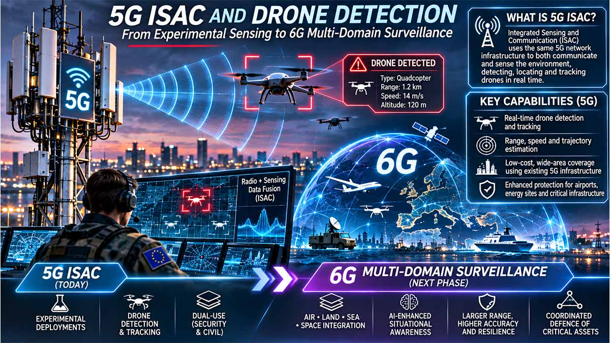
Technical Capability, Ericsson Field Demonstrations, Operational Maturity, Distributed Sensor Fusion, and Strategic Implications for Defence and Critical Infrastructure
Executive Summary — Bottom Line Up Front
Principal assessment — High confidence: Fifth-generation mobile infrastructure has demonstrated the ability to detect, locate and track drones through reflected radio signals, including aircraft that are not connected to the cellular network. The technology is physically credible and has progressed beyond laboratory simulations, but publicly documented performance does not yet establish independently validated, nationwide operational sensing.
Ericsson’s 2026 demonstrations in the United States, Finland and Poland establish different levels of technical and operational integration. The most informative public example is the July 2026 AT&T–Ericsson demonstration at Arlington, Texas, where several drones flying at 300–400 feet (approximately 91–122 metres) were detected and continuously tracked using multiple synchronized sensing sites. Those figures describe tested flight altitude, not maximum detection range or positioning accuracy. The future takes flight: AT&T and Ericsson demonstrate drone detection outside of AT&T Stadium — Ericsson — Jul 2026
Operational assessment — High confidence: Existing 5G ISAC is most defensible as an additional sensing layer complementing radar, optical systems, acoustic detection and command-and-control infrastructure, rather than as their replacement.
Technology outlook — Moderate confidence: Sixth-generation networks are likely to provide substantially more capable sensing through coordinated radio architectures, improved waveform design, artificial intelligence and sensing-specific network functions. Standardisation milestones support a commercial development trajectory toward approximately 2030, but do not establish when individual military-grade capabilities will be operationally certified.
Strategic assessment — Moderate confidence: The important development is not merely a new drone-detection technique. It is the possibility of incorporating telecommunications infrastructure into a persistent, geographically distributed source of environmental intelligence. This changes the relationship between civilian networks, national security infrastructure and the management of low-altitude airspace.
The principal unresolved variables are independently measured detection probability, false-alarm frequency, tracking continuity, positioning error, target-size sensitivity, sensing availability, and performance under operational interference or physical obstruction.
5G Networks Are Becoming Sensors: Europe’s New Security Dependency
The decision to turn telecommunications networks into instruments of environmental surveillance is moving from laboratory research to commercial deployment, raising a question European governments have not yet resolved: who will control the infrastructure that detects threats when that infrastructure also carries civilian communications? On 2 November 2026, Ericsson introduced its Integrated Sensing and Communication (ISAC) System, reporting kilometer-scale detection of micro-drones and announcing commercial pilots for 2027, followed by broader deployments from 2028. The technology could extend low-altitude airspace monitoring without constructing an entirely separate network of sensors. But its performance at national scale remains independently unverified, while cybersecurity, spectrum regulation and operational authority are divided among telecommunications operators, regulators and security institutions. Europe risks acquiring a new surveillance capability before establishing who can operate it, certify it and guarantee its availability during a crisis.
The mobile network is becoming a second surveillance infrastructure
The significance of Ericsson’s announcement lies in a change in the economic and security function of telecommunications assets. Fifth-generation mobile infrastructure was built to transmit information between connected devices. ISAC introduces the possibility of detecting objects through reflected radio signals, including aircraft that neither connect to the network nor transmit their own location. Existing radio sites, antenna systems, transmission infrastructure and computing resources could therefore acquire a second function: producing environmental intelligence for authorized security users.
The distinction is particularly consequential for drones. Conventional systems that monitor aircraft communications depend, to varying degrees, on observable emissions. Ericsson’s reflection-based approach seeks to detect physical objects independently of their participation in cellular communications. This does not make the network a substitute for dedicated radar, acoustic or optical systems. It potentially adds geographically distributed observations that can be correlated with those systems, increasing the information available to an operator without requiring every measurement to originate from a newly constructed sensing installation.
The industrial shift became visible during 2026. Ericsson demonstrated passive-object sensing in Plano, Texas, in February; distributed tracking with AT&T in Arlington in July; multisite sensing with Finland’s state-security-network operator Erillisverkot in September; and integration with acoustic detection and Asseco’s PUSZCZYK platform in Poland in October. The November commercial introduction transformed that sequence into a product roadmap, but not yet into evidence of sustained national deployment.
The commercial proposition is substantial: telecommunications networks already possess physical sites, licensed spectrum, transmission connections and operational management systems. Reusing suitable assets could lower some deployment costs. Yet a communications coverage map cannot establish a sensing coverage map. Antenna geometry, radio compatibility, processing requirements and the conditions under which small objects produce detectable reflections determine whether a particular installation can provide useful observations. The economic advantage must therefore be measured site by site, not inferred from the number of existing base stations.
The 2026 figures prove feasibility, not national coverage
The most informative numerical evidence comes from the 10 July 2026 demonstration outside AT&T Stadium in Arlington. Ericsson reported that several drones flying at 300–400 feet, approximately 91–122 metres, were detected and continuously tracked using multiple synchronized sensing sites. The system generated information concerning location, velocity and elevation. These results establish more than the presence of a reflected signal: they demonstrate a practical capacity to construct moving-object tracks under selected conditions.
But the reported altitude is not a detection range. It does not reveal how far the aircraft were from the receiving sites, how accurately their positions were established or how reliably smaller targets would be detected under different conditions. A successful tracking sequence is not equivalent to a statistical guarantee of continuous detection. The publicly disclosed results lack the complete independently comparable distributions needed to determine missed detections, false alarms, localization errors and sustained service availability.
Ericsson’s 2 November 2026 announcement advanced the performance claim by reporting the detection and tracking of micro-drones at kilometer-scale distances, with three-dimensional positioning. That is a material technical assertion, but the publication does not establish a universal detection radius or a numerical positioning-error guarantee. Without defined target characteristics, test populations, environmental conditions and independent ground truth, the result cannot be multiplied across an operator’s national network to calculate protected territory.
The October Polish demonstration provides another instructive figure. Play reported more than 13,500 base stations and 13.5 million mobile subscribers, establishing the scale of its telecommunications business. But the sensing demonstration used industrial spectrum, while Play’s 5G infrastructure provided backhaul connectivity. Those base stations were not thereby demonstrated to be sensing-enabled. The distinction illustrates the central investment risk: existing infrastructure can reduce barriers to deployment without making the conversion technically universal or economically automatic.
Nor does the evidence yet support a credible comparison with dedicated radar on total cost. Operators and governments would need to account for radio upgrades, edge computing, synchronization, software, electricity, maintenance, spectrum permissions and security accreditation. Until those costs are matched against independently verified detection performance, claims of lower-cost national surveillance remain commercial propositions rather than established economic conclusions.
Ericsson’s business model transfers the problem to network operators
Ericsson’s planned 2027 sensing-only commercial pilots reveal an important feature of the emerging market. The first commercial configurations need not be fully integrated communications-and-sensing networks. They may operate as specialized sensing services using selected telecommunications assets, with tighter integration envisaged as sixth-generation technology develops. This creates a possible entry route for the manufacturer without requiring an immediate transformation of every commercial base station.
The model also creates new contractual questions. A telecommunications operator may own or manage towers, spectrum and transmission infrastructure; an equipment supplier may provide the sensing software and processing system; a security agency may receive the resulting tracks; and another contractor may integrate those observations into a command-and-control platform. Each organization controls a different part of the service. A failure in measurement processing, data transport or authorization may prevent a usable operational result even while the cellular communications network remains functional.
The 15 October 2026 Kraków demonstration involving Ericsson, Play and Asseco illustrated this division of functions. Radio sensing, acoustic observations, telecommunications connectivity and software integration were combined in one system concept. That arrangement is commercially significant because the future customer may be purchasing an integrated service involving several providers rather than a discrete piece of detection equipment.
It also changes procurement economics. The cost of a sensing service will depend not only on the radio equipment, but on who guarantees performance, maintains processing systems, protects sensitive data and restores operations after failure. A network operator may be able to supply infrastructure without accepting responsibility for the final security decision. Conversely, a public authority may depend on commercial infrastructure without controlling every system component necessary to maintain the resulting surveillance service.
The security implications are equally material. A geographically distributed sensing service may provide multiple observation points, but those points can share software, transport, management and computing dependencies. Physical distribution does not automatically produce operational resilience. Adding a security function to civilian telecommunications infrastructure therefore requires assurance that the new service will not compromise essential communications or expose sensitive information through poorly governed interfaces.
Europe is standardizing the technology faster than its operational authority
The technological roadmap is increasingly formal. The International Telecommunication Union incorporated Integrated Sensing and Communication into its IMT-2030 framework in November 2023, identifying it among six future mobile-network usage scenarios. The Third Generation Partnership Project subsequently developed ISAC service requirements under Release 19, while Release 20 includes radio-access sensing studies and Release 21 contains developing sixth-generation service specifications.
The European Telecommunications Standards Institute has exposed the distance still separating architecture from implementation. Its February 2026 report on ISAC system and radio-access architectures identified 17 technical challenges. Its March security and sustainability publication identified 19 issues, including 15 concerning security and privacy. On 5 November 2026, ETSI announced further work on computing integration, identifying five challenges and six potential solutions. These are not documented failures in Ericsson equipment. They identify functions and constraints that a scalable sensing architecture must address.
The timing creates a regulatory tension. Europe already regulates electronic communications, cybersecurity, critical infrastructure and relevant personal-data processing through distinct instruments. The NIS2 Directive, Directive (EU) 2022/2555, establishes cybersecurity obligations for covered entities, including relevant telecommunications providers. The Critical Entities Resilience Directive, Directive (EU) 2022/2557, addresses resilience in designated sectors. The European Electronic Communications Code, Directive (EU) 2018/1972, governs important aspects of communications and spectrum regulation. None of these instruments, taken alone, authorizes the unrestricted transformation of civilian networks into security-surveillance infrastructure.
Nor do future 6G standards resolve that legal question. The ITU’s candidate radio-interface submission process is scheduled to begin in February 2027 and extend through 2029. Around 2030, commercial sixth-generation services may begin to emerge, but a standardized sensing interface will not determine which government body can activate surveillance functions, who can receive observations or under what conditions information may be retained.
The result is a division between technical interoperability and institutional authority. Industry can develop the equipment and standards necessary to exchange sensing information. Governments must separately determine the lawful purposes, permitted operators, security requirements and responsibility for operational decisions. A technically interoperable network can remain institutionally unusable if those questions are unresolved.
Italy, France, Germany and Britain face different constraints
For Italy, the immediate issue is the potential use of commercial infrastructure around ports, airports, energy facilities and military installations. Legislative Decree No. 138 of 4 September 2024, effective from 16 October 2024, implemented NIS2 and assigned relevant national cybersecurity responsibilities to the Agenzia per la Cybersicurezza Nazionale. This establishes an important framework for protecting covered digital infrastructure, but does not itself grant authority for every form of environmental sensing. Italian adoption would therefore require an operational arrangement among network providers, competent public authorities and security users, supported by site-specific verification.
France faces a more explicit spectrum and surveillance-governance problem. Arcep’s July 2026 records identify mobile operators’ frequency holdings and authorization conditions, including the 3.4–3.8 GHz range. These rights establish communications-spectrum assignments, not unrestricted permission for sensing applications. France’s data-protection authority, CNIL, has also demonstrated through its June 2025 guidance on camera-equipped public-security drones that surveillance technologies must be evaluated according to their actual functions and legal purposes. Radio sensing and camera surveillance are different activities, but combining their outputs can create additional data-governance questions.
Germany’s relevant institutional baseline changed with the entry into force of its NIS2 implementation on 6 December 2025. For an industrial or critical infrastructure operator, introducing cellular sensing creates an additional function requiring cybersecurity assurance, configuration control and clear responsibility for incident response. A system that adds useful environmental information must still justify the additional technical dependencies imposed on networks and facilities already subject to security requirements.
Britain presents the clearest documented procurement pressure in the dossier. The Ministry of Defence reported more than £200 million allocated during 2026 to counter-uncrewed-aircraft systems, while the September Project PANOPTES competition made £5 million immediately available for integrated force-protection innovation. Neither figure is an Ericsson ISAC contract. They establish government demand for counter-drone capabilities and for integrating different technologies. The United Kingdom’s 2026 examination of fiber-optically controlled drones further illustrates why security authorities cannot depend exclusively on detecting an aircraft’s communications emissions.
These national differences limit the possibility of treating Europe as one ready-made sensing market. The European Union can support common standards, while governments retain distinct national-security responsibilities, operators control different infrastructure and regulators apply different authorization procedures. NATO interoperability would add another layer: information shared between allied systems must retain provenance, measurement uncertainty and handling restrictions. A common display is not proof of a common operational capability.
The next 24 months will determine who bears the cost of conversion
Between November 2026 and November 2028, the decisive test will be whether Ericsson’s announced 2027 pilots produce independently validated performance and whether the wider deployments envisaged from 2028 establish economically sustainable services. Governments will need evidence of detection reliability, false-alarm burden, localization uncertainty, service availability and the cost of adapting actual network installations. Contracts and demonstrations that omit those measurements will not establish the degree of security protection being purchased.
For telecommunications operators, the immediate exposure is additional capital and operating expenditure, alongside new responsibilities for processing, data integrity and service continuity. For equipment suppliers, it is the need to convert successful demonstrations into repeatable performance guarantees. For public authorities, it is the risk of procuring sensing coverage that cannot be independently verified or of depending on infrastructure whose operational control remains fragmented.
The cost of inaction is not confined to delayed equipment purchases. Airports, ports, energy operators and defence installations may remain dependent on existing surveillance arrangements while potentially useful complementary observations are left undeveloped. Conversely, premature adoption could divert security expenditure toward systems that have not demonstrated the reliability required for their assigned mission, while introducing new risks to communications infrastructure.
The fiscal and security burden will ultimately fall on the governments and infrastructure operators that purchase, integrate and rely upon the service. The distinction Ericsson’s 2026 announcement has made unavoidable is between possessing radio infrastructure capable of producing environmental observations and operating a surveillance system whose performance, authority and availability can be guaranteed. Europe can buy the former before 2028. Whether it can responsibly rely on the latter remains the decisive question.
Navigational Index
Pillar I — Physical Principles, Ericsson Technology and Verified Operational Performance
Chapter 1 — Key Judgments : Eight principal intelligence judgments, each with a stated confidence level, distinguishing demonstrated capabilities from projections and unresolved operational claims.
Chapter 2 — Technical Foundations of ISAC in 5G : Radio propagation, orthogonal frequency-division multiplexing, massive multiple-input multiple-output antennas, beamforming, Doppler measurements, reflected-signal processing, monostatic, bistatic and multistatic architectures, synchronization and sensing-specific requirements under Third Generation Partnership Project (3GPP) standards.
Chapter 3 — Ericsson Solution Assessment : Technical architecture of Ericsson ISAC System; sensing-enabled base stations; non-cooperative drone detection; multicell tracking; results from the United States, Finland and Poland; measurable performance; limitations of disclosed test data; and requirements for independent verification.
Chapter 4 — Current Operational Reality : Technology-readiness assessment, trial-to-deployment transition, environmental effects, false alarms, target classification, scalability, equipment compatibility, network load, coverage geometry and operational availability.
Pillar II — Sensor Fusion, 6G Evolution and Multi-Domain Awareness
Chapter 5 — Data Fusion and Situational Awareness : Correlation of cellular sensing with radar, radio-frequency monitoring, acoustic arrays, electro-optical and infrared sensors, cooperative identification, artificial intelligence and command-and-control systems; track association, confidence management and human decision authority.
Chapter 6 — Pathway to 6G ISAC : International Telecommunication Union (ITU) IMT-2030 framework, 3GPP Release 19–21 development, European Telecommunications Standards Institute (ETSI) reference architectures, radio-frequency evolution, integrated waveforms, AI-native processing, practical performance gains and deployment scenarios through 2031.
Chapter 7 — Multi-Domain Extension : Realistic air and surface sensing capabilities, cross-domain data correlation, the physical limits of direct terrestrial-radio sensing through water and soil, and potential integration with maritime, underwater, geological and other specialist sensor systems.
Pillar III — Competing Explanations, Strategic Exposure and Intelligence Requirements
Chapter 8 — Analysis of Competing Hypotheses : Formal ACH matrix evaluating four distinct but partially overlapping propositions concerning current operational maturity, technical limitations, 6G transformation and regulatory constraints.
Chapter 9 — Strategic Implications and Risks : National defence, low-altitude airspace security, protection of airports, ports, energy infrastructure and military installations; civil–military telecommunications dependencies; cybersecurity, spoofing, network survivability, intelligence exposure and dual-use governance. Separate European Union, Italian, French, German and British implications.
Chapter 10 — Gaps, Indicators & Warnings, and Collection Recommendations : Priority intelligence requirements; independent performance validation; observable technology and procurement milestones; deployment indicators; standards monitoring; regulatory developments; and conditions that would materially change the assessment.
Chapter 11 — Source Evaluation Appendix : Source-by-source reliability and information-credibility evaluation, methodological limitations, provenance, commercial conflicts of interest, corroboration and the distinction between standards, manufacturer claims, field demonstrations and independently evaluated operational systems.
Master Abstract
The emergence of a new class of distributed sensor infrastructure
Integrated Sensing and Communication (ISAC) represents a potentially consequential change in the function of terrestrial mobile networks. Conventional cellular infrastructure is engineered primarily to transmit information between network equipment and connected devices. ISAC extends that infrastructure’s possible functions by extracting information about the surrounding physical environment from radio-wave propagation, reflections and changes in received signals. Under suitable hardware, signal-processing and network-coordination conditions, transmitters and receivers can estimate the presence, location and movement of objects that have no communications relationship with the network. This distinction is particularly significant for small unmanned aircraft: cooperative identification depends upon the target transmitting or participating in an identification mechanism, whereas reflection-based sensing is intended to observe the aircraft independently of such participation. Ericsson’s published architecture combines sensing-capable massive-MIMO radios, distributed processing and coordinated measurements across multiple sites. However, the existence of communications coverage does not automatically establish useful sensing coverage, and the reuse of existing infrastructure does not eliminate requirements for appropriate hardware, site geometry, synchronization or additional processing resources. Assessment: the technological principle is established, but the operational value of any given deployment remains conditional on its validated performance envelope — High confidence. Sensing in 6G: Use Cases and Architecture — Ericsson Technology Review — Oct 2025
What the 2026 demonstrations actually establish
During 2026, Ericsson announced several demonstrations that materially strengthen the public evidence of practical 5G sensing. Its February proof of concept in Plano, Texas, showed drone tracking using massive-MIMO radio equipment, including the sensing of passive objects. The July demonstration with AT&T at Arlington used multiple synchronized sites and reported the continuous detection and tracking of several drones at specified flight altitudes. In September, Ericsson and Finnish state-security-network operator Erillisverkot demonstrated distributed drone sensing, including a live trial at Helsinki’s Vuosaari Harbor. In October, Ericsson, Play and Asseco presented a Polish demonstration combining a cellular-sensing concept with acoustic detection and an operational visualization platform. The Polish case requires particularly careful interpretation: Ericsson reported that the demonstration used industrial spectrum while Play’s 5G network supplied backhaul connectivity, so it must not be represented as proof that Play’s entire commercial cellular footprint performed ISAC sensing. These demonstrations establish technical feasibility and an emerging route to operational integration, but the accessible manufacturer disclosures do not provide a complete, independently audited dataset of detection range, position error, receiver operating characteristics or network-wide sensing availability. Assessment: targeted sensing applications have progressed materially, while claims of already-validated nationwide counter-drone surveillance remain premature — High confidence. U.S. shows ISAC leadership as Ericsson demonstrates drone detection — Ericsson — Feb 2026; Ericsson and Erillisverkot demonstrate 5G ISAC drone detection for Finnish authorities — Ericsson — Sep 2026; Ericsson, Play and Asseco show detection of unauthorized drones for Polish authorities — Ericsson — Oct 2026
Why multi-sensor integration is more important than isolated detection
The operational significance of ISAC lies partly in its ability to furnish additional observations to systems already responsible for constructing a recognized air picture. Conventional radar, passive radio-frequency monitoring, acoustic detection, electro-optical observation and cooperative aircraft identification each possess different strengths and limitations. Cellular sensing can introduce additional viewing geometries and observations, potentially increasing confidence in an existing track or supporting continuity when another sensor temporarily loses contact. Yet the integration problem is not simply to place multiple detections on one display. Measurements must be associated with the same physical object, time-aligned, evaluated for uncertainty and protected against duplicated evidence. A fusion platform can otherwise mistake several correlated observations for independent confirmation. The October 2026 Polish demonstration is an important early example of combining telecommunications sensing, acoustic observations and software-based tracking, although its disclosed results do not prove a fully validated command-and-control system. Assessment: integrated sensing is more likely to provide operationally useful benefits in the near term as part of layered surveillance architectures than as a standalone sensor replacement — High confidence. Ericsson ISAC System — Ericsson — undated; Ericsson, Play and Asseco show detection of unauthorized drones for Polish authorities — Ericsson — Oct 2026
The 6G transition: physical opportunity versus deployment reality
The sixth-generation technology pathway should be understood as an evolution in radio-system design rather than as an automatic consequence of increasing frequency or base-station density. The International Telecommunication Union formally incorporated Integrated Sensing and Communication into the IMT-2030 usage framework in November 2023. Within 3GPP, Release 19 established sensing service requirements, while Release 20 includes further work on New Radio sensing. ETSI’s February 2026 architectural report identifies seventeen unresolved architectural challenges and addresses monostatic, bistatic and multistatic systems, sensing control, measurements, resource coordination and integration into network functions. Higher frequencies and larger bandwidths can improve certain resolution measures, while denser networks may provide more favorable observation geometries. These benefits remain subject to propagation losses, coverage gaps, deployment costs, synchronization, interference and the limited visibility of small targets. Crucially, a future sensing-capable 6G network will not automatically provide direct surveillance of objects underwater or underground: those domains involve different propagation physics and usually require specialist instruments. Their realistic integration is through correlation of independently obtained measurements, not the unrestricted extension of terrestrial cellular sensing across physical media. Assessment: sensing will become more structurally integrated into 6G, but the speed and geographic extent of effective deployments remain uncertain — Moderate confidence. Recommendation ITU-R M.2160-0 — ITU — Nov 2023; ETSI issues new Report on ISAC System and RAN Architectures — ETSI — Feb 2026
Strategic and institutional consequences
The prospective convergence between communication and environmental observation creates a new category of dual-use infrastructure. For national security agencies, mobile networks could provide additional awareness across geographically dispersed assets without constructing an entirely separate sensing network at every location. For telecommunications operators, the same capability introduces new responsibilities regarding system security, data stewardship, infrastructure access and the separation of civilian communications from security-related sensing tasks. For governments, the critical issue is whether operational authority, safeguards, resilience requirements and evidence standards can evolve alongside the underlying technology. These constraints are substantive rather than peripheral: ETSI’s March 2026 report identifies nineteen security, privacy, trustworthiness and sustainability issues, of which fifteen concern security and privacy. The strategic competition will consequently involve not only radio technology and algorithms, but also access to existing infrastructure, standards influence, secure processing capacity, trusted integration and the institutional authority to operate sensing services. Assessment: control over the orchestration and lawful use of distributed sensing infrastructure could become strategically significant even before fully mature 6G networks arrive — Moderate confidence. ETSI issues new Report on Security, Privacy, Trustworthiness and Sustainability for 6G ISAC — ETSI — Mar 2026
Key Evidence Table
The following table distinguishes documented technical achievements from standardisation activity, proposed capabilities and information that remains unavailable in the examined official and first-party disclosures.
| Indicator | Value / status | Reference date | Definition / scope | Issuer | Exact source |
|---|---|---|---|---|---|
| Initial 3GPP ISAC study | TR 22.837, Release 19 | Created March 2022 | Service-level study, not a commercial deployment certificate | 3GPP | TR 22.837 |
| ISAC service specification | TS 22.137 | 2023 onward | Standardised service requirements, not proof of implemented sensing accuracy | 3GPP | TS 22.137 |
| Ericsson US proof of concept | Drone tracking reported | 26 Feb 2026 | Plano, Texas; massive-MIMO sensing | Ericsson | Plano demonstration |
| AT&T–Ericsson tracking | Multiple drones at 300–400 ft | 10 Jul 2026 | Reported flight altitude, approximately 91–122 m; not detection range | Ericsson / AT&T | Arlington demonstration |
| Finnish distributed sensing | Multi-site harbor trial | 16–18 Sep 2026 | Helsinki and Vuosaari Harbor demonstration | Ericsson / Erillisverkot | Finland trial |
| Polish multimodal demonstration | ISAC, acoustics and data integration | 15 Oct 2026 | Industrial sensing spectrum; Play mobile-network backhaul | Ericsson / Play / Asseco | Kraków demonstration |
| 5G NR sensing study | TR 38.765, Release 20 | June 2026 version | Radio-access sensing study; document under change control | 3GPP | TR 38.765 |
| 6G ISAC architecture | ETSI GR ISC 003; 17 identified architectural challenges | Feb 2026 | System, radio-access and lower-layer architecture | ETSI | Architectural report |
| Sensing security and privacy | 19 issues, including 15 security/privacy issues | Mar 2026 | Technical and governance requirements | ETSI | Security report |
| 6G evaluation process | Candidate submissions envisaged Feb 2027–Feb 2029 | ITU status, Oct 2026 | Radio interface submission window, not commercial availability | ITU-R | IMT-2030 programme |
| Independently validated Ericsson sensing performance | No comparable public measurement series established | 7 Nov 2026 | Detection probability, false alarms, accuracy, range and availability remain unresolved in examined records | Analytical assessment | Public demonstration evidence |
The central measurement issue is the distinction between observing a successful tracked flight and demonstrating a statistically defensible detection capability across defined operational conditions. A successful demonstration does not by itself establish the false-alarm rate, missed-detection probability, coverage reliability or maximum operational range. These quantities require controlled test design, clear denominators, known target characteristics and reproducible measurement procedures. Consequently, a reported flight altitude cannot legitimately be transformed into a horizontal sensing-range estimate, nor can a successful tracking sequence establish continuous performance across weather, terrain, clutter and target variations.
Competing Explanations and Development Pathways
Preliminary Analysis of Competing Hypotheses
The four hypotheses concern different dimensions of technological maturity and future adoption. They are not fully mutually exclusive: a currently immature system may improve substantially under 6G while remaining constrained by legal and operational conditions. The matrix therefore evaluates consistency with the public evidence rather than assigning artificial probabilities or treating all propositions as exclusive outcomes.
| Hypothesis | Diagnostic support | Disconfirming evidence or limitation | Indicators | Current standing |
|---|---|---|---|---|
| H1 — 5G ISAC already provides operationally useful distributed sensing at scale | Multiple 2026 demonstrations; multistatic tracking; existing tower integration | No examined independent nationwide operational-performance record; limited published detection statistics | Sustained multisite operations; independently documented performance; operational acceptance | Not established at national scale — High confidence |
| H2 — Current systems remain limited to trials or specialised uses with significant performance gaps | Manufacturer demonstrations dominate public evidence; missing comparative performance measures; continuing radio and architectural standardisation | Successful outdoor tracking and multisensor demonstrations show meaningful progress beyond laboratory concepts | Repeatable detection results; certification; long-duration operations; documented operational availability | Best-supported current-maturity explanation — High confidence |
| H3 — 6G will deliver a substantial sensing capability improvement within the next decade | ITU IMT-2030 framework; dedicated architecture work; broader sensing support envisioned in standards | Final technical profiles, implementation scale, costs and operational reliability remain unresolved | Standards completion; commercial hardware; validated trials; certified services | Plausible development pathway — Moderate confidence |
| H4 — Regulatory, privacy and spectrum constraints will materially limit security adoption | ETSI has identified substantive security and privacy issues; sensing requires lawful authority and appropriate network governance | Government-focused demonstrations indicate institutional demand and possible specialised deployment arrangements | Licensing decisions; legal frameworks; access agreements; privacy controls; spectrum authorisation | Material adoption constraint; severity varies by jurisdiction — Moderate confidence |
Net ACH finding
H2 currently provides the strongest explanation of the public operational record, but this is not equivalent to rejecting the technological foundation of H1. The demonstrations show that distributed sensing functions can operate outside a purely laboratory environment. What remains unproven is the extent to which those functions achieve reliable, scalable and independently evaluated performance under sustained operational requirements.
H3 is principally a forecast rather than a direct explanation of present performance. It gains credibility from continuing ITU, 3GPP and ETSI standardisation, but those activities establish technical direction, not guaranteed outcomes. H4 is a potentially important conditional constraint that may coexist with either successful deployment or delayed commercial adoption. Its effects depend upon the jurisdiction, mission authority, spectrum arrangements and governance model. The most informative future evidence would combine independent field measurements with public regulatory decisions and long-duration operational records.
Principal Intelligence Gaps and Watch Indicators
PRIORITISED COLLECTION REQUIREMENTS
| Priority | Unresolved intelligence requirement | Observable evidence that would materially change the assessment |
|---|---|---|
| Critical | Actual detection probability and false-alarm performance | Independently evaluated field trials reporting detection and false-alarm statistics under defined conditions |
| Critical | Effective range, localization error and tracking continuity | Published measurement distributions by target type, distance, geometry and environmental conditions |
| Critical | Extent of existing-infrastructure reuse | Site-level documentation separating software upgrades, radio replacements, new receivers and additional synchronization equipment |
| High | Operational maturity beyond demonstrations | Public procurement acceptance, sustained operations, maintenance records or independent operational evaluations |
| High | Integration into security command-and-control | Verified interoperability trials and evidence of track-quality preservation across sensor interfaces |
| High | Resilience of distributed sensing | Authorized interference-resilience testing, service-continuity reports and network-failure recovery assessments |
| High | Regulation and lawful sensing authority | Spectrum authorisations, adopted legal provisions, supervisory decisions and approved security-use frameworks |
| High | 6G sensing performance trajectory | Approved 3GPP work items, ITU evaluation outcomes, independent prototypes and commercial equipment specifications |
| Moderate | Direct versus indirect multi-domain sensing | Demonstrations distinguishing measurements obtained through cellular radio from information supplied by other sensors |
| Moderate | Economics of deployment at scale | Auditable per-site retrofit costs, total operating costs, processing demands and energy-use measurements |
Principal watch indicators through 2031
2026–2027: From demonstrations to verification. The decisive development would be publication of reproducible operational sensing results rather than further demonstrations reporting detection success without associated statistical performance. The ITU’s IMT-2030 submission and evaluation process is a separate standards milestone and should not be interpreted as automatic evidence of field performance.
2027–2029: From bespoke systems to reproducible architectures. The most significant indicators would be standardized sensing interfaces, interoperable equipment, demonstrated multisite coordination across different environments and explicit governance arrangements for security-related use of telecommunications infrastructure.
2029–2031: From technical feasibility to institutional adoption. A material change in the assessment would require evidence that sensing is being purchased, operated, maintained and independently validated as an enduring service, rather than demonstrated temporarily as an experimental capability. For 6G, evidence of commercial availability must still be separated from evidence of mission-grade operational suitability.
Strategic Geographic Relevance
The European consequences warrant national differentiation rather than treating Europe as a homogeneous telecommunications or defence environment.
Italy. The principal questions concern the potential integration of civilian cellular infrastructure with the protection of ports, energy systems, airports and other critical facilities. Relevant issues include network-operator participation, the separation of civilian and public-security functions, spectrum permissions, equipment provenance and integration with established national security responsibilities. The existence of extensive telecommunications infrastructure would not, by itself, establish an operational ISAC capability.
France. The material questions include opportunities for domestic telecommunications and defence industries, integration with established security systems, and the relationship between civilian sensing networks and state-controlled defence capabilities. National defence applications must be assessed separately from commercial sensing services because operational authority, security accreditation and network access can differ substantially.
Germany. The principal issues involve industrial infrastructure security, network interoperability, the technical verification of systems intended for public-safety or defence purposes, and the institutional conditions under which mobile-network operators could provide distributed sensing data to authorized bodies.
United Kingdom. The relevant assessment centres on the governance of mobile-network sensing, counter-unmanned-aircraft integration, national infrastructure resilience and the technical separation of telecommunications services from dedicated defence sensing systems.
European Union. The continental dimension concerns standardisation, technology sovereignty, research investment, security and privacy requirements, interoperability and cross-border implementation. The European Commission reported €116 million for 20 research and innovation projects announced in March 2026 within the Smart Networks and Services Joint Undertaking, bringing the programme portfolio to 100 projects. This is evidence of an organized European 6G research effort, not a dedicated ISAC deployment budget or evidence of operational counter-drone coverage. Europe to advance 6G innovation as 20 projects set to receive €116 million — European Commission — Mar 2026
The central European strategic question is therefore not whether existing mobile networks can theoretically contribute to low-altitude sensing; the demonstrations have already established that this is possible. It is whether individual states and European institutions can transform that possibility into validated, governed and resilient capabilities without compromising the telecommunications infrastructure upon which civilian economic activity, public services and emergency communications already depend.
Preliminary Source Evaluation
The present evidentiary foundation is strongest where source institutions publish formal technical specifications and where manufacturer announcements identify concrete test configurations or dates. It is weaker where commercial claims concern operational performance without independently accessible measurement data.
| Source group | Source reliability | Information credibility for the assessed claim | Main limitation |
|---|---|---|---|
| ITU-R recommendations and official IMT-2030 records | High | High for adopted frameworks and documented standards activity | Not independent validation of commercial sensor performance |
| 3GPP specification records | High | High for technical specification identity, status and revision history | Requirements and studies do not establish deployed capability |
| ETSI ISAC reports | High | High for identified architectural and security challenges | Technical proposals are not proof of completed interoperable implementations |
| Ericsson technical publications | High for attribution and architectural description | Moderate for projected performance and scalability | Manufacturer interest; limited independent validation |
| Ericsson and operator demonstration announcements | High for identifying what the participants publicly reported | Moderate for operational performance claims | Limited public test methodology, statistical data and independent audit |
| European Commission research-programme disclosures | High | High for funding and programme milestones | Programme activity is not equivalent to achieved military capability |
These evaluations concern the trustworthiness of each source for its particular evidentiary function. They do not assume that an authoritative technical standards body has independently confirmed vendor field-performance claims, or that manufacturer declarations are invalid merely because they are commercially interested.
Overall Preliminary Assessment
Fifth-generation ISAC has crossed the threshold of demonstrated physical feasibility, but has not yet crossed the publicly verifiable threshold of mature distributed surveillance at national scale. The differentiation matters because strategic decision-makers must not confuse a functioning reflection-based drone-tracking experiment with a security capability that can be relied upon across extensive geography, variable environmental conditions and sustained operating periods.
The transition toward sixth-generation networks is likely to improve the technological foundations of integrated sensing, particularly through more explicit sensing-aware radio architectures, network-level coordination and advanced signal processing. The resulting operational value will depend on the relationship between sensor physics, deployment density, system integration, lawful access, resilience and validated performance. Consequently, the most significant prospective transformation is the evolution of telecommunications networks into dual-use information infrastructure capable of contributing environmental observations to national situational awareness, rather than the assumption that 6G will independently provide complete surveillance across air, surface and subsurface domains.
The immediate analytical priority is to establish the real operational performance of the systems already demonstrated, before projecting their capabilities to national defence architectures or future multi-domain sensing systems.
No decision-useful quantitative visualization is supportable from the verified performance record; the evidence and hypothesis tables retain the relevant distinctions without inventing precision.
5G ISAC / 6G SENSING INTELLIGENCE
Distributed radio sensing, drone tracking, evidence maturity and the pathway to multi-domain situational awareness.
Distributed Sensing Architecture
Technology and Standardisation Timeline
Historical events, formal standards processes and projected milestones are distinguished.
Analysis of Competing Hypotheses
| Hypothesis | Supporting evidence | Disconfirming evidence / limits | Current standing |
|---|---|---|---|
| H1 — Operational 5G ISAC at scale | Multisite demonstrations | National-scale validation absent | Not established |
| H2 — Trials and specialised applications | Field trials; unresolved metrics | Real outdoor progress | Best supported |
| H3 — 6G step-change | Standards and architecture | Future deployment unverified | Plausible |
| H4 — Regulatory constraints | Security and privacy requirements | Security-sector trials | Material constraint |
H2 is the strongest present-maturity explanation. The hypotheses overlap and are not mutually exclusive.
Air, Surface and Subsurface Feasibility
Air: low-altitude objects
5G radio reflections have been used to track drones in field demonstrations. General-purpose coverage and operational performance remain unverified.
Surface: environmental observation
Object sensing and movement correlation are technically plausible, but results depend on target signatures, geometry, clutter and application-specific validation.
Subsurface: indirect correlation
Terrestrial cellular radio is not a general-purpose underground or underwater sensor. Information from specialist sensors may be correlated at the data-fusion layer.
Performance Gaps and Decision Indicators
| Priority | Intelligence gap | Decision-useful evidence |
|---|---|---|
| Critical | Detection and false-alarm rates | Independent operational measurements |
| Critical | Range and positioning accuracy | Published test distributions |
| Critical | Existing-site retrofit requirements | Auditable equipment configuration |
| High | Sustained operational availability | Long-duration deployment evaluations |
| High | Data-fusion interoperability | Validated multisensor integration |
| High | Regulatory authorisation | Published legal and licensing decisions |
Official and First-Party Evidence
As of: 7 November 2026 | Evidence period: 2022–2026 | Technical outlook: 2027–2031
PILLAR I — Physical Principles, Ericsson Technology and Verified Operational Performance
5G Integrated Sensing and Communication: The Physics, Engineering and Operational Evidence Behind Distributed Drone Detection
Principal intelligence finding — High confidence: Fifth-generation mobile radio infrastructure has crossed the threshold from experimental sensing concepts to demonstrated detection and tracking of non-cooperative drones, but independently verified performance at nationwide operational scale remains unestablished. The decisive development is Ericsson’s commercial introduction of its ISAC System on 2 November 2026, following demonstrations in the United States, Finland and Poland. Ericsson has disclosed kilometer-scale detection of micro-drones in tests and announced small-scale commercial sensing pilots for 2027, followed by broader deployments from 2028. Those statements materially strengthen the technical and industrial assessment, although the company has not published a sufficiently complete independent performance dataset to substantiate general claims of persistent national coverage, uniform localization accuracy or predictable false-alarm performance.
The resulting intelligence distinction is fundamental: the existence of a detectable radio reflection is a physical fact, the transformation of that reflection into an estimated target trajectory is a signal-processing achievement, the maintenance of a stable track across multiple base stations is a systems-engineering capability, and the delivery of dependable detection within a certified security architecture is an operational outcome. Each requires a different standard of evidence. The first three have been demonstrated under selected conditions; the fourth remains insufficiently documented in the public record.
The relevant evidence includes Ericsson brings drone detection capabilities to mobile networks — Ericsson — November 2026, The future takes flight: AT&T and Ericsson demonstrate drone detection outside of AT&T Stadium — Ericsson — July 2026, and ETSI GR ISC 003: System and RAN Architectures — ETSI — February 2026.
Chapter 1 — Key Judgments
The eight judgments below establish the present intelligence baseline. Confidence reflects the strength, directness and independence of the available evidence; it is not a numerical probability of technological success.
1. Judgment 1 — High confidence: Existing 5G radio technologies can detect and track non-connected drones using reflected radio energy, as demonstrated by Ericsson and telecommunications partners in outdoor, multisite trials during 2026, although the full operational performance envelope remains unpublished.
2. Judgment 2 — High confidence: Ericsson’s 2 November 2026 introduction of its ISAC System constitutes an identifiable commercial product-development milestone rather than a nationwide operational deployment, with selected sensing-only commercial pilots planned for 2027 and broader deployments envisaged from 2028.
3. Judgment 3 — High confidence: Multistatic sensing can provide additional observation geometries and improve the information available for target localization and track continuity, but its actual advantage depends on synchronization, propagation conditions, deployment geometry, signal quality and the algorithms used to combine measurements.
4. Judgment 4 — High confidence: Ericsson’s statement that micro-drones were detected at kilometer-scale distances establishes a manufacturer-reported test achievement, not a generally transferable detection radius, since the publicly disclosed record does not supply the complete target, environment, statistical detection and error conditions necessary for independent operational extrapolation.
5. Judgment 5 — High confidence: Reusing existing cellular towers, transport networks, radio equipment and licensed spectrum can reduce some infrastructure requirements, but installed 5G coverage cannot automatically be converted into reliable sensing coverage without verifying radio compatibility, processing requirements, spatial geometry and the availability of suitable sensing resources.
6. Judgment 6 — Moderate confidence: For near-term security applications, the most credible deployment model is an additional distributed sensing layer integrated with radar, acoustic and optical systems, because combining complementary observations may improve situational awareness while limiting dependence on the performance of any single sensing technology.
7. Judgment 7 — High confidence: As of the reporting date, the combination of incomplete publicly available receiver-performance statistics, unresolved standardization details, operational-security requirements and equipment-specific constraints prevents a defensible conclusion that commercial 5G ISAC is ready to replace dedicated air-surveillance systems.
8. Judgment 8 — Moderate confidence: The 2027–2028 product roadmap could establish an early operational foundation for sensing-enabled 6G networks, but improvements in resolution, coverage, classification and multi-domain integration will remain conditional on physical propagation limits, verified equipment performance, spectrum arrangements, financing and systems certification.
Strategic interpretation of the judgments
The first consequence is that ISAC should no longer be treated merely as an abstract sixth-generation research concept. Ericsson’s November 2026 announcement provides a concrete industrial transition point: an equipment manufacturer has presented an identifiable solution, specified the intended security and infrastructure markets, described the essential architectural components and announced prospective commercial deployment phases. Nevertheless, commercial introduction and operational acceptance are separate events. A technology may be sufficiently mature for selected paid or supervised pilots without possessing the documented reliability needed for continuous national-security service. The November announcement is therefore strong evidence of industrial commitment and advancing technological maturity, but weaker evidence of predictable operational outcomes.
The second consequence concerns the measurement of geographic availability. The coverage of an existing communications network is not equivalent to the coverage of an environmental sensing system. Communications networks are planned around particular link-budget requirements, users, traffic distributions, antenna orientations and service-quality objectives. Distributed sensing additionally depends on the ability of radio energy to illuminate an object and return a distinguishable signal to a suitable receiver. Consequently, a location that receives strong mobile communications service may not present favorable geometry for detecting a small drone, whereas a strategically positioned combination of sensing sites may observe an object outside the most obvious conventional communications service area. National-scale sensing is therefore an engineering proposition requiring geographical validation, rather than a feature that can be inferred from a mobile operator’s published coverage map.
The third consequence is institutional. Distributed sensing creates a potential pathway for commercial telecommunications operators to become providers of environmental observations relevant to public safety, critical infrastructure and national defence. This would expand the functional importance of network orchestration, radio-site access, secure transport, sensing-data integrity and operational resilience. However, the mere availability of object-position information does not establish the identity, intention or legal status of the detected aircraft. Those determinations require additional evidence, authorized decision procedures and, where applicable, correlation with cooperative identification or other sensor sources. The intelligence value of ISAC lies in the additional information it can contribute, not in an unsupported presumption that radio sensing alone can provide complete target attribution.
The fourth consequence is technological. The emerging distinction between communications-centered 5G hardware adapted for sensing and future networks designed with sensing as a native service will matter more than the marketing labels attached to successive network generations. A deliberately engineered fifth-generation sensing system may outperform a nominally more advanced network that lacks appropriate sensing geometry or resources. Conversely, sixth-generation standards may enable more consistent coordination, measurement exchange and sensing-service management across equipment and networks, provided that those functions are actually implemented. For defence procurement and critical infrastructure security, the relevant comparison will be between validated system capabilities under specified operating conditions, not between generations as abstract categories.
Documentary foundation: Ericsson ISAC System — Ericsson — November 2026; Ericsson brings drone detection capabilities to mobile networks — Ericsson — November 2026; 3GPP TS 22.137, Integrated Sensing and Communication — 3GPP — Release 19.
Chapter 2 — Technical Foundations of ISAC in 5G
Principal assessment — High confidence: The feasibility of 5G-based environmental sensing is established by radio-frequency propagation physics and by the processing capabilities available in modern cellular equipment, but obtaining militarily useful observations requires substantially more than identifying a reflected signal. The performance of an integrated sensing system depends on the relationship between transmitted waveform characteristics, target reflectivity, antenna geometry, receiver sensitivity, environmental clutter, coherent processing, timing synchronization and the quality of the algorithms responsible for distinguishing actual targets from background variations. These dependencies explain why field demonstrations can succeed without providing a universally applicable measure of detection coverage or accuracy.
The physical transformation of communications signals into environmental measurements
A conventional cellular transmission travels through a propagation environment containing buildings, terrain, vegetation, vehicles and other objects. The receiver ordinarily attempts to recover information carried by the desired signal, compensating for the many delayed and attenuated signal components created by reflections and scattering. Integrated sensing changes the analytical objective: part of the environmental information embedded within those signal components becomes useful data. A moving object can produce a reflected radio component whose propagation delay, direction, phase behavior and frequency characteristics differ from the surrounding background. When sufficient information is available, signal processing can distinguish a potential moving target and estimate its position or motion.
The important distinction is between a wireless communications channel and a radar-like observation process. Radio reflections have always existed around mobile networks, but conventional networks were not necessarily designed to preserve, synchronize and interpret the relevant measurements as persistent environmental tracks. Many communications algorithms suppress or compensate for the effects of propagation that a sensing algorithm would attempt to exploit. ISAC therefore requires a more deliberate relationship between radio measurements and environmental estimation, whether through dedicated sensing transmissions, reuse of communications waveforms, modified receiver processing or coordinated network operations. This is why a successful sensing system can reuse important communications infrastructure without being reducible to a simple software command applied to every installed base station.
The broader institutional significance was recognized when 3GPP created its service-level ISAC study, TR 22.837, in March 2022. The subsequent TS 22.137 established a formal requirements framework under Release 19, while the Release 20 radio-access study TR 38.765 addresses Integrated Sensing and Communication for New Radio. These documents concern distinct layers of technological development and must not be interpreted as proof that every compliant fifth-generation installation has standardized, interoperable drone-detection functionality. Study on Integrated Sensing and Communication, TR 22.837 — 3GPP — March 2022 onward; Integrated Sensing and Communication, TS 22.137 — 3GPP — Release 19; Study on Integrated Sensing and Communication for NR, TR 38.765 — 3GPP — Release 20.
OFDM waveforms and the limits of temporal and spatial resolution
Fifth-generation New Radio uses orthogonal frequency-division multiplexing (OFDM), a waveform family in which transmissions occupy multiple frequency-separated subcarriers. For sensing, this structure offers useful opportunities because known transmitted information and suitable receiver observations can support estimation of propagation delay, phase differences and Doppler characteristics. By examining how received components differ across subcarriers and successive observations, an appropriately engineered receiver can potentially separate reflections with different delays and estimate their variation over time. However, the existence of an OFDM waveform does not independently determine achievable environmental resolution. The sensing processor must have access to suitable transmitted-signal knowledge and received measurements, while the effective coherent bandwidth, signal-to-noise ratio, frequency allocation, observation duration and processing design constrain what can actually be inferred.
A useful technical distinction concerns range resolution. In an ideal monostatic radar approximation, the characteristic range-resolution limit associated with bandwidth is the speed of light divided by twice the effective sensing bandwidth. This relationship describes an idealized signal-processing limit rather than the guaranteed performance of a commercial ISAC system. For example, an ideal effective bandwidth of 20 MHz corresponds to a nominal range-resolution scale of approximately 7.5 metres, whereas 100 MHz corresponds to approximately 1.5 metres. These are calculated theoretical reference values, not Ericsson field measurements, not target-location error estimates and not proof that particular 5G configurations can reliably separate objects at those distances. Actual estimation may achieve sub-resolution parameter precision under favorable conditions or perform substantially worse in cluttered, multipath environments.
Importantly, range resolution, position accuracy and detection range are three different quantities. Range resolution concerns the separation of closely spaced reflections in a relevant measurement dimension. Position accuracy concerns the difference between an estimated location and the target’s true location, which depends on additional factors including angular accuracy, geometry, synchronization and statistical estimation. Detection range concerns the distance over which a specified target can be detected with a defined probability under specified operating conditions. A system may produce a relatively precise position estimate for a favorable target while remaining unable to detect a smaller or less reflective object at the same distance. The technical evidence must therefore specify which quantity is being measured.
Table 2.1 — Radio-sensing observables and their operational limitations
| Technical observable | Physical or processing mechanism | What it can contribute | Principal technical limitation | Confidence |
|---|---|---|---|---|
| Propagation delay | Time difference between transmitted and received components | Path-length or range-related measurement | Synchronization, multipath and waveform bandwidth | High |
| Doppler shift | Frequency change associated with relative motion | Radial-velocity information | Geometry, observation time and motion ambiguity | High |
| Angle of arrival | Relative received phase or amplitude across antenna elements | Directional observation of an arriving signal | Array aperture, calibration and multipath | High |
| Angle of departure | Transmitting-array steering and known radiation direction | Illumination geometry and directional constraints | Beam pattern, sidelobes and target position | High |
| Reflected-signal strength | Target scattering and propagation attenuation | Evidence supporting candidate detection | Target orientation, clutter and range dependence | High |
| Multisite correlation | Association of observations from separated radio locations | Position estimation and track continuity | Time alignment, geometry and measurement association | High |
| Temporal tracking | Sequential estimation of target movement | Velocity, trajectory and continuity | Missed observations, maneuvering and false associations | High |
| AI-assisted classification | Statistical discrimination using measured characteristics | Possible differentiation among target categories | Training coverage, domain shift and unknown targets | Moderate |
The table describes established engineering mechanisms and conditional system contributions, not a claim that all of the functions have been independently validated in Ericsson’s commercial configuration. The relevant standards foundation includes ETSI GR ISC 002, Channel Modelling, Measurements and Evaluation Methodology — ETSI — August 2025.
Doppler estimation and the problem of detecting slow, small or unconventional targets
Doppler processing is particularly important for detecting movement against a largely stationary environment. A target moving relative to the transmitting and receiving equipment changes the observed frequency characteristics of the reflected signal. For a conventional monostatic geometry, the Doppler frequency shift is proportional to twice the target’s radial velocity divided by the wavelength. In bistatic and multistatic configurations, the relevant relationship is more complex because the transmitting and receiving directions are different. The measured Doppler component is determined by the target’s movement relative to those propagation paths, which means that the same physical velocity can produce different observations across a distributed sensing network.
This distinction has practical consequences for drone surveillance. The ability to detect movement depends not only on the aircraft’s speed but also on the orientation of its movement relative to the sensing geometry. A small aircraft moving predominantly across a particular observation direction may produce a different Doppler signature from an aircraft moving toward or away from that sensor. Multiple sensing geometries can offer complementary information, but the actual effectiveness depends on whether the separate observations can be detected and combined reliably. Hovering aircraft also present a different challenge from rapidly moving aircraft because the dominant movement characteristics and the relationship between the drone and environmental clutter may change. Rotating components can contribute additional signal modulation, but their detectability and usefulness for classification depend on target design, aspect and measurement quality.
The practical implication is that the detection and classification of small unmanned aircraft cannot be established by testing only one flight behavior. An evaluation must distinguish straight-line flight, changes of direction, acceleration, stationary hovering and changes in target orientation, without assuming that results from one maneuver generalize to all others. Small aircraft with different constructions may also exhibit substantially different scattering properties. Materials, geometry, relative aspect, frequency and polarization affect radar cross-section, making target-size labels such as micro-drone inadequate substitutes for a characterized electromagnetic signature.
Massive MIMO, beamforming and distributed observation geometry
Massive multiple-input multiple-output (massive MIMO) systems use antenna arrays with multiple transmitting and receiving elements to manipulate and observe radio signals spatially. Beamforming can direct transmitted energy toward selected angular regions and improve communications performance by exploiting spatial structure. For sensing, the same underlying antenna capabilities can contribute directional information and improve the usefulness of observed reflections, provided the equipment and processing chain can support the required measurements. Ericsson explicitly identifies its massive-MIMO radio platform, beam steering, specialized edge computing and sensing software as key elements of the technology presented during the October 2026 Polish demonstration. Ericsson, Play and Asseco show detection of unauthorized drones for Polish authorities — Ericsson — October 2026.
The difference between directional communications and environmental sensing should not be understated. A commercial base-station antenna is commonly oriented and configured around a communications service objective, whereas the radio geometry for observing low-altitude aircraft may require useful illumination and reception across different elevation angles, azimuth sectors and propagation paths. A radio site with excellent communications capacity can consequently be poorly situated for particular sensing tasks. Moreover, a transmitted beam does not define a sharply bounded volume inside which every object is detected. Radiation patterns contain main lobes, sidelobes and regions of reduced sensitivity; the interaction between those patterns and the target’s scattering characteristics affects the resulting observation.
For an operational sensing deployment, the relevant question is therefore whether the available antenna geometry and processing architecture can deliver the specified detection performance across the required three-dimensional space. That requires information about both the transmitting and receiving directions, rather than merely a map of tower locations or a statement of the network’s communications generation.
Monostatic, bistatic and multistatic sensing
The distinction between monostatic, bistatic and multistatic architectures is central to understanding both the technical achievement and the operational limitations of Ericsson’s approach. In a monostatic architecture, the transmitting and receiving functions are associated with the same sensing location. In a bistatic arrangement, transmitting and receiving functions are separated geographically, producing a measurement geometry determined by the transmitter, target and receiver. A multistatic system extends this principle through multiple transmitting or receiving locations and combinations of observations. The result can be a richer set of measurements, but those measurements must be interpreted with the appropriate geometry and synchronization model.
In a monostatic configuration, the relevant propagation distance is approximately the outward path to the target plus the return path to the sensing site. In a bistatic configuration, the total propagation path runs from the transmitting site to the target and then from the target to the receiving site, creating a different localization relationship. When several geometrically distinct paths are observable, the system may constrain the possible target position more effectively. However, the observations are not automatically independent, and poor site geometry can lead to weak localization in particular directions. Multisite cooperation may improve observability without removing all ambiguity, especially when signals are intermittent, targets are closely spaced or background reflections are difficult to distinguish.
Table 2.2 — Comparison of the principal sensing configurations
| Architecture | Transmitter and receiver relationship | Potential technical advantage | Principal constraint | Operational assessment |
|---|---|---|---|---|
| Monostatic | Transmit and receive functions at the same site | Simpler geometric interpretation; localized control | Limited viewing geometry and associated occlusions | Technically established |
| Bistatic | Spatially separated transmitter and receiver | Additional propagation geometry and target aspect | Clock coordination, direct-path interference and geometry | Technically established |
| Multistatic | Several distributed sensing sites and observation paths | More observations and possible improvement in localization and continuity | Distributed synchronization, processing and association complexity | Demonstrated in selected 2026 trials |
| Network-assisted multisensor fusion | Cellular sensing plus separate sensor types | Complementary evidence and broader situational awareness | Measurement consistency, security and system interoperability | Demonstrated in limited integrations |
| Future sensing-native 6G | Integrated sensing services and network coordination | More systematic orchestration and interoperability | Incomplete standardisation and deployment evidence | Development pathway |
Source: ETSI GR ISC 003, System and RAN Architectures — ETSI — February 2026; Ericsson ISAC System — Ericsson — November 2026.
Synchronization, calibration and the technical cost of distributed sensing
Distributed sensing introduces a form of measurement dependence that ordinary communications-network coverage indicators do not adequately describe. If several radio locations contribute to estimating one target’s position, their measurements must be associated with known timing, frequency and geometric references. A timing offset can introduce systematic path-length error; frequency instability can affect Doppler interpretation; calibration errors can distort angular measurements; and inconsistent measurement timestamps can make a moving target appear to occupy incompatible positions. These errors may be partially compensated through engineering techniques, but the residual uncertainty must be characterized rather than treated as negligible.
The precise synchronization requirement depends on the waveform, whether observations use absolute or differential delay, the integration period, the available reference signals and the estimation architecture. Consequently, it would be technically incorrect to impose one universal synchronization figure on every ISAC system. A distributed system can use different combinations of synchronization and estimation methods, each with its own trade-offs. What matters operationally is the residual measurement error under actual deployment conditions, including the behavior of equipment clocks, transmission paths and processing resources over time.
There is also an important distinction between detecting a target and maintaining a target track. A single observation may establish only that an object-like reflection is present. Tracking requires consecutive measurements to be associated with the same physical object, while allowing for uncertainty, missed detections and movement. In congested environments, the challenge becomes particularly significant because multiple moving objects and multiple propagation paths can generate competing explanations for the observed signal. The system must decide whether new observations correspond to an existing target, a different target, background clutter or an artifact. Different tracking algorithms may resolve these ambiguities differently, and without a documented test methodology their operational performance cannot be inferred from the simple fact that a demonstration displayed continuous tracks.
Specific ISAC requirements under 3GPP and ETSI
The development of formal ISAC requirements helps explain why early deployments can be based on 5G technology while the longer-term industry roadmap still emphasizes 6G. 3GPP TS 22.137 provides a service-requirements foundation, while TR 38.765, initially planned for Release 20 and recorded under change control in June 2026, addresses radio-access aspects. These records establish that sensing is part of recognized standardization activity, but they do not establish that one uniform implementation has been approved for all sensing configurations or that every current vendor system is fully interoperable across equipment manufacturers and operators.
ETSI’s February 2026 GR ISC 003 report provides additional architecture-level evidence. ETSI identified seventeen architectural challenges across system architecture, radio-access architecture and lower-layer radio engineering, covering functions such as sensing-service control, task coordination, measurement configuration, data processing, resource allocation, interference and sensing-data exposure. The report explicitly accommodates multiple sensing geometries rather than assuming that a single technical configuration will serve every environment. This matters because a distributed radar-like network cannot be engineered simply by treating the communications network as one giant receiver; it requires a set of operational functions dedicated to organizing who transmits, who observes, how measurements are collected and how sensing results are made available to authorized users. ETSI issues new Report on ISAC System and RAN Architectures — ETSI — February 2026.
Table 2.3 — Standards development and the evidentiary meaning of each document
| Instrument | Development status as of November 2026 | Primary function | What it establishes | What it does not establish |
|---|---|---|---|---|
| 3GPP TR 22.837 | Release 19 study; created March 2022 | Service-level study of ISAC | Structured examination of requirements and use cases | Fielded commercial sensing capability |
| 3GPP TS 22.137 | Release 19 technical specification; under change control | ISAC service requirements | Formal service-requirements framework | Universal radio implementation or field accuracy |
| 3GPP TR 38.765 | Release 20 study; under change control from June 2026 | ISAC for New Radio | Continuing radio-level technical study | Completed 6G interoperability |
| ETSI GR ISC 002 | Published August 2025 | Channel modelling, measurements and evaluation methods | Need for sensing-specific channel evaluation | Vendor-independent acceptance of specific field trials |
| ETSI GR ISC 003 | Published February 2026 | System and radio-access architecture | Reference architecture and seventeen technical challenges | Commercial completion of all proposed functions |
| ETSI GR ISC 004 | Published February 2026; public announcement March 2026 | Security, privacy, trustworthiness and sustainability | Nineteen identified issues, including fifteen relating to security and privacy | Adoption of a complete binding security regime |
| ITU-R IMT-2030 framework | Adopted November 2023 | International 6G capability framework | ISAC recognized within future mobile-system objectives | Operational availability of 6G sensing |
Official records: 3GPP TR 22.837, 3GPP TS 22.137, 3GPP TR 38.765, ETSI GR ISC 002 work-programme record — August 2025, ETSI GR ISC 003 — February 2026, ETSI GR ISC 004 — March 2026, and ITU-R M.2160-0 — November 2023.
WordPress Scheme 2.1 — Technical architecture of a distributed 5G ISAC sensing system
The following component provides a self-contained schematic showing the separation between radio illumination, reflection measurements, multisite processing and operational integration. Its purpose is to preserve the distinction between physical sensing and the subsequent interpretation of results. It does not represent proprietary Ericsson internal interfaces, specify undocumented hardware configurations or imply quantified performance. All styling is scoped to the component’s unique identifier; no global selectors, external scripts, fonts, libraries or WordPress settings are modified.
From Radio Transmission to Target Intelligence
Conceptual functional architecture, distinguishing observations, measurement processing and downstream operational integration.
Transmitting network site
5G radio, antenna array and configured sensing waveform.
Radio energy illuminates objects and environmental surfaces.
Target scattering and reception
Direct and reflected components arrive at suitable receivers.
Delay, Doppler, angle and scattering information can be extracted.
Multisite measurement fusion
Measurements require calibration, timing consistency and association.
Target detections become position estimates and associated tracks.
Reflection-based sensing, distributed observations and movement estimation.
Detection and tracking of drones under reported field-test conditions.
Generalized range, probability of detection, false alarms and availability.
Official technical references: ETSI GR ISC 003; 3GPP TS 22.137; Ericsson ISAC System.
Technical implications for military and security applications
The physics and standards record supports a carefully bounded conclusion about military relevance. Distributed sensing can add environmental observations to existing security architectures, potentially improving awareness of low-altitude movements in areas already served by appropriate radio infrastructure. Yet national defence applications impose requirements that exceed those of a successful commercial demonstration. A military or national-security user must know which objects the system can observe, the conditions under which observations fail, how rapidly measurements become available, how uncertain target coordinates are represented, whether the system remains available during telecommunications disruption and how sensing information is protected against unauthorized modification or disclosure. These questions arise directly from the technical mechanisms described above; they are not evidence that any particular Ericsson installation has failed such requirements.
For procurement and certification, the relevant challenge is to transform the physical possibilities of 5G sensing into explicit performance obligations. A statement that a system can track drones is less informative than a defined test protocol identifying target categories, environmental conditions, probability of detection, permissible false-alarm burden, positioning-error distribution, track interruption criteria and required availability. Until those measures are reported against a reproducible methodology, comparative judgments between ISAC and dedicated radar remain necessarily conditional.
Chapter 2 — Key judgments
The engineering mechanisms underlying ISAC are established with high confidence, and the availability of massive-MIMO equipment and modern baseband processing provides a credible technological foundation for sensing-enabled mobile networks. The ability to extract range-related, angular and motion information remains dependent on the measurement configuration and cannot be inferred from communications specifications alone. Multistatic sensing offers physically meaningful advantages in observation geometry, but distributed operation introduces synchronization, calibration, correlation and infrastructure-management requirements that must be evaluated as part of the complete system. The standards record demonstrates sustained institutional development, not complete operational harmonization.
What would change the assessment: Publicly accessible, independently reproduced measurements demonstrating consistent target detection and tracking across defined radio configurations, target signatures and environments would materially strengthen confidence in the transition from demonstrated technical feasibility to reliable operational service.
Chapter 3 — Ericsson Solution Assessment
Principal assessment — High confidence: Ericsson has moved from a sequence of successful 5G sensing demonstrations to a defined commercial ISAC System intended for defence, public safety, critical infrastructure and other low-altitude monitoring applications. Its architecture is based on geographically distributed radio observations, specialized signal processing, edge computing and integration with external sensing or command systems. The most consequential publicly disclosed performance statement is the detection and tracking of micro-drones at kilometer-scale distances with three-dimensional positioning, announced on 2 November 2026. This constitutes meaningful manufacturer-reported technical evidence, but it does not establish a universal detection radius, a specific positioning-error distribution or operational reliability across all drone types and environments.
Ericsson’s industrial transition from proof of concept to a commercial sensing system
The development of Ericsson’s 5G sensing technology during 2026 is particularly significant because it provides a documented sequence of technical demonstrations culminating in a named commercial offering. At the beginning of the year, the primary public evidence concerned experimental configurations and their capacity to observe non-connected objects. By November, Ericsson had presented a system architecture, described the intended deployment model, identified the operational markets and established a proposed timetable for commercial introduction. The technical importance of this sequence is that each stage addresses a different question: whether sensing can be achieved using cellular equipment, whether measurements from multiple sites can support target tracking, whether those functions can operate in realistic locations, whether they can be combined with other detection technologies and whether an industrial supplier intends to deliver them as an enduring commercial service.
Ericsson’s November announcement identifies sensing-capable 5G radios, edge computing, artificial intelligence and signal processing as elements of the ISAC System. The company describes a multistatic architecture in which radio signals are transmitted and received across geographically separated mobile-network locations, allowing observations from several perspectives to contribute to the target picture. The system is intended to exploit components of existing network infrastructure, including towers, transport connectivity and spectrum, while making sensing results available to authorized external systems. These architectural statements are sufficiently detailed to establish the functional design direction, but they do not disclose the complete implementation configuration, the proportion of existing radio sites that can be upgraded without hardware replacement, the processing resources required per coverage area or the extent of standardization of each external interface.
The company also distinguishes its immediate commercial roadmap from full 6G integration. According to the announcement, small-scale commercial pilots planned for 2027 will initially be sensing-only, with broader-scale deployments expected from 2028 and closer integration of sensing and communications envisaged as the technology evolves toward 6G. This is an important qualification because it prevents the inaccurate conclusion that Ericsson has already commercially deployed a uniform, sensing-native 5G network. A sensing-only pilot using elements of 5G infrastructure is a legitimate intermediate product configuration, but its operational and economic characteristics may differ from a future integrated network that dynamically coordinates communication and sensing resources.
The industrial assessment is consequently more advanced than an examination limited to the earlier demonstrations would suggest. The November 2026 introduction shows that Ericsson considers the technology sufficiently developed to announce a commercial deployment sequence. It does not establish that those future deployments have occurred, that customers have accepted particular performance requirements or that the financial and operational benefits have been independently verified. Ericsson brings drone detection capabilities to mobile networks — Ericsson — 2 November 2026; Ericsson ISAC System — Ericsson — November 2026.
Architectural components and the functions they perform
The relevant architecture can be divided analytically into radio sensing, distributed observation, measurement processing, track formation, operational management and external integration. This distinction is necessary because the existence of one component does not demonstrate the complete performance of the others. Radio equipment may detect a reflected signal without producing a stable target track; a tracking system may generate positions without accurately classifying the object; and a command platform may receive those positions without being certified to use them for security decisions. Ericsson’s published product description explicitly separates the functions of detection, tracking, integration and management, supporting a structured examination of the system rather than an undifferentiated interpretation of its commercial description.
Table 3.1 — Ericsson ISAC System: functional architecture and verification status
| Functional layer | Described function | Publicly documented evidence | Principal unresolved issue | Confidence |
|---|---|---|---|---|
| Radio transmission | Sensing-capable 5G radios illuminate the environment | Massive-MIMO equipment identified in demonstrations | Compatibility across installed radio generations and configurations | High |
| Distributed reception | Separated network sites receive useful sensing observations | Multisite configurations reported in US and Finnish trials | Operational geometry and per-site sensitivity | High |
| Signal processing | Radio reflections are processed into candidate object observations | Ericsson identifies specialized processing and sensing software | Exact processing implementation and validated receiver performance | High for architecture |
| Edge computing | Computing resources support sensing operations | Identified in commercial system description | Processing capacity, latency distributions and deployment economics | High for declared design |
| Target localization | Multiple measurements contribute to location estimates | Arlington demonstration and November test claims | Independent three-dimensional error distributions | High for demonstrated function |
| Track formation | Consecutive observations are associated with moving targets | Multiple drone tracks reported | Track loss, recovery and mistaken association rates | High for demonstrated function |
| AI classification | Data are processed to support target categorization | AI-enabled processing described by manufacturer | Classification accuracy across target categories | Moderate |
| Management and orchestration | Sensing functions are configured and coordinated | Centralized management described in product documentation | Commercial interoperability and operational service assurance | High for declared design |
| External integration | Track information is shared with authorized platforms | Product architecture and Polish demonstration | Interface conformance, end-to-end latency and accreditation | Moderate |
Evidence: Ericsson ISAC System — Ericsson — November 2026; Ericsson, Play and Asseco show detection of unauthorized drones for Polish authorities — Ericsson — October 2026.
United States: Plano establishes the feasibility of tracking passive objects
On 26 February 2026, Ericsson announced a live proof of concept at its United States headquarters in Plano, Texas. The demonstration employed massive-MIMO radio equipment and focused on the detection and tracking of unmanned aircraft in the surrounding airspace. Ericsson stated that the exercise demonstrated the integration of sensing and spatial localization of passive objects into mobile-network infrastructure. The reference to passive objects is important because the detection mechanism does not require the aircraft to register with the cellular network or actively communicate its position through that network.
From an intelligence perspective, the Plano event establishes an early public milestone in the transition from radio-sensing research toward a working technical implementation. The manufacturer reported a live demonstration rather than only a simulation or a proposed architecture. Nevertheless, the public release did not establish a detailed test population, an independently measured maximum distance, a numerical localization error or a statistical evaluation of missed detections and false alarms. It therefore supports a high-confidence judgment that the relevant sensing function was demonstrated, but not a high-confidence judgment regarding its general operational performance.
It is also important to distinguish a passive target from a passive sensor. The target may be non-cooperative, but the sensing infrastructure still requires radio energy, suitable receivers and processing capable of extracting reflected components. The absence of a drone’s own radio transmission eliminates dependence on cooperative telemetry; it does not eliminate the physical constraints of radio reflection or the possibility of unfavorable target geometry. This distinction becomes especially relevant when assessing small commercial drones, modified aircraft, autonomous platforms and aircraft operating without conventional radio-control links. U.S. shows ISAC leadership as Ericsson demonstrates drone detection proof of concept — Ericsson — 26 February 2026.
United States: Arlington establishes a more informative multistatic performance baseline
The demonstration announced by Ericsson and AT&T on 10 July 2026 outside AT&T Stadium in Arlington, Texas, provides the clearest published numerical flight parameter among the early field demonstrations. Ericsson reported that multiple drones flying at altitudes between 300 and 400 feet, equivalent to approximately 91–122 metres, were detected, localized and continuously tracked within the sensing coverage area. The system used massive-MIMO radios deployed across multiple existing cellular sites to create a multistatic sensing configuration, supported by signal processing and AI-enabled sensing algorithms. Ericsson stated that the system generated real-time target information including location, velocity and elevation.
These disclosures establish that the demonstration involved more than binary identification of an object’s presence. The system reportedly produced successive estimates of target location and movement, indicating that a target-tracking process operated during the test. The use of several synchronized sensing nodes further supports the conclusion that the demonstration involved geographically distributed measurements rather than a single co-located sensing device. However, the public record does not disclose the complete geometry of the participating sites, the lateral distances to the targets, the number and types of aircraft, the independent ground-truth measurement system or quantitative error distributions.
The distinction between test altitude and sensing range requires particular emphasis. The stated 300–400 feet describes the altitude at which the aircraft were flying during the demonstration. It does not indicate how far the drones could be detected horizontally, how their detection probability changed with distance or whether comparable results would occur at substantially lower altitudes. Likewise, a report of continuous tracking establishes continuity during the described flight activity, not a general ability to maintain every target track indefinitely across all operational conditions.
Ericsson’s characterization of improved reliability, positioning accuracy and robustness through multisite observations is physically plausible and consistent with the intended advantages of multistatic sensing. Nevertheless, the amount of improvement cannot be established without a reference configuration and measured results. A defensible comparison would require performance data showing what the system achieved with a single sensing site, what changed when additional sites were incorporated and whether the improvement persisted across different target trajectories and environmental conditions.
The Arlington event therefore provides high-confidence evidence that a multistatic cellular sensing configuration generated real-time drone tracks under selected field conditions, and moderate confidence that this architecture can offer practical tracking advantages in suitable deployments. It does not support an independently verified nationwide performance claim. The future takes flight: AT&T and Ericsson demonstrate drone detection outside of AT&T Stadium — Ericsson — 10 July 2026.
Finland: Helsinki and Vuosaari Harbor extend the evidence to a critical infrastructure setting
Between 16 and 18 September 2026, Ericsson and Erillisverkot, the Finnish state-security-network operator, conducted an ISAC demonstration in Helsinki that included a live trial at Vuosaari Harbor. The trial involved simultaneous sensing observations from several network points, illustrating the ability to construct a broader sensing picture through coordinated infrastructure. The participation of Erillisverkot is institutionally significant because the relevant partner operates within Finland’s security and public-authority communications environment, providing a different context from the earlier United States telecommunications demonstrations.
The harbor environment is operationally relevant because ports combine moving equipment, vessels, structures, industrial activity and surrounding infrastructure. These characteristics create the prospect of substantial environmental clutter, variable propagation and overlapping moving objects. It would nevertheless be incorrect to infer from the location alone that the trial comprehensively tested every relevant port condition. The manufacturer described the location and the multisite demonstration, but the publicly available account did not present a complete validation programme covering all target classes, weather conditions, obstructed paths or detection-error statistics.
The Finnish trial supports a high-confidence finding that the distributed sensing concept was demonstrated in a security-relevant infrastructure environment. Its more important strategic contribution is to establish that a public-authority telecommunications organization participated directly in evaluating the technology for potential operational use. This provides evidence of institutional engagement and a plausible pathway toward security applications, although it is not equivalent to a documented procurement acceptance or the establishment of an enduring operational service. Ericsson and Erillisverkot demonstrate 5G ISAC drone detection for Finnish authorities — Ericsson — 18 September 2026.
Poland: Kraków demonstrates a different integration model
The Polish demonstration took place on 15 October 2026 at Ericsson’s research and development centre in Kraków and was publicly announced on 22 October 2026. Ericsson, telecommunications operator Play and software group Asseco demonstrated a sensing concept combining Ericsson’s radio-based detection technology with acoustic sensing and Asseco’s PUSZCZYK drone-detection platform. The system concept brought together radio observations, acoustic detection and software-based visualization, with Play’s telecommunications network contributing data transport.
An operationally important detail is that the demonstration used industrial spectrum for sensing, while Play’s 5G network supplied backhaul connectivity. The distinction prevents a common analytical error: the use of a commercial mobile network to transport sensing information does not by itself establish that all of the operator’s commercial radio sites were functioning as sensing receivers. The demonstration confirms an integration pathway in which cellular infrastructure plays a role in the overall architecture, but the sensing configuration must be described according to the actual equipment, spectrum and functional allocation involved.
The Polish implementation is significant because it addresses an operational problem that distributed sensing alone cannot solve: the requirement to combine information from different physical detection mechanisms. Acoustic sensors may contribute observations that are independent of radio reflections under appropriate conditions. Asseco’s software platform can potentially correlate those observations into a more informative picture. However, the manufacturer account does not establish the extent of independent measurement validation, the improvement achieved through fusion or the degree to which the demonstrated configuration could be deployed without site-specific customization.
The public release also states that Play operated more than 13,500 base stations and served more than 13.5 million mobile subscribers. These values describe the telecommunications operator’s network scale and commercial footprint. They do not constitute a count of sensing-enabled installations or establish the size of any ISAC detection area. The distinction is especially important because an operator’s existing infrastructure can represent a potentially valuable source of sites and transport capacity without all those assets being technically suitable or authorized for a new sensing function.
The Polish demonstration therefore supports moderate-to-high confidence in the feasibility of combining telecommunications sensing with an acoustic detection and visualization platform in a controlled demonstration, but substantially lower confidence in any claim of achieved nationwide multi-sensor surveillance coverage. Ericsson, Play and Asseco show detection of unauthorized drones for Polish authorities — Ericsson — 22 October 2026.
Table 3.2 — Comparative assessment of Ericsson’s 2026 demonstrations
| Evidence dimension | Plano, United States | Arlington, United States | Helsinki/Vuosaari, Finland | Kraków, Poland |
|---|---|---|---|---|
| Event period | February 2026 | July 2026 | 16–18 September 2026 | 15 October 2026 |
| Principal participants | Ericsson | Ericsson, AT&T | Ericsson, Erillisverkot | Ericsson, Play, Asseco |
| Demonstration objective | Cellular sensing of passive objects | Distributed real-time drone tracking | Security-relevant multisite sensing | Integration with acoustic detection |
| Radio architecture publicly described | Massive-MIMO sensing | Multiple synchronized sensing sites | Several sensing points | Ericsson sensing with industrial spectrum |
| Non-connected target capability | Explicitly identified | Reflection-based operation | Identified as relevant capability | Non-connected flying-object positioning described |
| Target movement tracking | Reported | Reported continuous tracking | Reported | Detection and positioning demonstrated |
| Quantitative flight information | Not disclosed in examined release | 300–400 ft altitude | Not disclosed | Not disclosed |
| Quantified independent position error | Not established | Not established | Not established | Not established |
| Quantified detection probability | Not established | Not established | Not established | Not established |
| Quantified false-alarm frequency | Not established | Not established | Not established | Not established |
| Demonstrated multisensor integration | Not established | Not established | Future integration envisaged | Acoustic and radio-sensing integration |
| Main evidentiary contribution | Proof of physical and processing feasibility | Multistatic tracking | Infrastructure-security applicability | Multi-technology architecture |
| Major analytical limitation | Restricted performance detail | Missing independent error statistics | Missing operational validation data | Backhaul must not be confused with sensing footprint |
The entries refer specifically to the examined public disclosures. A measurement described as not established is not necessarily a measurement that was never taken; it is a measurement for which the necessary independently assessable evidence was not available in the examined record.
Primary documentation: Plano — Ericsson — February 2026; Arlington — Ericsson and AT&T — July 2026; Helsinki — Ericsson and Erillisverkot — September 2026; Kraków — Ericsson, Play and Asseco — October 2026.
November 2026: interpreting the kilometer-scale micro-drone claim
On 2 November 2026 Ericsson introduced a materially more specific performance claim than those contained in some of the earlier demonstrations. The company reported that validated tests had reliably detected and tracked micro-drones at kilometer-scale distances, with precise three-dimensional positioning, across a range of operating conditions, configurations and flight patterns. This is an important development because it associates the product with small targets and gives a qualitative measure of detection distance rather than merely documenting successful drone tracking.
However, the published statement does not specify a numerical distance distribution, a universal minimum or maximum range, the radar cross-section of the tested aircraft, the number of independent trials, the probability of detection, the false-alarm burden or the statistical definition of precise positioning. The wording establishes that Ericsson claims successful tests at distances measured in kilometres. It does not justify assigning an arbitrary radius, multiplying that radius by the number of cellular towers or assuming that every aircraft classified as a micro-drone will be detectable under equivalent conditions.
The expression validated tests also requires evidentiary discipline. It is evidence that the manufacturer describes its test results as validated, but it is not equivalent to an independent third-party certification unless the relevant validation organization, methodology and results are disclosed. The most defensible conclusion is therefore that the manufacturer has reported a significant advancement in practical sensing performance, while the precise performance envelope remains incompletely observable to external analysts. This increases confidence in the system’s ability to detect certain small targets at meaningful distances, but does not eliminate uncertainty about reliability or transferability.
The technical caveat matters particularly when comparing the system with established radar equipment. A radar’s quoted maximum range may itself be conditional upon target reflectivity, probability of detection and environmental assumptions. The same principles must apply to ISAC. A meaningful comparison cannot use one manufacturer’s favorable demonstration against another system’s operational specification without reconciling target characteristics, measurement conditions, detection thresholds and reliability criteria. Otherwise, apparently numerical comparisons may be analytically invalid even when each individual number is accurately quoted.
Ericsson brings drone detection capabilities to mobile networks — Ericsson — 2 November 2026.
Table 3.3 — The precise meaning of Ericsson’s disclosed performance claims
| Manufacturer-reported claim | Defensible interpretation | Unsupported extension | Additional evidence required |
|---|---|---|---|
| Micro-drones detected at kilometer-scale distances | Some tested small targets were detected at distances of kilometre order | Every micro-drone can be detected to a fixed radius | Target characteristics, test geometry and range-dependent performance |
| Precise 3D positioning | Test system generated three-dimensional target estimates described as precise | A particular metre-level position-error guarantee | Independent ground truth and error distributions |
| Continuous tracking | Tracks were maintained during reported test sequences | No track interruptions under operational conditions | Track continuity, loss and recovery statistics |
| Improved reliability through multiple sites | Distributed observations can increase useful information | Guaranteed improvement for every network geometry | Controlled single-site versus multisite comparison |
| AI-based classification | Classification is included in the system architecture | Verified identification of every drone type | Class-specific confusion matrices and out-of-distribution testing |
| Use of existing infrastructure | Existing network components can be reused | All deployed base stations are immediately compatible | Equipment and software compatibility audit |
| Wider-scale deployment from 2028 | Manufacturer roadmap indicates planned expansion | Operational nationwide deployment in 2028 | Signed contracts, deployment records and acceptance evidence |
| Integration with authorized external systems | Interfaces are part of the intended architecture | Certified interoperability with every defence C2 platform | Interface profiles, conformance and operational testing |
The commercial roadmap and its operational significance
The public commercial roadmap creates an observable basis for assessing technological maturity over the next several years. The first proposed phase, involving selected small-scale sensing-only commercial pilots during 2027, will be particularly informative because it can reveal whether customers are prepared to evaluate the technology under contractual arrangements and whether the system can operate with manageable engineering and support requirements. The second proposed phase, broader deployments beginning in 2028, would be more significant if accompanied by documented service requirements, repeatable site configurations and operational-performance acceptance. Neither phase should be treated as completed before evidence of actual implementation becomes available.
The roadmap also implies that Ericsson’s near-term sensing product may follow a different integration path from future fully sensing-native 6G systems. This could be commercially rational: a dedicated sensing service may allow controlled implementation for security customers without requiring complete redesign of every communications function. The operational trade-off is that the system may still depend on specialized equipment configurations, deployment-specific coordination and integration work. The advantages and costs of that approach remain to be demonstrated through real commercial deployments.
Chapter 3 — Net technical assessment
High confidence: Ericsson has established a credible, field-demonstrated distributed sensing technology and has formally introduced a commercial system with an identified deployment roadmap. The reported detection of micro-drones at kilometer-scale distances is meaningful but remains an attributed manufacturer claim whose generalized operational reliability cannot be independently established from the disclosed record.
Moderate confidence: Multistatic sensing and external data-fusion integration could make the technology useful for selected security environments before 6G commercialization, provided the actual deployment satisfies site-specific measurement, resilience and interoperability requirements.
Low confidence: The currently accessible public evidence is insufficient to determine a single reliable maximum detection range, a uniform target-position accuracy, a nationwide coverage fraction or a generalized false-alarm rate for the commercial system.
What would change the assessment: Publication of independently audited performance reports, complete test configurations, procurement acceptance documentation and sustained operation across multiple representative environments would permit a stronger judgment concerning operational maturity and deployment scalability.
Chapter 4 — Current Operational Reality
Principal assessment — High confidence: The central challenge facing 5G ISAC is no longer whether cellular radio infrastructure can detect the presence and movement of certain drones. It is whether a sensing system built from telecommunications assets can satisfy the continuous availability, calibrated performance, security accreditation, infrastructure compatibility and operational assurance requirements associated with critical infrastructure protection and national defence. As of 7 November 2026, Ericsson’s technology has demonstrated substantial progress in outdoor testing and has entered a defined commercialization process, but the publicly documented evidence remains insufficient to establish sustained service reliability across extensive operating areas.
From successful demonstration to operationally accepted capability
The transition from demonstration to operational capability involves a change in the standard of evidence. In a demonstration, the equipment configuration, target activity, operating conditions and observation area may be selected to establish that a technical concept works. An operational installation, by contrast, must continue meeting defined service requirements over time, including during unfavorable weather, changing environmental conditions, telecommunications maintenance, unexpected target behavior and partial equipment failure. Its performance must be evaluated against the needs of an actual operator rather than against the success criteria of a technology demonstration.
This distinction becomes particularly important when considering national security. A critical infrastructure operator needs to understand not only whether a drone has been detected, but also whether the system can produce useful observations when the operator needs them, how quickly detections are reported, how many false alarms must be investigated, what happens when a track disappears and how the sensing service interacts with existing security procedures. A defence organization may additionally require protected information flows, resilient communications, clearly defined operational authority and interoperability with command-and-control systems. These requirements cannot be presumed from the presence of a working radio-sensing algorithm.
Ericsson’s planned 2027 sensing-only pilots and 2028 wider deployments provide a practical mechanism through which some of these requirements could be evaluated. Nevertheless, the announcement is a prospective commercial statement. The strongest public evidence remains the preceding demonstration record and the manufacturer’s declared test results. There is no basis in that record for treating all prospective customer environments as operationally validated. Ericsson brings drone detection capabilities to mobile networks — Ericsson — November 2026.
Technology-readiness assessment: distinguish subsystem maturity from system readiness
A conventional technology-readiness approach can help distinguish whether the underlying physical principles have been proven, whether integrated prototypes have operated in relevant environments and whether a complete system has achieved operational qualification. However, assigning an exact Technology Readiness Level (TRL) to Ericsson’s commercial product would require evidence that the public record does not fully provide. The fact that several field demonstrations occurred does not independently establish the qualification status of the product configuration intended for delivery to customers. Equally, the absence of a published qualification certificate does not demonstrate that all subsystems remain experimental.
A more reliable approach is to evaluate separate dimensions of readiness, identifying the type of evidence available for each. This prevents the system’s demonstrated ability to produce drone tracks from being mistaken for evidence that every operational function has reached the same degree of maturity.
Table 4.1 — Operational-readiness assessment as of 7 November 2026
| Capability dimension | Established evidence | Current assessment | Confidence | Evidence required for stronger judgment |
|---|---|---|---|---|
| Reflection-based drone detection | Multiple manufacturer-reported field demonstrations | Demonstrated | High | Independent repeatability testing |
| Non-connected target sensing | Explicit manufacturer reports and demonstrated use cases | Demonstrated capability | High | Characterized results across target categories |
| Distributed multisite observations | Arlington and Finland demonstrations | Demonstrated in selected settings | High | Wider geographical and environmental evaluation |
| Three-dimensional localization | Manufacturer test statements and real-time tracking demonstrations | Demonstrated, precision not independently quantified | High for function | Independent error distributions |
| Continuous target tracking | Tracking reported during demonstrations | Demonstrated under selected test conditions | High | Long-duration continuity and recovery statistics |
| AI-based object classification | Product architecture includes classification | Function declared; effectiveness incompletely verified | Moderate | Class-specific validation results |
| Multisensor integration | Polish acoustic and ISAC demonstration | Limited integration demonstrated | High | End-to-end operational acceptance |
| Commercial product availability | Product introduced November 2026 | Announced commercial offering and roadmap | High | Actual customer delivery records |
| Sustained operational service | No complete independent operational dataset established | Not established from public evidence | High | Service acceptance and availability reports |
| Nationwide sensing capability | Infrastructure-reuse model and coverage ambition | Planned or proposed scalability, not verified coverage | High | Deployed site inventory and coverage validation |
| Certified defence interoperability | Integration pathway described | Certification not established | Moderate | Documented conformance and accreditation |
| Operational economics | Reuse of existing assets may reduce some costs | Unquantified benefit | Moderate | Auditable capital and operating expenditure data |
The table deliberately avoids assigning a numerical readiness level in the absence of a complete qualification record. Its purpose is to support defensible judgments about what has actually been demonstrated, announced or left unresolved.
Source basis: Ericsson ISAC System — Ericsson — November 2026; Ericsson and AT&T demonstration — July 2026; Ericsson commercial introduction — November 2026.
Environmental conditions: why a successful sensing area is not a universal sensing environment
Radio sensing performance is strongly affected by the physical environment. In open areas, favorable visibility between transmitting sites, targets and receiving sites can provide relatively straightforward sensing geometries. In dense urban environments, the propagation field becomes more complex because buildings and other structures generate reflections, absorption, obstruction and multipath components. In industrial locations, large metallic structures, moving machinery and variable activity may contribute additional background signals. Terrain and vegetation can further modify the radio environment, while weather effects depend on frequency, propagation path and atmospheric conditions.
These environmental dependencies do not necessarily mean that a complex environment is always worse for every sensing function. Additional reflected paths can sometimes provide information that would not exist under a simple line-of-sight model. However, exploiting such information requires accurate environmental modelling or sufficiently capable processing algorithms. Multipath signals that contain useful location information in one configuration may create ambiguities in another. The appropriate operational judgment is therefore conditional: environmental complexity can introduce both information opportunities and measurement errors, and its net effect must be established through testing.
This issue is particularly relevant to infrastructure security because ports, airports, industrial facilities and dense transport corridors do not share a uniform radio environment. A performance specification established at one facility cannot automatically be transferred to another location with different buildings, terrain, antenna placements, target approaches or radio conditions. Site qualification must therefore examine the physical environment rather than relying exclusively on commercial coverage models.
ETSI’s channel-modelling programme is directly relevant to this problem. Its August 2025 GR ISC 002 report addresses sensing-specific channel modelling, measurements and evaluation methodology, reflecting the need to understand how radio propagation characteristics affect the performance of future integrated sensing systems. ETSI GR ISC 002, Channel Modelling, Measurements and Evaluation Methodology — ETSI — August 2025.
False alarms, missed detections and the operational cost of uncertainty
The usefulness of an environmental sensing system cannot be determined from successful detections alone. Two fundamental performance characteristics are its probability of detecting an actual target and its tendency to generate alarms when no relevant target is present. These characteristics must be evaluated together because reducing missed detections can increase the number of false alarms, depending on the detection threshold and processing configuration. A system designed for early warning may accept a relatively high number of candidate detections, provided that later processing or complementary sensors can filter them. A system that automatically initiates consequential actions would require a substantially different approach to decision confidence and authorization.
The denominator of any false-alarm measure is as important as its numerical value. False-alarm probability per sensing opportunity is not interchangeable with the number of false tracks generated per hour, while a high detection percentage may be misleading if measured only against a narrow set of cooperative flight trajectories. Similarly, the percentage of successful detections does not reveal whether the system lost a target at the moment when continuous observation was most important. These measures describe different operational failure modes and cannot be substituted for one another.
For distributed 5G ISAC, the problem becomes more complex because multiple receivers can observe the same target or the same environmental disturbance. An algorithm must distinguish independent evidence from correlated measurements, associate new observations with existing tracks and decide when a track should be created, maintained, downgraded or closed. Without appropriate correlation and uncertainty management, an apparently richer sensor picture may generate duplicate tracks or false confidence. Artificial intelligence may support these operations, but its outputs also require validation, especially when targets or environments differ from those represented in the training data.
Table 4.2 — Minimum measurement requirements for a credible operational evaluation
| Performance metric | Required definition | Why it matters | Public evidence status for Ericsson ISAC |
|---|---|---|---|
| Probability of detection | Correct detections divided by relevant target opportunities under stated conditions | Determines sensitivity to specified target classes | Complete independent distribution not established |
| False-alarm frequency | False detections or tracks per defined observation unit and period | Determines operator workload and alert credibility | Not quantified in examined public releases |
| Localization error | Estimated position compared with independently measured ground truth | Determines whether target coordinates are useful | Exact distributions not established |
| Tracking continuity | Proportion of a defined target movement period represented by a valid track | Measures sustained observation performance | Demonstrated in selected trials; generalized distribution unavailable |
| Time to first detection | Time between a defined observation opportunity and first valid detection | Measures timeliness of initial awareness | Not independently quantified |
| Track recovery time | Time required to re-establish an interrupted target track | Measures resilience to intermittent observations | Not independently quantified |
| Classification performance | Correct and incorrect category assignments across a defined test population | Determines the reliability of target categorization | Class-specific results unavailable |
| Operational availability | Time during which the complete system meets specified requirements | Determines usefulness as a continuing service | Long-duration record not established |
| Site coverage completeness | Portion of a defined three-dimensional area meeting performance thresholds | Distinguishes coverage from simple tower presence | Not independently established |
| Communications impact | Change in communications quality or capacity attributable to sensing operations | Establishes the cost of sharing radio infrastructure | Comparable deployment data unavailable |
| Processing latency | Time between a measurement and the availability of an authorized sensing result | Determines integration suitability | Complete end-to-end distribution unavailable |
An independent evaluation should report these characteristics against explicit target categories and environmental conditions rather than treating a single average value as sufficient. For security users, the distribution and consequences of measurement failures may be more important than an attractive mean performance figure, particularly when the sensing system is intended to support sustained surveillance around an important facility.
Small targets, low-altitude flight and classification uncertainty
The detection of small unmanned aircraft is technically demanding because physical size alone does not determine the strength or consistency of a reflected radio signal. Effective radar cross-section varies with target design, material composition, frequency, orientation and the relationship between the object and the illuminating or receiving equipment. A drone that produces a distinguishable return from one direction may present a different signature from another direction. Changes in orientation, flight behavior and surrounding structures can therefore alter the observations available to the sensing algorithm.
Classification is a separate challenge. A system may detect a moving object without reliably determining whether it is a particular class of drone, a bird or another moving object. The existence of AI-assisted classification functions does not resolve the problem automatically, because a classifier’s reliability depends on its training data, validation conditions and treatment of unfamiliar objects. The operational question is not simply whether an algorithm can label a target in a demonstration, but whether its errors have been quantified under conditions representative of the intended deployment.
This distinction has consequences for alert management. An authorized security operator needs to understand the difference between a raw sensing observation, a confirmed target track, a probabilistic category assignment and an independently corroborated identification. Treating these different information states as equivalent could create unjustified confidence in the operational picture. Conversely, dismissing observations that cannot be conclusively classified could eliminate useful early-warning information. Effective integration therefore requires explicit representations of uncertainty and procedures defining how sensing results are evaluated.
Ericsson’s declared use of AI and target classification provides evidence that these functions are included within the product concept, but the public record does not establish a detailed, independently validated confusion matrix across relevant target categories. Ericsson ISAC System — Ericsson — November 2026.
Scalability: existing towers provide assets, not automatic sensing coverage
The proposed reuse of cellular infrastructure is one of the most consequential aspects of ISAC. Modern mobile networks provide extensive physical assets, including towers, rooftop installations, equipment locations, transport connectivity and network-management systems. Reusing suitable components could reduce the need to construct entirely new infrastructure for environmental sensing. However, the economic and operational benefits depend on how much of the existing infrastructure can be used without substantial alteration.
A cellular operator may have many thousands of installed base stations, but these installations can differ in antenna geometry, radio bands, equipment generations, processing resources, backhaul capabilities, power availability and physical surroundings. Some locations may be suitable for sensing with limited changes, while others may require equipment replacements, additional processing resources or different operational configurations. The existence of a large installed base is therefore evidence of potential infrastructure reuse, not proof of ready-made sensing coverage.
Nor does the presence of several overlapping communications cells guarantee useful multistatic observation geometry. The positioning of sites optimized for cellular service may not coincide with the geometry needed to obtain complementary target measurements. A distributed sensing service may consequently require selective site participation, coordination across radio locations and careful evaluation of its three-dimensional coverage. That makes the actual cost advantage a function of existing asset suitability, not simply a comparison between the number of cellular towers and the number of dedicated radar stations.
There is also a distinction between infrastructure sharing and spectrum sharing. A system can reuse existing towers and transport while operating its sensing function through a dedicated spectrum configuration, as illustrated by the Polish demonstration. Such an arrangement is meaningfully different from a fully integrated network in which sensing and commercial communications dynamically share radio resources. The industrial feasibility of both models is credible, but their regulatory, engineering and economic implications are not interchangeable. Ericsson, Play and Asseco show detection of unauthorized drones for Polish authorities — Ericsson — October 2026.
Table 4.3 — Existing network assets and the actual requirements for sensing reuse
| Existing cellular asset | Potential contribution to ISAC | Compatibility question | Principal financial or operational consequence |
|---|---|---|---|
| Towers and rooftop locations | Physical sites for sensing equipment | Suitable geometry, structural capacity and site permissions | May reduce new construction but not necessarily retrofit costs |
| Massive-MIMO antennas | Spatial radio transmission and reception | Supported measurements, calibration and sensing functionality | May require compatible equipment or replacement |
| Licensed radio spectrum | Radio resources for sensing operations | Regulatory permission and available sensing configuration | May create spectrum-management obligations |
| Transport and backhaul | Movement of sensing observations and processed data | Capacity, resilience, timing and security | Additional data traffic and service requirements |
| Edge-computing infrastructure | Local signal and sensing-data processing | Available compute, energy and software support | Processing and operating expenditure |
| Network-management systems | Equipment configuration and operational monitoring | Support for sensing tasks and access controls | Integration and operational-management burden |
| Existing energy supply | Operation of installed radio and computing equipment | Additional load and continuity requirements | Power and resilience expenditure |
| Physical-site security | Protection of important network components | Suitability for security-sensitive data and equipment | Possible additional protection requirements |
| External system interfaces | Delivery of measurements to authorized users | Data formats, security, latency and certification | Integration and accreditation expenditure |
The table describes potential reuse mechanisms rather than a verified bill of materials for Ericsson’s commercial system. The relevant financial comparison must eventually include the total cost of equipment adaptation, processing, licensing, energy, operations, maintenance and security accreditation, rather than assessing only the cost of erecting new towers.
Communications capacity, sensing-resource competition and energy demand
A communications-oriented network is designed to allocate radio and processing resources in order to serve users and applications. Adding sensing functions introduces another potential demand on those resources. Depending on the implementation, sensing may share waveforms or transmission opportunities with communications, use dedicated sensing resources or operate through a hybrid arrangement. The resulting impact on communications service depends on the amount of shared resource consumption, processing capacity, interference management and network scheduling.
The presence of sophisticated signal processing in modern cellular systems does not mean that sensing computations are free. Detection and tracking require processing, and distributing measurements across sites creates additional communication and data-management requirements. The engineering significance of edge computing lies partly in the possibility of processing measurements closer to the source, reducing the need to transport all underlying information to more distant facilities. However, edge processing also creates equipment, energy, maintenance and management requirements. Its economic contribution cannot be determined without knowing the sensing workload, processing architecture and operational availability targets.
For national-security applications, the communications impact must be treated as an operational constraint. A sensing system that contributes valuable environmental observations but materially degrades an essential communications service could create an undesirable trade-off, particularly during an emergency. Future sensing-native network architectures may improve coordination between these functions, but the effectiveness of such mechanisms must be demonstrated. ETSI’s February 2026 architectural work identifies interference, power control, sensing signal design and coordinated resource allocation as relevant engineering challenges, confirming that their resolution is part of ongoing system development rather than a trivial consequence of 5G infrastructure availability. ETSI GR ISC 003, System and RAN Architectures — ETSI — February 2026.
Operational availability and the resilience of a distributed sensing layer
Distributed architectures may offer resilience advantages because multiple sites can contribute observations and may preserve some sensing capability when a particular observation source becomes unavailable. However, physical distribution does not automatically guarantee resilience. The system may depend on common network-management services, shared timing infrastructure, transport connectivity, software versions or centralized processing functions. Failures affecting those dependencies can degrade multiple sensing locations simultaneously, even when the radio equipment remains physically distributed.
An assessment of operational resilience must therefore distinguish the availability of individual radio sites from the availability of the complete sensing service. A base station can remain operational for cellular communications while the specialized sensing function is unavailable, degraded or unable to exchange measurements with other nodes. Similarly, sensing equipment may continue generating local observations while the external command platform is unable to receive usable tracks. Both conditions may be important to security operators, but they represent different failure states and require different forms of monitoring and recovery.
Cybersecurity also becomes part of sensing reliability because the operational picture depends on the integrity of measurement processing, network control and the delivery of results. An unauthorized modification to the sensing configuration or data-handling process could undermine confidence in observations even without physically disabling the radio equipment. ETSI’s March 2026 publication on security, privacy, trustworthiness and sustainability identifies nineteen issues, including fifteen concerning security and privacy. These include unauthorized sensing, data protection, manipulation risks, secure transport and appropriate controls over sensing activity. Their identification establishes that the governance and protection of sensing services constitute explicit engineering concerns within the emerging standards environment. ETSI issues new Report on Security, Privacy, Trustworthiness and Sustainability for 6G ISAC — ETSI — 2 March 2026.
Table 4.4 — Operational failure categories and required verification
| Failure category | Possible operational consequence | Verification requirement | Assessment status |
|---|---|---|---|
| Radio observation degradation | Reduced ability to distinguish target reflections | Controlled evaluation across relevant environments | Environment-dependent |
| Unfavorable site geometry | Increased localization uncertainty | Three-dimensional coverage and geometry assessment | Not quantified for general deployments |
| Synchronization degradation | Measurement inconsistency and position errors | Residual timing and calibration validation | System-specific |
| Processing saturation | Delayed or incomplete sensing results | Workload and capacity testing | Public capacity limits unavailable |
| Track-association errors | Incorrect track continuity or duplication | Independent track-quality assessment | Full statistics unavailable |
| Communications-resource contention | Reduced communications or sensing service quality | Joint communications and sensing load testing | Implementation-dependent |
| Transport interruption | Loss of multisite coordination or external reporting | Service continuity and recovery evaluation | Deployment-dependent |
| Software or configuration failure | Incorrect processing or unavailable sensing functions | Configuration control and operational acceptance | Product-specific evidence required |
| Unauthorized access or manipulation | Loss of trust in sensing information | Security accreditation and integrity testing | Recognized standards concern |
| External integration failure | Valid observations fail to reach operational users | End-to-end interface and service testing | General certification not established |
The relationships in this table are engineering failure pathways, not reports of incidents affecting Ericsson installations. They identify the categories of evidence required before a distributed sensing deployment can be assigned a defensible operational reliability classification.
WordPress Scheme 4.1 — Operational acceptance and evidence matrix
This second component is designed for insertion immediately after the operational-readiness analysis. It separates documented demonstration evidence, announced commercial milestones and operational validation requirements, avoiding an unsupported numerical readiness score. It uses a self-contained HTML table and restrained visual depth, without external JavaScript or modification of WordPress global parameters.
From Field Demonstration to Qualified Sensing Service
Evidence-based status as of 7 November 2026. Commercial roadmap dates are manufacturer plans, not completed deployments.
Measured flight altitude
AT&T / Ericsson, Arlington, July 2026.
Approximately 91–122 metres. This is not detection range.
Manufacturer-reported sensing
Micro-drone detection claimed in validated tests, November 2026.
Exact performance distributions not disclosed.
Commercial transition
Selected sensing-only commercial pilots planned for 2027.
Broader deployment expected from 2028.
| Verification dimension | Public evidence | Current standing | Required next proof |
|---|---|---|---|
| Non-connected target detection | Outdoor tests and manufacturer disclosures | Demonstrated | Independent target-class evaluation |
| Multisite real-time tracking | US and Finnish trials | Demonstrated | Tracking continuity statistics |
| Acoustic and ISAC integration | Polish demonstration | Demonstrated in trial | End-to-end fusion validation |
| Probability of detection | No complete independent dataset established | Unresolved | Defined detection trials and statistical results |
| Position accuracy | Three-dimensional localization reported | Not quantified independently | Ground-truth position-error distributions |
| Operational availability | Demonstrations and prospective pilot roadmap | Not established at scale | Sustained service-acceptance evidence |
| Nationwide sensing footprint | Infrastructure scalability proposed | Not verified | Deployed-site and three-dimensional coverage records |
Sources: Ericsson, 2 November 2026; Ericsson / AT&T, July 2026; Ericsson / Play / Asseco, October 2026.
Operational consequences for critical infrastructure and defence
The evidence supports a realistic near-term role for 5G ISAC as an additional observation layer in selected security environments. Critical infrastructure operators could benefit from sensing data that supplement existing detection arrangements, particularly where distributed radio locations offer observations that are difficult for one localized instrument to obtain. However, the value of those observations depends on how they are validated, how quickly they become available to operational users and whether the sensing system adds useful information rather than simply duplicating measurements that existing systems already provide.
For defence and security authorities, the prospective benefit is the possibility of exploiting an already extensive communications infrastructure to support environmental monitoring. The operational challenge is that civilian networks were not originally created with identical requirements to dedicated military surveillance systems. Their geographic distribution, equipment specifications, operating arrangements, access controls and maintenance practices may not correspond to military mission requirements. The potential advantage of infrastructure reuse must therefore be assessed against the additional governance, technical integration and protection obligations created by the sensing role.
Another consequential issue is the distinction between detection and security response. An ISAC system may provide location and movement information, but that does not establish whether an aircraft is authorized, hostile or involved in an unlawful activity. In many environments, the meaning of a detection depends on external information, including airspace permissions, cooperative identification, local operating procedures and additional sensor observations. A technically valid detection can therefore remain operationally ambiguous. The responsible use of distributed sensing requires the separation of observed physical movement from subsequent classification, attribution and authorized action.
This limitation does not reduce the importance of the technology. It defines the appropriate role of the information it produces. In an integrated surveillance architecture, a sensing observation can be valuable even when it does not independently identify a target, because it may prompt further observation, support correlation or improve the continuity of an existing track. The system’s effectiveness should therefore be evaluated by its demonstrable contribution to operational awareness and decision quality, not only by the number of objects it detects during a demonstration.
The industrial economics of scaling must be demonstrated, not presumed
The commercial proposition behind distributed mobile-network sensing includes the possibility of obtaining a new sensing service from assets that telecommunications operators already own or manage. This may offer advantages compared with constructing an entirely separate network of detection installations, particularly where existing sites provide favorable locations, power, transport connectivity and physical access. Nevertheless, an assessment of total cost must account for the additional equipment, processing, integration, security and operating requirements needed to deliver sensing at an agreed performance level.
The financial benefit can therefore vary considerably by location and customer. A facility surrounded by compatible cellular equipment may offer a different economic opportunity from a remote strategic area where suitable sensing geometry is absent or where additional infrastructure is necessary. Similarly, a sensing-only deployment with dedicated resources may carry different costs from a future system sharing resources dynamically with commercial communications. Neither configuration can be assessed reliably from the number of existing towers alone.
A defensible economic comparison would need to identify the relevant capital expenditure, incremental energy demand, equipment-maintenance requirements, transport and processing costs, software licensing, systems integration, operational monitoring, security accreditation and any additional obligations arising from commercial service commitments. It would also need to distinguish costs attributable to sensing from expenditure already required for the underlying telecommunications network. Without such accounting, broad claims of lower total cost of ownership remain plausible commercial propositions rather than independently established economic results.
Table 4.5 — Conditions required to move from commercial pilot to operational acceptance
| Acceptance domain | Required demonstration | Principal authority or responsible actor | Consequence of inadequate evidence |
|---|---|---|---|
| Physical detection | Detection performance across defined target types and conditions | Customer evaluation authority and technical test team | Uncertain surveillance effectiveness |
| Localization and tracking | Validated position errors and track behavior | Independent test organization and system operator | Unreliable target coordinates |
| Communications coexistence | Acceptable service performance under joint operating conditions | Mobile network operator and spectrum authority | Risk to essential communications services |
| System availability | Sustained operation against defined service requirements | Contracting authority and service provider | Inability to rely on sensing continuously |
| Data security | Authorized control, protected transport and verified integrity | Security accreditation authority | Loss of trust in sensing information |
| Interoperability | Verified exchange with operational systems | Customer integration authority | Sensor information may not be operationally usable |
| Configuration management | Controlled software and equipment changes | Manufacturer and operating organization | Inconsistent performance across sites |
| Regulatory compliance | Appropriate authority for spectrum use and sensing activity | Competent national regulators | Restrictions on lawful deployment |
| Operational economics | Auditable lifecycle cost and support arrangements | Procurement and financial authorities | Uncertain total cost and financial sustainability |
The institutional assignments in the table describe categories of responsibility rather than a uniform legal allocation across jurisdictions. The competent authority and exact acceptance procedure must be established separately for each national implementation.
Chapter 4 — Net operational assessment
The present evidence demonstrates that distributed radio sensing has moved materially beyond theoretical feasibility and isolated laboratory research. The progression from Ericsson’s February 2026 Plano proof of concept to the July Arlington demonstration, September Finnish trial, October Polish integration and November commercial introduction establishes a coherent sequence of technological and industrial development. The sequence is significant because it includes demonstrated sensing of non-connected aircraft, multiple geographical observation points, real-time target tracking, operation in security-relevant environments and initial integration with other detection technologies. The November announcement adds a manufacturer-reported kilometer-scale micro-drone performance claim and a timetable for prospective commercial deployments. Together, these developments justify treating 5G ISAC as an emerging operational technology rather than an entirely speculative future capability.
However, the documentary record does not justify interpreting that progress as completed national-scale surveillance. The distinction between telecommunications coverage and verified sensing coverage remains unresolved; independently established detection and false-alarm distributions are unavailable in the examined public disclosures; site-level compatibility and adaptation costs have not been adequately quantified; and sustained operational availability has not been established through comparable independent records. These gaps are consequential because they affect precisely the characteristics upon which defence and critical infrastructure users must rely when determining whether a system can support security operations.
Final judgment — High confidence: Ericsson has demonstrated the principal technical functions required for a distributed cellular drone-sensing system and introduced a defined commercial product, but a complete, independently validated operational capability at national scale has not yet been established by the public record.
Forward judgment — Moderate confidence: The announced 2027 sensing-only pilots and proposed broader deployment from 2028 may provide the evidence necessary to validate selected operational applications and expose the practical constraints of implementation. Their strategic importance will depend less on further proof that drones can be detected than on reproducible measurements demonstrating where, how reliably and at what complete lifecycle cost that detection can be sustained.
Critical unresolved judgment — Low confidence: It is not currently possible to assign a defensible universal detection radius, position-error guarantee, false-alarm frequency or percentage of national territory that could be monitored by the announced system. The published evidence does not contain the necessary comparable measurements.
Pillar I — Consolidated Intelligence Assessment
The first pillar establishes the technical and operational baseline for evaluating fifth-generation networks as distributed sensors. The essential physics is credible, the underlying telecommunications components exist, multistatic drone tracking has been demonstrated and a major manufacturer has announced a specific commercialization pathway. The evidence also establishes a clear boundary between the current technology and the more ambitious claim that conventional mobile-network infrastructure can already provide persistent, comprehensive environmental surveillance. The latter proposition remains unproven in the independently assessable public record.
The decisive intelligence issue now concerns the conversion of demonstrated sensing into measurable operational assurance. The next meaningful advancement will not necessarily be another successful detection demonstration, a more elaborate visualization or a broader claim about the number of cellular installations available. It will be the presentation of evidence establishing target-specific detection reliability, localization uncertainty, false-alarm behavior, sustained availability, compatibility with installed infrastructure and the actual costs of maintaining the complete service. Such evidence would allow public authorities to distinguish economically attractive technical demonstrations from systems capable of accepting operational responsibility.
The distinction has immediate significance for industrial policy and defence planning. If existing cellular infrastructure can support reliable sensing within defined geographic and operational boundaries, it could offer a valuable addition to national situational awareness. If achieving that performance requires substantial radio replacement, specialized processing, extensive site adaptation or considerable interference and security management, the economic advantages will be narrower and more deployment-specific than broad infrastructure-reuse claims suggest. Neither outcome should be assumed before the relevant measurements are available.
The most defensible position as of 7 November 2026 is that 5G ISAC is a technically demonstrated, commercially emerging and strategically relevant sensing capability whose operational scalability remains conditional. That finding provides the appropriate foundation for evaluating multisensor data fusion, sensing-native 6G architectures and the eventual integration of air, surface and other domain observations without assigning present capabilities to systems that have not yet been independently demonstrated.
Principal official and first-party sources: Ericsson ISAC System — Ericsson — November 2026; Ericsson commercial introduction — 2 November 2026; 3GPP TS 22.137 — Integrated Sensing and Communication; 3GPP TR 38.765 — Study on ISAC for New Radio; ETSI GR ISC 003 — System and RAN Architectures — February 2026; ETSI GR ISC 004 — Security, Privacy, Trustworthiness and Sustainability — March 2026.
OPEN-SOURCE ANALYTICAL ASSESSMENT
Evidence cut-off: 7 November 2026 | Technical forecast: 2027–2031 | Geographic relevance: Global, NATO and European Union
PILLAR II — Sensor Fusion, 6G Evolution and Multi-Domain Awareness
From Distributed Radio Observations to Integrated Environmental Intelligence: The Operational Architecture of 5G–6G Sensing
Principal intelligence assessment — High confidence: The next significant development in Integrated Sensing and Communication (ISAC) is not simply the ability to detect additional objects using mobile-network radio signals. It is the construction of a system capable of combining heterogeneous observations, preserving their uncertainty and provenance, maintaining coherent target tracks, and distributing validated information to authorized operational users. Fifth-generation cellular sensing has demonstrated the necessary foundation for contributing radio-derived observations, but the completeness and reliability of a multi-sensor operational picture remain dependent on capabilities outside the cellular network itself. Sixth-generation standardization is progressively formalizing sensing-service control, distributed processing, measurement coordination, security and network-native data exposure. These developments could substantially increase the usefulness of mobile infrastructure as an environmental information source, without eliminating the physical constraints of radio propagation or the institutional requirements of military and public-security operations.
A particularly important development occurred on 5 November 2026, when the European Telecommunications Standards Institute (ETSI) announced GR ISC 005, Integration of Computing with ISAC, identifying five technical challenges and six potential solutions for coordinating sensing, communications and computing resources. This is relevant because the practical usefulness of environmental observations depends on how rapidly and reliably they can be processed, correlated and made available. The report strengthens the evidence that 6G sensing is evolving from a radio-layer concept toward an integrated service architecture, although it does not establish that these proposed functions have already been implemented or operationally certified. ETSI outlines how integrated computing could unlock future 6G services — ETSI — November 2026.
Chapter 5 — Data Fusion and Situational Awareness
Principal judgment — High confidence: Combining cellular sensing with radar, passive radio-frequency monitoring, acoustic sensors, electro-optical and infrared equipment, cooperative aircraft identification and command-and-control systems can produce a more informative operational picture than any individual sensing method, but the improvement is conditional rather than automatic. Sensor fusion creates value only when observations can be reconciled spatially and temporally, associated with the correct physical objects, evaluated for uncertainty and transmitted through trusted interfaces. Without those controls, multiplying the number of sensors can increase false associations, duplicated tracks, inconsistent coordinates and unjustified confidence.
From sensor observations to operational knowledge
The first analytical distinction concerns the difference between collecting measurements and developing operational knowledge. A sensing-capable cellular network may observe radio reflections consistent with a moving object. Radar may independently estimate a position or velocity. An acoustic sensor may detect a recognizable sound pattern, while an electro-optical system may generate an image of an object within its field of view. A cooperative aircraft-identification mechanism may provide additional information about a participating aircraft. These outputs are not directly interchangeable: they involve different measurement principles, update intervals, coordinate systems, error distributions and assumptions about target behavior.
The operational requirement is to transform these observations into a consistent interpretation of the physical environment. This requires establishing which measurements refer to the same object, how reliable each observation is, whether the measurements are mutually consistent and how uncertainty changes when the target moves or disappears temporarily from one sensor’s coverage. Information fusion is therefore both a statistical and a systems-engineering problem. It includes measurement normalization, spatial registration, time synchronization, detection association, target-state estimation, classification, track management, security controls and the eventual presentation of information to an authorized user.
A critical feature of this process is the distinction between observation fusion and decision fusion. Observation fusion combines measured information to estimate physical states. Decision fusion combines those estimates with mission rules, authorization information, operational context and other evidence to support a decision. A sensing network may establish with substantial confidence that an object is moving through a monitored area without establishing its identity, authorization or intent. Conflating those functions can convert technically valid measurements into unjustified operational conclusions.
Ericsson’s November 2026 commercial architecture explicitly provides for sensing results to be shared with authorized external systems, including command-and-control platforms, through standardized interfaces. The company positions ISAC as complementary to radar and other sensors rather than their replacement. This supports the engineering direction of integrated surveillance, but published evidence does not yet establish a universally interoperable architecture or a completed, independently verified multi-sensor command-and-control capability across national networks. Ericsson brings drone detection capabilities to mobile networks — Ericsson — November 2026; Ericsson ISAC System — Ericsson — November 2026.
The complementary value of different sensing technologies
Cellular sensing, radar, passive radio-frequency monitoring, acoustic detection and optical observation occupy different positions within an environmental-surveillance architecture. Their usefulness depends on the objective and operating conditions rather than a universal ranking of technological superiority. A dedicated radar can provide an engineered surveillance function with performance characteristics specific to its design, while cellular sensing may contribute distributed observation geometries using suitable radio infrastructure. Passive radio-frequency sensors can characterize emissions associated with some unmanned aircraft, but their effectiveness depends on the presence and observability of those emissions. Acoustic systems respond to sound generated by an object and can provide complementary evidence, although their performance is affected by background noise, propagation and target sound characteristics. Optical systems may support visual identification, but require adequate imaging geometry and environmental visibility.
A robust fusion system should exploit these differences without assuming that every source will produce a valid observation at the same time. Some observations may be absent because a target does not emit the relevant signal; others may be degraded because the environment is unfavorable or because the sensor lacks an appropriate line of sight. In operational terms, the absence of a detection is not necessarily evidence that the target has disappeared. A fusion system must represent uncertainty explicitly and distinguish a genuinely negative observation from a period during which a sensor could not make a reliable measurement.
Table 5.1 — Comparative contribution of principal sensing technologies
| Sensing source | Primary observable | Potential operational contribution | Principal limitations | Confidence in the underlying mechanism |
|---|---|---|---|---|
| Cellular ISAC | Reflected radio signals, delay, angular and motion-related information | Additional distributed observations and target tracks | Deployment geometry, clutter, synchronization and variable target reflectivity | High |
| Dedicated radar | Electromagnetic target reflections | Detection, localization and movement estimation within its validated envelope | System-specific coverage, clutter, obstruction and target characteristics | High |
| Passive RF monitoring | Signals emitted by aircraft or associated equipment | Emission characterization and possible identification | Does not guarantee detection of non-emitting targets | High |
| Acoustic arrays | Target-generated sound | Complementary detection and possible classification | Noise, propagation, range and acoustic signature variability | High |
| Electro-optical imaging | Visible-light imagery | Visual confirmation and contextual interpretation | Illumination, line of sight and atmospheric visibility | High |
| Infrared imaging | Infrared radiation and thermal contrast | Observation under suitable thermal and visibility conditions | Thermal background, attenuation and target contrast | High |
| Cooperative identification | Information transmitted by participating equipment | Declared identity, position or operational status | Participation, authenticity, completeness and integrity | High |
| Environmental data | Weather, terrain, physical layout and other contextual measurements | Better interpretation of observation conditions | Resolution, currency and model validity | High |
| Integrated command-and-control | Fused tracks and authorized operational information | Situational awareness and coordinated decision support | Interface quality, governance, latency and human interpretation | Moderate for ISAC integration maturity |
The table compares functional roles, not measured detection ranges or independently validated relative performance. A claim that one system is universally more accurate or resilient than another would require comparable tests using common targets, environments and acceptance criteria.
Why sensor independence is essential to confidence management
The numerical confidence attached to an object track can become misleading if the fusion process treats correlated measurements as independent evidence. A cellular sensing system may combine several radio observations originating from common transmitted signals or from propagation conditions influenced by the same physical obstruction. Two processing modules may also use overlapping input data. A track displayed by one system and subsequently imported into another platform does not automatically constitute independent confirmation merely because it appears through two interfaces.
This problem matters because the multiplication of correlated observations can create false confidence. If several measurements share a common source of error, treating them as independent reduces the estimated uncertainty more than the available information justifies. In a security system, this could cause an uncertain target position to be presented as highly precise or an ambiguous object classification to appear confirmed. The correct response is not to reject data fusion but to preserve information about measurement origins, uncertainty, processing history and any known dependencies among sources.
Fusion architectures may operate at different levels. Raw measurement fusion combines lower-level observations before complete target estimates are formed. Detection-level fusion combines candidate detections from different sensors. Track-level fusion combines estimates that separate systems have already generated. Decision-level fusion evaluates operational outputs and supporting context. Each approach involves different bandwidth, security, processing and information-loss trade-offs. Raw measurements can contain useful information that later processing discards, but sharing them may be expensive or inappropriate. Track-level fusion reduces the amount of data exchanged but can conceal correlations created during upstream processing.
The relevant design objective is therefore not maximal centralization of every measurement. It is the preservation of sufficient information to produce defensible conclusions while controlling latency, processing demand, security exposure and operational burden.
Table 5.2 — Fusion architectures and their principal engineering trade-offs
| Fusion architecture | Information exchanged | Potential advantage | Principal risk | Evidence required for operational acceptance |
|---|---|---|---|---|
| Raw-data fusion | Original or minimally processed sensor measurements | Retains substantial measurement information | High transport, storage and processing demand | Data integrity, timing and processing validation |
| Detection-level fusion | Candidate object detections | Supports centralized target association | Inconsistent detection thresholds and missed observations | Common detection definitions and calibrated uncertainty |
| Track-level fusion | Estimated target states and quality metadata | Lower data volume and easier integration | Double counting, hidden correlations and inconsistent models | Track-to-track consistency and provenance |
| Feature-level fusion | Extracted signatures or classifications | May support improved object categorization | Feature incompatibility and training bias | Cross-sensor validation datasets |
| Decision-level fusion | Classified assessments and operational context | Supports authorized human decisions | Loss of underlying uncertainty and traceability | Auditability and explicit decision rules |
| Hybrid distributed fusion | Selected measurements, detections and tracks | Flexible allocation of processing and information exchange | Greater architectural and governance complexity | End-to-end validation across distributed systems |
Technical and institutional basis: ETSI GR ISC 003, System and RAN Architectures — ETSI — February 2026; ETSI GR ISC 005, Integration of Computing with ISAC — ETSI — November 2026.
Track association, identity continuity and the limits of a common operational picture
Track association is among the most consequential technical functions in a multi-sensor surveillance system. When observations arrive from separate sources, the processing architecture must determine whether they belong to an existing track or represent another object. The task becomes more difficult when objects move close together, measurements arrive at different times, observation quality changes or sensors temporarily lose visibility. These conditions create ambiguity even when each individual sensor is functioning according to its specification.
The system must also distinguish track identity continuity from object identification. Track identity continuity concerns whether successive measurements are associated with the same physical object. Object identification concerns what the object actually is, including any associated identity information. A stable trajectory may be correctly maintained while the object’s classification remains uncertain. Conversely, an optical system may produce useful identification evidence from one observation without maintaining continuous tracking afterward. These information states are different and should remain distinguishable to operational users.
For low-altitude airspace monitoring, a coherent operational picture would ideally represent estimated position, movement, observation age, track quality, source provenance, classification uncertainty and the distinction between cooperative and non-cooperative aircraft. Yet the existence of these fields within a proposed architecture does not establish that they are implemented in every current ISAC system. Their operational usefulness requires consistent data definitions, reliable measurement handling and appropriate presentation standards. The difficulty is not merely producing a visual map; it is ensuring that every symbol or reported position communicates a defensible degree of certainty.
The October 2026 Polish demonstration illustrates an early integration pathway. Ericsson’s sensing technology was combined with acoustic detection and Asseco’s PUSZCZYK platform, while Play’s mobile network supported data transfer. This provides evidence of functional integration between technologies, but the public release does not publish a controlled comparison demonstrating the amount by which fusion improved detection probability, classification or tracking reliability. It should therefore be treated as a demonstrated architecture concept rather than definitive evidence of complete operational awareness. Ericsson, Play and Asseco show detection of unauthorized drones for Polish authorities — Ericsson — October 2026.
Artificial intelligence: classification, association and operational trust
Artificial intelligence can contribute to several distinct stages of sensing and fusion, including identifying candidate reflections, suppressing background interference, estimating target movement, distinguishing signal patterns and supporting classification. It may also help allocate processing resources, select relevant observations and detect inconsistencies between data sources. However, these functions require different models, input data and validation procedures. A model trained to identify characteristic reflection patterns cannot automatically be assumed to classify every unfamiliar aircraft or determine the operational significance of its behavior.
The principal limitation is that a model’s performance depends on the relationship between its training environment and its deployment environment. Changes in sensor configuration, frequency, background conditions, target classes or observation geometry may affect performance. A model that performs well on a particular test population may become less reliable when exposed to different aircraft types, unusual operating conditions or unforeseen interference. Consequently, statements that AI is integrated into a sensing system do not establish its general classification accuracy, resilience or suitability for autonomous security decisions.
For national-security use, AI-generated assessments also introduce accountability requirements. An operator must be able to understand whether a reported classification reflects direct observation, statistical inference, external information or a combination of the three. The confidence of a classification should not be presented as a substitute for legal authority or operational authorization. Human decision-makers remain responsible for determining the significance of the information according to the applicable mission and legal framework.
ETSI’s March 2026 security and trustworthiness work identifies unauthorized sensing, privacy, protected data handling and manipulation risks as important design concerns. The report identifies 19 issues, including 15 related to security and privacy and four to sustainability. These are identified standardization concerns, not a count of observed attacks or documented vulnerabilities in Ericsson installations. ETSI GR ISC 004, Security, Privacy, Trustworthiness and Sustainability — ETSI — March 2026.
Command-and-control integration and the preservation of human authority
The transmission of sensor data into a command-and-control environment creates additional requirements beyond those of the sensing equipment itself. The receiving system must know which organization produced the data, whether the source was authorized, what the reported values mean, how recently they were measured and whether an update supersedes an earlier observation. Changes in coordinate reference, time conventions, confidence labels or object identifiers can undermine interpretation even when the original measurements were valid.
An important organizational issue is the allocation of responsibility between telecommunications providers, sensing-service operators, fusion-platform providers and public authorities. The telecommunications operator may control the underlying network infrastructure, while a security agency controls the use of the resulting sensing information. A specialized supplier may operate the analytics software, while another organization maintains a separate radar or optical network. Unless the responsibilities for configuration, data quality, access, retention, incident response and operational decisions are explicit, a technically functional system can produce institutional ambiguity.
The most defensible approach is to regard human authority as a separate layer from automated sensing and fusion. Automated systems may produce timely observations, maintain tracks and identify inconsistencies, but consequential security decisions require an authorized process appropriate to the mission. This is particularly important when the target’s identity or intention cannot be established directly from the radio measurements.
Table 5.3 — Essential information attributes for an auditable fused track
| Data attribute | Operational purpose | Consequence if absent |
|---|---|---|
| Persistent track reference | Maintains continuity across observations | Duplicate or confused tracks |
| Measurement timestamp | Supports temporal alignment | Inconsistent movement estimates |
| Coordinate reference | Establishes comparable positions | Location disagreement between systems |
| Estimated position and velocity | Describes physical movement | Incomplete situational awareness |
| Position uncertainty | Qualifies location estimates | False impression of precision |
| Observation source | Establishes provenance | Inability to evaluate source reliability |
| Processing history | Identifies transformations and fusion steps | Hidden correlations and poor auditability |
| Classification status | Separates candidate categories from confirmed identity | Misleading target attribution |
| Observation age | Shows how current the information is | Outdated tracks may appear current |
| Data-integrity status | Supports confidence in information handling | Risk of accepting altered information |
| Access and handling designation | Controls dissemination | Unauthorized exposure of sensitive sensing data |
| Human review and decision record | Preserves institutional accountability | Ambiguous decision responsibility |
These attributes constitute an analytically derived information-assurance framework rather than a claim that one published ISAC standard already mandates every field. The need for secure sensing-result exposure, data handling and trustworthy network functions is directly supported by ETSI GR ISC 003 — February 2026 and ETSI GR ISC 004 — March 2026.
WordPress Scheme 5.1 — Multi-sensor fusion and information-assurance architecture
This component visualizes the distinction between heterogeneous observations, measurement processing, track fusion and authorized decisions. It intentionally avoids representing perfect sensor coverage, guaranteed detection or autonomous target engagement. The CSS is isolated under a unique container, with no external scripts or changes to WordPress styling or settings.
From Independent Observations to Authorized Decisions
Conceptual architecture. Sensor outputs require uncertainty, provenance and time alignment before they can support a common track.
Delay, direction, velocity and source-dependent detection information.
Sound, imagery and thermal evidence under suitable conditions.
Context may support interpretation but does not replace measurement.
DISTRIBUTED FUSION AND TRACK MANAGEMENT
SUPPORTED TECHNICAL OUTPUT
Estimated position, movement, observation age, source quality and target classification with uncertainty.
SEPARATE HUMAN AUTHORITY
Authorized operational interpretation, escalation and response remain distinct from automated object detection.
References: ETSI GR ISC 003; ETSI GR ISC 005; Ericsson ISAC System.
Chapter 5 — Operational assessment
The public evidence supports high confidence that ISAC-derived radio measurements can contribute to an integrated sensing environment and that the engineering principles of combining heterogeneous observations are established. The Polish demonstration strengthens confidence in practical integration between cellular sensing, acoustic detection and operational software, while Ericsson’s commercial architecture confirms that external data exchange is an intended product function. The evidence supports only moderate confidence that current commercially emerging configurations can deliver sustained improvements in operational awareness across multiple security environments, because independent before-and-after fusion performance measurements remain unavailable.
The most consequential unresolved questions concern whether the fusion process preserves source uncertainty, whether track continuity is reliably maintained across heterogeneous sensors, whether false classifications are quantified and whether command-and-control interfaces permit trustworthy interpretation. A security architecture that simply collects more observations without resolving these issues could become more complex without becoming more reliable. Conversely, a carefully validated system could improve continuity and situational understanding even when its cellular sensing component remains imperfect.
What would change the assessment: Independent, controlled evaluations comparing single-sensor and multi-sensor performance under common conditions, accompanied by auditable source provenance, track-quality measures, false-alarm results and documented human oversight procedures, would materially strengthen the operational judgment.
Chapter 6 — Pathway to 6G ISAC
Principal assessment — Moderate confidence: Sixth-generation mobile networks are likely to make sensing more explicitly integrated into radio design, network management, processing allocation and the delivery of environmental information. This could improve the usefulness and scalability of distributed sensing, particularly where multiple sites or devices cooperate. However, the transition will not be a uniform step-change across every sensing application. The achievable benefits will depend on spectrum, bandwidth, antenna design, propagation geometry, network density, computing capacity, interoperability and deployment economics. As of November 2026, 6G sensing is supported by established international technology frameworks and progressively more detailed standards studies, but a completed, globally interoperable commercial sensing specification and independently validated military deployment model have not yet been established.
IMT-2030: sensing becomes a recognized objective of the next mobile generation
The International Telecommunication Union’s Recommendation ITU-R M.2160-0, approved on 13 November 2023, establishes the framework and overall objectives for International Mobile Telecommunications toward 2030 and beyond. It identifies six usage scenarios: immersive communication, hyper-reliable and low-latency communication, massive communication, ubiquitous connectivity, artificial intelligence and communication, and Integrated Sensing and Communication. The inclusion of ISAC is significant because it recognizes environmental observation as a potential native function of future mobile systems rather than a secondary capability derived incidentally from communications technology.
The same framework identifies 15 capability dimensions, including existing mobile-performance categories and emerging requirements relevant to sensing and AI. Nevertheless, a usage scenario is not a specification of a completed commercial product. IMT-2030 establishes a common development direction against which proposed technologies can be evaluated. It does not determine the final implementation of every radio interface, guarantee a particular sensing resolution or create a universal obligation for operators to deploy sensing functions.
The distinction is consequential for defence planning. A government may identify ISAC as a future technology of strategic relevance without assuming that every sixth-generation network will provide an equivalent surveillance capability. The eventual operational result depends on which features become standardized, which features manufacturers implement, which spectrum bands are available and which services operators choose or are authorized to provide. The presence of ISAC within the IMT-2030 framework is therefore strong evidence of international technological recognition and weaker evidence of future geographic coverage or operational performance.
Recommendation ITU-R M.2160-0, Framework and overall objectives of IMT for 2030 and beyond — ITU — November 2023; Advanced Mobile Networks: IMT-2020, IMT-2030 and Beyond — ITU — 2026.
The 3GPP sequence: Release 19, Release 20 and Release 21 have different functions
The Third Generation Partnership Project’s development sequence provides a more granular indication of technological maturity than the broad designation 6G. Release 19 includes the ISAC service-requirements framework through TS 22.137, while the earlier TR 22.837 examined use cases and requirements. Release 20 includes studies specifically related to the evolution toward 6G, including radio-level sensing through TR 38.765 and broader 6G service and architecture work. Release 21 includes draft technical specifications intended to support subsequent 6G service requirements.
As of the reporting date, 3GPP TR 22.870, Study on 6G Use Cases and Service Requirements is recorded as a Release 20 technical report under change control, while 3GPP TS 22.270, 6G Service Requirements is recorded as a Release 21 draft. The Release 21 specification record shows its creation in March 2026 and subsequent draft development during the year. The existence of the draft establishes that formal normative work has begun, not that the complete 6G sensing architecture has been finalized.
This distinction is particularly important because international telecommunications standards normally develop across separate service, architecture, radio and protocol workstreams. A sensing use case may be recognized before the complete technical requirements are settled; the relevant measurement functions may be studied before interoperable network procedures are finalized; and commercial products may implement selected functions before all elements of the long-term architecture are standardized. Ericsson’s 2027 sensing-only pilot roadmap is consistent with such a staged technological transition, but it should not be confused with completion of a universal 6G standard.
Table 6.1 — Verified standards and technical development status
| Document or programme | Verified date or status | Technical significance | Remaining limitation |
|---|---|---|---|
| ITU-R M.2160-0 | Approved 13 November 2023 | Recognizes ISAC among six IMT-2030 usage scenarios | Framework, not a sensing-product specification |
| ITU-R M.2541-0 | Approved May 2024 | Examines technical feasibility of IMT above 100 GHz | Does not establish wide-area deployment feasibility |
| 3GPP TR 22.837 | Release 19 study; created March 2022 | Early ISAC use cases and requirements | Study status does not establish implementation |
| 3GPP TS 22.137 | Release 19 specification | ISAC service requirements | Does not validate sensor performance |
| 3GPP TR 38.765 | Release 20 study; under change control June 2026 | ISAC radio-access technology examination | Radio implementation still evolving |
| 3GPP TR 22.870 | Release 20; under change control March 2026 | 6G use cases and service requirements | Study, not a completed fielded specification |
| 3GPP TS 22.270 | Release 21 draft in 2026 | Developing 6G service requirements | Draft status; no final performance guarantee |
| ETSI GR ISC 003 | Published February 2026 | 17 ISAC architectural challenges | Several architectural questions remain open |
| ETSI GR ISC 004 | Published February 2026; announced March | 19 security, privacy and sustainability issues | Requirements and approaches, not universal certification |
| ETSI GR ISC 005 | October 2026 document; announced 5 November | 5 computing challenges and 6 potential solutions | Proposed integration approaches, not fielded performance |
| ITU-R IMT-2030 evaluation process | Candidate-submission window beginning February 2027 | Evaluation of proposed radio-interface technologies | Does not determine national commercial deployment schedules |
Official records: ITU-R IMT-2030 programme, ITU-R M.2541-0 — May 2024, 3GPP TR 22.870, 3GPP TS 22.270, ETSI ISAC technical publications.
ETSI’s architecture: from radio measurements to managed sensing services
ETSI GR ISC 003, published in February 2026, provides one of the clearest official accounts of the architectural transformations that could distinguish future sensing-native networks from current sensing-enabled cellular installations. The report identifies 17 architectural challenges, divided across system architecture, radio-access network architecture and lower-layer radio functions. It considers monostatic, bistatic and multistatic configurations and explicitly includes sensing arrangements involving both network infrastructure and user equipment.
The system-level requirements are particularly important because future ISAC networks may need to coordinate sensing requests, select appropriate sensing entities, configure observations, collect and process measurements, manage sensing devices, and expose results to authorized external users. These activities require more than the radio ability to receive reflections. They require an operational architecture capable of deciding which network resources perform sensing, what data they produce, how tasks are coordinated, where processing occurs and which entities have permission to access the results.
The radio-access network introduces a second level of complexity. Sensing operations may require coordination among transmitting and receiving sites, control of measurement resources, management of interference, sensing waveform design and adjustment of transmission power. These issues interact with the communications functions of the network. The engineering problem is therefore to balance communications quality and environmental sensing requirements without assuming that radio and processing resources are unlimited.
A third challenge concerns multiple operators. In many countries, commercial mobile infrastructure is divided among competing networks with different frequency assignments, equipment configurations and operational responsibilities. A future sensing service might benefit from observations across more than one operator’s infrastructure, but this introduces technical and institutional problems involving coordination, access rights, data confidentiality, commercial incentives and operational control. ETSI explicitly identifies further work on multi-operator sensing and coordination between core-network and radio-access functions. That makes cross-operator national surveillance an architectural possibility under study rather than an already standardized capability.
ETSI GR ISC 003, System and RAN Architectures — ETSI — February 2026.
Computing becomes part of the sensing architecture
The publication of ETSI GR ISC 005 in November 2026 advances the discussion beyond radio and network-control functions. ETSI identifies five key technical challenges and six potential solutions associated with the integration of computing into ISAC. The report recognizes that future applications such as collaborative robotics, drones, intelligent factories and extended reality may require sensing information to be processed under demanding latency, energy and resource constraints. Merely transmitting measurements to a remote computing location does not guarantee that the information will arrive, be processed and return to the operational application quickly enough to support its intended use.
The important architectural distinction is between computing that happens near a sensing source and computing performed elsewhere in the network or cloud. Edge processing may reduce the transport of high-volume raw measurements and provide earlier access to local results, but it can be constrained by equipment capacity, energy use and maintenance requirements. Centralized processing can benefit from larger computing resources and wider data aggregation, but it may introduce transport dependence and additional delay. A distributed architecture can combine both approaches, provided that workloads, security responsibilities and data consistency are properly managed.
Artificial intelligence adds a further dimension. Future networks may use learning-based algorithms not only to classify sensed objects but also to improve signal processing, resource allocation, measurement association or network management. However, the term AI-native should be interpreted carefully. The incorporation of AI into network functions does not establish that the entire system can autonomously maintain reliable environmental awareness. Machine-learning components require appropriate training and validation, while their computational cost and behavior under unfamiliar conditions can materially affect service performance.
The most realistic significance of computing integration is therefore the potential to manage the sensing process as a coordinated service. A future network may be better equipped to determine which sensing resources are required, where processing should take place and how results should be made available. The degree of improvement will depend on actual implementation and measurable performance rather than on the mere adoption of a new architectural label.
ETSI outlines how integrated computing could unlock future 6G services — ETSI — 5 November 2026.
Frequency evolution: higher frequencies offer opportunities but impose constraints
One of the most frequently overstated propositions in discussions of 6G sensing is that higher radio frequencies will automatically produce more accurate and extensive environmental observation. The physical reality is more complicated. Higher carrier frequencies generally correspond to shorter wavelengths, which can support compact antenna arrays and different angular-resolution characteristics for a given physical aperture. Greater available bandwidth can improve idealized delay resolution. However, these advantages do not necessarily occur together, and neither carrier frequency nor bandwidth alone determines the complete performance of a sensing system.
Propagation conditions become increasingly important at higher frequencies. Signal attenuation, atmospheric absorption, blockage, scattering characteristics, available transmission power and equipment noise influence the practical ability to obtain useful observations. A shorter wavelength may support certain measurement advantages while increasing sensitivity to obstruction and reducing the usefulness of some longer propagation paths. Consequently, the optimal frequency depends on whether the intended sensing service prioritizes detailed observations over shorter distances, broad-area coverage or a compromise between the two.
The ITU addressed this issue in Report ITU-R M.2541-0, approved in May 2024, examining the technical feasibility of mobile communications in frequency bands above 100 GHz. The report discusses propagation mechanisms, channel models, antenna technologies, deployment architectures and the results of measurements and simulations. It also identifies additional technical challenges associated with very high frequencies. Its existence is evidence of serious international investigation into those bands, not evidence that they have become the universal foundation for sixth-generation networks.
For defence applications, the distinction between sensing resolution and sensing persistence is fundamental. A future system may achieve finer measurements under favorable conditions while having a smaller effective coverage area or greater dependence on dense infrastructure. A lower-frequency sensing network may retain advantages in particular propagation environments, while higher-frequency sensing could be useful in more localized applications. A realistic future architecture is therefore likely to employ different spectrum resources according to the mission, rather than relying on the assumption that one frequency range will dominate all sensing tasks.
Report ITU-R M.2541-0, Technical feasibility of IMT in bands above 100 GHz — ITU — May 2024.
Table 6.2 — Technical changes expected under 6G and the limitations of each
| 6G development area | Potential sensing benefit | Physical or system dependency | Confidence in technical direction | Confidence in specific deployment outcome |
|---|---|---|---|---|
| Wider effective sensing bandwidth | Finer delay discrimination | Spectrum availability, waveform and receiver design | High | Moderate |
| Larger or more capable antenna arrays | Improved angular measurement potential | Calibration, aperture and signal quality | High | Moderate |
| More distributed sensing locations | Additional observation geometries | Site density, synchronization and economics | High | Moderate |
| Sensing-aware radio waveforms | More explicit management of sensing measurements | Standardization and communications coexistence | High | Moderate |
| AI-assisted signal processing | Better extraction or classification under suitable conditions | Training data, validation and computing demand | High | Moderate to low |
| Distributed edge computing | Reduced data-transport demand and possible lower processing latency | Capacity, workload allocation and resilience | High | Moderate |
| Network-native sensing services | More systematic control and result exposure | Interoperability, authorization and implementation | High | Moderate |
| Multi-operator coordination | Potential expansion of available observations | Institutional agreements and technical coordination | Moderate | Low |
| Higher-frequency sensing | Potentially finer local measurements | Propagation, blockage, power and equipment costs | High | Moderate to low |
| Cross-domain data integration | Broader information correlation | Availability of other physical sensor systems | High | Moderate |
| Autonomous sensing orchestration | Dynamic allocation of sensing functions | Trustworthy AI, policy controls and testing | Moderate | Low |
The table uses qualitative confidence judgments rather than fabricated numerical performance gains. The official standardization record supports the development directions, but does not provide a comparable, validated basis for predicting a universal percentage improvement in detection probability, localization accuracy or geographical coverage.
The timetable: what can realistically occur between 2027 and 2031?
The ITU’s IMT-2030 process provides an important chronological anchor. The official programme records a candidate radio-interface submission period beginning in February 2027, extending into 2029, alongside evaluation and consensus-building activities. The ITU also scheduled an IMT-2030 workshop for 12 February 2027 in Geneva. These milestones concern the development and evaluation of international radio-interface technologies. They must be distinguished from the commercial deployment schedules of individual equipment manufacturers and from the acceptance of particular sensing services by military or security organizations.
There is an additional temporal qualification. By October 2026, ITU-R Working Party 5D had completed draft reports concerning technical performance requirements, evaluation guidelines and submission templates. Those drafts were scheduled for consideration by the parent Study Group 5 in December 2026. As of 7 November, that future consideration should not be represented as completed approval. The distinction illustrates why a current assessment cannot simply treat an announced future standards milestone as an adopted instrument.
Ericsson’s commercial roadmap provides a different category of evidence. The company plans selected sensing-only commercial pilots during 2027, wider deployments from 2028 and closer communications integration as its technology evolves toward 6G. This is useful evidence of industrial intentions and development sequencing, but its realization remains dependent on customer decisions, equipment delivery, qualification, regulatory conditions and operational results.
A conservative forecast can therefore distinguish several overlapping stages. During 2027, selected security-oriented sensing pilots could provide more information about real operating costs and technical reliability. During 2028–2029, broader deployments may become feasible where equipment and regulatory conditions permit, while IMT-2030 candidate technologies undergo international evaluation. Around 2030, initial commercial sixth-generation services may emerge, but their sensing features and operational capabilities will depend on implementation. By 2031, some specialized applications may be more mature, although nationwide military-grade sensing cannot be treated as a guaranteed outcome.
Table 6.3 — Scenario-based deployment outlook through 2031
| Period | Official or manufacturer milestone | Realistic operational interpretation | Main condition | Confidence |
|---|---|---|---|---|
| 2026 | ETSI architecture, security and computing reports; Ericsson ISAC System introduced | Technical framework and defined commercial product direction | Completed studies do not equal fielded national systems | High |
| 2027 | ITU IMT-2030 submission process begins; Ericsson plans small sensing-only pilots | Early customer evaluation and further 6G technical selection | Actual pilot execution and independent measurement | Moderate |
| 2028 | Ericsson anticipates wider sensing deployments | Expansion in selected applications may become feasible | Customer demand, site compatibility and verified performance | Moderate |
| 2029 | IMT-2030 candidate evaluation process continues toward conclusion | Greater clarity on future radio technology | Consensus, specifications and implementation | Moderate |
| 2030 | Approximate initial commercial 6G development horizon | Possible introduction of selected integrated sensing features | Final standards and commercial equipment | Moderate |
| 2031 | Post-initial deployment and maturation period | More integrated sensing services possible in selected markets | Field validation, regulation, investment and interoperability | Moderate to low |
Sources: ITU-R IMT-2030 submission and evaluation process; ITU-R IMT-2030 programme — October 2026 status; Ericsson commercial roadmap — November 2026.
WordPress Scheme 6.1 — Standards and deployment chronology
The component below separates four different evidence classes: adopted frameworks, published technical reports, draft specifications and projected commercial milestones. It is intentionally non-quantitative: no invented adoption percentages, arbitrary maturity scores or simulated deployment curves are included.
ISAC Evolution: 2026–2031
The chronology distinguishes completed documentary milestones from manufacturer plans and analytical forecasts.
ETSI GR ISC 003, 004 and 005. Ericsson introduces the ISAC System.
ITU candidate submissions begin. Ericsson anticipates sensing-only pilots.
Ericsson roadmap envisages broader sensing deployments, subject to customer implementation.
International candidate submission and evaluation activities reach a later stage.
Initial commercial 6G services may appear, with sensing functions depending on implementation.
Selected sensing services may mature; national defence-scale acceptance is not guaranteed.
Sources: ITU IMT-2030; ETSI ISAC publications; Ericsson ISAC roadmap.
The realistic meaning of a 6G sensing capability improvement
A future network could improve sensing by supporting more consistent coordination between participating radios, richer measurement information, better processing allocation and standardized interfaces. Greater bandwidth and more capable antenna systems could improve certain estimation functions. More distributed sensing entities could offer additional viewpoints, while AI-assisted processing might improve the extraction of useful signals under some conditions. These advances are technically plausible and supported by the direction of ongoing standards work.
The critical limitation is that their benefits cannot be added together as if each improvement independently generated a predictable percentage increase in overall performance. Wider bandwidth does not remove propagation blockage; denser infrastructure does not guarantee independent viewing geometries; better classification does not establish object identity; and more processing capacity does not compensate for measurements that were never obtained. A sensing system’s operational capability remains constrained by the weakest relevant components of its observation, processing, integration and governance chain.
Chapter 6 net judgment — Moderate confidence: By 2031, selected sixth-generation sensing applications may deliver more capable and integrated environmental observation than the 5G systems demonstrated in 2026. The public record does not justify a universal forecast of radar-equivalent nationwide coverage, a guaranteed localization accuracy or a completed military-grade sensing architecture.
What would change the assessment: Finalized interoperable specifications, independent performance evaluations of candidate systems, demonstrated commercial deployment and documented operational acceptance would strengthen confidence. Failure to resolve resource coordination, propagation, computing costs or lawful sensing-service exposure would weaken the forecast.
Chapter 7 — Multi-Domain Extension
Principal assessment — High confidence: ISAC’s most realistic multi-domain contribution is the ability to add a new class of terrestrial radio observations to existing air, surface and maritime information systems, rather than to create a universal sensor capable of directly observing every physical domain. The distinction is decisive because radio propagation through air, water, soil and engineered structures follows different physical constraints. Fifth-generation cellular sensing can contribute observations of suitable objects in the atmosphere and above-ground environment; future 6G systems may improve those functions. Extending the resulting information into maritime, underwater or underground situational awareness will ordinarily require integration with specialist instruments operating through other physical mechanisms.
Defining multi-domain sensing precisely
The term multi-domain sensing can describe several technically different activities that should not be treated as equivalent. The first is direct observation, in which a sensing system measures a physical object or phenomenon through signals capable of propagating through the relevant environment. The second is indirect inference, in which measurements in one domain provide evidence about activity in another. The third is data correlation, in which independently obtained information from several sensor systems is combined to develop a broader interpretation.
These distinctions matter because they impose different standards of evidence. A 5G radio system observing an aircraft through reflected electromagnetic energy is a direct sensing application. A radio system detecting a moving surface object may also be performing direct sensing under suitable conditions. A coastal telecommunications network receiving information from an underwater acoustic array is performing a communications and data-fusion function; it is not necessarily sensing the underwater target directly. Similarly, a cellular network carrying measurements from buried infrastructure sensors does not become a ground-penetrating radar merely because its network transports the observations.
The strategic potential is nevertheless substantial. A national situation-awareness architecture may benefit from correlating movements in the air with activities at ports, industrial installations, roads, railways or maritime facilities. The value comes from the combined interpretation of separate observations across time and geography, subject to confidence and lawful-access controls. The engineering challenge is to preserve the boundaries between what was directly measured and what was inferred from correlations. A combined display that fails to distinguish those categories can create a false impression of sensor capability.
ETSI’s March 2025 report on ISAC use cases and deployment scenarios establishes a structured foundation for examining sensing applications beyond a single category of drone detection. The February 2026 architectural work then extends consideration toward sensing-service coordination, measurement processing and network-based exposure of results, providing a credible route for including different sensing applications within a common information environment. ETSI ISAC Use Cases and Deployment Scenarios, GR ISC 001 — ETSI — March 2025; ETSI GR ISC 003, System and RAN Architectures — ETSI — February 2026.
Air domain: the strongest immediate application
The air domain remains the most mature and directly evidenced application relevant to the present assessment. The 2026 Ericsson demonstrations establish that suitable cellular sensing systems can detect and track selected non-connected unmanned aircraft, including through distributed sensing configurations. Airborne objects can present usable electromagnetic reflections, and their movement can be represented through measurements of propagation characteristics, direction and Doppler-related information.
The operational significance extends beyond the mere ability to locate a drone at one moment. Low-altitude airspace is a dynamic environment in which objects may enter or leave particular observation geometries, move through complex terrain and operate among other airborne or ground-based activities. A distributed sensing network may provide observations that complement fixed radar or optical coverage, particularly where multiple suitably positioned radio sites exist. However, effective sensing coverage must be established through measurement and is not determined by telecommunications-network coverage alone.
Future 6G systems could potentially improve coordination of sensing activities, the allocation of radio resources and the processing of measurements from several locations. They might also support a broader set of network-connected and non-connected sensing entities. This does not guarantee that an individual network will be able to observe every small aircraft, classify its type or maintain uninterrupted tracks across a national airspace. The interaction between target characteristics, environmental conditions and radio geometry remains decisive.
A second consideration concerns cooperative airspace information. Unmanned aircraft operating lawfully may participate in identification or traffic-management arrangements, while other aircraft may not provide such information. Cellular sensing can potentially contribute observations independently of target participation, but it cannot automatically determine whether the detected aircraft is authorized. An effective low-altitude awareness system therefore needs to distinguish physical observation from declared identity and regulatory status.
Surface domain: broader environmental observation with more heterogeneous conditions
Surface sensing offers a wider variety of potential applications but also a more heterogeneous set of physical environments and targets. Possible categories include movements of suitable vehicles or machinery, activity near infrastructure, selected industrial operations and changes in the surrounding physical environment that can be inferred from radio measurements. The technical plausibility of these functions follows from the interaction between radio propagation and objects, but practical performance depends strongly on the type of object, its movement, surrounding clutter and the geometry of available sensing equipment.
Surface environments differ from low-altitude airspace because radio reflections may originate from dense collections of stationary and moving objects at similar heights. Buildings, roadside infrastructure, vegetation, ground surfaces and industrial equipment can all contribute propagation components. Distinguishing a moving object from background reflections becomes an application-specific estimation task. A radio configuration suitable for detecting an airborne target above a relatively open area may be less suitable for resolving movement among closely spaced objects near the ground.
The distinction between sensing movement and identifying an activity is again important. A network might detect that a physical object is moving without reliably determining its precise category or the reason for its movement. A surface sensing system might also register changes in the radio environment that cannot be uniquely attributed to one physical event. Operationally useful interpretation therefore requires additional context or corroborating measurements.
The strategic contribution is more defensibly expressed as additional environmental information than as comprehensive surface surveillance. A future network may provide useful observations for selected applications, but each must have an independently established performance envelope. The technical capabilities relevant to industrial environments, transport monitoring and infrastructure observation should not be extrapolated from drone-detection trials without appropriate testing.
Maritime surface: coastal observation is not underwater observation
Coastal and maritime environments introduce an important distinction between electromagnetic sensing above the water surface and acoustic or other forms of underwater sensing. A radio signal propagating through air may interact with objects located above the sea surface, including suitably detectable vessels or structures, but the electromagnetic characteristics of seawater make penetration into the underwater environment fundamentally different.
Seawater is electrically conductive and strongly attenuates the radio frequencies commonly used for terrestrial mobile communications. Its interaction with electromagnetic waves depends on frequency and material properties, but the general consequence is that ordinary cellular signals cannot provide the same practical observation of underwater objects that they can provide of suitable objects in air. Very low-frequency electromagnetic systems are a separate technical category and should not be conflated with conventional 5G or proposed higher-frequency 6G sensing.
The US National Oceanic and Atmospheric Administration explicitly identifies strong attenuation of Global Navigation Satellite System radio frequencies in seawater as a reason that underwater geodetic monitoring uses acoustic transponders. NOAA describes configurations in which acoustic measurements between seafloor instruments and surface platforms are combined with satellite-derived surface positioning to estimate underwater locations. This provides an authoritative example of multi-technology integration governed by the physical differences between propagation media. Seafloor Geodesy — National Oceanic and Atmospheric Administration.
The analogy is important but should not be overstated. The NOAA application concerns seafloor geodesy, not a demonstrated Ericsson maritime surveillance system. It establishes a physical and architectural principle: a comprehensive observation process may combine radio-based positioning above the water with acoustic measurements below it. A future 6G network could transport, process or correlate information from underwater instruments without directly detecting the underwater object through ordinary terrestrial cellular reflections.
Underwater sensing: specialist instruments remain essential
Practical underwater sensing generally requires technologies adapted to the underwater propagation environment. Acoustic instruments are particularly important because sound can propagate through water under conditions fundamentally different from those governing terrestrial radio. Sonar and acoustic arrays can provide information about underwater objects or environmental characteristics within their own operating envelopes, while fixed or mobile sensors may monitor selected locations or conditions. Other systems, such as pressure, magnetic or fiber-optic instruments, can contribute different forms of observation according to the physical phenomenon being measured.
Each type of underwater sensor has distinct constraints. Acoustic observations may be affected by temperature, salinity, depth-dependent sound propagation, background noise, reverberation and the geometry of the sensing installation. Fiber-optic measurements respond to particular physical perturbations along or near the instrumented infrastructure; they do not automatically identify all objects in the surrounding water. Magnetic measurements and pressure observations can provide useful information under suitable conditions but may be difficult to interpret uniquely.
Combining these outputs with cellular or 6G network information would require a fusion architecture capable of handling fundamentally different measurement models. A radio-derived surface position, an acoustic underwater estimate and a fiber-optic disturbance cannot be treated as if they were observations from identical sensors. Their uncertainties, coordinate references and temporal properties must be reconciled. The fusion process may support a wider maritime picture, but its accuracy remains limited by the underlying instruments and by how reliably their measurements can be associated with the same physical event.
The practical implication is that future terrestrial sensing networks are more likely to serve as components of a broader coastal information architecture than as replacements for dedicated underwater sensors. This conclusion is grounded in propagation physics rather than in any assumption about the commercial success or failure of individual sixth-generation systems.
Subsurface land sensing: ordinary cellular networks do not become ground-penetrating radar
The terrestrial subsurface presents a different but related physical limitation. Ground-penetrating radar is a specialist electromagnetic sensing technique designed to investigate underground structures or material interfaces under suitable conditions. Its performance depends on frequency, antenna configuration, soil conductivity, moisture, dielectric properties and the nature of the target. It is not equivalent to ordinary cellular radio sensing conducted from conventional telecommunications base stations.
The United States Geological Survey describes ground-penetrating radar as a method in which electromagnetic pulses enter the ground and are reflected by changes in material properties. The agency identifies electrical conductivity as a major influence on signal attenuation and notes the trade-off between resolution and penetration depth: higher frequencies may resolve smaller features but generally penetrate less deeply. Soil water content, porosity, composition and other material characteristics also affect propagation.
These physical relationships prevent a credible prediction that increasing cellular frequencies toward 6G will produce comprehensive underground detection. Higher frequencies may offer finer resolution for some specialized sensing configurations, but their penetration through conductive or lossy materials can be limited. An ordinary terrestrial base station does not acquire the antenna geometry, measurement sensitivity or validated underground propagation model of a dedicated geophysical instrument merely by operating at a different frequency.
The realistic route toward subsurface correlation is therefore the integration of measurements from ground-penetrating radar, seismic monitoring, distributed acoustic sensing, geological instrumentation or other specialist systems. A terrestrial communications network can help transport or correlate these observations, but the physical sensing capability resides primarily in the relevant specialist instrument. Ground-Penetrating Radar: Principles and Applications — U.S. Geological Survey — Open-File Report 95-825.
Table 7.1 — Direct sensing feasibility and cross-domain integration
| Domain | Primary sensing mechanism | Direct cellular ISAC feasibility | Most credible integration pathway | Operational maturity assessment |
|---|---|---|---|---|
| Low-altitude airspace | Reflected terrestrial radio signals | Demonstrated for selected drones | Distributed ISAC plus other air sensors | Field demonstrations; broader operations unverified |
| Above-ground vehicles and machinery | Radio reflections from suitable surface objects | Physically plausible and application-dependent | Cellular sensing combined with transport or industrial systems | Requires application-specific validation |
| Ports and coastal infrastructure | Radio sensing of suitable above-water objects | Conditional on geometry and target characteristics | Radio, radar, optical and infrastructure sensors | Integration potential established; ISAC performance case-specific |
| Sea surface | Above-water electromagnetic reflections | Physically possible in suitable configurations | Coastal sensing and maritime information fusion | Dedicated validation required |
| Underwater objects | Primarily acoustic and other specialist measurements | Ordinary terrestrial cellular sensing generally unsuitable for direct underwater observation | Acoustic systems plus surface connectivity and fusion | Specialist sensing established; ISAC role largely indirect |
| Buried infrastructure | Ground-penetrating radar, acoustic, electrical or other specialist sensing | Not a general-purpose direct cellular ISAC application | Integration of underground instruments with network processing | Specialist instrumentation required |
| Geological activity | Seismic, acoustic, geodetic and other physical measurements | Not directly established by ordinary cellular drone-sensing configurations | Correlation with geological instrumentation | Indirect integration technically feasible |
| Cross-domain operational picture | Fusion of independently measured information | Cellular sensing contributes only where physically applicable | Secure multi-sensor data integration | Potentially valuable, but completeness unverified |
The table distinguishes established sensing principles from prospective integrations. It does not imply that Ericsson has demonstrated the underwater or underground capabilities described in the specialist-sensor rows.
Evidence: ETSI GR ISC 001, Use Cases and Deployment Scenarios — ETSI — March 2025; Seafloor Geodesy — NOAA; Ground-Penetrating Radar — USGS.
Data fusion across domains: correlations are evidence, not proof of causation
A cross-domain operational picture can become misleading when temporally or geographically related observations are interpreted as proof of a common cause. A radio detection of airborne movement near a maritime facility and an independent underwater acoustic observation may be temporally associated, but that association does not establish that they represent coordinated activity. Similarly, a surface movement pattern occurring near an underground disturbance does not by itself demonstrate a direct physical relationship between the two.
Cross-domain intelligence analysis requires identifying possible common causes, alternative explanations, measurement uncertainty and the degree to which observations are actually independent. The assessment should distinguish direct evidence of a physical object from contextual information that merely increases or decreases the plausibility of a particular explanation. The ability to place multiple observations on a common map does not resolve causal ambiguity.
An operational architecture should therefore support confidence management at more than one level. The location of an observed object may have one degree of uncertainty, its classification another and the inferred relationship to a separate event a substantially greater degree of uncertainty. A fused display that collapses these assessments into a single confidence label risks overstating the available knowledge.
This becomes especially important where automated analytics generate correlations among large numbers of sensors. Artificial intelligence can discover patterns that are difficult to identify manually, but the significance of those patterns depends on the quality and independence of the input data. Unusual coincidences may arise naturally in complex environments containing many moving objects and events. A high-confidence correlation does not necessarily imply high-confidence attribution or a defensible conclusion about intention.
WordPress Scheme 7.1 — Physical sensing boundaries and multi-domain information fusion
The scheme separates direct sensing by terrestrial radio from specialist underwater and subsurface measurements. The objective is to prevent a technical visualization from implying that 5G or 6G signals can freely penetrate seawater and soil. It is self-contained and does not load external code or alter WordPress global parameters.
Physical Observation versus Data Correlation
Different environments require different sensing mechanisms. An integrated information picture does not imply a universal physical sensor.
AIR AND ABOVE-GROUND ENVIRONMENT
5G ISAC can detect suitable airborne objects through reflected radio energy under demonstrated test conditions.
Radio reflections may also support selected above-ground observation tasks, subject to geometry and environment.
MARITIME AND UNDERWATER ENVIRONMENT
Coastal and terrestrial sensors may observe suitable objects above the water surface.
Seawater strongly attenuates ordinary cellular frequencies. Underwater sensing generally requires specialist instruments.
SOIL, UNDERGROUND STRUCTURES AND GEOLOGICAL SYSTEMS
Underground electromagnetic sensing depends on soil conductivity, moisture, frequency and specialized instrument configuration.
Geophysical radar, seismic, acoustic and other instruments provide measurements adapted to their respective physical domains.
MULTI-DOMAIN DATA FUSION
Radio observations + maritime sensing + specialist underground measurements + contextual information.
Common processing requires timestamp consistency, provenance, coordinate reconciliation, uncertainty management and authorized access.
References: NOAA Seafloor Geodesy; USGS Ground-Penetrating Radar; ETSI ISAC architecture.
Multi-domain applications through 2031: a realistic maturity forecast
The strongest prospective advancement is likely to occur where the physical sensing mechanism is already demonstrated and the remaining problems concern integration, standardization or operational management. Low-altitude airspace monitoring meets the first condition because selected drone detection and tracking functions have been demonstrated using cellular infrastructure. Future network functions could improve measurement coordination and data processing, although the extent of improvement is uncertain.
Surface applications represent a more diverse development area. Some observation functions may benefit from better integrated radio sensing, especially in controlled industrial or transport environments with suitable infrastructure. However, broad claims of comprehensive ground activity recognition would require substantial application-specific evidence. The ability to identify every object, interpret its activity and maintain its identity under complex conditions cannot be inferred from the underlying presence of radio reflections.
Underwater and underground applications follow a different pathway. They are unlikely to become direct general-purpose functions of terrestrial cellular sensing during the adopted horizon because the relevant limitations arise from propagation physics, not merely from insufficient computing power or incomplete standardization. More realistic progress would involve better interfaces, processing and correlation among existing specialist systems and telecommunications infrastructure.
Table 7.2 — Indicative maturity and outlook by domain
| Domain | Established baseline in 2026 | Plausible development by 2031 | Principal limiting factor | Forecast confidence |
|---|---|---|---|---|
| Low-altitude drone sensing | Selected 5G ISAC field demonstrations | More integrated and commercially deployed sensing services in selected areas | Independent performance and service validation | Moderate |
| Distributed air-track correlation | Multisite cellular observations demonstrated | More standardized network-level track exchange | Interoperability and uncertainty management | Moderate |
| Surface movement observation | Physical sensing mechanisms and relevant use cases | Selected transport or industrial sensing applications | Clutter, geometry and target characterization | Moderate |
| Maritime above-water awareness | Dedicated surface sensors and potential terrestrial sensing contributions | Greater integration of coastal observation sources | Propagation, infrastructure and fusion quality | Moderate |
| Underwater observation via cellular radio | Physical propagation constraints remain decisive | No credible general-purpose direct terrestrial cellular sensing expectation | Electromagnetic attenuation in seawater | High confidence in limitation |
| Underground direct cellular sensing | Specialist geophysical methods required | No credible general-purpose underground sensing expectation from ordinary mobile networks | Soil properties and instrument geometry | High confidence in limitation |
| Underwater and underground data integration | Specialist sensing and networked data systems exist | Improved fusion through future network services | Data standards, processing and governance | Moderate |
| Comprehensive cross-domain awareness | Separate observation systems and selected integration demonstrations | Potentially broader information correlation in authorized architectures | Physical coverage, missing observations and attribution ambiguity | Low to moderate |
This forecast does not imply that a complete multi-domain surveillance system will be operationally available in 2031. It distinguishes technological feasibility from procurement, implementation, regulatory approval and sustained operational availability.
Strategic implications of a correctly bounded multi-domain architecture
The principal strategic opportunity is the possibility of treating sensing information as a coordinated infrastructure service rather than as isolated outputs from independent instruments. A cellular network capable of contributing environmental measurements could become one component of a wider architecture combining air surveillance, infrastructure monitoring, maritime observations and other specialist sensing systems. The value of such an architecture would depend on its ability to provide reliable information while preserving the different evidentiary meanings of each observation.
This evolution could alter the relationship between telecommunications operators and national-security institutions. A mobile-network operator might provide infrastructure, radio observations, processing capacity or data transport, while specialized agencies retain responsibility for security operations and interpretation. Other technology suppliers could provide radar, acoustic instruments, geophysical sensors or fusion software. The resulting system would be distributed not only physically but also institutionally, creating requirements for clearly allocated authority, access rights, security responsibilities and data-governance arrangements.
The presence of multiple organizations also creates a question of operational dependency. An information system that relies on communications infrastructure, distributed computing and specialist sensors may provide useful redundancy, but it can also develop common dependencies on transport links, software platforms or identity and access management. Its resilience cannot be determined simply by counting sensor sources. A defensible architectural evaluation must consider whether the system can continue providing useful observations when individual components or organizational interfaces are unavailable.
A final consideration concerns the risk of overstating the completeness of the resulting picture. A multi-domain platform can appear comprehensive because it displays information from many physical environments. Yet the actual level of awareness depends on the quality, spatial extent, age and uncertainty of the underlying measurements. Some areas may be observed directly, others indirectly, and others not at all. The distinction should remain explicit in both technical documentation and operational presentation.
Chapter 7 — Key judgments
High confidence: Terrestrial cellular ISAC is physically capable of contributing direct observations of suitable objects in air and selected above-ground environments, while seawater and soil impose constraints that prevent its treatment as a universal underwater or underground sensing technology.
Moderate confidence: Future 6G systems may make the collection, processing and authorized exchange of heterogeneous sensing information more systematic, supporting selected multi-domain applications through integration with specialist sensors.
Low confidence: The present official record does not establish that a complete, persistent air–surface–subsurface situational-awareness system based on 6G infrastructure will be operational by 2031.
What would change the assessment: Independently validated demonstrations of cross-domain measurement correlation, standardized interfaces that preserve source uncertainty, sustained operational deployments and evidence of practical integration costs would materially strengthen confidence in multi-domain applications. Claims of direct underwater or underground sensing would require separate physical measurements using explicitly described frequencies, instruments and propagation conditions.
Pillar II — Integrated Net Assessment and Decision-Relevant Implications
The evidence assembled across the three chapters supports a differentiated judgment concerning the future of distributed sensing. The critical technological advance is the prospective integration of radio observations, distributed processing, information assurance and sensor coordination within a common network architecture. Such integration could provide a more consistent foundation for environmental awareness than separate sensing systems operating through incompatible interfaces. However, the value of this architecture will depend on whether it preserves measurement uncertainty, supports trustworthy track association, separates observation from attribution and allows authorized users to interpret information without mistaking technical correlations for established operational facts.
The standards development record is more advanced than the state of independently validated deployment. ITU-R has recognized ISAC as one of the six IMT-2030 usage scenarios; 3GPP has established service-level requirements and progressed toward more detailed 6G technical work; ETSI has published reports covering architecture, security, sustainability and integrated computing. The November 2026 computing report adds a particularly consequential dimension by recognizing that computing allocation is itself a limiting factor for future sensing applications. Yet none of these developments guarantees uniform commercial implementation, universal sensing performance or operational accreditation across national-security systems.
The distinction between physical sensing and information fusion must remain central to future planning. Sixth-generation networks may improve the ability to observe suitable objects, coordinate radio resources and exchange measurements, but they will not remove the constraints imposed by electromagnetic propagation, target characteristics, environmental clutter or the physical differences between air, water and soil. The future of multi-domain awareness therefore depends on combining distinct sensors according to their demonstrated capabilities rather than assigning universal detection properties to cellular infrastructure.
Table 7.3 — Principal decisions and the evidence required
| Decision area | Defensible position in November 2026 | Required evidence before broader adoption | Principal risk |
|---|---|---|---|
| Integrating cellular sensing into existing surveillance | Technically credible as a complementary source | Measured improvement against an existing baseline | Complexity without demonstrable operational gain |
| Developing multi-sensor fusion | Supported by established engineering principles and limited integration demonstrations | Independent association, uncertainty and interoperability testing | False confidence from correlated evidence |
| Planning sensing-native 6G infrastructure | Justified as forward technological planning | Approved standards and tested equipment configurations | Premature technology commitment |
| Using higher-frequency radio sensing | Appropriate for investigation in defined applications | Propagation and performance measurements under actual deployment conditions | Overestimating coverage or resolution benefits |
| Allocating edge-computing resources | Relevant to latency and processing requirements | Workload, energy, reliability and lifecycle cost data | Unanticipated infrastructure expenditure |
| Extending awareness across physical domains | Feasible through the integration of specialist sensor systems | Validated cross-domain measurement and data exchange | Confusing correlation with direct observation |
| Establishing national operational coverage | Not established by existing demonstrations | Site-level validation, security accreditation and sustained performance | Dependence on an unqualified surveillance service |
Final intelligence judgment
The strategic importance of 5G–6G ISAC lies in the emergence of telecommunications infrastructure as a potential contributor to distributed environmental intelligence, not in the assumption that mobile networks will become universal radar systems.
The public record supports high confidence in the underlying technical feasibility of selected radio-sensing functions, moderate confidence in the progressive integration of those functions into future network architectures and substantially lower confidence in the timing or completeness of comprehensive national-security deployment. The 2027–2031 period is therefore best understood as a phase in which commercialization, standardization, measurement validation and institutional governance will determine whether today’s demonstrated sensing capabilities become enduring operational infrastructure.
The decisive evidence will concern independently measured performance, interoperability, system reliability and the preservation of trustworthy information as observations move between different sensing technologies and authorized decision systems. Without those elements, increasing the number of connected sensors may produce a larger volume of data without creating proportionately better operational awareness. With them, distributed sensing could provide an important additional layer of information for defence, public safety and infrastructure protection while remaining complementary to the specialist sensing systems required by different physical domains.
PILLAR III — Competing Explanations, Strategic Exposure and Intelligence Requirements
From Distributed Cellular Sensing to National Security Infrastructure: Strategic Competition, Operational Dependencies, Regulatory Constraints and Intelligence Priorities
Principal intelligence assessment — High confidence: Integrated Sensing and Communication (ISAC) has established a credible pathway for transforming selected mobile-network assets into contributors to national environmental surveillance, but its strategic importance cannot be evaluated solely through radio performance or the commercial availability of sensing equipment. The decisive questions now concern whether distributed sensing delivers independently measurable operational advantages, whether national institutions can lawfully and securely integrate civilian telecommunications infrastructure into security missions, whether the resulting service remains available under adverse conditions, and whether its financial and governance requirements justify adoption relative to alternative surveillance arrangements.
The public evidence establishes a significant industrial milestone but not a completed national-security capability. Ericsson introduced its commercial ISAC System on 2 November 2026, reporting kilometer-scale detection of micro-drones under tested conditions, announcing selected sensing-only commercial pilots for 2027 and envisaging broader deployments from 2028. Meanwhile, European technical and legal institutions have advanced standards and regulatory frameworks relevant to communications security, critical infrastructure, sensing-data protection and future network architectures. These developments support the assessment that the technology is moving toward potentially consequential dual-use applications, while leaving material uncertainty concerning national deployment readiness, verified sensing coverage, lifecycle economics and operational resilience. Ericsson brings drone detection capabilities to mobile networks — Ericsson — November 2026; ETSI ISAC technical publications — ETSI — 2025–2026.
Chapter 8 — Analysis of Competing Hypotheses
Principal judgment — High confidence: The explanation most consistent with the currently disclosed evidence is that 5G ISAC has demonstrated technically meaningful drone-sensing functions and entered an early commercial transition, but its suitability for sustained, geographically extensive security operations has not been independently established. A substantial improvement under 6G remains plausible, while regulatory and institutional constraints are likely to influence the deployment model rather than impose a uniform technological prohibition. These propositions overlap: the present system can remain immature for nationwide operations while future architectures improve and legal requirements continue to shape adoption.
The intelligence question and the appropriate evidentiary test
The central analytical problem is to determine whether the commercialization of distributed cellular sensing represents an immediately usable national surveillance capability, a specialized technology still undergoing operational maturation, the beginning of a more substantial 6G transformation, or a development whose adoption will be constrained by legal authority and the institutional ownership of telecommunications infrastructure. These explanations cannot be tested reliably by counting favorable statements, because several public claims originate from the same technology suppliers and refer to overlapping demonstrations. Nor can the existence of formal standardization work be treated as independent confirmation of performance in an operational environment.
Analysis of Competing Hypotheses (ACH) requires attention to evidence capable of distinguishing between alternative explanations, particularly observations that would be unlikely if a given hypothesis were correct. Accordingly, the assessment places greater weight on the absence or presence of independent performance measurements, actual deployment records, certification decisions and operative regulatory instruments than on the repetition of general technological claims. The hypotheses are assessed on the basis of their consistency with the publicly accessible record as of 7 November 2026; they are not assigned numerical probabilities because the evidence does not provide defensible base rates or quantitative likelihoods.
The first two hypotheses principally concern the current maturity of the technology and are substantially competitive. The third concerns future technical development and may become true even if the second accurately describes the present. The fourth concerns adoption constraints and may operate alongside any of the other three. Treating all four as mutually exclusive would therefore produce a misleading analytical result.
Formal definition of the four hypotheses
H1 — Present operational sufficiency: Existing 5G ISAC systems already provide an operationally useful distributed sensing capability at a scale appropriate for enduring security missions, with the main remaining requirement being geographic expansion and customer adoption.
H2 — Limited but advancing operational maturity: Present systems can perform important sensing functions in selected settings, but remain dependent on specialized configurations, limited deployments and further verification before generalized operational performance can be claimed.
H3 — Transformational 6G development: The progressive adoption of sensing-aware radio technology, coordinated network processing, artificial intelligence and standardized interfaces will produce a material improvement in practical sensing capabilities by approximately 2031.
H4 — Institutionally constrained deployment: Spectrum regulation, privacy and data-protection obligations, cybersecurity requirements, telecommunications ownership structures and national-security authority will materially restrict or reshape the deployment of cellular sensing, regardless of its underlying technical feasibility.
Table 8.1 — Formal ACH evidence matrix
In this matrix, supporting means consistent with the hypothesis, contradictory means the observation weakens a necessary claim, and non-diagnostic means the observation does not adequately distinguish the hypothesis from alternatives. The ratings are qualitative and do not represent numerical likelihood ratios.
| Evidence or observation | H1: Operational at scale | H2: Limited maturity | H3: 6G transformation | H4: Institutional constraints |
|---|---|---|---|---|
| Ericsson’s February–October 2026 field demonstrations | Supporting, but limited | Supporting | Non-diagnostic | Non-diagnostic |
| Non-connected drone detection reported in selected tests | Supporting | Supporting | Non-diagnostic | Non-diagnostic |
| November 2026 commercial product introduction | Supporting | Supporting | Supporting development trajectory | Non-diagnostic |
| Selected commercial pilots planned for 2027 | Weakens claim of already broad deployment | Supporting | Supporting development trajectory | Non-diagnostic |
| Wider deployment proposed from 2028 | Weakens claim of presently completed scale | Supporting | Supporting development trajectory | Non-diagnostic |
| Manufacturer-reported kilometer-scale micro-drone detection | Supporting for selected performance | Compatible with limited maturity | Non-diagnostic | Non-diagnostic |
| Comparable independent nationwide performance dataset not established | Material limitation | Strongly supporting | Non-diagnostic | Non-diagnostic |
| Complete false-alarm and localization-error distributions unavailable | Material limitation | Supporting | Non-diagnostic | Non-diagnostic |
| 3GPP and ETSI continue architectural and radio-access work | Limits claim of complete interoperability | Supporting | Strongly supporting technical development | Supporting governance complexity |
| ITU IMT-2030 includes sensing and relevant evaluation environments | Non-diagnostic for current operation | Non-diagnostic | Supporting | Non-diagnostic |
| ETSI identifies security, privacy and architectural challenges | Operational qualification concern | Supporting | Supporting need for design evolution | Strongly supporting |
| Existing EU telecom, cyber and critical-entity legislation | Non-diagnostic | Non-diagnostic | Non-diagnostic | Supporting |
| Government and operator participation in sensing demonstrations | Supporting institutional interest | Supporting early-stage adoption | Supporting continued investment | Weakens hypothesis of categorical prohibition |
| Independently verified national-scale operational acceptance | Would strongly support | Would weaken | Non-diagnostic | Would clarify actual constraints |
The strongest potentially disconfirming evidence for H1 would be comprehensive deployment evaluations showing that extensive sensor coverage requires substantial new infrastructure or that operational reliability falls below defined mission requirements. Conversely, independent long-duration evaluations demonstrating dependable geographic coverage, acceptable false-alarm performance and manageable lifecycle costs would materially weaken H2. For H3, the decisive test will be whether future systems deliver independently measured capabilities that cannot be explained merely by greater deployment expenditure or more favorable sensing-site geometry. H4 requires closer examination of concrete legal decisions and deployment permissions rather than reliance on the general existence of privacy or spectrum regulation.
Evaluating H1: the difference between distributed functionality and operational scale
The strongest evidence favoring H1 is the successful manufacturer-reported operation of distributed sensing configurations, the use of existing mobile-network components and the formal introduction of a commercial product. Ericsson’s November announcement explicitly describes a system intended to provide detection across wide areas and to integrate with authorized security platforms. These statements support the technical plausibility of scaling the technology beyond isolated demonstrations. They also establish that a major industrial supplier considers the technology sufficiently mature to pursue a commercial offering.
However, H1 contains a stronger claim than the evidence currently establishes. It does not merely assert that distributed sensing works; it asserts that an operationally useful service at extensive scale already exists. That claim requires evidence concerning deployed installations, actual covered volumes, measurement performance, sustained availability, customer acceptance and operational support. A manufacturer’s ability to detect micro-drones at kilometer-scale distances does not establish a uniform detection radius, and even a verified sensing radius would not independently determine the fraction of a country’s low-altitude airspace that can be monitored. The absence of a complete public operational dataset therefore materially limits H1, although it does not prove that no customer or government possesses additional non-public evidence.
ACH standing: not established at national scale — High confidence.
Evaluating H2: the strongest explanation of the presently disclosed operational record
H2 is supported by the alignment between successful demonstrations, continued standards development and a future-dated commercial deployment plan. The technology has advanced beyond an experimental physical principle, but the commercial roadmap still distinguishes selected sensing-only pilots from wider deployments. That distinction is particularly diagnostic: it is more consistent with a system entering customer evaluation and deployment maturation than with a capability already operating across national infrastructure at validated scale.
The hypothesis should not be interpreted as a claim that the technology is ineffective or confined to laboratory experiments. The 2026 evidence establishes outdoor tracking, multiple observation sites and integration with an acoustic sensing platform. These achievements are material and reduce uncertainty about technical feasibility. The unresolved question is the repeatability of the resulting performance across different operating environments, target classes and long-duration service conditions. A technology can therefore be operationally useful at an individual site while remaining immature for broader national deployment.
The important weakness in H2 is that publicly unavailable information may conceal more extensive validation. A manufacturer’s public communications are not necessarily comprehensive engineering reports, and commercial or security-sensitive evaluations may remain unpublished. The correct analytical response is to recognize that limitation without converting the absence of available evidence into proof of an absent capability.
ACH standing: strongest current-maturity explanation — High confidence.
Evaluating H3: what would constitute a genuine 6G step-change?
The evidence favoring H3 is institutional and architectural rather than operational. The International Telecommunication Union’s IMT-2030 framework recognizes Integrated Sensing and Communication as a future mobile-system usage scenario; 3GPP is developing the relevant services and radio-access technologies; and ETSI has published reports addressing architecture, security, trustworthiness and integrated computing. These activities establish sustained technical investment and a plausible route toward more systematic sensing coordination.
However, a technological step-change must be defined against a measurable outcome rather than assumed from the adoption of a new network generation. Material improvement could involve more reliable track continuity, greater useful coverage per appropriate site, reduced processing latency, improved measurement coordination or more consistent interoperability. Each improvement requires its own evaluation. A larger number of deployed sites, greater computing expenditure or a shift to a different operating frequency may improve performance without demonstrating that the new generation itself caused the change.
The ITU’s 2026 evaluation framework is especially relevant. Its proposed evaluation environments include Indoor Factory-ISAC and Urban Macro-ISAC, indicating that sensing is being considered through defined radio-interface evaluation scenarios. Yet the relevant reports had been submitted for consideration by ITU-R Study Group 5 in December 2026 and should not be treated as already approved on 7 November. Nor should standards evaluation be confused with national military acceptance. IMT towards 2030 and beyond — ITU-R — October 2026 status.
ACH standing: plausible technological development pathway — Moderate confidence.
Evaluating H4: regulatory friction is not equivalent to a prohibition
The fourth hypothesis has stronger documentary support than a purely technological assessment might suggest, but its implications require careful definition. Within the European Union, providers of public electronic communications networks and services fall within the scope of the NIS2 cybersecurity framework, subject to the directive’s relevant provisions and national implementation. Critical entities may also face resilience obligations under the Critical Entities Resilience Directive. The European Electronic Communications Code establishes the general legal framework for electronic communications networks and spectrum-related responsibilities. Where sensing information constitutes personal data, the applicable data-protection regime and any relevant public-security or law-enforcement provisions require separate examination.
These instruments do not collectively create a categorical ban on environmental radio sensing. They establish obligations and competent authorities that may affect the technical design, contractual relationships, lawful purposes, security controls and deployment model. Military and national-security activities can also be subject to distinct legal arrangements, making it inappropriate to apply one civilian regulatory conclusion uniformly to every security application.
The strongest evidence against an extreme interpretation of H4 is the documented participation of public authorities and security-sector actors in sensing demonstrations. Such participation indicates institutional interest and possible deployment pathways, even while it does not establish that every contemplated service has obtained the necessary authorization.
ACH standing: materially relevant and jurisdiction-dependent constraint — Moderate confidence.
Principal legal references: Directive (EU) 2022/2555 — NIS2 — European Parliament and Council — December 2022; Directive (EU) 2022/2557 — Critical Entities Resilience — European Parliament and Council — December 2022; Directive (EU) 2018/1972 — European Electronic Communications Code — European Parliament and Council — December 2018.
Table 8.2 — Diagnostic evidence that would change the standing of each hypothesis
| Hypothesis | Strongest supporting future evidence | Strongest weakening evidence | Priority of collection |
|---|---|---|---|
| H1 | Independent certification of sustained sensing across an extensive operational area | Published deployment results demonstrating persistent performance or coverage failure | Critical |
| H2 | Trials continue to dominate; significant performance and integration gaps persist | Repeated independent acceptance of mature operational systems | Critical |
| H3 | Standardized 6G sensing demonstrates reproducible operational improvements under comparable conditions | Repeated failure to implement sensing-specific functions or to demonstrate measurable advantages | High |
| H4 | Regulators impose substantive limits on sensing operation, access or permitted data use | Approved deployments demonstrate lawful and scalable operating models without prohibitive burden | High |
WordPress Scheme 8.1 — Interactive ACH evidence matrix
The following component is intended only for the ACH table within the WordPress report. It contains four selectable hypotheses and displays the supporting and disconfirming evidence. The graphical emphasis is qualitative; it does not fabricate probabilities, likelihood scores or numerical confidence values. All styling and script operations are restricted to the component’s own container.
Four Competing and Overlapping Pathways
Select a hypothesis to inspect diagnostic evidence, limitations and conditions capable of changing the assessment.
H2 — Limited but advancing maturity
Successful field demonstrations and future commercial pilot milestones are consistent with a system still undergoing operational maturation.
Some demonstrated functions are already technically mature; unpublished testing may establish stronger performance.
Independent operational acceptance and sustained performance evaluation.
HIGH
Sources: Ericsson — November 2026; ITU IMT-2030; EU NIS2.
Chapter 8 — Net ACH finding
The comparison favors a differentiated explanation rather than an extreme interpretation of the technology. Distributed sensing is real, field-demonstrated and commercially emerging, but the available evidence does not establish a completed national surveillance service. The most consequential uncertainty is the absence of independently comparable operational measurements, particularly those needed to determine whether sensing performance remains satisfactory across extensive areas and sustained operating periods. The continuing development of 6G may improve the architecture and economics of sensing, but those improvements remain subject to verification. Regulatory and institutional arrangements will influence which entities can operate the capability, access its outputs and integrate it with security systems.
The present standing is therefore H2 as the strongest account of current maturity, H3 as a credible but conditional development pathway, H4 as a material cross-cutting adoption factor, and H1 as insufficiently established at national scale. This conclusion is supported with high confidence for present-maturity distinctions and moderate confidence for future implementation and regulatory effects. It would change substantially if independently validated large-area operations demonstrated reliable detection, track continuity and acceptable lifecycle costs, accompanied by clearly documented authorization and security arrangements.
Chapter 9 — Strategic Implications and Risks
Principal assessment — High confidence: The principal strategic value of distributed cellular sensing is its potential to extend the observation capabilities available to defence and public-security organizations without requiring a wholly separate physical network for every sensing function. Its principal strategic liability is that it can introduce a security-relevant dependency into infrastructure that was originally organized around civilian communications, commercial service provision and multiple regulatory jurisdictions. The resulting architecture may improve situational awareness while creating new obligations relating to network survivability, cybersecurity, lawful access, supplier assurance, information protection and the preservation of essential communications services.
Telecommunications infrastructure as a dual-use security asset
The integration of sensing into mobile networks creates a potential change in the strategic classification of telecommunications infrastructure. A radio site traditionally assessed principally according to communications coverage, capacity and service continuity may acquire an additional role as a source of environmental observations. When multiple sites cooperate, the value of an individual installation can depend not only on its local communications function but also on the information it contributes to a wider sensing system. Such a change affects how operators, customers and public authorities evaluate infrastructure resilience, technology procurement and the management of sensitive operational information.
The central strategic advantage lies in the possible reuse of assets already distributed across populated regions and economically important infrastructure corridors. Existing towers, radio equipment, transport networks and processing facilities may reduce some of the barriers associated with installing dedicated sensing infrastructure. However, the economic value of reuse is conditional on equipment compatibility, suitable geometry, available radio resources and the security requirements of the intended application. The same broad network footprint that creates an attractive industrial proposition also introduces the possibility of dependence on multiple commercial organizations, different equipment configurations and infrastructure originally optimized for another purpose.
A government considering cellular sensing for defence or public security must therefore distinguish between infrastructure availability, operational control and mission assurance. The presence of telecommunications equipment does not establish that a security authority can lawfully direct its sensing functions, obtain the resulting measurements or require a particular level of availability. Nor does a contractual right to receive information automatically provide control over the radio equipment, software configuration or network services on which that information depends. These distinctions are especially consequential when the infrastructure is owned or operated by commercial entities rather than directly by the state.
The Swedish Armed Forces’ engagement with Ericsson provides a relevant example of growing institutional interest. In November 2026, Ericsson reported that Swedish defence-related demonstrations included ISAC drone detection, alongside initiatives involving military and cross-border critical communications. This indicates attention to dual-use network capabilities, but it does not independently establish national deployment of the sensing system or the transfer of operational control over civilian networks to military authorities. Nations tap 5G for defence and cross-border emergency communications — Ericsson — November 2026.
Low-altitude airspace security: intelligence value and operational limits
For national-security authorities, low-altitude airspace presents a distinct surveillance problem because small unmanned aircraft can be difficult to observe consistently with individual sensing technologies. A distributed cellular sensing layer may provide additional observations of certain non-cooperative objects, improving the information available to existing airspace monitoring systems. The strategic consequence is not necessarily the elimination of an existing surveillance gap, but the possibility of reducing uncertainty across selected operating areas through complementary measurement geometries.
The value of this additional information depends on the intended mission. The protection of a major public event, an airport perimeter, a transport corridor or a military installation may require different observation characteristics. A monitoring system intended to provide general awareness does not necessarily require the same performance as a system used to support time-sensitive protective decisions. Similarly, a security service focused on documenting unusual activity may place different emphasis on track continuity, identification and evidentiary integrity from an airspace-management service coordinating authorized drone operations.
The distinction between detection and response must remain explicit. A radio-derived target track does not identify the legal status of an aircraft, determine its intent or provide independent authority for intervention. The observation may warrant further investigation or correlation, but consequential decisions require the applicable institutional process. This is consistent with the United Kingdom’s established counter-unmanned-aircraft approach, which distinguishes understanding threats, detecting and identifying objects, layered defensive measures and lawful operational responses. Counter-Unmanned Aircraft Strategy — UK Home Office — October 2019.
A particularly informative current development is the United Kingdom Ministry of Defence’s 2026 market engagement concerning fiber-optically controlled unmanned aircraft. The Ministry explicitly identified platforms controlled through trailing fiber-optic cables as a challenge for conventional radio-frequency countermeasures and sought innovative detection and defeat approaches compatible with layered, open-architecture systems. The document does not specifically validate Ericsson ISAC against such aircraft. It does, however, demonstrate why reliance on observing the target’s own communications emissions is insufficient for every unmanned-aircraft category and why security organizations are pursuing complementary detection technologies. Market Engagement Document: Countering Fibre Optic Uncrewed Aerial Systems — UK Defence Innovation — March 2026.
Airports, ports, energy assets and military installations: different security requirements
The potential usefulness of cellular sensing differs materially across infrastructure categories. Airports combine protected airspace, regulated aviation activities, moving aircraft, extensive operational systems and strict safety obligations. A sensing installation may therefore need to distinguish aircraft observations from authorized operational activity, while preserving compatibility with existing aviation-surveillance and operational procedures. An airport application cannot be evaluated solely by the ability to detect an unfamiliar drone; the information must be placed within a legitimate, time-sensitive and safety-critical operational context.
Ports present another environment. Their geography combines waterside infrastructure, industrial activity, moving equipment, access roads, vessels and potentially complex electromagnetic reflections. Cellular sensing may contribute to the observation of suitable airborne objects, while dedicated maritime and other sensors remain responsible for functions outside its physical capability. The challenge is to incorporate new information without implying that one radio network can monitor every object across the air, sea surface and underwater domains. The Finnish Vuosaari Harbor demonstration establishes that this environment has already attracted relevant testing, but it does not establish a completed operational protection system.
Energy infrastructure introduces concerns regarding operational continuity and the protection of systems that support electricity, fuel or other essential services. A sensing service installed around an energy asset should not create uncontrolled dependencies on the facility’s operational technology or undermine essential communications. Its information interfaces, maintenance activities and cybersecurity arrangements need to be consistent with the broader security architecture. The relevant value lies in adding a potentially useful source of observation without expanding the infrastructure’s exposure beyond the benefit delivered.
Military installations impose different requirements again, including information classification, supplier assurance, access control, interoperability and resilience. A civilian-origin sensing system may be technically capable of supporting a military security mission without being accredited for that use. The processes governing equipment acceptance and information handling therefore matter as much as radio performance. A system accepted for one civilian security application cannot automatically be presumed suitable for a defence installation.
Table 9.1 — Security missions and differentiated operational requirements
| Protected environment | Primary intelligence contribution sought | Critical validation requirement | Principal institutional risk |
|---|---|---|---|
| Airports | Additional awareness of unfamiliar low-altitude movement | Reliable track correlation with authorized aviation activity | Unsafe interpretation of ambiguous detections |
| Ports | Complementary sensing around industrial and maritime infrastructure | Demonstrated performance amid complex activity and clutter | Confusion between air, surface and underwater observation |
| Power generation and energy facilities | Additional environmental awareness around sensitive installations | Continuity, cyber isolation and operational-system compatibility | Introduction of new critical dependencies |
| Transport corridors | Distributed observation where suitable network assets exist | Geographical and temporal consistency across locations | Treating telecom coverage as sensing coverage |
| Large public venues | Detection and monitoring of suitable low-altitude objects | False-alarm burden and authorized response workflow | Excessive operational alerts or inappropriate escalation |
| Military installations | Additional surveillance information for protective systems | Security accreditation and mission-specific assurance | Reliance on infrastructure without appropriate authority |
| Border and coastal areas | Potential contribution to a larger surveillance architecture | Verified sensing geometry and interoperability | Unsupported claims of continuous territorial coverage |
| Industrial production sites | Observation of relevant movement and environmental changes | Application-specific classification and system integration | False attribution of routine activity |
The requirements above are an analytical framework, not a claim that any listed category has achieved national-scale cellular-sensing deployment. The relevant primary evidence includes Ericsson ISAC System — November 2026, Ericsson and Erillisverkot demonstrate ISAC at Vuosaari Harbor — September 2026, and UK Counter-Unmanned Aircraft Strategy — Home Office.
Cybersecurity, data integrity and the creation of a new attack surface
The addition of sensing functions can change the security properties of a telecommunications network because environmental measurements, target estimates, processing configurations and access permissions become information assets in their own right. The relevant risks extend beyond the confidentiality of ordinary network communications. An adversary who could alter authorized sensing configurations, compromise processing integrity or manipulate the exchange of observations might undermine confidence in the resulting operational picture. However, the existence of these theoretical failure pathways should not be misrepresented as evidence that they have been exploited against a specific Ericsson installation.
The distinction between compromise of a sensor and compromise of its output is important. A sensing source may continue operating correctly while information is altered elsewhere in the processing or transmission chain. Conversely, the data transport mechanism may remain secure while a measurement is inaccurate because of physical propagation or calibration effects. These are different classes of failure and require different forms of assurance. The operational system must preserve the integrity of both the measurements and their interpretation.
Spoofing and deception require particular care in analytical treatment. A sensing architecture may be exposed to false information, misleading signals or manipulated contextual data, but the feasibility and effectiveness of any particular technique depend on the implementation and physical environment. It would be unsupported to infer a specific vulnerability in Ericsson’s commercial ISAC System from the general possibility of deception in radio or information systems. The appropriate assessment is that sensing-specific integrity controls and independent testing are necessary before a service can be relied upon for sensitive operational decisions.
A related concern is the concentration of information. A network capable of correlating measurements across many locations may create a more informative environmental picture than individual installations could produce. That information can itself be sensitive, even where it does not contain conventional personal identifiers. Aggregated sensing records could potentially reveal patterns of activity or information about protected locations, depending on what the system actually measures and retains. Access policies, retention controls, processing logs and data minimization therefore form part of the architecture’s security requirements, not merely its administrative documentation.
ETSI’s March 2026 security report identifies concerns related to unauthorized sensing, privacy, trustworthiness, protected data exchange and sustainability. The report provides official evidence that these issues are recognized within the emerging technology framework; it does not establish a statistical record of successful compromises or a verified vulnerability inventory for current commercial products. ETSI GR ISC 004, Security, Privacy, Trustworthiness and Sustainability — ETSI — March 2026.
Network survivability and shared dependencies
The strategic advantage of a distributed sensing network is the possibility of obtaining measurements from multiple geographically separated locations. Yet geographical distribution should not be confused with independence of the supporting infrastructure. Several sensing sites may depend on common management systems, processing platforms, timing references, transport infrastructure or commercial service providers. A disruption affecting those common dependencies may reduce the usefulness of many geographically separated measurements simultaneously.
This creates a difference between physical distribution and functional resilience. A large number of sensing locations may provide alternative observation paths, but the complete service remains dependent on the ability to collect, associate, process and distribute measurements. Reliability must therefore be evaluated at the service level rather than inferred from the continued operation of individual radio sites.
The issue is particularly consequential for dual-use networks because security sensing may coexist with essential civilian communications. During an emergency, mobile infrastructure may be needed for public safety, emergency response and ordinary communications, while sensing customers may simultaneously demand environmental awareness. The allocation of network resources and the continuity of essential services must be governed according to established authority and contractual arrangements. A security service that undermines the underlying communications network could create a harmful second-order consequence even if its sensing performance were technically successful.
The European Commission’s 30 September 2026 proposal for a European Union Critical Communication System is relevant to this broader dependency problem. The proposal seeks secure and resilient communications for first responders across European borders, addressing incompatibilities between national critical communications systems. It is not an ISAC deployment programme and should not be described as such. Its significance is institutional: it shows that European authorities are addressing secure, interoperable critical communications as a separate strategic requirement, one that any future sensing-based security architecture would need to respect rather than compromise. Commission proposes a new EU Critical Communication System for first responders — European Commission — September 2026.
Table 9.2 — Strategic exposure and appropriate assurance controls
| Risk category | Mechanism | Consequence | Relevant assurance evidence | Assessment |
|---|---|---|---|---|
| Sensing-data manipulation | Alteration of measurements or processed tracks | Misleading operational awareness | Integrity testing, provenance and access controls | Credible general risk |
| Unauthorized sensing access | Improper activation or use of sensing functions | Privacy, security and governance exposure | Authorization and audit records | Recognized standards concern |
| Common service dependency | Multiple sites rely on shared infrastructure | Correlated service disruption | Resilience and failure-recovery tests | Architecture-dependent |
| Processing compromise | Unauthorized modification of sensing analytics | Incorrect classification or track estimates | Software assurance and configuration controls | Credible general risk |
| Misleading object classification | Statistical inference exceeds available evidence | Incorrect operational interpretation | Independent classification evaluation | Technically relevant |
| Spectrum conflict | Sensing activities interfere with authorized use | Service degradation or regulatory non-compliance | Spectrum authorization and coexistence measurements | Implementation-dependent |
| Supplier concentration | Important functions rely on limited providers | Procurement and continuity exposure | Supply-chain and support assurance | Commercially relevant |
| Excessive data retention | Environmental observations retained beyond justified purpose | Unnecessary privacy or intelligence exposure | Retention policy and access auditing | Governance-dependent |
| Civil–military control ambiguity | Unclear authority over infrastructure and information | Operational and legal disputes | Contractual and statutory authority mapping | Institutionally significant |
| Overstated coverage | Communications footprints treated as sensing footprints | Misallocation of security reliance | Independent three-dimensional coverage validation | High-priority analytical risk |
The table identifies plausible categories of exposure, not observed incidents or verified product vulnerabilities.
The European Union: security integration without automatic centralization
The European Union’s role must be understood through its competence in internal-market regulation, electronic communications, cybersecurity, data protection, research funding and critical infrastructure resilience. It is not institutionally equivalent to a single national defence authority capable of directly controlling all telecommunications installations in Member States. This distinction limits the extent to which common technical standards or EU-level policy initiatives can be interpreted as evidence of a unified European sensing system.
The NIS2 Directive, Directive (EU) 2022/2555, establishes a cybersecurity framework relevant to public electronic communications networks and services, among other covered entities. Its provisions include risk-management, incident-reporting, governance and supervisory mechanisms, subject to scope conditions and national implementation. The Critical Entities Resilience Directive, Directive (EU) 2022/2557, establishes a framework for the resilience of entities in identified sectors. Together, these instruments make cybersecurity and resilience relevant to the introduction of new functions into telecommunications infrastructure, although neither instrument directly establishes a European ISAC surveillance service.
The General Data Protection Regulation, Regulation (EU) 2016/679, is relevant where environmental sensing involves the processing of personal data within its scope. Its applicability depends on the nature of the data, the controller, the purpose and the relevant exclusions or specialized regimes. It would be inaccurate to claim that every radio reflection is necessarily personal data or that every public-security sensing activity falls under an identical legal basis. Similarly, the Artificial Intelligence Act, Regulation (EU) 2024/1689 as amended in 2026, requires an application-specific assessment rather than the assumption that every ISAC classifier is automatically a prohibited or high-risk system. The classification of an AI application depends on its intended purpose, deployment and applicable provisions.
The Union’s emerging critical communications policy adds another dimension. The proposed EU Critical Communication System could strengthen institutional attention to secure communications and interoperability, but as of November 2026 it remains a legislative proposal rather than an operational infrastructure that should be counted as an available sensing network.
Operative instruments and proposals: Directive (EU) 2022/2555 — NIS2; Directive (EU) 2022/2557 — Critical Entities Resilience; Regulation (EU) 2016/679 — General Data Protection Regulation; Regulation (EU) 2024/1689 — Artificial Intelligence Act; Regulation (EU) 2026/1744 — Digital Omnibus on AI; European Commission proposals for the EU Critical Communication System — September 2026.
Italy: infrastructure-security opportunity and institutional coordination
Italy’s strategic interest in distributed sensing derives from the potential relevance of telecommunications infrastructure to the protection of ports, airports, energy installations, transport systems and military facilities. The country-specific challenge is to coordinate the potential technical contribution of commercial operators with the responsibilities of national cybersecurity, electronic-communications, aviation, defence and public-security authorities. The availability of an extensive commercial network does not by itself give one institution authority to operate sensing services across it or to use the information for every security purpose.
Italy’s implementation of NIS2 is established through Legislative Decree No. 138 of 4 September 2024, published on 1 October and effective from 16 October 2024. The decree identifies the Agenzia per la Cybersicurezza Nazionale as the national competent NIS authority and establishes obligations concerning cyber risk management, incident reporting and related governance matters within its scope. This creates a relevant cybersecurity baseline for organizations implementing new sensing functions in covered communications or infrastructure environments, but the decree should not be interpreted as an authorization to conduct every form of environmental surveillance. Decreto legislativo 4 settembre 2024, n. 138 — Normattiva — October 2024.
The Italian operational problem is consequently one of defining the service before allocating reliance upon it. A port authority or energy operator could commission a feasibility assessment to determine whether suitable radio sites provide useful observations within a defined environment. Such an assessment would need to establish the sensing purpose, participating infrastructure, data recipient, technical reliability and applicable permissions. For military applications, separate defence-security requirements would become relevant. These functions should not be presumed to fall under one uniform authorization merely because the sensing technology is similar.
Italy also faces a potential industrial choice between treating sensing as a specialized security procurement and treating it as a future telecommunications service. The first model emphasizes a defined site or mission, acceptance tests and operational responsibility. The second emphasizes possible reuse of commercial network assets across several customers or locations. Neither is inherently superior; their relative feasibility depends on licensing, ownership, verified performance and lifecycle costs. The immediate priority is to establish which model actually produces dependable results without introducing unmanaged dependencies into essential communications.
Country judgment — Moderate confidence: Italy could benefit from selected, validated ISAC applications around critical infrastructure, but claims of national operational readiness require evidence not presently established in the examined public record.
France: spectrum control, privacy and state-security responsibilities
France presents a materially different institutional configuration because the deployment of sensing functions intersects with established spectrum authorizations, telecommunications regulation, privacy supervision and national-security responsibilities. The Autorité de régulation des communications électroniques, des postes et de la distribution de la presse (Arcep) publishes the authorizations and frequency holdings of mobile operators, including the 3.4–3.8 GHz range used for 5G deployment. These records establish the existence and distribution of communications spectrum rights; they do not automatically establish authorization for every specialized sensing operation or allow the totality of operator spectrum holdings to be treated as available sensing capacity.
Arcep’s updated July 2026 frequency records identify operator-specific assignments and authorization conditions. This is important for any future commercial sensing model because different operators may hold different resources and have different deployment obligations. A multi-operator sensing architecture would need to account for those assignments and the applicable rights rather than assuming that all frequencies can be centrally pooled for security use. Le patrimoine de fréquences des opérateurs mobiles — Arcep — July 2026; Attribution des fréquences en métropole — Arcep — July 2026.
France also demonstrates the importance of distinguishing environmental sensing from other surveillance technologies. In June 2025, the Commission nationale de l’informatique et des libertés (CNIL) published detailed guidance on public-security use of camera-equipped drones, including restrictions concerning authorization, data collection and privacy. That guidance concerns cameras mounted on drones, not cellular radio detection of drones; applying its provisions directly to every ISAC installation would be legally inaccurate. Its relevance is that it demonstrates the specificity with which French authorities differentiate surveillance purposes, technologies and authorized operators. Any future fusion of radio-derived tracks with identifiable video imagery would require a separate analysis of the resulting data processing and applicable legal authority. Les drones équipés de caméras pour la sécurité publique — CNIL — June 2025.
France’s defence-industrial capabilities and security institutions could make the integration of cellular sensing with established surveillance architectures strategically relevant, but the public record examined does not establish a national ISAC procurement award or a completed operational deployment. Industrial competence should not be substituted for documentary evidence of adoption.
Country judgment — Moderate confidence: French adoption is likely to depend on spectrum authorization, public-security authority, data-governance arrangements and interoperability with existing systems rather than radio feasibility alone.
Germany: cybersecurity obligations and infrastructure assurance
Germany’s principal institutional issue is the relationship between the security of communications infrastructure and any new sensing function introduced into it. The German government’s NIS2 implementation legislation entered into force on 6 December 2025, establishing additional cybersecurity requirements and governance obligations for relevant organizations. The federal government’s published explanation emphasizes the protection of critical infrastructure, important services and the resilience of economic and administrative systems. This framework is directly relevant to organizations considering the introduction of a security-related sensing service into infrastructure that already supports essential communications. Umsetzung der NIS-2-Richtlinie: Mehr digitale Sicherheit — Bundesregierung — December 2025.
The German assessment must also distinguish between the security of individual sensing equipment and the security of the broader network. A sensing application could introduce additional software, processing interfaces or operational dependencies even when the underlying radio network remains unchanged. The resulting implementation would require attention to responsibility for updates, configuration, access management and incident response. These are not uniquely German engineering problems, but Germany’s cybersecurity framework provides a concrete institutional context within which they would need to be addressed.
Industrial applications could be relevant where suitable telecommunications sites and specialized production environments coexist. However, a factory or transport facility may already possess established physical-security and operational systems. Adding cellular sensing would therefore need to produce a measurable improvement relative to the existing baseline. Without such evidence, industrial-scale network deployment alone would be insufficient justification for introducing additional sensing components.
Country judgment — Moderate confidence: Germany’s likely implementation constraints concern cybersecurity assurance, operator responsibilities and validated integration into existing infrastructure systems; the examined official record does not establish nationwide operational ISAC deployment.
United Kingdom: existing counter-drone requirements and procurement pathways
The United Kingdom provides particularly useful official evidence concerning demand for counter-unmanned-aircraft capabilities, the organization of layered defence and the relationship between security technology and public authority. The government’s established counter-unmanned-aircraft strategy explicitly emphasizes understanding threats, combining complementary detection and protection measures, evaluating technologies and enabling lawful operational responses. It also recognizes that different critical infrastructure sectors require different protective arrangements.
In 2026, the Ministry of Defence reported substantially increased counter-drone investment and expanded measures for protecting military installations. An official announcement referred to more than £200 million allocated during the year for counter-uncrewed-aircraft systems, new protective measures at defence facilities and additional investment in surveillance and infrastructure security. These amounts concern the United Kingdom’s broader counter-drone programme, not a contract for Ericsson ISAC. They must not be converted into an estimated cellular-sensing budget. New powers for Defence personnel to defeat drones following doubling of incidents near bases — UK Ministry of Defence — 2026.
A second official programme provides a clearer procurement signal. In September 2026, UK Defence Innovation announced Project PANOPTES, a themed competition seeking integrated counter-uncrewed-aircraft force-protection capabilities, with £5 million immediately available through the competition. The Ministry emphasized integration and the movement from development toward deployment. This is evidence of government demand for integrated counter-drone systems, not proof that ISAC was selected or that the full amount was awarded. Fast-paced funding for force-protection innovation — UK Defence Innovation — September 2026.
Spectrum regulation is an additional consideration. Ofcom’s published framework for unmanned-aircraft spectrum use demonstrates that aviation-related radio operations require specific permissions and coordination. These provisions do not directly constitute an ISAC sensing license, but they establish the importance of distinguishing permissions for aircraft communications from any proposed sensing use of licensed mobile-network spectrum. Spectrum for Unmanned Aircraft Systems — Ofcom — September 2024.
Country judgment — Moderate confidence: The United Kingdom has identifiable demand, institutional mechanisms and procurement activity relevant to integrated counter-drone systems, but the evidence does not establish a specific national Ericsson ISAC acquisition or operational fielding programme.
Table 9.3 — Comparative European institutional assessment
| Jurisdiction | Verified institutional baseline | Strategic opportunity | Principal unresolved question | ISAC adoption evidence |
|---|---|---|---|---|
| European Union | NIS2, Critical Entities Resilience, electronic communications law, AI and data-protection instruments; proposed EUCCS | Common technical and security framework | Coordination across national authorities and operators | Standards and policy development, not a unified operational network |
| Italy | Legislative Decree 138/2024 implementing NIS2 | Selected protection of ports, energy and strategic installations | Service authority, operator access and equipment qualification | No nationwide operational ISAC programme established in examined record |
| France | Arcep spectrum authorizations and sector-specific privacy supervision | Integration into authorized national security and infrastructure arrangements | Frequency permissions and lawful information processing | No national deployment established in examined record |
| Germany | NIS2 implementation in force from December 2025 | Secure integration into industrial and infrastructure environments | Assurance, operator responsibility and lifecycle management | No national deployment established in examined record |
| United Kingdom | Counter-drone strategy, defence investment and 2026 innovation competition | Layered defence and integration of new detection technologies | Operational certification and technology selection | Government demand established; specific ISAC adoption unproven |
The comparison is qualitative because the publicly established records do not provide a compatible series of national ISAC spending, installation counts, sensing coverage or operational performance. Presenting such a numerical ranking would create artificial precision.
Strategic assessment: NATO coordination and the limits of common architecture
At alliance level, distributed sensing may eventually contribute information to wider surveillance and situational-awareness architectures, but such integration requires more than shared interest in the underlying technology. Participating nations may differ in their telecommunications infrastructure, spectrum allocations, security classifications, data-protection rules, technical interfaces and authority to release sensing information. A national sensing service cannot automatically be presumed interoperable with an allied command system merely because the underlying network uses internationally standardized radio technology.
The most consequential challenge is the transfer of appropriately characterized information across organizational boundaries. An allied user needs to understand not only what a track reports, but also its provenance, age, uncertainty, classification status and handling restrictions. If participating countries use incompatible definitions or omit uncertainty information, a common display could create the appearance of interoperability without providing the evidentiary consistency required for reliable decisions.
Chapter 9 net assessment — High confidence: Cellular sensing introduces both a potential surveillance advantage and a new class of dependencies involving commercial infrastructure, security authority and information assurance. Its adoption should be evaluated through validated operational contributions, clear institutional responsibility and resilience requirements rather than the geographical extent of existing 5G infrastructure. The present official record supports the strategic relevance of this pathway but not a claim that the European Union or NATO has already established a common operational ISAC surveillance service.
Chapter 10 — Gaps, Indicators & Warnings, and Collection Recommendations
Principal assessment — High confidence: The decisive intelligence gaps concern the independent validation of system performance, the extent of installed-infrastructure compatibility, the transition from manufacturer demonstrations to customer-accepted deployments, and the legal and operational arrangements under which sensing data may be collected and used. Further manufacturer announcements will be informative only if they establish a new technical or contractual fact. The most valuable future collection is therefore not additional general commentary on ISAC’s potential, but primary evidence capable of distinguishing successful product commercialization from sustained, measurable and legally authorized operational service.
Intelligence collection must distinguish capability, deployment and operational reliance
The first collection requirement is to establish what an ISAC system can actually achieve under defined conditions. This requires more than evidence that a drone appeared on a sensing display or that a network produced a track. An independent evaluation should identify the class of object, the relevant environmental conditions, the geometry of the sensing installation, the duration of the test, the reference measurements used to establish ground truth and the statistical criteria by which successful detection and tracking were judged. The results should distinguish the probability of detection from false-alarm frequency, the accuracy of estimated positions from the ability to distinguish nearby targets, and uninterrupted tracking from the ability to recover an interrupted track.
A second requirement is to establish how much existing telecommunications infrastructure can be reused. The number of base stations owned by a commercial operator is insufficient because not every site necessarily possesses the equipment, geometry, computing resources or authority needed for sensing. The relevant evidence would be a deployment inventory identifying participating sites, compatible radios, software requirements, processing arrangements and additional infrastructure costs. This would permit meaningful evaluation of the commercial argument that cellular sensing can expand geographically without constructing a fully independent physical network.
A third requirement concerns the relationship between technology acceptance and operational responsibility. A pilot may demonstrate that a service works under supervised conditions; a customer acceptance process may establish compliance with specified contractual requirements; and a sensitive security installation may require further accreditation. These milestones should not be conflated. The intelligence significance of a commercial contract depends partly on what the customer has actually purchased and accepted. An order for equipment, a pilot agreement, an integration framework and a fully operational service are different forms of evidence.
Ericsson’s published roadmap provides a clear collection sequence: selected sensing-only commercial pilots are anticipated in 2027, followed by broader deployments from 2028. These dates create identifiable milestones against which future developments can be monitored, but they do not establish whether customers will accept the system’s performance, whether deployment will proceed at the announced scale or whether security authorities will authorize every intended application. Ericsson brings drone detection capabilities to mobile networks — Ericsson — November 2026.
Priority Intelligence Requirements
The collection programme should be organized around questions that would materially change a national-security decision. Priority should reflect not merely how interesting a technical detail is, but whether the information would alter a procurement choice, deployment plan, regulatory assessment or level of operational reliance. The classifications below are relative collection priorities, not probabilities or indications of classified source access.
Table 10.1 — Priority Intelligence Requirements and collection plan
| Priority | Intelligence requirement | Required primary evidence | Appropriate source or authority | Decision affected |
|---|---|---|---|---|
| Critical | What detection probability does the system achieve against defined target classes? | Independent test reports with denominators and test conditions | Accredited evaluation organization or competent procuring authority | Operational suitability |
| Critical | What false-alarm burden occurs during sustained operation? | False alerts or tracks per defined time and observation area | Operational evaluation and acceptance record | Staffing and reliability |
| Critical | What localization and tracking performance is achieved? | Ground-truth comparisons, position-error distributions and continuity measures | Independent test organization | Track usefulness |
| Critical | Which installed network assets are actually compatible? | Site inventory, radio configuration and retrofit requirements | Network operator and equipment supplier | Deployment feasibility |
| Critical | Have customers accepted the system as an enduring service? | Acceptance documentation and operational service status | Procuring authority and service provider | Maturity determination |
| High | What is the sensing-specific impact on communications service? | Coexistence, interference and resource-use measurements | Operator and spectrum regulator | Communications continuity |
| High | How resilient is the complete sensing service? | Availability, recovery and continuity assessments | Operator and independent evaluator | Security reliance |
| High | Are sensing-data interfaces interoperable? | Interface specifications and conformance evaluations | Standards bodies, suppliers and customers | Integration architecture |
| High | How are unauthorized sensing and data manipulation prevented? | Security requirements, audit and accreditation evidence | Competent security authority | Information assurance |
| High | What is the applicable legal authority in each jurisdiction? | Authorizations, statutory provisions, regulatory decisions | Spectrum, data-protection and security authorities | Lawful deployment |
| High | What is the actual total cost of the service? | Equipment, integration, energy, licensing and lifecycle costs | Procurement and financial records | Economic justification |
| High | Which 6G sensing functions become normative standards? | Approved specifications and evaluation decisions | ITU-R, 3GPP and ETSI | Technology roadmap |
| Moderate | Can AI classification generalize across unfamiliar targets? | Independent classification tests and error analysis | Evaluation organization | Automation assurance |
| Moderate | Can sensing operate across multiple commercial operators? | Interoperability trials and authorized coordination agreements | Operators and regulators | Geographic expansion |
| Moderate | Can other physical sensor domains be integrated reliably? | Cross-domain interface and fusion evaluations | Specialist sensor operators | Broader situational awareness |
A complete intelligence collection programme would also need to distinguish whether any inaccessible records exist and whether they could materially change the current assessment. For example, a security customer may have evaluated performance under confidential arrangements that are not visible in public reporting. The existence of such possible records is a limitation of open-source assessment, not a reason to assume favorable or unfavorable results.
A defensible performance-validation model
The recommended evaluation should avoid a single headline performance figure. A sensor that performs well against one object under favorable conditions may produce materially different results against another target or in another environment. Similarly, a measurement of localization accuracy should not be reported without the relevant geometry and the reference method used to determine the object’s true position.
A strong evaluation programme would therefore compare defined target categories, representative operating environments and relevant system configurations, preserving the results separately rather than averaging incompatible conditions. The objective would be to establish a performance envelope: the conditions under which the system meets a particular requirement, the conditions under which it becomes less reliable and the conditions for which evidence is insufficient.
An independent evaluation should distinguish measurement uncertainty from model uncertainty. Measurement uncertainty concerns the precision and validity of a particular observed result. Model uncertainty concerns whether the assumptions used to translate test results into future deployment expectations are appropriate. A system may have accurately measured results from a small test area while remaining subject to considerable uncertainty about performance in a different geographical environment.
Table 10.2 — Minimum independent validation record
| Test category | Required reported variable | Required contextual information | Inadequate substitute |
|---|---|---|---|
| Detection | Successful and missed detections | Target population, observation opportunities and conditions | Selected successful detections |
| False alarms | False detections or tracks per defined denominator | Duration, sensing area, background activity | Statement of low false alarms |
| Localization | Distribution of position-estimation errors | Ground-truth method, geometry and target conditions | Description of precise positioning |
| Tracking | Track continuity, loss and recovery | Flight behavior, observation period and association rules | Single successful trajectory |
| Classification | Per-class correctness and confusion matrix | Test population and unfamiliar-target handling | AI-enabled classification claim |
| Coverage | Volumes or areas meeting a specified performance threshold | Target class, altitude, geography and environment | Communications coverage map |
| Availability | End-to-end service availability over a stated period | Failure definitions, maintenance and recovery | Base-station uptime alone |
| Resilience | Service response to defined failures | Dependency and recovery observations | Number of geographically separated sites |
| Communications coexistence | Change in communications performance during sensing | Radio configuration and workload | Statement that existing spectrum is reused |
| Data integrity | Successful validation of sensing-data handling | Interface, processing and access-control scope | General cybersecurity certification claim |
| Economics | Total incremental lifecycle cost | Equipment, power, software, integration and operations | Tower-reuse assumption |
This framework is a collection recommendation rather than a record of completed Ericsson testing. It is consistent with the need for sensing-specific evaluation methodology identified by ETSI GR ISC 002 — ETSI — August 2025 and the more formal IMT-2030 evaluation process described by ITU-R — October 2026.
Indicators and Warnings: distinguishing progress, delay and strategic exposure
Indicators should be observable, tied to a specific hypothesis and sufficiently diagnostic to change the present judgment. A product announcement may indicate continued commercial activity, but it should not receive the same analytical weight as a successful operational acceptance test. A published standard may establish architectural maturity, but not deployed capability. A new spectrum authorization may support implementation feasibility without proving that the authorized equipment meets security requirements.
The most valuable indicators are therefore those that cross a recognized evidentiary boundary. The transition from test to operational service would be indicated by customer acceptance and sustained performance. The transition from manufacturer-specific integration to broader interoperability would be indicated by independently demonstrated conformance. The transition from regulatory uncertainty to lawful operation would be indicated by actual authorizations. The transition from technical potential to economic justification would be indicated by comparable lifecycle cost and demonstrated performance.
Table 10.3 — Indicators, warnings and conditions that change the assessment
| Indicator or warning | What it establishes | Interpretation if observed | Hypothesis affected |
|---|---|---|---|
| Independent large-area sensing test completed | Performance under a defined deployment configuration | Could strengthen operational confidence | H1 / H2 |
| Complete false-alarm and detection statistics published | Measurable reliability rather than selected success | Supports direct evaluation of operational usefulness | H1 / H2 |
| Customer accepts sustained operational service | A defined service has met customer requirements | Material advancement beyond a demonstration | H1 / H2 |
| Wider deployments repeatedly postponed | Commercialization is not proceeding as forecast | Strengthens uncertainty about scalability or adoption | H2 / H3 |
| Major retrofits required at participating sites | Reuse is more limited than assumed | Weakens simplified economic scaling claims | H1 / H2 |
| Standardized sensing interfaces achieve multi-vendor interoperability | Vendor-specific integration barriers decline | Supports broader adoption potential | H3 |
| Independent 6G trials show reproducible improvement over a matched baseline | Technical progress beyond marketing labels | Strengthens transformation judgment | H3 |
| Regulatory approval granted for defined sensing operations | Lawful implementation pathway is demonstrated | Reduces one category of adoption uncertainty | H4 |
| Regulatory authority imposes material restrictions | Specific deployment model becomes less feasible | Strengthens institutional-constraint hypothesis | H4 |
| Security evaluation identifies significant unresolved dependencies | Operational reliance becomes less defensible | Strengthens need for architectural changes | H2 / H4 |
| Operator contracts disclose sustainable service economics | Commercial viability becomes more assessable | May strengthen scalability judgment | H1 / H2 |
| Cross-domain sensing claims lack measurement provenance | Interpretation exceeds evidence | Warning of overstated situational awareness | H1 / H3 |
Specific standards indicators through 2029
The ITU-R IMT-2030 process provides particularly useful external milestones because it is institutionally distinct from the commercial claims of individual sensing suppliers. Working Party 5D completed draft reports on technical performance requirements, evaluation guidelines and submission templates during 2026. The technical evaluation framework includes seven test environments, among them newly introduced indoor-factory and urban-macro sensing scenarios. The documents had been forwarded to ITU-R Study Group 5 for consideration in December 2026, while candidate submissions were invited during the period February 2027 to February 2029.
The inclusion of ISAC-specific evaluation environments matters because it increases the prospect of comparing candidate radio technologies under defined technical conditions. It does not mean that all future systems will achieve a uniform operational detection capability. The relevant collection indicators are the approval and revision of the evaluation framework, submission of candidate technologies, publication of independent evaluation results, final normative decisions and subsequent implementation in commercial equipment. Each milestone changes the evidentiary basis in a different way.
IMT-2030 submission and evaluation process — ITU-R — 2026; IMT towards 2030 and beyond — ITU-R — October 2026 status.
WordPress Scheme 10.1 — Intelligence collection and decision gates
This component is a specific decision-gate scheme for placement after the collection requirements. It separates demonstration, independent measurement, service acceptance, regulatory authority and operational reliance. No arbitrary scores or unsupported performance targets are used, and its styling and script are restricted to the component itself.
When Can Distributed Sensing Be Relied Upon?
Five distinct evidentiary conditions. Completion of an earlier stage does not automatically establish the later stages.
Technical demonstration
Show that relevant radio-sensing and tracking functions operate.
DEMONSTRATEDIndependent validation
Report detection, false alarms, position errors and continuity.
NOT ESTABLISHED AT SCALEOperational acceptance
Demonstrate sustained service against explicit requirements.
REQUIRES EVIDENCELegal and security authority
Establish permitted operation, data use and security controls.
JURISDICTION-SPECIFICEnduring operational reliance
Validate resilience, maintenance, governance and lifecycle cost.
NOT ESTABLISHED GENERALLY| Evidence class | Decisive document | Responsible function |
|---|---|---|
| Technical | Independent performance evaluation | Qualified testing authority |
| Operational | Customer acceptance and service record | Procuring and operating organizations |
| Regulatory | Applicable licenses and authorizations | Competent national authorities |
| Security | Accreditation and integrity-assurance evidence | Authorized security authority |
| Economic | Auditable lifecycle and service-cost records | Procurement and financial functions |
Source foundations: Ericsson ISAC release; ITU-R evaluation process; ETSI security study.
Recommended collection courses of action
Course of action A — Commission independent sensing-performance evaluation. The appropriate authority would be the prospective procurement or operational organization, acting within its existing legal powers and using suitably qualified evaluation resources. The expected effect would be to replace manufacturer-reported performance with a reproducible, mission-relevant measurement record. The principal implementation burden would be the design and execution of representative tests, including independent ground truth and comparison of target and environmental conditions. The time to effect would depend on access to equipment, representative sites and a sufficient observation period; a specific duration cannot be responsibly estimated from the present record. The process would be reversible before a procurement commitment, but the principal downside would be evaluation expenditure that might reveal insufficient performance for the intended use.
Course of action B — Undertake a site-specific infrastructure and compatibility audit. The responsible organizations would include the relevant telecommunications operators, equipment suppliers and authorized security customer. The expected effect would be to establish which sites can actually participate in a sensing configuration and what additional hardware, processing, transport or operational resources would be required. This is necessary to distinguish infrastructure reuse from the assumption of cost-free nationwide conversion. The implementation burden includes access to equipment inventories, site configurations and potentially commercially sensitive information. The principal risk is that a technically feasible system proves more expensive or geographically restricted than initially anticipated.
Course of action C — Establish an operational governance and authorization model before broad integration. The competent public authorities and participating operators would need to define the permitted sensing purpose, data access, retention, security responsibility, incident management and applicable licensing. The expected effect would be to reduce legal and institutional ambiguity before sensing data are used for sensitive security decisions. This work can proceed without assuming that a national-scale service is technically ready. Its principal burden lies in coordinating organizations with different statutory powers and commercial responsibilities. Its downside is additional procedural complexity, but premature deployment without an adequate framework may create greater security and legal exposure.
Course of action D — Maintain a standards and commercialization watch process. The relevant national technical or policy organization should monitor ITU-R, 3GPP, ETSI and published manufacturer developments, separating adopted standards from drafts, announced commercial plans from actual deployment and integration demonstrations from certified interoperability. The expected effect would be earlier recognition of developments that materially affect procurement or policy choices. The implementation burden is primarily analytical and documentary, making the process relatively reversible compared with infrastructure commitments. Its principal risk is excessive attention to announcements that do not change operational reality; a predefined evidence threshold is therefore essential.
Chapter 10 — Intelligence requirements and warning judgment
The most consequential warning would be a procurement or security decision that assigns operational reliance to an ISAC sensing service before independent evidence establishes its performance under the intended conditions. A second warning would arise if a commercial network’s geographical coverage were used as a substitute for measured three-dimensional sensing coverage. A third would concern the introduction of security-sensitive sensing information into systems without adequate authorization, provenance or integrity controls.
The principal positive indicator would be the emergence of independently evaluated deployments accompanied by complete performance measures, verified infrastructure configurations, clear regulatory authority and documented operational acceptance. Such records would significantly increase confidence in the technology’s suitability for specific security missions and could justify reconsidering the present maturity assessment.
Chapter 10 judgment — High confidence: The next decisive intelligence gain will come from independently measurable operational evidence and actual implementation records, not from additional statements about the theoretical ability of 5G and 6G networks to perform sensing.
Chapter 11 — Source Evaluation Appendix
Principal assessment — High confidence: The reliability of the public record concerning 5G ISAC differs substantially according to the type of proposition being evaluated. Official telecommunications standards provide strong evidence of adopted requirements, technical studies and institutional development, but they do not independently establish commercial sensing performance. Manufacturer publications provide direct evidence of announced products, system architecture, field demonstrations and company-reported test results, but their commercial interest and limited disclosure of test methodology reduce confidence in generalized operational claims. Government procurement and legal records provide strong evidence of institutional authority, programmes and requirements, but should not be interpreted as proof that a particular ISAC technology has been selected or operationally deployed unless the relevant record explicitly establishes that fact.
Source evaluation methodology: reliability and information credibility are different
For this appendix, source reliability refers to the institution’s authority, access to relevant information, publication procedures and record of producing traceable material. Information credibility refers to the strength of evidence supporting the particular claim made within the source. These dimensions must be assessed separately. A telecommunications manufacturer can be highly reliable when stating that it introduced a product on a specified date while providing less independently credible evidence when claiming generalized superiority in performance. Similarly, an international standards organization can be highly reliable concerning the contents and status of a specification without possessing direct evidence that all technologies described in the document operate successfully in the field.
The following evaluation uses two qualitative scales adapted for open-source analytical comparison. Reliability is expressed from A to E, where A denotes an official or first-order authoritative record for its institutional domain, B denotes a competent first-party source with direct access to the reported activity, C denotes a source whose information requires further corroboration, D denotes materially uncertain provenance and E denotes an unreliable source for the claim concerned. Information credibility is expressed from 1 to 5, where 1 indicates direct, well-documented and independently checkable evidence; 2 indicates strong documentary support with limited independent corroboration; 3 indicates plausible first-party information whose generalization remains unresolved; 4 indicates material uncertainty or inadequate supporting detail; and 5 indicates information that cannot be substantiated from the available record.
These ratings are analytical conventions applied within this report. They are not official ratings assigned by the source institutions, and they must not be interpreted as a claim of access to classified evaluations. A source can receive different credibility assessments for different propositions, which is preferable to assigning one universal score to an institution.
The evidentiary hierarchy for ISAC
The strongest category of evidence consists of official records that establish an adopted standard, legally operative requirement, regulatory authorization, procurement decision or independently documented evaluation. Such records are authoritative within their institutional competence. Their limitations arise when analysts attempt to use them to establish facts outside that competence. For example, an ITU recommendation can confirm that sensing is recognized within an international technology framework; it cannot establish how accurately Ericsson’s commercial equipment tracked a drone during a particular test.
The second category consists of first-party technical disclosures, including official manufacturer announcements and technical publications. These can establish product identity, the existence of a demonstration, the manufacturer’s description of its architecture and the specific results the company reports. They cannot automatically establish the independence or general applicability of those results. Commercial incentives need not invalidate a reported achievement, but they require careful attribution where the evaluation methodology is incomplete.
A third category consists of independent operational evaluations and customer acceptance records. These would be especially valuable because they can connect a defined technical configuration with an actual operating requirement. However, a complete independently accessible evaluation record covering generalized Ericsson ISAC performance was not established during the present research. That gap is central to the confidence judgments in this dossier and should not be concealed by combining several manufacturer announcements into an appearance of independent corroboration.
Table 11.1 — Source-by-source reliability and credibility assessment
| Source | Issuer and date | Reliability | Credibility for its principal claim | Primary evidentiary value | Principal limitation |
|---|---|---|---|---|---|
| ITU-R M.2160-0, IMT-2030 framework | ITU, November 2023 | A | 1 | Adopted international framework and recognized usage scenarios | Does not validate commercial sensing systems |
| ITU-R IMT-2030 programme | ITU-R, updated October 2026 | A | 1 | Standards milestones, candidate evaluation process and draft status | Future approvals and deployments remain uncertain |
| 3GPP TS 22.137 | 3GPP, Release 19 | A | 1 | Formal ISAC service-requirements specification | Requirements are not field-performance measurements |
| 3GPP TR 38.765 | 3GPP, Release 20 | A | 1 | Technical study status and radio-access development | Study does not establish completed implementation |
| ETSI GR ISC 003 | ETSI, February 2026 | A | 1 | Architecture and 17 identified technical challenges | Proposed approaches are not certified implementations |
| ETSI GR ISC 004 | ETSI, February–March 2026 | A | 1 | Security, privacy, trustworthiness and sustainability issues | Identified risks are not observed product incidents |
| ETSI GR ISC 005 | ETSI, November 2026 | A | 1 | Five computing challenges and six proposed solutions | Solutions are proposals, not demonstrated commercial outcomes |
| Ericsson Plano demonstration | Ericsson, February 2026 | B | 2 for event; 3 for generalized capability | Reported live sensing proof of concept | Incomplete independent performance metrics |
| Ericsson–AT&T Arlington demonstration | Ericsson, July 2026 | B | 2 for test description; 3 for generalized performance | Multistatic tracking and stated test altitudes | No complete independent accuracy or detection statistics |
| Ericsson–Erillisverkot Finnish trial | Ericsson, September 2026 | B | 2 for trial; 3 for broader applicability | Public-authority participation and multisite sensing | No sustained operational acceptance record |
| Ericsson–Play–Asseco Polish trial | Ericsson, October 2026 | B | 2 for integration; 3 for broader performance | Sensing, acoustic and platform integration | Demonstration does not prove national network sensing |
| Ericsson ISAC System announcement | Ericsson, November 2026 | B | 2 for product and roadmap; 3 for reported sensing performance | Commercial introduction and manufacturer test claims | Generalized accuracy and reliability remain independently unverified |
| NIS2 Directive | EU legislature, December 2022 | A | 1 | Binding legal framework within its scope | Does not itself authorize an ISAC mission |
| Critical Entities Resilience Directive | EU legislature, December 2022 | A | 1 | Applicable resilience framework | Does not certify sensing technology |
| Italian Legislative Decree 138/2024 | Italian state, September–October 2024 | A | 1 | National NIS2 implementation and institutional authority | Does not establish Italian ISAC deployment |
| German NIS2 implementation announcement | Federal Government, December 2025 | A | 1 for reported enactment | Official confirmation of national implementation | Not a sensing deployment record |
| Arcep frequency authorizations | Arcep, July 2026 update | A | 1 | Operator spectrum holdings and authorization records | Communications licenses do not automatically establish sensing permissions |
| CNIL public-security drone guidance | CNIL, June 2025 | A | 1 | Privacy and authorization rules for camera-equipped drones | Different technology from terrestrial radio sensing |
| UK Defence Innovation Project PANOPTES | UK Ministry of Defence, September 2026 | A | 1 for competition terms | Identifiable counter-drone procurement demand | Not an award of ISAC equipment |
| Ofcom UAS spectrum statement | Ofcom, September 2024 | A | 1 | UAS spectrum authorization conditions | Not a dedicated ISAC spectrum license |
The ratings above are proposition-specific. A credibility rating of 3 for a manufacturer’s generalized performance claim does not mean that its reported demonstration did not occur. It means that the available evidence supports attribution and technical plausibility more strongly than independent extrapolation to other deployment conditions.
Core international standards: institutional authority and practical limits
ITU-R M.2160-0. The recommendation provides a high-reliability basis for describing the technological objectives and usage scenarios of IMT-2030. Its adoption is a documentary fact that can be verified against the official ITU record. The existence of ISAC as a usage scenario establishes international recognition, not the final operational design of a sixth-generation sensing network. Confidence in the framework’s content and adoption is high; confidence in the specific future commercial results implied by broader industry discussions is necessarily lower. Recommendation ITU-R M.2160-0 — ITU — November 2023.
ITU-R evaluation records. The October 2026 programme status provides authoritative information about completed Working Party 5D draft work and future procedural milestones. The distinction between completion of a draft by a working party and approval by the parent study group is essential. The source supports high-confidence statements about the scheduled evaluation process and the presence of ISAC-specific environments, but does not justify treating future approvals as completed. It also provides no basis for predicting national commercial deployment or military certification by a specific date. IMT towards 2030 and beyond — ITU-R — October 2026.
3GPP TS 22.137 and related studies. The official specification registry establishes the identity, release association and status of ISAC-related standards work. TS 22.137 is recorded as a Release 19 technical specification under change control, while TR 38.765 is a Release 20 study addressing radio-access sensing. These facts provide strong evidence of institutional technical development. They do not independently validate the performance of a manufacturer’s implementation or establish that all commercial networks support standardized sensing functions. 3GPP TS 22.137 — Integrated Sensing and Communication; 3GPP TR 38.765 — Study on ISAC for New Radio.
ETSI GR ISC 003, GR ISC 004 and GR ISC 005. These documents provide the strongest official foundation for discussing future sensing-service architecture, security requirements and computing integration. The February 2026 architectural report identifies seventeen challenges. The March 2026 security announcement describes nineteen issues, including fifteen relating to security and privacy and four relating to sustainability. The November 2026 computing report identifies five challenges and six potential solutions. These quantities describe the organization and findings of technical studies; they must not be converted into vulnerability counts, product-defect rates or performance measures. ETSI GR ISC 003 — February 2026; ETSI GR ISC 004 — March 2026; ETSI GR ISC 005 — November 2026.
Manufacturer evidence: why attribution remains essential
Ericsson’s public record is particularly valuable because it contains concrete accounts of equipment use, experimental locations, participating organizations and a commercial product roadmap. The source has direct access to the events it describes. It is therefore reasonable to assign strong confidence to the attribution of those announcements and to the fact that the company has publicly committed to a development pathway.
The difficulty arises when converting a reported achievement into a general performance specification. Ericsson’s November 2026 statement that validated tests detected micro-drones at kilometer-scale distances is more informative than an unqualified assertion of successful detection. Nevertheless, it omits the complete target and measurement conditions required for external comparison. Without the relevant target characteristics, probability of detection, false-alarm measures and positioning-error distributions, the statement cannot establish a universal sensing radius or an independently guaranteed service level.
This distinction should also be preserved when evaluating statements made by customers, partners or invited participants within manufacturer publications. A public-authority representative describing the potential importance of sensing may provide evidence of institutional interest. The statement does not independently certify the performance of the system unless the representative or organization has conducted and disclosed an appropriate evaluation. Multiple favorable statements appearing in one manufacturer announcement should not be counted as multiple independent technical validations.
The same principle applies to the Polish integration demonstration. Ericsson’s release establishes that the participants demonstrated an arrangement combining sensing, acoustic detection and Asseco’s PUSZCZYK platform. However, the use of Play’s mobile network for data transport must remain distinct from the technical configuration used to generate sensing measurements. The demonstration is strong evidence of a particular integration concept and weaker evidence of generalized operational scalability. Ericsson, Play and Asseco show detection of unauthorized drones for Polish authorities — Ericsson — October 2026.
Table 11.2 — Claims that must not be promoted beyond their evidence
| Publicly documented statement | Acceptable analytical use | Unsupported interpretation |
|---|---|---|
| Micro-drones detected at kilometer-scale distances in reported tests | Manufacturer-reported detection at kilometre-order distances under tested conditions | Guaranteed universal detection radius |
| Three-dimensional positioning described as precise | Reported ability to estimate three-dimensional target positions | Specific independently validated metre-level accuracy |
| Multiple drones tracked during demonstration | Tracking was demonstrated under selected conditions | Permanent detection of all relevant targets |
| Existing mobile infrastructure can be reused | Identified infrastructure-reuse model | All existing towers are sensing-ready |
| Commercial pilots expected in 2027 | Manufacturer roadmap and planned activity | Completed 2027 operational deployment |
| Broader deployments expected from 2028 | Prospective commercialization milestone | Guaranteed nationwide rollout |
| ISAC appears in IMT-2030 | International standards framework includes sensing | Operational 6G sensing is already standardized and deployed |
| ETSI identifies security issues | Technical challenges require resolution | Verified exploits against a particular commercial system |
| Government funds counter-drone innovation | Public procurement or development demand | Funding awarded to Ericsson ISAC |
| Mobile operators hold spectrum licenses | Operator-specific communications authorization exists | Unrestricted permission for every sensing application |
| Several sensors contribute to a common display | A fusion architecture may be technically functional | Fully validated common operational picture |
Evaluating the independence of evidence
A common analytical failure in technology assessment is to treat repeated information as independent confirmation. One manufacturer announcement may be reproduced by partners, media organizations, market analysts and institutional publications, creating the impression that multiple sources have separately established a claim. In reality, the resulting accounts may all derive from the same test and the same underlying performance data.
The appropriate unit of evidence is therefore the underlying observation or documentary record, not the number of publications repeating it. A report of a demonstration by Ericsson, a statement by a partner participating in that demonstration and a later company summary referring to the same event may all provide useful contextual information. They should not automatically be treated as three independent performance evaluations.
Independence also depends on the type of question. An operator participating in a demonstration may independently confirm that its equipment or network was involved, while still relying on the sensing supplier for target-performance statistics. A government official may independently confirm the existence of a procurement process while having no public basis to certify the performance of a specific candidate. The analysis must therefore distinguish independent confirmation of an event from independent validation of the technical results attributed to that event.
Source gaps and evidentiary limitations
The most consequential limitation of the examined public record is the absence of a complete, independently accessible performance-validation dataset for the commercial ISAC System. This prevents a defensible comparison of its detection, classification and tracking performance with specified alternative sensor systems under equivalent conditions. It also limits the ability to evaluate the economic proposition that widespread infrastructure reuse would deliver a lower-cost surveillance service across extensive geographic areas.
A second limitation is that the present standards environment is still developing. The existence of service requirements, architectural studies and candidate technology evaluation procedures does not establish universal sensing interoperability. Some proposed functions may change during subsequent standardization or may be implemented differently by manufacturers. Forecasts through 2031 must therefore remain conditional.
A third limitation concerns national adoption. The examined government records establish legal frameworks, spectrum responsibilities, cybersecurity obligations and demand for counter-drone capabilities, but they do not establish comparable deployment statistics for 5G ISAC across Italy, France, Germany and the United Kingdom. The absence of such statistics should not be replaced by assumptions derived from national 5G coverage, defence spending or existing counter-drone procurement programmes.
A fourth limitation concerns the publication of security-sensitive information. Some evaluation results, site configurations or operational arrangements may not be publicly disclosed for legitimate commercial or security reasons. This limits an open-source assessment without authorizing speculation about the content of unavailable records. Where a judgment depends on evidence that is not accessible, the appropriate conclusion is to state the uncertainty and identify the kind of observation needed to resolve it.
Table 11.3 — Source gaps, consequences and collection priority
| Missing or incomplete evidence | Consequence for present assessment | Collection priority | Required record |
|---|---|---|---|
| Independent ISAC receiver-performance evaluation | Detection reliability cannot be generalized | Critical | Complete test report |
| Position-error and target-class distributions | Accuracy and classification claims cannot be compared rigorously | Critical | Validated measurement dataset |
| Sustained commercial service acceptance | Operational maturity remains uncertain | Critical | Acceptance and service records |
| Sensing-enabled site inventory | Infrastructure scalability remains unverified | Critical | Equipment and deployment documentation |
| Detailed upgrade and operating costs | Economic advantage remains unquantified | High | Auditable lifecycle cost model |
| Multi-vendor sensing interoperability | Standardization benefit remains uncertain | High | Conformance and interoperation tests |
| Jurisdiction-specific sensing authorization | Legal feasibility cannot be generalized | High | Competent authority decisions |
| Security accreditation and integrity evaluations | Sensitive operational reliance remains uncertain | High | Accreditation documentation |
| Cross-domain integration performance | Completeness of operational picture remains unverified | Moderate | Independent fusion evaluation |
| Comparative 5G/6G sensing trials | Magnitude of future improvement remains unknown | Moderate | Matched technical evaluation |
The final source-governance principle
No single class of source can establish the complete strategic assessment. Official international standards determine the formal technology-development baseline; manufacturer records document announced products and reported demonstrations; public procurement and regulatory records establish institutional decisions and legal conditions; and independent technical evaluations are required to establish reproducible operational performance. The credibility of the final judgment depends on preserving these distinctions when integrating the sources, rather than allowing the authority of one category to compensate for missing evidence in another.
This is particularly important for a technology that combines civilian telecommunications, national-security applications, artificial intelligence and geographically distributed sensing. Its commercial potential, technical performance, lawful use and strategic value are connected but analytically separate questions. The evidentiary standard appropriate to one cannot automatically settle the others.
Chapter 11 net judgment — High confidence: The public record establishes a credible, technically demonstrated and commercially advancing sensing technology, supported by substantial international standardization activity. It does not yet provide the independent, comparable and sustained operational measurements required to conclude that national-scale cellular surveillance has become a mature, certified capability.
Final Pillar III — Strategic Intelligence Assessment
The Analysis of Competing Hypotheses, institutional assessment, priority collection framework and source evaluation produce one coherent conclusion. The development of 5G ISAC is strategically meaningful because it introduces the possibility that telecommunications infrastructure could contribute environmental observations to defence, public-security and critical infrastructure systems. That development has already progressed beyond theoretical feasibility and now has an identifiable commercial roadmap. However, its future importance depends on whether the emerging capability can be translated into reliable, secure, authorized and economically defensible operational services.
The current public record provides stronger evidence of technological feasibility and supplier commitment than of independently validated national deployment. The 2026 demonstrations and November commercial product introduction confirm that important functions have been achieved. They do not, by themselves, establish complete operational coverage, uniform detection reliability or enduring availability. The next evidentiary threshold will be crossed only when independent evaluations, customer acceptance records and implemented service arrangements establish that the system meets specified operational requirements under representative conditions.
The European dimension adds an institutional challenge. The European Union has substantial regulatory and standardization competence relevant to the technology, while individual states retain distinct responsibilities concerning national security, defence, public safety and the use of communications infrastructure. Italy, France, Germany and the United Kingdom therefore face different implementation questions despite sharing many of the same technical opportunities. The existing legal frameworks do not amount to a general prohibition of ISAC, but neither do they create automatic authority to convert all civilian communications infrastructure into security-sensing systems.
For national-security decision-makers, the most consequential mistake would be to equate infrastructure availability with operational capability. A commercial cellular network may provide an extensive foundation of physical assets, but the value of those assets as sensing infrastructure must be established through their actual technical suitability, the performance of complete sensing configurations and the conditions under which authorized organizations can rely on the information.
Final intelligence judgment — High confidence: Fifth-generation distributed cellular sensing represents a demonstrated and strategically relevant capability entering commercial maturation, but national-scale operational assurance remains insufficiently established in the examined open-source record. Sixth-generation architectures are likely to strengthen the technical foundations of sensing and information integration, while their actual operational benefits remain conditional on standardization, investment, validation and lawful implementation.
The decisive strategic variable through 2031 will not be the nominal generation of the mobile network. It will be the demonstrated ability to convert distributed radio observations into trusted, resilient and operationally usable information under clearly established institutional authority.


