












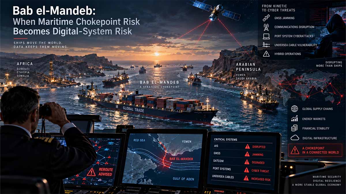
Scope — This assessment examines the Bab el-Mandeb–Red Sea–Suez system as a converged maritime-security environment in which Houthi missile and unmanned-system capabilities, merchant-shipping exposure, GNSS and AIS dependency, submarine telecommunications infrastructure, port cyber resilience and European supply-chain continuity increasingly interact, with specific attention to Italy, France, Germany, the United Kingdom and the European Union, while preserving a strict distinction between documented electronic interference and publicly unproven attribution.
Executive Summary / BLUF
- Bab el-Mandeb should now be assessed as a physical-digital chokepoint rather than solely as a naval one, because the same geographic corridor concentrates merchant shipping exposed to missiles and unmanned systems, satellite-dependent navigation, AIS-based situational awareness, telecommunications routes and logistics systems whose disruption can transmit a local security incident into European supply chains, even when no single actor is responsible for every component of the risk.
- The kinetic baseline is established rather than hypothetical: the U.S. Maritime Administration records more than 100 separate Houthi attacks on commercial vessels between November 2023 and October 2025, affecting vessels associated with more than 60 countries, while its current advisory identifies UAVs, unmanned surface and underwater vehicles, ballistic and cruise missiles, small boats, explosive craft and seizure or boarding as continuing threat vectors in the southern Red Sea, Bab el-Mandeb and Gulf of Aden. 2026-006-Red Sea, Bab el Mandeb Strait, Gulf of Aden, Arabian Sea, and Somali Basin-Houthi Attacks on Commercial Vessels — U.S. Maritime Administration
- The digital-navigation problem is independently documented, but attribution must remain disciplined: the U.S. Coast Guard GPS User Issue Detection & Evaluation Tool records repeated 2026 Red Sea reports of GPS loss, jamming and spoofing, including positions jumping to manifestly incorrect coordinates, while NAVCEN repeatedly found no corresponding GPS constellation failure, authorised test or evident space-weather explanation and classified the cases as “Unknown Interference”, which establishes the phenomenon but not its perpetrator. GPS User Issue Detection & Evaluation (GUIDE) Tool — U.S. Coast Guard Navigation Center
- The AIS problem is different but complementary: U.S. maritime guidance does not establish that the Houthis manipulate AIS signals, yet it explicitly warns that vessels transmitting AIS in the threat area can become easier for hostile actors to track and target, while the European Maritime Safety Agency has separately established a specialist working group dealing with AIS spoofing and GPS/GNSS jamming, demonstrating that European maritime authorities already treat manipulation of maritime digital positioning and identification systems as a security problem in its own right. 2026-006-Red Sea, Bab el Mandeb Strait, Gulf of Aden, Arabian Sea, and Somali Basin-Houthi Attacks on Commercial Vessels — U.S. Maritime Administration Working Group on “Automatic Identification System (AIS) spoofing” — European Maritime Safety Agency
- The telecommunications layer materially enlarges the strategic stakes because the International Telecommunication Union states that submarine telecommunications cables carry more than 99% of worldwide data traffic and identifies physical exposure, repair delays, geographic concentration and dependency on limited numbers of systems as major resilience problems; consequently, an armed crisis can degrade connectivity even without deliberate cable sabotage if access, repair vessels, insurance, port logistics or maintenance windows become constrained. International Advisory Body approves landmark report to strengthen submarine cable resilience — International Telecommunication Union — Jul 2026
- The European policy architecture already contains many of the required instruments, because the revised EU Maritime Security Strategy explicitly covers cyber and hybrid attacks, critical maritime infrastructure, underwater cables, ports, information sharing and civilian-military situational awareness, while the 2025–2026 EU cable-security framework adds prevention, detection, response, repair and deterrence; the strategic gap therefore lies less in recognising the problem than in integrating these instruments operationally around exposed sea lanes such as Bab el-Mandeb. Maritime security: Council approves revised EU strategy and action plan — Council of the European Union — Oct 2023 Submarine Cable Security Toolbox and Cable Projects of European Interest — European Commission — Feb 2026
- For Italy, the issue is immediate rather than conceptual: Defence Minister Guido Crosetto stated in September 2026 that he had instructed the Italian Navy to prepare what was necessary to secure the transit of Italian ships through the worsening Bab el-Mandeb situation, while Italy had already deployed frigates under EUNAVFOR ASPIDES and escorted merchant vessels through the Red Sea during 2026; the central institutional question is therefore how to connect naval protection to cyber resilience, alternative navigation, cable continuity, port preparedness and commercial intelligence. Il Ministro Crosetto al Forum “Risorsa Mare” — Italian Ministry of Defence — Sep 2026 Comunicato Stampa n. 29 del 01 agosto 2026 — Italian Ministry of Defence
Bab el-Mandeb: Europe’s Maritime Defence Is Becoming a Digital Resilience Test
Europe’s Red Sea problem is no longer whether it can escort a merchant vessel through Bab el-Mandeb, but whether it can keep the entire Europe–Suez–Asia continuity chain functioning when physical attack, corrupted navigation, communications failure and infrastructure disruption occur in the same operating space. By 24 August 2026, EUNAVFOR ASPIDES had supported more than 2,390 merchant vessels and provided close protection to more than 720 ships, while the European Union had already extended the mission to 28 February 2027. Yet the decisive institutional shift came on 30 March 2026, when ASPIDES and ATALANTA were authorised to collect and share information on suspicious activity concerning critical submarine infrastructure. That decision exposes the new strategic equation: naval defence can keep a ship moving, but only integrated cyber, port, telecommunications and recovery capacity can keep trade moving.
The cost of insecurity is measured in displaced commerce, not ships sunk
The 2024 Suez figures demonstrate why a relatively limited attack capability can generate effects far beyond the number of vessels actually struck. Suez Canal transits fell from 26,434 vessels in 2023 to 13,213 in 2024, a decline of approximately 50%, while net tonnage dropped from 1.568 billion tonnes to 525 million tonnes, down 66.5%, and canal revenue fell from $10.250 billion to $3.991 billion. UNCTAD separately recorded Gulf of Aden ship capacity down 76% and Cape of Good Hope arrivals up 89% by mid-2024.
Those numbers describe a behavioural shock rather than a physical closure. The European Central Bank calculated that an Asia–Europe voyage routed around the Cape of Good Hope is roughly 30% longer than the Suez alternative, which converts insecurity into additional vessel-days, bunker fuel, charter demand and inventory time. UNCTAD later estimated global ton-mile growth at nearly 6% in 2024 and container ton-mile growth at about 17%, even though global seaborne trade volume grew only 2.2%. Bab el-Mandeb therefore produces leverage because one threatened corridor can absorb capacity across an entire shipping network.
ASPIDES has become more than an escort operation
The institutional response has expanded with the burden. On 27 May 2026, ASPIDES reported more than 1,960 merchant vessels supported and more than 650 protected; by 24 August, those figures had risen above 2,390 and 720 respectively. The operation’s mandate now runs through 28 February 2027, with nearly €15 million allocated as the reference amount for EU common costs between March 2026 and February 2027, excluding the wider national cost of ships, aircraft, crews and logistics.
The more important change is qualitative. On 30 March 2026, the Council of the European Union expanded the mandates of ASPIDES and ATALANTA to allow collection and sharing of information on suspicious activity related to critical submarine infrastructure, strengthened ASPIDES links with the EU’s CRIMARIO maritime-awareness programme and added cooperation with the Yemeni Coast Guard and maritime forces of Djibouti. The EU has therefore begun to move from protection of individual hulls toward awareness of the infrastructure environment around the route, without converting ASPIDES into a general cyber or cable-protection command.
Navigation integrity has entered the security equation without settling attribution
U.S. Coast Guard NAVCEN records from March to June 2026 document repeated Red Sea GPS and GNSS anomalies, including loss of signal, position jumps and locations displayed far from a vessel’s actual position. Several cases were classified as “Unknown Interference” after investigators found no known GPS constellation anomaly, authorised test or convincing space-weather explanation. That distinction matters: interference is documented; public attribution to Ansar Allah is not.
The operational problem exists regardless of attribution because spoofing can be more dangerous than simple signal denial. A bridge receiving no position knows that navigation has degraded; a bridge receiving a plausible but false position may continue feeding corrupted information into ECDIS, AIS-related situational awareness and shore reporting. EMSA’s dedicated work on AIS spoofing and GPS/GNSS jamming therefore addresses a problem already visible in operational reporting, while the EU’s revised Maritime Security Strategy explicitly places cyber and hybrid threats, ports and undersea cables inside the maritime-security perimeter.
Europe has built the rules, but the information still sits in different institutions
The legal structure is unusually complete. Directive (EU) 2022/2555, NIS2, brings sea and coastal freight transport companies, port managing bodies, port facilities and operators of port equipment inside Europe’s high-criticality cybersecurity regime. Directive (EU) 2022/2557, the Critical Entities Resilience Directive, adds an all-hazard resilience framework. EMSA handles navigation-integrity cooperation, national CSIRTs handle cyber incidents, telecom authorities oversee communications infrastructure, while ASPIDES provides the deployed maritime-security component.
The weakness lies between these systems. A merchant master can report GNSS spoofing, a frigate can observe suspicious activity near infrastructure, a port operator can detect an OT anomaly and a cable company can register capacity loss, but those observations originate under different authorities, classification rules and commercial obligations. As of September 2026, the public dossier does not establish a permanent real-time European mechanism automatically correlating ASPIDES observations, EMSA navigation data, national cyber incident reporting, port status and cable performance. Europe has built the sensors and the mandates; the unresolved task is fusion.
Cable security is forcing Europe to treat recovery as a defence capability
Submarine telecommunications cables carry more than 99% of international data traffic, yet more than 200 cable repairs were recorded globally in 2023, showing why cable security cannot be designed around sabotage prevention alone. A fault may be accidental, but a security crisis can still raise its economic cost if repair ships cannot enter an area quickly, permits are delayed, port support is unavailable or alternative capacity is already congested.
The European Commission’s 2026 response moves directly into this recovery problem. Its cable-security package includes €347 million for strategic digital-backbone and resilience measures during 2026–2027 and a dedicated €20 million call for adaptable repair modules that can be positioned in ports or shipyards. This sits alongside €595 million supporting 74 backbone-connectivity projects and €35.6 million invested in eight Atlantic and Nordic submarine cable projects. The policy sequence has therefore shifted from mapping vulnerabilities to financing restoration capacity, because redundancy protects services immediately after failure while repair determines how long emergency routing must carry the load.
Italy and France bring ships; Germany and Britain expose the limits of a single European model
Italy entered 2026 with a direct operational role. The frigate Carlo Bergamini completed dedicated ASPIDES preparation against air, surface and underwater threats before deployment, and by September the Italian Navy also reported the mine-countermeasure vessels Rimini and Crotone operating in the theatre. Italy’s next problem is therefore institutional rather than purely naval: information gathered at sea must be usable by authorities responsible for ports, telecommunications, cybersecurity and merchant shipping if the country is to convert naval presence into national continuity.
France has combined surface escort with airborne maritime awareness. In August 2026, a French frigate escorted merchant shipping through Bab el-Mandeb while an ATLANTIQUE 2 maritime-patrol aircraft conducted surveillance, and a late-July operational update recorded two FREMM frigates and an ATLANTIQUE 2 active in the region. Germany presents a different profile: its Bundeswehr mandate allowed up to 350 personnel in ASPIDES through 31 October 2026, but only about 10 German personnel were actually deployed on 7 September. The United Kingdom remains outside ASPIDES while retaining national maritime cyber codes for ships and ports and, on 22 September 2026, announcing additional defensive military support to Saudi Arabia. Europe therefore has no uniform force model to integrate; it has different national assets that must remain interoperable.
The next 12–24 months will determine whether Europe owns a system or a collection of programmes
Between September 2026 and the end of 2028, the decisive test will not be whether Europe publishes another maritime-security strategy but whether existing instruments begin producing measurable recovery and coordination performance. ASPIDES already has a mandate through 28 February 2027; the €347 million cable programme is moving into implementation; NIS2 and the Critical Entities Resilience Directive provide the civilian regulatory base; EMSA already has a specialist GNSS/AIS mechanism; and Italy, France, Germany and the United Kingdom already contribute different combinations of naval, cyber and infrastructure capability.
The cost of failing to connect them will not fall mainly on defence ministries. Shipping companies will pay through longer routing and vessel utilisation; manufacturers will pay through inventory delays; ports will pay through disrupted throughput; telecommunications operators will pay for redundancy and emergency restoration; Egypt has already demonstrated the fiscal cost through the collapse of Suez revenue from $10.250 billion in 2023 to $3.991 billion in 2024; and European consumers ultimately absorb part of the transport and supply-chain premium. The institutional choice for the next 12–24 months is therefore concrete: either Europe turns naval protection, cyber regulation, navigation integrity and cable recovery into one interoperable continuity system, or it continues paying separately for each failure after it reaches a different ministry, operator or balance sheet.
Navigational Index
Physical Coercion, Maritime Access and Strategic Leverage
How Houthi missiles, drones, unmanned maritime systems and geographic position translate limited regional military power into disproportionate effects on commercial routes linking Asia, the Middle East and Europe.
Navigation, Data and Infrastructure as a Single Exposure Surface
Why GNSS disruption, AIS dependency, submarine cables, digital vessel management, communications and port IT/OT systems now create a second layer of vulnerability that remains analytically distinct from the kinetic threat but can interact with it operationally.
From Naval Protection to European Cyber-Maritime Resilience
How ASPIDES, national naval deployments, EU maritime-security policy, cable-resilience instruments, cybersecurity law and national capabilities can be connected so that protection of the route encompasses ships, positioning, communications, ports, data and recovery capacity.
Master Abstract
The chokepoint has changed before the map has changed
The principal judgment is that Bab el-Mandeb has acquired a digital-security dimension that materially changes the meaning of maritime defence even though the public record does not establish a unified Houthi capability to attack every element of that digital ecosystem, because the strategic risk emerges from the co-location and interdependence of systems rather than from proof that one adversary controls them all. The kinetic component is documented by official maritime-security reporting: the current U.S. Maritime Administration advisory describes continued Houthi capacity to threaten commercial vessels through ballistic and cruise missiles, one-way UAVs, unmanned surface vehicles, unmanned underwater vehicles, small craft and boarding or seizure, while the International Maritime Organization in July and August 2026 again documented lethal attacks and warned that attacks in the Red Sea threaten seafarers, shipping security and global supply chains. 2026-006-Red Sea, Bab el Mandeb Strait, Gulf of Aden, Arabian Sea, and Somali Basin-Houthi Attacks on Commercial Vessels — U.S. Maritime Administration Statement on deadly ship attack in the Red Sea — International Maritime Organization — Aug 2026
What changes the analytical picture is that modern commercial navigation through the same battlespace is inseparable from satellite positioning, ship-identification systems, communications networks, digital charts, remote operational support, port-information systems and increasingly automated logistics processes, so degradation of the informational layer can increase the consequences of an already dangerous physical environment without constituting a conventional “cyberattack” in the narrow sense. The European Maritime Safety Agency has therefore convened Member-State experts specifically around AIS spoofing and GPS/GNSS jamming, while the revised EU Maritime Security Strategy explicitly places maritime-domain awareness, cyber and hybrid threats and the protection of underwater cables, ports and offshore infrastructure within a common security framework rather than treating them as unrelated technical disciplines. Working Group on “Automatic Identification System (AIS) spoofing” — European Maritime Safety Agency Maritime security strategy — European Commission
GNSS interference is established; Houthi attribution is not
The strongest publicly verifiable evidence for the electronic-navigation dimension comes from the U.S. Coast Guard Navigation Center, whose 2026 GUIDE records contain repeated Red Sea reports of GPS loss, spoofing and jamming, including a 23 March report in which a vessel’s position repeatedly moved between correct and clearly incorrect coordinates, a 21 May report describing intermittent loss and false positioning toward Sudan, and a June report of a position being displaced far from the vessel’s actual location. In many of those records, the GPS Operations Center reported no known constellation or control-segment anomaly, no authorised local test and no convincing space-weather explanation, while the cause was nevertheless retained as Unknown Interference rather than assigned to a named actor. GPS User Issue Detection & Evaluation (GUIDE) Tool — U.S. Coast Guard Navigation Center
That distinction is strategically significant because evidence of interference and evidence of attribution answer different intelligence questions: the first establishes an operational condition requiring redundancy and altered procedures, whereas the second would require evidence about emitter location, technical signatures, command relationships, captured systems, intelligence collection or another attribution chain that the public GUIDE record does not provide. Nothing in the verified Coast Guard material reviewed here permits the narrower conclusion that the documented Red Sea GNSS anomalies were conducted by Ansar Allah, and asserting such attribution would therefore turn an observed vulnerability into an unsupported actor-specific claim; conversely, the absence of public attribution does not diminish the operational requirement to navigate safely in an environment where reliable PNT cannot always be assumed. GPS User Issue Detection & Evaluation (GUIDE) Tool — U.S. Coast Guard Navigation Center
AIS is simultaneously a safety mechanism and an information exposure
AIS presents a related but technically different problem because its primary function is maritime safety, identification and situational awareness rather than positioning itself, yet the information it transmits can also reveal vessel identity, movement and location to actors capable of exploiting commercially available or directly received maritime data. The U.S. Maritime Administration therefore advises U.S.-flagged commercial vessels in the affected region that operation of AIS transponders can increase targeting exposure and notes that SOLAS and IMO guidance allow masters to disable AIS where continuous operation would compromise the safety or security of the ship, while also emphasising that such a decision remains a safety judgment because AIS has collision-avoidance and navigational value. 2026-006-Red Sea, Bab el Mandeb Strait, Gulf of Aden, Arabian Sea, and Somali Basin-Houthi Attacks on Commercial Vessels — U.S. Maritime Administration
This evidence supports a narrower and more defensible proposition than the claim that Ansar Allah is “hacking AIS”: maritime digital visibility can interact with kinetic targeting, while AIS itself is also exposed to spoofing and falsification risks that European authorities are separately studying, meaning vessel operators must manage both the danger of excessive visibility and the danger of corrupted situational awareness. EMSA’s dedicated working group explicitly addresses both AIS spoofing and GPS/GNSS jamming and describes its objective as improving detection, assessment and resilience against threats to critical digital systems at sea, which makes the cyber-maritime concept institutionally grounded rather than merely rhetorical. Working Group on “Automatic Identification System (AIS) spoofing” — European Maritime Safety Agency
The undersea layer turns navigation security into communications security
The second major expansion of the risk surface lies below the vessels rather than aboard them, because submarine telecommunications infrastructure carries the overwhelming majority of international data and therefore places communications continuity within the same broad maritime-security geography. The International Advisory Body on Submarine Cable Resilience, whose final recommendations were approved in July 2026, describes submarine telecommunications cables as infrastructure carrying more than 99% of data traffic worldwide and identifies exposure to physical hazards, prolonged repair times, geographic concentration and dependency on limited numbers of systems as central resilience challenges. International Advisory Body approves landmark report to strengthen submarine cable resilience — International Telecommunication Union — Jul 2026
The important analytical implication is that intentional sabotage is only one possible failure pathway, because armed conflict can reduce infrastructure availability indirectly by making repair zones inaccessible, increasing risk to specialist vessels and crews, delaying permits or port operations, altering insurance conditions, constraining maintenance windows or forcing cable operators to depend longer on remaining routes. The European Union has adopted the same resilience logic through its 2025 cable-security action framework and the February 2026 Submarine Cable Security Toolbox and Cable Projects of European Interest, which organise cable security around prevention, detection, response and recovery, and deterrence rather than assuming that perimeter protection alone can guarantee continuity. Joint Communication to strengthen the security and resilience of submarine cables — European Commission — Feb 2025 Submarine Cable Security Toolbox and Cable Projects of European Interest — European Commission — Feb 2026
Houthi technological supply chains connect commercial components to military capability
The public official record also demonstrates why technology supply chains belong within the analysis even though this does not establish a Houthi cyberwarfare programme, because the latest publicly available UN Panel of Experts final report on Yemen records seizures containing drones, drone components, complete drone kits, remote-control units, high-frequency equipment, antennas, GPS modules, propellers, surveillance equipment, missile components, radars and communications equipment, while the Security Council subsequently required additional reporting on dual-use components and precursor chemicals. Reports — Panel of Experts on Yemen — United Nations Security Council
The analytical significance lies not in treating every navigation component as a weapon, but in recognising that contemporary missile and unmanned-system architectures depend on electronics, communications, positioning, propulsion, sensors and control components whose commercial availability can complicate export control and interdiction. The Security Council’s own 2025–2026 mandate specifically directed the Panel to report on dual-use components and precursor chemicals and their direct or indirect supply to Yemen, which provides an official institutional basis for treating supply-chain disruption and technology-control enforcement as components of the wider maritime-security response rather than as unrelated customs issues. Repertoire of the Practice of the Security Council — 28th Supplement — United Nations Security Council
Key Evidence Table
| Indicator | Value/status | Reference date | Definition/scope | Issuer | Exact source |
|---|---|---|---|---|---|
| Houthi attacks on commercial vessels | More than 100 attacks, affecting vessels associated with more than 60 nations | Nov 2023–Oct 2025 | Separate Houthi attacks against commercial vessels in the southern Red Sea/Gulf of Aden threat environment | U.S. Maritime Administration | 2026-006-Red Sea, Bab el Mandeb Strait, Gulf of Aden, Arabian Sea, and Somali Basin-Houthi Attacks on Commercial Vessels |
| Red Sea GNSS interference | Multiple reports of GPS loss, jamming and spoofing; causes repeatedly recorded as Unknown Interference | Mar–Jun 2026 examples | User reports investigated against GPS constellation status, authorised testing and space weather | U.S. Coast Guard NAVCEN | GPS User Issue Detection & Evaluation (GUIDE) Tool |
| AIS-related targeting exposure | AIS transmission assessed as capable of increasing hostile targeting exposure | Current 2026 advisory | U.S.-flag commercial shipping in Red Sea/Bab el-Mandeb/Gulf of Aden and adjoining threat areas | U.S. Maritime Administration | 2026-006-Red Sea, Bab el Mandeb Strait, Gulf of Aden, Arabian Sea, and Somali Basin-Houthi Attacks on Commercial Vessels |
| European AIS/GNSS security activity | Dedicated working group on AIS spoofing and GPS/GNSS jamming | Nov 2024 onward | Detection, assessment and resilience of digital maritime systems | EMSA | Working Group on “Automatic Identification System (AIS) spoofing” |
| Submarine-cable share of global data | More than 99% of worldwide data traffic | Jul 2026 | Submarine telecommunications cables | ITU | International Advisory Body approves landmark report to strengthen submarine cable resilience |
| ASPIDES mandate | Extended to 28 February 2027 | 23 Feb 2026 | EU defensive maritime-security operation for Red Sea and surrounding waters | Council of the EU | Red Sea: Council extends the mandate of Operation ASPIDES to safeguard freedom of navigation |
| ASPIDES common-cost reference amount | Nearly €15 million | 1 Mar 2026–28 Feb 2027 | Common costs of operation during extended mandate | Council of the EU | Red Sea: Council extends the mandate of Operation ASPIDES to safeguard freedom of navigation |
| Merchant vessels protected by ASPIDES | More than 670 | First 29 months of operation, reported Jul 2026 | Merchant vessels protected under defensive EU operation | EEAS / EUNAVFOR ASPIDES | HR/VP Kaja Kallas Visits EUNAVFOR ASPIDES in Djibouti |
| Seafarers assisted by ASPIDES | 128 | First 29 months of operation, reported Jul 2026 | Seafarers saved/assisted by the operation | EEAS / EUNAVFOR ASPIDES | HR/VP Kaja Kallas Visits EUNAVFOR ASPIDES in Djibouti |
| Detour penalty via Cape of Good Hope | Asia–Europe voyages roughly 30% longer in the ECB’s 2024 assessment | 2024 benchmark | Distance/time effect of rerouting around Africa rather than using Suez | European Central Bank | ECB staff macroeconomic projections for the euro area, March 2024 |
Physical Coercion, Maritime Access and Strategic Leverage
Bab el-Mandeb generates disproportionate strategic leverage because the military effect of a weapon deployed near the strait is not limited to physical damage against its direct target; rather, the relevant transmission mechanism operates through operator risk assessments, insurance, crew safety, naval-protection requirements, route planning, fleet allocation and the willingness of shipping companies to accept continued exposure. UNCTAD describes maritime transport as carrying more than 80% of world merchandise trade by volume and identifies the Red Sea and Suez disruptions as part of a broader pattern in which chokepoint instability reshapes routes, schedules and logistics, while its earlier documented observations showed substantial rerouting around the Cape of Good Hope when Red Sea risk rose. Multi-year expert meeting on transport, trade logistics and trade facilitation, 12th session — UN Trade and Development — Apr 2026
The European Central Bank’s historical measurement of the 2024 disruption illustrates the mechanism without implying that those exact magnitudes automatically describe September 2026: its March 2024 analysis estimated that rerouting Asia–Europe shipping around the Cape made voyages approximately 30% longer, while a more severe prolonged-disruption scenario would have reduced euro-area extra-area export growth by 1.3 percentage points in 2024 and 0.8 percentage points in 2025 relative to that projection’s baseline. Those numbers are scenario-dependent and historical rather than current forecasts, but they demonstrate why a relatively narrow physical chokepoint can produce macroeconomic consequences through vessel utilisation, transport prices, inventory timing and manufacturing supply chains rather than through destruction of cargo alone. ECB staff macroeconomic projections for the euro area, March 2024 — European Central Bank
The current operational environment reinforces that transmission mechanism because the IMO in July 2026 again characterised the Red Sea as a critical corridor for international trade and warned that renewed attacks endangered seafarers, shipping security, the marine environment and global supply-chain stability, while in August it confirmed fatalities following a projectile strike against the cargo ship TIHAMAH off Al Mokha. These official records establish that the threat is not reducible to political messaging or theoretical anti-access capability and that commercial-shipping decisions must account for recurrent lethal risk in the same geographic space through which Europe accesses Suez. Statement on recent attacks on ships in the Red Sea — International Maritime Organization — Jul 2026 Statement on deadly ship attack in the Red Sea — International Maritime Organization — Aug 2026
Navigation, Data and Infrastructure as a Single Exposure Surface
The decisive shift is therefore conceptual but grounded in observable systems: a protected merchant vessel is not operationally independent of accurate navigation, communications availability, trustworthy situational awareness, port connectivity and logistics data, so intercepting a missile protects one part of the maritime system without necessarily ensuring the continuity of the route. This is consistent with the revised EU Maritime Security Strategy, which directs attention not only to naval activity but also to improved maritime-domain situational awareness, greater civilian-military information exchange, cyber and hybrid threats, underwater cables, ports and other critical maritime infrastructure. Maritime security: Council approves revised EU strategy and action plan — Council of the European Union — Oct 2023
The EU already possesses elements of the institutional architecture required to integrate this picture, because the strategy specifies greater use of the Common Information Sharing Environment (CISE) and MARSUR for secure information exchange and coordination between national and European maritime-surveillance authorities, together with increased integration of space-based solutions and exercises addressing harbour protection, cyber threats and hybrid threats. The practical implication for Bab el-Mandeb is that GNSS interference reports, suspicious AIS anomalies, threat intelligence, naval observations, commercial shipping data, cable incidents and port cyber indicators should be treated as mutually relevant operational information streams rather than as separate technical datasets owned by unrelated communities. Maritime security: Council approves revised EU strategy and action plan — Council of the European Union — Oct 2023
European cybersecurity law provides another part of the architecture, because Directive (EU) 2022/2555 — the NIS2 Directive requires cybersecurity risk-management and incident-reporting mechanisms across designated essential and important entities and explicitly covers categories of critical economic infrastructure rather than limiting cybersecurity governance to traditional information-technology companies. The analytical implication is not that NIS2 constitutes a naval instrument, but that European resilience against Bab el-Mandeb disruption necessarily reaches beyond warships into the regulated cyber preparedness of ports, communications providers and other infrastructure operators whose service continuity determines whether maritime trade can continue under degraded conditions. Directive (EU) 2022/2555 — EUR-Lex
From Naval Protection to European Cyber-Maritime Resilience
Italy: the most immediate national convergence problem
Italy has already moved beyond a purely declaratory posture because the Ministry of Defence confirms the deployment of Italian naval units under EUNAVFOR ASPIDES, including Luigi Rizzo and Bergamini, with the latter conducting merchant-vessel protection in the Red Sea during summer 2026, while the Italian Navy defines ASPIDES as a defensive mission capable of close protection, area protection and escort against missile, aerial-drone, maritime-drone and small-boat threats in the high-threat zone off Yemen. Operazione Aspides — Marina Militare Comunicato Stampa n. 29 del 01 agosto 2026 — Italian Ministry of Defence
The September 2026 shift is important because Crosetto publicly stated that he and the Chief of Defence had activated the Navy to prepare what was necessary to secure Italian vessels through the deteriorating Bab el-Mandeb situation, explicitly connecting route interruption with shipment delays, higher costs and consequences for businesses and households. The statement is evidence of Italian government intent and preparatory action rather than, by itself, proof that a distinct new national naval mission has completed authorisation, deployment or reached operational capability, which should therefore be verified separately as the institutional record develops. Il Ministro Crosetto al Forum “Risorsa Mare” — Italian Ministry of Defence — Sep 2026
Italy’s next policy problem is consequently less about discovering the existence of a maritime threat than about joining naval escort, merchant-shipping intelligence, GNSS anomaly reporting, cable resilience, port cyber protection and degraded-mode operations into one national continuity framework, particularly because Italy’s geography and port-industrial system expose it directly to changes in Suez-linked maritime flows. Such integration would be consistent with the EU Maritime Security Strategy rather than a departure from it, because the strategy already defines maritime security in terms broad enough to encompass infrastructure, cyber threats and information-sharing alongside conventional naval functions. Maritime security strategy — European Commission
France: sustained naval presence combined with regional situational awareness
France remains directly relevant because the French Ministry of the Armed Forces reported in August 2026 that a French frigate escorted a merchant vessel through Bab el-Mandeb and the Red Sea under ASPIDES while an ATLANTIQUE 2 maritime-patrol aircraft conducted surveillance and situational-awareness missions, providing a model in which vessel protection and broader maritime-domain awareness are already operated together. Point de situation des opérations du jeudi 13 au 20 août 2026 — Ministère des Armées et des Anciens combattants
For the cyber-maritime problem, France’s comparative institutional value therefore lies in the combination of deployed naval capability, maritime surveillance and the ability to connect national assets to an EU operational architecture, although the official evidence reviewed here does not establish a dedicated French Bab el-Mandeb mission focused specifically on GNSS interference or submarine-cable protection. The relevant European requirement is thus to ensure that surveillance architectures capable of detecting ships, aircraft and missile threats can receive and distribute digital-navigation and infrastructure-warning information without conflating physical-domain observations with cyber attribution.
Germany: continued institutional relevance despite a different current force posture
Germany participated militarily in ASPIDES with the frigate Hessen, but the Bundeswehr’s current public operation page records that its last frigate contribution ended on 20 April 2024, meaning current German involvement should not be described as equivalent to the Italian or French naval deployments evidenced in 2026 unless a newer official deployment record emerges. Rotes Meer – EUNAVFOR Aspides — Bundeswehr
Germany nonetheless remains materially implicated through European trade, logistics, EU decision-making and the collective cyber and infrastructure-resilience architecture, while German personnel have previously participated in multinational ASPIDES command structures. The distinction matters analytically because European political participation, staff participation, industrial exposure and deployment of a surface combatant are separate variables and should not be collapsed into a binary description of whether a state “participates” in maritime security. Security and Defence Committee visits ITS Marceglia: two days at sea aboard the Flagship of Operation Aspides — EEAS
United Kingdom: outside ASPIDES but inside the same strategic problem
The United Kingdom is not a participant in the EU’s ASPIDES command structure, but the British government on 22 September 2026 joined France, Germany, Italy, the United States, Canada, Japan and the EU High Representative in a G7 statement characterising the situation in Yemen and Bab al-Mandab as a threat to regional stability, energy security, navigational rights and maritime security, while the UK Ministry of Defence announced additional defensive military support to Saudi Arabia following renewed Houthi attacks. G7 Statement on Bab al-Mandab and Navigational Rights and Freedoms — GOV.UK — Sep 2026 UK military support to the Kingdom of Saudi Arabia — GOV.UK — Sep 2026
The UK position therefore illustrates the importance of analysing European security beyond EU institutional membership, because British naval, air-defence, maritime-regulatory, intelligence and cyber capabilities remain relevant to regional stability while being connected through different political and operational mechanisms. The September G7 statement provides a fresh common diplomatic baseline across Italy, France, Germany and the United Kingdom, but it does not itself create a shared cyber-maritime command structure or establish a collective GNSS, cable and port-resilience mechanism; those would require additional institutional and technical arrangements beyond political alignment. G7 Statement on Bab al-Mandab and Navigational Rights and Freedoms — GOV.UK — Sep 2026
European Union: the instruments exist, but operational integration is incomplete
EUNAVFOR ASPIDES remains the principal EU kinetic-protection instrument in the theatre, and the Council extended its mandate through 28 February 2027, with nearly €15 million allocated for common costs during the extension period; by July 2026, the EEAS reported that the operation had protected more than 670 merchant vessels and saved 128 seafarers during its first 29 months. Red Sea: Council extends the mandate of Operation ASPIDES to safeguard freedom of navigation — Council of the European Union — Feb 2026 HR/VP Kaja Kallas Visits EUNAVFOR ASPIDES in Djibouti — EEAS — Jul 2026
The missing layer is not an absence of European policy instruments but the absence, in the official material reviewed, of a single operational framework that treats the Bab el-Mandeb route simultaneously as a missile-defence problem, a navigation-assurance problem, a telecommunications-continuity problem, a port-cyber problem and a supply-chain intelligence problem. The revised Maritime Security Strategy, EMSA’s AIS/GNSS work, NIS2, CISE, MARSUR and the EU submarine-cable framework provide compatible components, meaning the strategic evolution required is principally one of integration, information-sharing and operational continuity, not the invention of an entirely new policy field. Maritime security: Council approves revised EU strategy and action plan — Council of the European Union Working Group on “Automatic Identification System (AIS) spoofing” — EMSA Submarine Cable Security Toolbox and Cable Projects of European Interest — European Commission
Principal Gaps and Watch Indicators
The assessment would materially change if credible official evidence emerged assigning specific Red Sea GNSS spoofing or jamming incidents to Ansar Allah, because that would convert the current condition of co-located kinetic threat and unattributed electronic interference into evidence of integrated electronic-warfare employment; until such attribution is supported by technical or intelligence evidence, the correct formulation remains that both phenomena coexist in the same maritime environment without a publicly established common perpetrator. GPS User Issue Detection & Evaluation (GUIDE) Tool — U.S. Coast Guard Navigation Center
A second decisive indicator is whether Italian preparations announced in September 2026 produce a formally authorised and operationally distinct national protection mission, additional naval assets or new rules for cooperation with ASPIDES, because the current Ministry of Defence statement establishes preparation and intent while existing official records separately establish Italy’s substantial participation in ASPIDES. Il Ministro Crosetto al Forum “Risorsa Mare” — Italian Ministry of Defence Operazione Aspides — Marina Militare
A third indicator is any confirmed physical degradation of submarine telecommunications infrastructure in the southern Red Sea or Gulf of Aden combined with constrained repair access, because the ITU’s 2026 resilience analysis identifies repair time, physical exposure and geographic concentration as systemic vulnerabilities, while the EU cable-security framework makes rapid detection, recovery and rerouting central to resilience. International Advisory Body approves landmark report to strengthen submarine cable resilience — ITU Joint Communication to strengthen the security and resilience of submarine cables — European Commission
A fourth indicator is evidence that merchant vessels increasingly resort to dead reckoning, manual fixes, multi-constellation cross-checking or other alternative PNT procedures during Red Sea transit, because such behaviour would indicate that GNSS degradation is moving from intermittent electronic anomaly to a sustained operational-navigation constraint; NAVCEN already records at least one regional report describing navigation through dead reckoning and manual shore fixes during spoofing, although that example occurred in the Gulf of Oman rather than Bab el-Mandeb itself and should therefore not be misrepresented geographically. GPS User Issue Detection & Evaluation (GUIDE) Tool — U.S. Coast Guard Navigation Center
A fifth indicator concerns technological supply chains, because additional Panel of Experts evidence showing recurrent interdiction of guidance, communications, sensors, propulsion or specialised dual-use components would increase confidence that targeted export-control and interdiction measures can constrain replenishment, whereas evidence of effective substitution, indigenous production or diversified procurement would reduce the expected effect of component-denial policies. Reports — Panel of Experts on Yemen — United Nations Security Council
Decision-Relevant Courses of Action
| Course | Institutional hook | Expected effect | Implementation burden | Time-to-effect | Reversibility | Principal downside |
|---|---|---|---|---|---|---|
| Expand naval protection and maritime-domain awareness without changing ASPIDES’ defensive character | Existing ASPIDES mandate, national naval authorities, CISE/MARSUR | Reduces kinetic exposure and improves warning and tracking | High operational and force-generation burden | Immediate to months | High | Sustained deployments consume scarce high-end naval assets and do not independently solve navigation or infrastructure failure |
| Establish a Red Sea GNSS/AIS anomaly-sharing mechanism for European shipping | EMSA AIS-spoofing work, CISE, national maritime authorities, ASPIDES information structures | Converts isolated technical reports into operational maritime-domain awareness and accelerates anomaly verification | Moderate technical and coordination burden | Months | High | Poorly governed reporting could generate false alarms or reveal commercially sensitive vessel information |
| Require tested degraded-PNT and degraded-connectivity procedures for exposed shipping and ports | Flag-state safety frameworks, maritime regulators, port-security and cybersecurity obligations | Reduces dependency on a single navigation or communications channel | Moderate training, equipment and certification burden | Months to several years | High | Additional operating cost and procedural complexity without eliminating sophisticated interference |
| Integrate Red Sea contingencies into EU cable-resilience planning | EU Cable Security Action Plan, Cable Security Toolbox, national telecom authorities | Improves rerouting, repair prioritisation, spare capacity and recovery planning | High cross-border infrastructure and commercial coordination burden | Medium term | Medium | Redundancy and repair capacity require sustained investment and cannot eliminate geographically concentrated risk |
| Tighten intelligence-led controls on military-relevant dual-use supply networks | UN Yemen sanctions framework, EU and national export-control regimes, customs and maritime interdiction | Raises replenishment friction for missiles and unmanned systems where identifiable components remain externally sourced | High intelligence, customs and diplomatic burden | Medium term | Medium | Substitution, diversion and legitimate commercial use complicate enforcement and can impose costs on lawful trade |
These options are complementary rather than substitutes, because naval escort reduces immediate physical exposure while PNT resilience, cable redundancy, port cyber preparedness and supply-chain enforcement address different mechanisms through which the same geographic crisis can produce systemic economic effects; the principal policy choice is therefore not between “military” and “cyber” responses, but how much institutional integration is required to prevent failure in one domain from amplifying risk in another.
Principal Judgment
The public record supports describing Bab el-Mandeb as an emerging cyber-maritime chokepoint, provided that expression is defined carefully: Houthi missiles, drones and maritime attacks constitute the documented hostile component; Red Sea GNSS interference constitutes a separately documented electronic-navigation hazard whose public attribution remains unresolved; AIS creates both safety value and targeting exposure while also being vulnerable to spoofing; submarine cables create a communications-continuity layer whose vulnerability includes repair and redundancy rather than sabotage alone; and European ports and logistics systems transform disruption at sea into downstream economic consequences.
The resulting strategic requirement is broader than missile interception but narrower than an unsupported claim of integrated Houthi cyberwarfare, because the evidence supports convergence of vulnerabilities more strongly than it supports attribution of every digital anomaly to the same actor. For Italy and Europe, the decision-relevant objective is therefore to reduce the conversion efficiency by which a local military crisis becomes a systemic trade, navigation or communications shock: ships must remain navigable under degraded GNSS, maritime authorities must distinguish genuine and manipulated vessel information, ports must preserve essential operations during cyber disruption, cable networks must possess rerouting and repair options, and naval forces must receive enough digital-domain information to understand when physical and electronic anomalies are interacting.
That direction is already compatible with the EU’s own maritime-security doctrine, which explicitly combines freedom of navigation, maritime-domain awareness, critical infrastructure protection, cyber and hybrid threats and civilian-military cooperation, so the central institutional problem is no longer whether cyber resilience belongs inside maritime security, but how rapidly Europe can translate already fragmented authorities and capabilities into a common operational model for strategically exposed corridors such as Bab el-Mandeb. Maritime security: Council approves revised EU strategy and action plan — Council of the European Union
Visualisation determination
No quantitative chart would materially improve this first-delivery assessment without either mixing historical and current datasets or assigning unsupported weights to heterogeneous kinetic, navigational, cyber and infrastructure risks; the geographical orientation above is therefore retained solely to establish the corridor relationship, while no decision-useful quantitative visualisation is supportable from the verified record without introducing assumptions that would violate the stated methodology.
Because the operational picture is changing rapidly, the official-record watch can also be automated around new IMO incidents, Italian or ASPIDES deployments, NAVCEN GNSS reports, UN Panel findings and EU cable-security measures, with notification only when a development materially changes this assessment.
Bab el-Mandeb: When a Maritime Chokepoint Becomes a Digital-System Risk
The central judgment is that Bab el-Mandeb should now be assessed as a combined physical and digital chokepoint, because the same corridor concentrates merchant shipping exposed to Houthi missiles and unmanned systems, satellite-dependent navigation, AIS-based situational awareness, submarine telecommunications infrastructure, port cyber dependencies and European supply-chain exposure, while the official record still requires a strict distinction between documented GNSS interference and any actor-specific attribution that has not been publicly established by competent technical authorities.
Kinetic coercion converts geography into strategic leverage
Verified indicators, scope and source authority
| Indicator | Value / Status | Reference | Definition / Scope | Official source |
|---|---|---|---|---|
| Houthi attacks on commercial vessels | More than 100 | Nov 2023–Oct 2025 | Separate attacks affecting commercial vessels in the Red Sea / Bab el-Mandeb threat environment and vessels associated with more than 60 nations. | U.S. Maritime Administration — MSCI 2026-006 |
| Red Sea GNSS interference | Multiple incidents; attribution unresolved | 2026 reports | GPS loss, jamming and spoofing reports investigated against constellation status, authorised testing and space-weather conditions; multiple cases classified as “Unknown Interference”. | U.S. Coast Guard NAVCEN — GUIDE Tool |
| AIS targeting exposure | Operational warning | 2026 advisory | MARAD warns that AIS transmission can increase targeting exposure in the Houthi threat environment, while AIS remains important to navigational safety. | U.S. Maritime Administration — MSCI 2026-006 |
| AIS spoofing and GNSS-jamming resilience | Dedicated EU working activity | From 2024 onward | European specialist work on detection, assessment and resilience relating to AIS spoofing and GPS/GNSS jamming. | European Maritime Safety Agency |
| Submarine cables and global data traffic | More than 99% | Jul 2026 | Worldwide data traffic carried over submarine telecommunications cables, making cable availability and repair continuity a systemic infrastructure issue. | International Telecommunication Union |
| ASPIDES mandate | Extended to 28 Feb 2027 | 23 Feb 2026 | EU defensive maritime operation created to safeguard freedom of navigation in the Red Sea and adjoining waters. | Council of the European Union |
| ASPIDES protected vessels | More than 670 | First 29 months, reported Jul 2026 | Merchant vessels reported protected under the EU defensive operation. | EEAS / EUNAVFOR ASPIDES |
| Cape of Good Hope diversion | Approx. 30% longer | ECB 2024 benchmark | Asia–Europe voyage distance/time effect from avoiding Suez and routing around Africa; historical benchmark rather than a 2026 forecast. | European Central Bank |
Four interacting layers define the chokepoint
Weapons alter commercial behaviour
Missiles, drones, unmanned maritime systems and boarding risks influence routing, insurance, crew safety and fleet deployment even when an individual vessel is not struck, because the economic transmission mechanism begins with expected exposure rather than only realised damage.
GNSS disruption changes operating assumptions
The Red Sea public record confirms GPS/GNSS anomalies but does not publicly establish Houthi responsibility for those events, which means maritime operators must design for degraded navigation without converting a technical condition into an unsupported attribution claim.
Cable resilience is part of route security
Submarine telecommunications systems introduce a second undersea dependency in which physical damage, delayed repair access, route concentration or reduced maintenance capacity can degrade connectivity even without a confirmed sabotage operation.
The policy instruments exist but remain distributed
ASPIDES, the EU Maritime Security Strategy, EMSA work on GNSS and AIS, NIS2, CISE, MARSUR and the European cable-security framework already address major components, while the unresolved challenge is operational integration across naval, digital, regulatory and commercial systems.
Italy, France, Germany and the United Kingdom face the same corridor through different institutional positions
Italy has deployed naval units under ASPIDES and in September 2026 Defence Minister Guido Crosetto stated that preparations were being made to secure the transit of Italian shipping through the deteriorating Bab el-Mandeb environment, which makes integration of naval protection, merchant intelligence, GNSS anomaly reporting, port cyber resilience and communications continuity a direct national requirement.
Italian Ministry of Defence →France has combined merchant-vessel escort with ATLANTIQUE 2 surveillance missions under the wider Red Sea security effort, providing an operational model in which physical protection and maritime-domain awareness are linked, although the reviewed public record does not demonstrate a dedicated French mission specifically attributable to Red Sea GNSS disruption or cable protection.
French Ministry of the Armed Forces →Germany contributed the frigate Hessen to ASPIDES, but the Bundeswehr’s public operation record states that the last frigate deployment ended in April 2024, which requires analysts to distinguish political participation, command contribution, economic exposure and current deployment of surface combatants rather than treating them as interchangeable measures.
Bundeswehr →The United Kingdom does not operate inside the EU ASPIDES command structure, yet its diplomatic, naval, intelligence and cyber capabilities remain relevant to Red Sea stability, illustrating why European maritime security cannot be reduced to EU institutional membership alone.
UK Government →What the evidence supports
Complementary courses of action
| Course | Institutional hook | Expected effect | Burden | Time-to-effect | Principal downside |
|---|---|---|---|---|---|
| Expand naval protection and maritime-domain awareness | ASPIDES, national naval authorities, CISE/MARSUR | Reduces immediate kinetic exposure and improves warning, escort and tracking. | High | Immediate to months | Consumes high-end naval assets and does not independently solve digital-navigation or infrastructure failures. |
| Create a Red Sea GNSS/AIS anomaly-sharing mechanism | EMSA, CISE, national maritime authorities | Transforms isolated technical reports into actionable maritime-domain awareness. | Moderate | Months | Poorly governed reporting could generate false alarms or expose commercially sensitive vessel information. |
| Institutionalise degraded-PNT and degraded-connectivity procedures | Flag-state safety, ports, maritime regulators, cybersecurity frameworks | Reduces dependence on a single satellite-navigation or communications channel. | Moderate | Months to years | Adds training, equipment and procedural complexity without eliminating sophisticated interference. |
| Integrate Red Sea contingencies into EU cable-resilience planning | EU Cable Security Action Plan and Cable Security Toolbox | Improves rerouting, repair prioritisation and restoration planning. | High | Medium term | Redundancy and specialist repair capacity require sustained infrastructure investment. |
| Tighten intelligence-led controls on military-relevant dual-use flows | UN Yemen sanctions framework, export controls, customs, maritime interdiction | Raises replenishment friction where externally sourced guidance, communications, propulsion or sensor components remain relevant. | High | Medium term | Diversion, substitution and legitimate civilian use complicate enforcement. |
- No reviewed public technical record establishes that the documented Red Sea GNSS jamming or spoofing incidents were conducted by Ansar Allah.
- The Italian announcement of September 2026 establishes preparation and intent but does not by itself prove that a distinct new national naval mission has completed all authorisation and deployment steps.
- No single public EU framework reviewed here integrates naval defence, GNSS anomaly management, AIS integrity, port cyber resilience and submarine-cable restoration into one Bab el-Mandeb operational architecture.
- The public record does not establish a unified Houthi cyber-maritime command capable of manipulating all elements of the maritime digital ecosystem.
Physical Coercion, Maritime Access and Strategic Leverage
Principal judgment
Bab el-Mandeb gives Ansar Allah a form of coercive leverage that is substantially larger than the movement’s conventional naval strength because the strategic effect of an attack is produced not only by the probability of destroying a vessel, but by the much wider commercial reaction generated when shipowners, charterers, insurers, crews, cargo owners and naval authorities conclude that passage through a geographically constrained corridor has become operationally uncertain. The evidence therefore supports interpreting the Red Sea campaign as an access-disruption mechanism rather than simply a succession of attacks on individual ships, because the costs transmitted through the system include rerouting, additional sailing time, higher fuel consumption, increased vessel utilisation, schedule unreliability, war-risk exposure, escort requirements and the absorption of additional fleet capacity on longer routes. UN Trade and Development reported that by mid-2024 ship capacity transiting the Gulf of Aden had fallen 76%, Suez Canal tonnage had fallen 70%, arrivals around the Cape of Good Hope had risen 89%, and longer routes had increased global container-ship demand by 12%, demonstrating quantitatively how threats concentrated around one maritime gateway can reconfigure traffic well outside the immediate battlespace. Review of Maritime Transport 2024 — UN Trade and Development
The physical threat should consequently be assessed through four linked effects: destruction, where a vessel or crew is physically damaged; deterrence, where the probability of attack changes operator behaviour before an attack occurs; displacement, where ships are forced onto longer alternative routes; and capacity absorption, where longer voyages reduce the effective availability of the global fleet even when no physical tonnage has been destroyed. The resulting leverage is structurally asymmetric because the attacker does not need to close the waterway in the legal or physical sense to impose costs approaching those associated with partial closure; it is sufficient to raise perceived transit risk above the commercial threshold at which a meaningful share of operators decides that additional time and distance are preferable to exposure. UNCTAD’s subsequent 2025 assessment confirms that this effect persisted beyond the initial shock, reporting that Suez tonnage remained approximately 70% below the 2023 average and that prolonged route displacement had become a structural feature of the maritime transport system rather than a brief interruption. Review of Maritime Transport 2025: Staying the course in turbulent waters — UN Trade and Development
A corridor can be disrupted without being physically closed
The central operational characteristic of Bab el-Mandeb is that freedom of navigation can remain legally available while becoming commercially unattractive for part of the fleet, which makes physical closure an unnecessarily demanding benchmark for measuring coercive success. Commercial routing decisions are made under uncertainty, and the relevant question for a shipping company is not whether every vessel will be attacked, but whether the expected combination of casualty risk, hull damage, cargo loss, crew exposure, delay, insurance conditions and potential diversion makes continued transit acceptable relative to the Cape of Good Hope alternative. The U.S. Maritime Administration’s current Red Sea advisory identifies one-way UAVs, unmanned surface vehicles, unmanned underwater vehicles, ballistic and cruise missiles, explosive boats, small-arms attacks, boarding, detention and seizure among the potential hostile actions facing commercial shipping, which means operators must account for several attack geometries rather than a single weapons system.
That diversity matters because defensive success against one vector does not automatically restore normal commercial confidence, while the attacker can exploit uncertainty by retaining several means of imposing risk even when only a fraction of them are employed during a particular period. A missile-interception capability can reduce the probability of a successful missile strike without removing the possibility of unmanned-surface attack, boarding, collateral damage from a nearby engagement, navigational hazards created by a damaged vessel, or renewed targeting after a period of inactivity; equally, a shipping company cannot assume that the absence of attacks during one month proves that the underlying threat architecture has disappeared. This distinction is reflected in the EU’s decision to maintain and extend EUNAVFOR ASPIDES through 28 February 2027, because the Council described the operation as a continuing response to threats against merchant and commercial vessels rather than as an emergency whose relevance ended with individual pauses in attack activity. Red Sea: Council extends the mandate of Operation ASPIDES to safeguard freedom of navigation — Council of the European Union — 23 February 2026
The public record shows a larger attack universe than a simple incident count suggests
Two official datasets are especially useful but should not be treated as interchangeable because they measure different things. The U.S. Maritime Administration reports more than 100 separate Houthi attacks on commercial vessels between November 2023 and October 2025, affecting vessels associated with more than 60 nations, whereas the IMO’s Red Sea incident register records 61 confirmed incidents from 10 January 2024 onward plus 17 incidents between November 2023 and 9 January 2024, producing a total of 78 confirmed incidents across those two reporting periods as currently displayed. The difference does not constitute a contradiction because an “attack” and an “incident notified to IMO and confirmed” are different units of observation, and one maritime incident can involve multiple projectiles or attack events, while institutional reporting thresholds, confirmation procedures and temporal coverage also differ. 2026-006 Red Sea, Bab el Mandeb Strait, Gulf of Aden, Arabian Sea, and Somali Basin — U.S. Maritime Administration and Red Sea area — International Maritime Organization provide the relevant official baselines.
Audited incident-count reconciliation
| Official measure | Recorded value | Reporting period | Unit being counted | Analytical use | Important limitation |
|---|---|---|---|---|---|
| Houthi attacks on commercial vessels | 100+ | Nov 2023–Oct 2025 | Separate attacks | Measures frequency of hostile action | Not identical to number of affected ships or IMO-confirmed incidents |
| National association of affected vessels | 60+ nations | Nov 2023–Oct 2025 | National associations connected with affected vessels | Demonstrates geographic breadth of exposure | Association may involve flag, ownership, management or related commercial structure depending on case |
| IMO-confirmed incidents after UNSCR 2722 reporting began | 61 | 10 Jan 2024–current IMO register | Incidents notified to and confirmed by IMO | High-confidence incident baseline | Does not necessarily count every weapon employed during an incident |
| IMO-confirmed incidents before UNSCR 2722 reporting framework | 17 | Nov 2023–9 Jan 2024 | Confirmed maritime incidents | Extends comparable historical context | Separate reporting period |
| Combined IMO confirmed incidents shown across both periods | 78 | Nov 2023–current register | Calculated from 61 + 17 | Demonstrates sustained physical threat | Calculated total; not equivalent to MARAD’s 100+ attack count |
Sources: U.S. Maritime Administration, MSCI Advisory 2026-006 and IMO Red Sea Area incident reporting.
The most important conclusion from these figures is not the precise choice between 78 incidents and more than 100 attacks, but the fact that hostile activity has been persistent enough to generate independent reporting regimes at MARAD, IMO, the United Nations Security Council and the European Union, while the Security Council in July 2026 extended its formal request for continued reporting on Houthi attacks through 15 January 2027. This institutional persistence is itself evidence that maritime risk has not reverted to a normal peacetime baseline even when attack intensity fluctuates, because the international system continues to allocate diplomatic, military and reporting resources to the corridor. Security Council Resolution 2826 (2026) — United Nations Security Council and the Council’s document search record confirm that the reporting mandate established under resolution 2722 was again extended in July 2026.
Weapon diversity increases the cost of defence more than the cost of coercion
The asymmetric character of the threat becomes more visible when the attack architecture is decomposed by operational function rather than by individual weapon designation. Ballistic and cruise missiles allow stand-off attacks against shipping; one-way UAVs can create repeated low-cost aerial threats and consume defensive attention; unmanned surface and underwater vehicles expand the threat into the maritime domain; small craft create boarding, seizure and close-range fire risks; and explosive boats create a different defensive problem involving detection and engagement close to commercial traffic. MARAD’s current advisory explicitly lists all of these categories, which means the defensive system must maintain simultaneous capacity against trajectories, speeds, signatures and engagement ranges that are operationally dissimilar. MSCI Advisory 2026-006 — U.S. Maritime Administration
The coercive advantage emerges because the attacker does not need each weapon category to achieve high success rates independently; a heterogeneous threat set can impose defensive expenditure by forcing naval forces to retain sensors, interceptors, aviation, electronic surveillance, close-in protection and command capacity against several possibilities at once. The defender must also discriminate threats in proximity to neutral commercial traffic, while a merchant vessel generally lacks the organic detection, air-defence and damage-control architecture of a warship. As a result, the economic value at risk aboard the merchant vessel, including hull, cargo, crew, contractual obligations and schedule integrity, can greatly exceed the cost of the individual attacking system, although a precise cost-exchange ratio cannot be responsibly calculated from the available official record because publicly verifiable unit costs, expenditure rates and engagement-specific inventories are incomplete.
Operational threat architecture
| Threat vector identified in official guidance | Primary coercive function | Defensive demand created | Commercial consequence if threat remains credible |
|---|---|---|---|
| Ballistic missiles | High-speed stand-off strike | Long-range detection, tracking and missile defence | Higher perceived casualty and hull-loss risk |
| Cruise missiles | Low-altitude precision or area attack | Persistent radar coverage and intercept capacity | Route avoidance and escort demand |
| One-way UAVs | Persistent aerial harassment and strike | Air surveillance and repeated interception | Increased uncertainty and defence expenditure |
| Unmanned surface vehicles | Maritime strike from surface approach | Surface surveillance and close-in engagement | Additional threat near constrained routes |
| Unmanned underwater vehicles | Subsurface threat potential | Underwater awareness and force protection | Greater uncertainty around high-value vessels and infrastructure |
| Explosive boats | Close-range asymmetric attack | Rapid identification and close-in defence | Higher risk in congested navigation zones |
| Small boats / small-arms fire | Harassment, boarding or seizure | Escort, manoeuvre and force-protection requirements | Crew risk and possible vessel capture |
| Boarding / detention / seizure | Direct control of vessel and crew | Physical protection and crisis response | Cargo delay, hostage risk and reputational pressure |
Source: threat categories are taken directly from U.S. Maritime Administration MSCI Advisory 2026-006; the stated coercive and defensive implications are analytical assessments derived from those officially identified vectors.
Target selection multiplies pressure beyond the ship actually attacked
Another important source of leverage lies in uncertainty over commercial association, because the current U.S. advisory warns that vessels with Israeli, U.S. or UK associations, as well as vessels within corporate or fleet structures connected to Israeli port calls, can face elevated risk. This creates a broader problem than direct flag-state targeting because modern shipping separates beneficial ownership, registered ownership, management, chartering, flag, cargo ownership, port history and group-company relationships across multiple jurisdictions, meaning that a vessel’s perceived exposure can depend on commercial relationships that are not obvious from its flag alone. MSCI Advisory 2026-006 — U.S. Maritime Administration
This expands coercive reach because fleet-level risk management can cause an operator to divert vessels that have never individually been threatened if the company believes that its wider commercial structure has entered the attacker’s targeting logic. The effect can therefore propagate horizontally across sister vessels, charter relationships and corporate networks, generating route changes that exceed the number of ships physically struck. It also complicates underwriting and operational planning because commercial entities must evaluate not only location but attribution of ownership, management and trading patterns, some of which change over time. The attack therefore operates partly against the network identity of the vessel, not merely against the physical hull occupying a set of coordinates, which helps explain why relatively limited attack volume can influence much larger numbers of voyages.
The 2024 traffic shock provides a measurable benchmark for strategic leverage
The clearest audited demonstration of the mechanism comes from Suez Canal traffic statistics, because the Suez Canal Authority reported that vessel transits fell from 26,434 in 2023 to 13,213 in 2024, a decline of approximately 50%, while net tonnage fell from 1.568 billion tonnes to 525 million tonnes, a reduction of 66.5%, and dollar-denominated revenue fell from $10.250 billion to $3.991 billion, a decline of approximately 61%. The Authority explicitly linked those changes to regional conditions and the Red Sea crisis, which makes the series particularly useful for identifying the macro-scale displacement created by insecurity south of Suez. Suez Canal Authority, navigation-performance statement — 16 April 2025
Suez Canal disruption benchmark
| Indicator | 2023 | 2024 | Change reported by Suez Canal Authority | Strategic meaning |
|---|---|---|---|---|
| Vessel transits | 26,434 | 13,213 | −50% | Approximately half of the previous year’s vessel traffic remained |
| Net tonnage | 1.568 bn tonnes | 525 mn tonnes | −66.5% | Larger reduction than vessel count, indicating substantial displacement of carrying capacity |
| Revenue | $10.250 bn | $3.991 bn | −61% | Direct fiscal effect on Egypt from route avoidance |
| Cape of Good Hope arrivals | Baseline comparison | +89% by mid-2024 | UNCTAD measure | Confirms route substitution rather than disappearance of underlying trade |
| Gulf of Aden ship capacity | Baseline comparison | −76% by mid-2024 | UNCTAD measure | Demonstrates severe reduction in traffic entering the Red Sea route |
| Suez tonnage | Baseline comparison | −70% by mid-2024 | UNCTAD measure | Confirms magnitude across a separate international dataset |
Sources: Suez Canal Authority — 16 April 2025 and UNCTAD Review of Maritime Transport 2024.
These figures provide one of the strongest demonstrations of asymmetric leverage in the entire case because they show that the strategic objective does not require destroying a proportion of shipping comparable to the proportion diverted; the number of vessels physically attacked was a small fraction of the traffic volume that ultimately changed route, yet commercial and military risk perceptions produced a system-wide behavioural response. The critical ratio is therefore not weapons fired per vessel sunk but credible threat per voyage decision altered, which is much more favourable to an actor positioned near a geographic chokepoint than conventional force comparisons would suggest.
Longer routing consumes global shipping capacity even when every cargo eventually arrives
The economic mechanism becomes more consequential when measured in ton-miles rather than tonnes because a cargo moved an additional several thousand nautical miles consumes more vessel-days, crew time, bunker fuel and charter capacity even though the physical quantity of cargo is unchanged. UNCTAD reported that geopolitical rerouting drove global ton-mile growth to nearly 6% in 2024, almost three times the growth rate of cargo volume, while its detailed freight-rate analysis found that Red Sea rerouting contributed to an estimated 17% increase in container-shipping ton-miles during 2024, alongside higher vessel demand, delays and increased time-charter and fuel costs. Review of Maritime Transport 2025 — UN Trade and Development and Chapter III: Freight rates and maritime transport costs document those transport-market effects.
The European Central Bank quantified the route-length mechanism from another institutional perspective, estimating that voyages between Asia and Europe become approximately 30% longer when rerouted around the Cape of Good Hope rather than through the Suez route. The ECB also noted that roughly 10% of global seaborne trade by volume and approximately 12% of global crude-oil shipments passed through the Suez Canal in the reference period it examined, which explains why disturbances around Bab el-Mandeb can produce economic effects well beyond the immediate volume of attacked vessels. ECB staff macroeconomic projections for the euro area, March 2024 — European Central Bank
Transmission from physical threat to economic burden
| Transmission mechanism | Verified quantitative evidence | Operational interpretation |
|---|---|---|
| Asia–Europe route extension | ~30% longer when routed around Cape of Good Hope | More vessel-days required for each voyage |
| Global ton-mile increase | ~6% in 2024 | Shipping demand grew much faster than physical trade volume |
| Container ton-mile effect | ~17% increase in 2024 according to UNCTAD freight chapter | Container fleet absorbed by distance rather than solely cargo growth |
| Container fleet-capacity growth | 10.1% in 2024, nearly 3 million TEU | Significant new supply was partly absorbed by longer voyages |
| Container-demand growth | 7.1% in 2024 | Demand growth combined with rerouting prevented capacity additions from immediately normalising rates |
| Global seaborne-trade growth | 2.2% in 2024 | Physical trade expanded far more slowly than route-distance demand |
| Cape arrivals | +89% by mid-2024 | Strong direct evidence of geographic substitution |
| Suez tonnage | −70% by mid-2024 | Corresponding contraction through original corridor |
Sources: UNCTAD Review of Maritime Transport 2025, UNCTAD Chapter III on freight rates, UNCTAD Review of Maritime Transport 2024, and European Central Bank, March 2024 projections.
The fleet-capacity implication is especially important because shipping supply cannot instantaneously expand when voyage length increases; vessels that previously completed a round trip in a shorter cycle become unavailable for additional voyages while they are still sailing around Africa, which raises the number of vessels required to preserve a given weekly service frequency. UNCTAD reported that global container capacity nevertheless expanded by 10.1% in 2024, equivalent to nearly 3 million TEU and the highest annual growth since 2008, yet the additional capacity did not immediately drive spot rates back to pre-crisis levels because longer routes and cargo growth absorbed much of that supply. Review of Maritime Transport 2025, Chapter III — UNCTAD
The strategic yield is amplified by uncertainty rather than continuous attack tempo
An important analytical error would be to assume that strategic pressure falls to zero whenever launches temporarily stop, because maritime commerce responds to expected future risk and the costs of reversing route decisions rather than solely to attacks occurring on the day a vessel enters the corridor. MARAD notes that there was a period without commercial attacks after the October 2025 Israel–Gaza ceasefire, yet its 2026 advisory still assessed that the Houthis retained the capability to threaten commercial vessels and maintained special warnings for vessels with designated associations; EUNAVFOR ASPIDES similarly remained operational and continued conducting close protection missions throughout 2026, including documented escorts by Italian and Greek frigates and multiple protection events in August and September. MSCI Advisory 2026-006 — U.S. Maritime Administration, EUNAVFOR ASPIDES Mandate — EEAS and the 7 September 2026 ASPIDES close-protection record demonstrate the persistence of the defensive posture.
By 24 August 2026, ASPIDES reported that since its February 2024 launch it had supported more than 2,390 merchant vessels and provided close protection to more than 720 ships, figures that substantially expand the earlier July totals and provide a more current measure of the operational burden generated by the threat environment. These numbers should not be interpreted as evidence that every protected ship would otherwise have been attacked, but they quantify the scale of military effort required to preserve confidence and transit through the corridor. EUNAVFOR ASPIDES Mandate — 24 August 2026 — EEAS
Defensive burden generated by the threat
| Indicator | Current verified value | Date / period | What it measures |
|---|---|---|---|
| Merchant vessels supported by ASPIDES | 2,390+ | Launch Feb 2024 to 24 Aug 2026 | Broad operational assistance to commercial traffic |
| Ships receiving close protection | 720+ | Launch Feb 2024 to 24 Aug 2026 | Higher-intensity escort/protection activity |
| ASPIDES mandate | Through 28 Feb 2027 | Council decision 23 Feb 2026 | Persistence of EU operational commitment |
| Common-cost financial reference | Nearly €15 million | 1 Mar 2026–28 Feb 2027 | EU common-cost envelope, not total national cost |
| Italian frigate BERGAMINI protection event | Confirmed | 23 Jul 2026 | National asset employed within EU protective mission |
| Italian frigate LUIGI RIZZO protection event | Confirmed | 3 Apr 2026 | Additional Italian close-protection activity |
| Repeated EU close-protection events | Confirmed | Aug–Sep 2026 | Threat management remained operationally active |
Sources: EUNAVFOR ASPIDES Mandate — EEAS, 24 August 2026, Council extension of ASPIDES — 23 February 2026, BERGAMINI Close Protection and LUIGI RIZZO Close Protection.
Lethality matters because commercial shipping cannot absorb casualties as an ordinary cost of transit
The coercive mechanism cannot be reduced to freight economics because casualties alter both legal and corporate risk tolerances, particularly when civilian seafarers are exposed to weapons originally associated with state-level warfare. MARAD records that the July 2025 attacks on Magic Seas and Eternity C resulted in both vessels being sunk and four seafarers killed, while a September 2025 missile strike on a Dutch-flagged cargo vessel in the Gulf of Aden killed another mariner. MSCI Advisory 2026-006 — U.S. Maritime Administration
The lethal dimension remained active in 2026, when the IMO reported in August that the cargo ship TIHAMAH had been struck by a projectile off Al Mokha and that several seafarer fatalities had been confirmed; the IMO consequently urged shipowners and operators to conduct thorough risk assessments before transit. Statement on deadly ship attack in the Red Sea — International Maritime Organization — 12 August 2026
This human dimension strengthens the coercive effect because route selection is not exclusively an optimisation problem between additional fuel cost and insurance premium; shipowners and flag states must also consider obligations towards civilian crews, while crew availability itself can become a constraint if mariners or labour organisations judge particular routes unacceptably dangerous. The IMO’s repeated public interventions in July and August 2026 explicitly linked attacks not only to trade disruption but to the protection of civilian seafarers, demonstrating that the operational threshold for continued transit is partly human and legal rather than purely financial. Statement on recent attacks on ships in the Red Sea — IMO — 23 July 2026
Disruption creates secondary hazards even after the attacking weapon has completed its effect
A successful or attempted strike can produce navigational and environmental consequences independent of the initial weapon effect because a damaged vessel can lose propulsion, manoeuvrability or steering, create debris, require salvage assistance or generate pollution risk in already constrained waters. MARAD specifically warns commercial vessels to remain vigilant for hazards to navigation caused by vessels struck by the Houthis, while the IMO has repeatedly raised concern over the marine-environment consequences of attacks in the region. MSCI Advisory 2026-006 — U.S. Maritime Administration and Statement on recent attacks on ships in the Red Sea — IMO provide the relevant official warnings.
This means a single kinetic event can impose additional burdens on nearby shipping even when those ships were never intended targets, particularly when operators must alter course, wait for navigational warnings, avoid a damaged vessel or accommodate military operations surrounding the incident. The threat therefore has a collateral-access effect in addition to direct targeting, and this distinction is important for European planning because convoy or close-protection concepts address an individual vessel’s vulnerability but do not automatically remove navigation hazards created by damage elsewhere in the corridor.
The Suez shock shows why physical protection and economic resilience must be evaluated separately
Naval protection can improve the probability that a protected ship reaches its destination safely, but it cannot by itself restore the commercial equilibrium that existed before the threat because the economic system also depends on insurers, schedules, fleet networks, cargo owners and port sequencing returning to normal assumptions. The official traffic data demonstrate that route recovery can lag security developments substantially; even when some carriers resume transits, a network cannot instantaneously reverse months of revised schedules, contracted capacity, fleet positioning and Cape-routing practice. The Suez Canal Authority’s own 2025 data illustrate this gradual recovery dynamic, reporting that from the beginning of July through early December 2025 the Canal handled 5,874 vessels, 247.2 million net tonnes and $1.970 billion in revenue, compared with 5,584 vessels, 216 million tonnes and $1.677 billion in the corresponding previous-year period, which represented improvement but not an automatic return to the 2023 annual peak. Suez Canal Authority — Meeting with IMF Mission — 8 December 2025
The policy implication is that maritime access has both a tactical threshold and a commercial-confidence threshold: the first concerns whether passage can physically be defended, while the second concerns whether enough market participants believe that the corridor has become sufficiently predictable to restore network economics. This difference explains why limited attacks can impose costs long after an individual engagement has ended and why European governments cannot evaluate operational success solely by counting intercepted drones, missiles or escorted ships.
The European defensive response is evolving from vessel protection toward corridor protection
A significant institutional development occurred on 30 March 2026, when the Council of the European Union amended the mandates of ASPIDES and ATALANTA and authorised them, within available means and capabilities, to collect and share information on suspicious activities related to critical submarine infrastructure, while ASPIDES was also tasked with strengthening links to CRIMARIO and cooperating with regional maritime forces. This change is analytically important because it indicates that the EU itself has begun expanding the mission logic beyond immediate ship defence toward situational awareness of the wider maritime infrastructure environment. Maritime security: Council updates mandates of EU naval operations ASPIDES and ATALANTA — Council of the European Union — 30 March 2026
This does not transform ASPIDES into an offensive operation or establish that it protects every piece of submarine infrastructure directly, because the Council expressly conditioned the new information task on available means and capabilities, while the mission remains defensive. The significance instead lies in doctrinal expansion: the same naval presence originally created to protect commercial navigation is increasingly being asked to contribute information about infrastructure whose disruption can affect communications and economic continuity, showing that European policy is moving toward a corridor-level definition of maritime security.
Coercive leverage can therefore be measured through five distinct outputs
The military effectiveness of the Bab el-Mandeb campaign should not be measured solely by ships sunk, because that approach would miss most of the observable strategic effect. A more defensible framework separates physical attrition, traffic displacement, fleet-capacity absorption, defensive-resource consumption, and commercial-confidence degradation, with each category measured through its own evidence rather than collapsed into a single synthetic risk score.
Strategic-yield framework
| Effect | Observable indicator | Verified evidence already available | Why it matters |
|---|---|---|---|
| Physical attrition | Ships damaged, sunk; casualties | Magic Seas, Eternity C, TIHAMAH and other officially recorded incidents | Demonstrates credibility of the threat |
| Traffic displacement | Suez / Gulf of Aden traffic reduction | Suez vessel count −50% in 2024; Suez tonnage −66.5%; Gulf of Aden capacity −76% by mid-2024 | Shows effect far beyond ships actually struck |
| Alternative-route expansion | Cape of Good Hope traffic | Arrivals +89% by mid-2024 | Identifies where displaced traffic went |
| Fleet-capacity absorption | Ton-mile growth and voyage extension | Asia–Europe journeys ~30% longer; global ton-miles nearly +6% in 2024 | Converts geography into higher transport-resource demand |
| Defensive burden | Escort / support activity | 2,390+ vessels supported; 720+ close-protected by ASPIDES to Aug 2026 | Quantifies military effort required to sustain transit |
| Fiscal transmission | Suez Canal revenue | $10.250bn in 2023 to $3.991bn in 2024 | Shows direct state-level economic impact |
| Commercial uncertainty | Freight-rate volatility and capacity demand | Elevated 2024 container spot rates; container ton-mile increase | Demonstrates broader market propagation |
Sources: Suez Canal Authority, UNCTAD Review of Maritime Transport 2024, UNCTAD Review of Maritime Transport 2025, European Central Bank, EUNAVFOR ASPIDES and U.S. Maritime Administration.
What the physical-threat record does and does not establish
The evidence establishes that Houthi attacks have produced lethal outcomes, forced sustained international naval protection, contributed to a major rerouting of maritime traffic, materially reduced Suez Canal activity and imposed measurable additional transport demand through longer voyages, while the persistence of ASPIDES and UN reporting mechanisms indicates that governments continue to treat the threat as strategically relevant in 2026. It also establishes that the attack architecture is heterogeneous, encompassing missiles, UAVs, surface and underwater unmanned systems, small craft and seizure risks, which increases the complexity of defending commercial traffic. U.S. Maritime Administration, International Maritime Organization and Council of the European Union jointly support that baseline.
The official record does not justify concluding that Ansar Allah has physically closed Bab el-Mandeb, that every commercial diversion results directly from a specific Houthi launch, that every ship transiting without escort faces identical risk, or that the movement must achieve high rates of successful strikes to retain strategic leverage. The available evidence instead supports the more precise conclusion that credible capacity to impose selective lethal risk at a geographically concentrated passage can alter behaviour across a commercial system much larger than the attack force itself, and that this effect becomes strategically important when operators have only one economically significant alternative route, the Cape of Good Hope, whose additional distance consumes time, fuel and global fleet capacity.
Key judgments
The geographic advantage is multiplicative rather than additive, because Bab el-Mandeb allows relatively limited numbers of weapons and launch platforms to influence a shipping system whose economic value is determined by the continuity of thousands of voyages rather than by the fate of one vessel, while the 2024 collapse in Suez traffic demonstrates that operator behaviour can magnify military pressure far beyond the number of attacks physically conducted.
The strongest measure of coercive performance is commercial displacement rather than physical destruction, because a reduction of approximately 50% in Suez vessel transits and 66.5% in net tonnage during 2024 occurred without destruction of anything approaching a comparable share of global shipping capacity, demonstrating that perceived exposure itself became an economically consequential weapon.
The threat architecture raises the defender’s resource burden through heterogeneity, because missiles, UAVs, surface craft, underwater systems, boarding and explosive-boat scenarios demand overlapping but non-identical surveillance and engagement capabilities, while the merchant fleet cannot organically reproduce the protection architecture of a naval task group.
European close protection has become a persistent rather than episodic requirement, with more than 2,390 merchant vessels supported and more than 720 receiving close protection under ASPIDES by 24 August 2026, which shows the scale of defensive effort needed to keep traffic moving even when the majority of protected ships are never directly attacked. EUNAVFOR ASPIDES Mandate — EEAS
The coercive mechanism remains effective during pauses because commercial risk has memory, meaning insurers, operators and fleet planners cannot immediately reverse Cape-routing strategies every time attack tempo temporarily declines, while the continued existence of naval escort, risk advisories and UN reporting mechanisms confirms that residual capability and uncertainty remain operationally relevant.
The strategic contest is ultimately over the reliability of access rather than formal possession of the strait, because the actor that can repeatedly make passage uncertain can impose costs on international trade without controlling Bab el-Mandeb, whereas the defensive coalition succeeds only when it can reduce risk sufficiently for commercial actors to regard routine transit as more attractive than diversion.
What would change the assessment
The assessment of asymmetric coercive leverage would weaken materially if sustained official traffic data showed Suez and Gulf of Aden flows returning close to pre-crisis levels while Houthi military capabilities remained present, because that would indicate that operators had learned to discount the threat or that defensive measures had lowered expected losses below the threshold that drives diversion. Conversely, the assessment would strengthen if renewed attacks produced another measurable fall in transits, if war-risk or commercial restrictions broadened across additional vessel categories, if ASPIDES close-protection demand increased sharply, or if attack patterns demonstrated reliable engagement of vessels at greater distances from the Yemeni coast.
A second major change would occur if authoritative evidence showed substantial depletion of missile, UAV or maritime-unmanned inventories accompanied by declining ability to replenish them, because the present assessment assumes continuing capability rather than unlimited stocks; the UN Panel of Experts reported in its 2025 final report that strikes had affected storage facilities, production personnel and infrastructure but that knowledge and domestic manufacturing capability remained in place and that military experts consulted by the Panel considered the impact on overall Houthi military capability limited. Final report of the Panel of Experts on Yemen — United Nations — S/2025/650
Open official record
The most consequential unresolved records for this physical-coercion chapter are the current size and serviceability of Houthi missile and unmanned-system inventories, verified production rates for locally assembled weapons, replenishment rates for imported components, engagement-specific interceptor expenditure by defending naval forces, commercial war-risk premium series with sufficient public granularity to isolate Bab el-Mandeb exposure, and comprehensive 2026 Suez transit data comparable with the Suez Canal Authority’s audited 2023–2024 annual series. Without those records, the public evidence can establish the direction and scale of strategic disruption, but it cannot support a defensible numerical estimate of remaining Houthi strike endurance, the cost-exchange ratio between attacking weapons and naval interceptors, or the exact probability that a particular class of merchant vessel will be successfully attacked during one transit.
Physical Coercion, Maritime Access and Strategic Leverage
Bab el-Mandeb gives Ansar Allah strategic leverage far greater than its conventional naval mass because the effect of attack is transmitted through shipowner risk calculations, insurance, crew safety, naval escort demand, fleet utilisation, route selection and schedule reliability, meaning that the corridor does not need to be physically closed for a relatively limited attack capability to impose system-wide costs on trade between Asia, the Middle East and Europe.
Physical risk produces effects much larger than the number of ships attacked
Traffic, tonnage, revenue and rerouting effects
| Indicator | Baseline | Crisis value | Observed change | Interpretation | Official source |
|---|---|---|---|---|---|
| Suez Canal vessel transits | 26,434 vessels in 2023 | 13,213 vessels in 2024 | −50% | Large-scale commercial displacement occurred without physical closure of the canal. | Suez Canal Authority |
| Suez Canal net tonnage | 1.568 bn tonnes in 2023 | 525 mn tonnes in 2024 | −66.5% | Carrying capacity displaced more sharply than vessel count. | Suez Canal Authority |
| Suez Canal revenue | $10.250 bn in 2023 | $3.991 bn in 2024 | ≈ −61% | Direct fiscal transmission of route disruption to Egypt. | Suez Canal Authority |
| Gulf of Aden ship capacity | Pre-crisis comparison | −76% by mid-2024 | Severe contraction | Demonstrates reduction before entry into the Red Sea corridor. | UNCTAD Review of Maritime Transport 2024 |
| Cape of Good Hope arrivals | Pre-crisis comparison | +89% by mid-2024 | Major substitution | Confirms that displaced traffic shifted route rather than disappearing. | UNCTAD Review of Maritime Transport 2024 |
| Asia–Europe route extension | Suez routing | ≈30% longer via Cape | Higher voyage burden | Additional distance consumes vessel-days, fuel and effective fleet supply. | European Central Bank |
How longer routes convert local risk into global transport demand
| Indicator | Verified value | Period | Mechanism | Official source |
|---|---|---|---|---|
| Global ton-mile growth | Nearly +6% | 2024 | Trade moved farther even though physical cargo volumes grew much more slowly. | UNCTAD RMT 2025 |
| Container ton-mile increase | ≈ +17% | 2024 | Red Sea rerouting increased distance travelled by containerised cargo. | UNCTAD Freight Rates Chapter |
| Container fleet-capacity growth | +10.1% | 2024 | Nearly 3 million TEU of new capacity entered service but was partly absorbed by longer routes. | UNCTAD Freight Rates Chapter |
| Container demand growth | +7.1% | 2024 | Demand growth compounded the fleet-capacity pressure created by longer voyages. | UNCTAD Freight Rates Chapter |
| Global seaborne trade growth | +2.2% | 2024 | Physical cargo volume grew much less rapidly than transport-distance demand. | UNCTAD RMT 2025 |
Weapon diversity increases defensive burden without requiring uniform tactical success
Stand-off coercion
High-speed or low-altitude stand-off attack forces defending naval units to maintain persistent radar coverage, command-and-control readiness and interceptor capacity while commercial operators price the possibility of catastrophic hull and crew loss into route selection.
Persistent aerial pressure
Repeated unmanned aerial threats impose surveillance and interception demand disproportionate to the cost of the individual attacking platform while contributing to uncertainty even when the majority of launched systems are intercepted.
Surface and subsurface diversification
Unmanned surface and underwater systems expand the geometry of defence into maritime approaches that require different detection and engagement methods from missile or aerial defence, thereby multiplying the defender’s readiness burden.
Close-range coercion
Small craft, explosive boats, boarding and seizure threats require close-in surveillance and physical force protection, creating a separate vulnerability layer for merchant vessels that cannot replicate the organic defensive architecture of a warship.
| Threat vector | Primary coercive function | Defensive demand | Commercial effect |
|---|---|---|---|
| Ballistic missiles | High-speed stand-off attack | Long-range detection, tracking, interception | Higher casualty and hull-loss perception |
| Cruise missiles | Low-altitude precision or area strike | Persistent radar coverage and intercept capacity | Route avoidance and escort demand |
| One-way UAVs | Persistent aerial strike pressure | Air surveillance and repeated interception | Uncertainty and defence-resource consumption |
| Unmanned surface vehicles | Maritime strike from surface approach | Surface surveillance and close engagement | Additional danger in constrained routes |
| Unmanned underwater vehicles | Subsurface threat potential | Underwater awareness and force protection | Greater uncertainty around vessels and infrastructure |
| Small boats / boarding / seizure | Close-range harassment and physical control | Escort, manoeuvre and force protection | Crew risk, hostage risk, cargo delay |
Protecting access requires sustained military effort even when most vessels are never attacked
By 24 August 2026, ASPIDES reported that it had supported more than 2,390 merchant vessels and provided close protection to more than 720 ships since the operation began in February 2024, which does not mean that all protected vessels would otherwise have been attacked but does quantify the scale of military effort required to preserve transit confidence and practical access through a high-risk corridor.
Coercive performance must be measured beyond ships sunk
| Effect | Observable indicator | Verified evidence | Strategic meaning |
|---|---|---|---|
| Physical attrition | Ships damaged, sunk, casualties | Magic Seas, Eternity C, TIHAMAH and other officially recorded incidents | Establishes credibility of the threat |
| Traffic displacement | Suez and Gulf of Aden traffic contraction | −50% Suez vessels; −66.5% tonnage; −76% Gulf of Aden capacity | Shows effects far beyond attacked hulls |
| Route substitution | Cape of Good Hope traffic | +89% arrivals by mid-2024 | Confirms traffic displacement rather than disappearance |
| Capacity absorption | Ton-miles and route duration | Asia–Europe voyages ≈30% longer; global ton-miles nearly +6% | Consumes fleet supply without destroying vessels |
| Defensive burden | Ships supported or close-protected | 2,390+ supported; 720+ close-protected | Quantifies military effort required to preserve commercial access |
| Fiscal transmission | Suez Canal revenue | $10.250bn to $3.991bn | Shows direct state-level economic damage |
Six conclusions supported by the verified record
- Current size and serviceability of Houthi missile, UAV and maritime-unmanned inventories remain unavailable in a sufficiently audited public form.
- Verified indigenous production and replenishment rates remain incomplete, preventing a defensible estimate of campaign endurance.
- Engagement-specific interceptor expenditure by defending naval forces is not publicly complete enough to calculate a reliable cost-exchange ratio.
- Public war-risk insurance data are not granular enough to isolate a universal Bab el-Mandeb premium by vessel class and ownership structure.
- A full 2026 Suez series directly comparable with the 2023–2024 annual benchmark is still required for a current structural-recovery assessment.
Navigation, Data and Infrastructure as a Single Exposure Surface
Principal judgment
The second layer of vulnerability around Bab el-Mandeb does not depend on proving the existence of a unified “Houthi cyber campaign,” because the relevant risk arises from the operational interdependence of navigation, identification, communications, vessel-management systems, port information technology, operational technology and submarine telecommunications infrastructure, all of which can degrade the safety or continuity of maritime trade even when the initiating cause differs across incidents. The public record supports a precise distinction: GNSS interference in the Red Sea is documented; public attribution of those incidents to Ansar Allah is not established in the U.S. Coast Guard reporting reviewed here; AIS carries both navigational value and manipulation risk; maritime bridge and machinery systems are increasingly software-dependent; ports sit inside the European Union’s high-criticality cybersecurity perimeter; and submarine cables carry more than 99% of international data traffic while remaining vulnerable to physical faults, repair delays and geographic concentration. The strategic issue is therefore not whether every digital failure has the same perpetrator, but whether disruption of one digital dependency can degrade the operation of ships, ports, cargo flows or communications during a period in which the physical maritime environment is already contested. GPS User Issue Detection & Evaluation (GUIDE) Tool — U.S. Coast Guard Navigation Center, Maritime cyber risk — International Maritime Organization, International Advisory Body approves landmark report to strengthen submarine cable resilience — International Telecommunication Union — Jul 2026 and Directive (EU) 2022/2555 — EUR-Lex establish the official baseline for those separate but connected dependencies.
GNSS interference is no longer an exceptional technical anomaly in the Red Sea record
The U.S. Coast Guard Navigation Center’s 2026 GUIDE database contains a sequence of Red Sea reports that is sufficiently dense to treat degraded satellite navigation as an operational condition requiring systematic mitigation rather than an isolated technical malfunction. Among the entries visible in the official database are reports of intermittent GPS spoofing on 12 March 2026, spoofing lasting approximately thirty minutes on 15 March, intermittent position jumps lasting about five hours on 23 March, loss of GPS on 24 and 30 March, continuous tracking alarms around Yanbu on 1 April, loss of GPS on 18 April and 4 May, disruption in the southern Red Sea on 13 May, jamming and spoofing around Yanbu on 21 May, loss of GPS aboard the VLCC DILAM on 22 May, intermittent disruption affecting two independent GPS units on 29 May, reported jamming on 14 June, and a 18 June 2026 report in which the indicated position was described as being very far from the vessel’s actual position. GPS User Issue Detection & Evaluation (GUIDE) Tool — U.S. Coast Guard Navigation Center documents these reports individually and classifies many of them as Unknown Interference rather than assigning them to a named actor.
The diagnostic value of the Coast Guard record lies not only in the reported symptoms but in the elimination of some alternative explanations. For several Red Sea entries, NAVCEN states that the GPS Operations Center reviewed the GPS constellation and control segment and found no known anomalies affecting signal integrity, while space weather was considered unlikely to explain the disruption, no authorised GPS tests were identified in the area, and no additional information established a specific cause. This does not prove hostile interference in every case, because the database records user reports followed by Coast Guard evaluation rather than a complete intelligence attribution process, but it does mean that several events cannot simply be dismissed as publicly documented satellite-system failure. The operational consequence is that mariners and authorities must plan for positioning data that can be unavailable or plausible but false even when the underlying GPS constellation remains healthy. GPS User Issue Detection & Evaluation (GUIDE) Tool — U.S. Coast Guard Navigation Center provides the incident-level evaluations.
Audited Red Sea GNSS incident sample
| Date of user report | Location | Reported phenomenon | Operational symptom | NAVCEN finding | Public attribution |
|---|---|---|---|---|---|
| 12 Mar 2026 | Red Sea | GPS spoofing / jamming | Intermittent false GNSS position during transit | No known constellation anomaly; space weather unlikely; no authorised test identified | Unknown interference |
| 15 Mar 2026 | Red Sea | GPS spoofing | Approx. 30-minute spoofing episode | No known GPS system anomaly identified | Unknown interference |
| 23 Mar 2026 | Red Sea | Position spoofing | Position repeatedly jumped from correct position to clearly incorrect coordinates for about five hours | GPS constellation/control segment checked; no known anomaly | Unknown interference |
| 24 Mar 2026 | Red Sea | Loss of GPS | Loss of positioning service | No constellation anomaly, test or space-weather explanation identified | Unknown interference |
| 30 Mar 2026 | Red Sea | Loss of GPS | Navigation data unavailable | Same diagnostic pattern | Unknown interference |
| 1 Apr 2026 | Yanbu, Saudi Arabia | Tracking degradation | Continuous “very few satellites for tracking” alarms | No known system-level cause established | Unknown interference |
| 13 May 2026 | Southern Red Sea | GPS disruption | Signal disruption approaching southern Red Sea | No known constellation anomaly or authorised testing identified | Unknown interference |
| 21 May 2026 | Yanbu area | Jamming and spoofing | GPS lost or vessel position falsely displayed inside Sudan | No known GPS control/constellation anomaly | Unknown interference |
| 22 May 2026 | Red Sea | Loss of GPS | VLCC DILAM reported loss of GPS | No known GPS system anomaly identified | Unknown interference |
| 29 May 2026 | Red Sea | Intermittent GPS disruption | Alternating disruption between two onboard GPS systems | No definitive cause recorded | Unknown interference |
| 14 Jun 2026 | Red Sea | GPS jamming | Reported jamming signal | No known constellation anomaly, testing or space-weather cause | Unknown interference |
| 18 Jun 2026 | Red Sea | GPS position spoofing | Indicated position very far from actual position | No known GPS system anomaly or authorised testing identified | Unknown interference |
Source: GPS User Issue Detection & Evaluation (GUIDE) Tool — U.S. Coast Guard Navigation Center. The table reproduces the operational meaning of selected official entries without assigning a perpetrator not identified by NAVCEN.
The evidence therefore supports a stronger operational conclusion than a simple statement that “GPS problems occur,” because several reports describe effects directly capable of altering bridge decision-making: complete position loss, intermittent restoration, incorrect geographical displacement, and disagreement between expected and displayed position. At least one related regional report from the Gulf of Oman described a vessel reverting to dead reckoning and manual fixes to shore references while GPS spoofing was observed, which demonstrates the practical fallback required when electronic PNT becomes unreliable, although that specific case should not be geographically misrepresented as a Bab el-Mandeb incident. GPS User Issue Detection & Evaluation (GUIDE) Tool — U.S. Coast Guard Navigation Center records the Gulf of Oman case as well as the Red Sea entries.
The distinction between jamming and spoofing changes the risk model
Jamming and spoofing produce different operational hazards and therefore require different responses. Jamming denies or degrades reception, which is often observable because the receiver loses satellites, position or timing information; spoofing is potentially more dangerous from a decision-support perspective because the receiver may continue producing a coherent but false position, velocity or timing solution. The Coast Guard reports from March, May and June 2026 include precisely this second category, with vessels reporting positions that jumped to clearly incorrect coordinates or were displayed inside another country, meaning the immediate safety problem is not merely absence of data but the possibility of trusted-looking false data entering the bridge system. GPS User Issue Detection & Evaluation (GUIDE) Tool — U.S. Coast Guard Navigation Center provides the official reports of both lost and falsified positioning.
That distinction matters because contemporary bridge systems increasingly fuse navigation information from GNSS, ECDIS, AIS, radar, speed logs, gyrocompass and other sensors, meaning a false position can propagate into route monitoring, collision-avoidance interpretation, vessel reporting or shore-side monitoring if integrity checks are weak or operators over-trust the primary PNT source. IMO’s navigation documentation includes specific guidance for shipborne Position, Navigation and Timing data processing, while its broader cyber guidance recognises that digital and interconnected bridge systems create vulnerabilities that can affect ECDIS, GNSS, AIS, voyage data recorders and radar/ARPA. IMO documents related to shipborne radiocommunication and navigation equipment and systems lists MSC.1/Circ.1575 on shipborne PNT data processing, while the industry cyber-security guidance hosted by IMO identifies bridge systems as a typical vulnerable system category.
Navigation degradation pathways
| Failure mode | What the bridge receives | Immediate danger | Verification requirement | Preferred resilience concept |
|---|---|---|---|---|
| GNSS jamming | No or degraded satellite solution | Loss of primary electronic position | Cross-check radar, terrestrial references, inertial/dead-reckoning sources | Maintain alternative PNT sources and trained manual procedures |
| GNSS spoofing | Plausible but false position/time | Incorrect route, collision or grounding decisions | Independent position validation against radar, visual fixes, other sensors | Multi-source integrity monitoring rather than automatic trust |
| AIS position falsification | Incorrect target position or identity | False situational picture of surrounding traffic | Radar/ARPA and visual correlation | Sensor fusion with anomaly detection |
| AIS loss | Target identity / movement information unavailable | Reduced cooperative awareness | Radar tracking and bridge watch | Ability to operate safely without cooperative data |
| ECDIS corruption or outage | Electronic chart/navigation display degraded | Route-monitoring disruption | Backup navigation arrangements | Segregated systems, validated updates, alternative navigation |
| Timing corruption | Incorrect common time reference | Sensor/data synchronisation problems | Cross-check independent timing | Holdover timing / independent sources |
| Communications outage | Loss of shore, fleet or emergency connectivity | Reduced warning and coordination | Alternative radio/satellite channels | Communications diversity |
| Integrated bridge failure | Multiple navigation functions impaired simultaneously | Compounded loss of situational awareness | Independent backup equipment | Functional segregation and degraded-mode procedures |
The analytical implication is that “GNSS resilience” cannot mean simply installing another GPS receiver, because two receivers can share the same vulnerable satellite signal environment. The May 2026 Coast Guard report explicitly describes disruption alternating between two independent GPS units, illustrating why receiver redundancy is not equivalent to signal-source diversity. The stronger resilience model requires dissimilar sources, independent validation and procedures that allow the bridge team to recognise when electronic data are internally consistent but externally wrong. GPS User Issue Detection & Evaluation (GUIDE) Tool — U.S. Coast Guard Navigation Center provides the official two-receiver Red Sea report.
AIS creates a dual vulnerability: visibility and trust
AIS is essential to modern navigational awareness because it distributes vessel identity, position, course, speed and voyage-related information to nearby ships and shore systems, but the same architecture creates two separate security problems: exposure, because transmitted information can help a hostile actor identify or follow shipping, and integrity, because false AIS identities or positions can corrupt the maritime picture. The European Maritime Safety Agency’s establishment of a dedicated working activity around AIS spoofing and GPS/GNSS jamming reflects institutional recognition that these are not merely theoretical technical weaknesses but operational maritime-security concerns requiring detection and resilience capabilities. Working Group on “Automatic Identification System (AIS) spoofing” — European Maritime Safety Agency documents that specialist activity.
A further technical limitation is that conventional AIS messages do not inherently provide strong authentication of identity and position. An International Association of Marine Aids to Navigation and Lighthouse Authorities workshop report published after the 2025 IMT workshop states that AIS messages can be transmitted with false identities or positions and that there is no built-in authentication mechanism in the current architecture, while it links future resilient maritime PNT to hybrid multi-technology solutions combining communications, navigation and sensing. Report on the IMT Workshop for Marine AtoN — IALA — Sep 2025 describes this vulnerability and the rationale for more resilient PNT architectures.
The operational significance is that AIS cannot be treated as an unquestioned ground truth during a period of electronic interference, especially when the same geographic theatre contains both kinetic targeting and navigational anomalies. A ship receiving an AIS contact whose identity or position is inconsistent with radar should not assume that the cooperative digital picture overrides independent sensors, while shore-side maritime-domain-awareness systems also require anomaly detection capable of recognising improbable movement, duplicated identities, impossible speeds or discontinuous tracks. This does not establish hostile AIS manipulation in the Red Sea by Ansar Allah, but it defines a technically documented attack or error surface that can amplify risk if the physical environment is already contested.
AIS dependency and integrity matrix
| AIS function | Operational value | Vulnerability | Failure effect | Required cross-check |
|---|---|---|---|---|
| Vessel identity | Rapid identification of surrounding traffic | False MMSI / identity transmission | Misclassification of vessel | Registry, radar, visual and intelligence correlation |
| Position | Cooperative traffic picture | Spoofed or erroneous coordinates | False traffic geometry | Radar/ARPA and independent positioning |
| Course / speed | Predictive collision avoidance | Manipulated or stale movement data | Incorrect CPA/TCPA assumptions | Radar-derived motion |
| Destination / voyage data | Port and traffic planning | Incorrect manual or manipulated inputs | Erroneous traffic expectations | Port-call data and operator confirmation |
| Shore monitoring | Wide-area maritime awareness | Spoofing, duplicated tracks, signal gaps | Distorted common operating picture | Multi-sensor fusion and anomaly detection |
| Tactical visibility | Safety and identification | Information can reveal commercial movement | Potential targeting exposure | Risk-based transmission procedures consistent with applicable maritime rules |
Digital bridge integration converts single-system failure into system-level risk
The maritime cyber problem becomes more serious as formerly separate shipboard systems are integrated. IMO’s current maritime cyber-risk framework defines cyber risk in terms of shipping-related operational, safety or security failures arising when technology or information is corrupted, lost or compromised, while the revised 2024 guidelines structure cyber-risk management around identify, protect, detect, respond and recover functions. Maritime cyber risk — International Maritime Organization and Maritime Safety Committee, 108th session — International Maritime Organization — May 2024 establish that framework.
The operational concern is not simply that “ships use computers,” but that modern navigation, propulsion, machinery, power, cargo handling, access control and communications systems increasingly depend on digital interfaces whose failure can produce physical consequences. The maritime cybersecurity guidance hosted by IMO identifies bridge systems, cargo handling and management systems, propulsion and machinery management, power-control systems, access-control systems, administrative systems and communications systems as vulnerable categories and notes that a cyber incident affecting navigation can extend to ECDIS, GNSS, AIS, VDR and radar/ARPA. Guidelines on Cyber Security Onboard Ships — hosted by IMO provides the detailed system categories.
The same guidance provides an operationally relevant example in which an integrated navigation bridge experienced failure of almost all navigation systems in a high-traffic area with reduced visibility, leaving the vessel to navigate using one radar and backup paper charts for two days until repairs could be completed. The documented cause in that case was outdated operating systems rather than hostile action, which is analytically important because it demonstrates that cyber-maritime resilience must cover software failure, configuration error, obsolete systems and supply-chain maintenance risks as well as malicious intrusion. Guidelines on Cyber Security Onboard Ships — hosted by IMO records the incident as a bridge-system vulnerability example.
Shipboard digital dependency matrix
| System domain | Primary operational function | Failure consequence | Cyber / digital dependency | Degraded-mode requirement |
|---|---|---|---|---|
| ECDIS | Route planning and monitoring | Loss of electronic chart/navigation support | Software, chart updates, positioning inputs | Backup navigation capability and validated charts |
| GNSS/PNT | Position and timing | False or unavailable navigation solution | External signal dependency | Independent PNT and manual fixing |
| AIS | Cooperative identification and tracking | Reduced or corrupted traffic picture | Digital radio messages and GNSS inputs | Radar/visual correlation |
| Radar / ARPA | Independent target detection | Reduced collision avoidance | Digital processing and sensor integration | Redundant radar / manual plotting capability |
| Voyage Data Recorder | Recording and incident reconstruction | Reduced forensic visibility | Integrated sensor feeds and storage | Protected recording architecture |
| Propulsion control | Vessel movement | Loss or degradation of propulsion | OT control networks | Local/manual control where designed |
| Steering | Manoeuvrability | Loss of course control | Electronic/OT control systems | Emergency steering procedures |
| Power management | Electrical continuity | Cascading loss of shipboard systems | Automated control and switching | Emergency generation and manual recovery |
| Cargo management | Cargo integrity and loading | Commercial, safety or stability effects | Digital cargo-management applications | Manual contingency procedures |
| Communications | Safety, operational coordination, company contact | Isolation or delayed warning | Satellite/radio/IP systems | Multiple independent communication paths |
Ports extend the exposure surface from vessel systems into industrial control
The cyber-maritime risk does not stop when a vessel reaches the harbour because ports combine information technology with operational technology controlling gates, cranes, terminal operations, cargo handling, access systems, energy supply, vessel traffic services and commercial documentation. The port cybersecurity guidance hosted by IMO states that many maritime IT, OT and Industrial Internet of Things platforms incorporate legacy technologies that were not originally designed for robust cybersecurity, while increasing operational efficiency has linked formerly standalone systems, networked OT equipment, Wi-Fi networks and administrative systems to broader digital environments. IAPH Cybersecurity Guidelines for Ports and Port Facilities — hosted by IMO describes this integration risk directly.
The distinction between IT and OT is critical because compromise of administrative IT can affect business processes, while compromise of OT can affect the physical movement of cranes, cargo, power or access systems; however, modern ports often connect the two through scheduling, inventory, terminal-management and maintenance systems, creating pathways for disruption to move from data to operations. A port can therefore remain physically undamaged while becoming unable to process ships at expected speed, release containers, coordinate truck flows or maintain safe terminal operations, which means cyber availability has become part of effective maritime capacity.
European law recognises this dependence explicitly. Directive (EU) 2022/2555, the NIS2 Directive, places the water-transport subsector within its Annex I sectors of high criticality and includes sea and coastal passenger and freight transport companies, port managing bodies and their port facilities, entities operating works and equipment within ports, and vessel traffic service operators. Directive (EU) 2022/2555 — EUR-Lex establishes this scope.
NIS2 maritime coverage relevant to cyber-maritime resilience
| NIS2 Annex I water-transport entity | Operational role | Why relevant to Red Sea/Suez disruption |
|---|---|---|
| Sea and coastal passenger transport companies | Vessel operation and passenger movement | Cyber resilience affects continuity of fleet operations |
| Sea and coastal freight transport companies | Cargo transport | Disruption can compound longer routing and schedule instability |
| Port managing bodies | Port governance and infrastructure | Cyber outage can reduce terminal and harbour throughput |
| Port facilities | Cargo/passenger handling interface | Operational continuity determines whether diverted or delayed traffic can be absorbed |
| Entities operating works/equipment within ports | Cranes, infrastructure and terminal machinery | OT compromise can affect physical cargo movement |
| Vessel Traffic Service operators | Maritime traffic coordination | Loss or manipulation of information can degrade safe port approaches and traffic management |
The significance is that cyber resilience is no longer merely a recommended technical best practice for European ports but part of the regulated resilience environment for critical transport entities, while the related Critical Entities Resilience Directive, Directive (EU) 2022/2557, also includes water transport, ports and VTS within its sectoral scope, creating a complementary physical-resilience framework alongside NIS2. Directive (EU) 2022/2557 — EUR-Lex confirms the corresponding critical-entity categories.
The operational risk is concentrated at interfaces rather than inside isolated systems
The highest-consequence failure points frequently occur where systems exchange data, because digital navigation and logistics depend on trusted interfaces between ship sensors, bridge displays, satellite services, shipping companies, port community systems, terminal operators and customs or cargo-management platforms. A false GNSS position can affect ECDIS; an incorrect AIS position can distort shore surveillance; loss of connectivity can prevent updated voyage information from reaching ship or shore; terminal-system disruption can delay unloading; and corrupted scheduling data can propagate through inland transport even though each individual subsystem remains physically intact.
This architecture means that redundancy has to be evaluated functionally rather than numerically. Two navigation displays fed by the same corrupted PNT source do not create genuine redundancy; two port applications hosted on the same infrastructure may fail simultaneously; a backup communications service dependent on the same terrestrial landing route may not survive the same cable outage; and two cyber-monitoring systems drawing from the same compromised telemetry may reproduce the same false picture. The appropriate resilience test is therefore whether the alternative path fails under the same initiating event, not simply whether a nominal backup exists.
Functional dependency and common-mode failure matrix
| Primary capability | Nominal backup | Common-mode failure risk | Stronger resilience design |
|---|---|---|---|
| GNSS receiver A | GNSS receiver B | Both depend on same satellite environment | Add radar, visual, terrestrial, inertial or other independent PNT |
| Primary ECDIS | Secondary ECDIS | Same software/update or corrupted position source | Independent validated backup and manual navigation procedures |
| Primary satcom terminal | Second terminal | Same satellite provider or gateway dependency | Provider and path diversity |
| Port terminal-management system | Mirrored server | Same compromised network/domain | Segmented recovery environment and tested offline operations |
| Primary cable route | Logical reroute | Same landing station or regional corridor | Geographic route diversity |
| Port operations centre | Disaster-recovery site | Same power/telecom dependencies | Independent utilities and communications |
| AIS shore picture | Second AIS receiver | Same false transmitted source | Radar, satellite imagery and multi-sensor correlation |
| Central OT management | Secondary control workstation | Same OT network compromise | Segmented local manual control and safe-state procedures |
Submarine cables make Bab el-Mandeb part of a wider digital-continuity problem
Submarine cables carry more than 99% of international data traffic, according to the ITU, which means maritime security increasingly includes an infrastructure layer whose primary product is not cargo or energy but digital connectivity. The ITU’s 2026 submarine-cable resilience work identifies physical exposure, increasing repair times, geographic concentration and high dependence on a limited number of cable systems as key resilience challenges, while its broader background material notes that more than 500 active and planned submarine telecommunications cable systems were estimated globally as of 2024. International Advisory Body approves landmark report to strengthen submarine cable resilience — ITU — 10 Jul 2026 and Submarine cable resilience — ITU provide the official global baseline.
The same ITU material reports more than 200 cable repairs worldwide in 2023, equivalent to more than three cable failures per week on average, while its February 2026 Porto summit material similarly describes more than 200 faults globally each year. The figure is strategically important because it demonstrates that cable failure is not an exceptional event requiring hostile sabotage; resilience must therefore be designed around recurring accidental and natural faults as well as deliberate interference. Submarine Cable Resilience — ITU and Second International Submarine Cable Resilience Summit — ITU — Feb 2026 provide those quantitative references.
Global cable resilience baseline
| Indicator | Verified value | Reference | Analytical significance |
|---|---|---|---|
| Share of international data traffic carried by subsea cables | >99% | ITU 2026 | Digital commerce and communications depend overwhelmingly on undersea infrastructure |
| Active and planned submarine telecom cable systems | 500+ estimated | ITU background, 2024 estimate | Global system has many routes but remains geographically concentrated in specific corridors |
| Cable repairs reported globally | 200+ in 2023 | ITU / ICPC | Cable faults are normal resilience events, not inherently evidence of hostile action |
| Average equivalent fault/repair frequency | >3 per week | Calculated from ITU 200+ annual repairs | Restoration capacity is part of normal network security |
| Major resilience challenges | Physical risk, repair time, geographic concentration, limited-route dependence | ITU 2026 | Security must include restoration and routing diversity, not only prevention |
| EU new cable-security investment announced | €347 million | European Commission, Feb 2026 | Indicates material European funding for cable security and resilience |
The Red Sea issue is therefore not simply that cables lie beneath a contested maritime corridor, but that crisis conditions can alter the time required to inspect, reach and repair infrastructure even when the initiating cable break is accidental. Specialist cable ships, crews, permits, coastal access, port support and security arrangements are all part of the restoration chain, meaning military instability can transform a routine infrastructure failure into a longer-duration communications disruption by reducing repair accessibility. The ITU’s explicit emphasis on increased repair time as a resilience challenge makes this mechanism institutionally documented rather than speculative. International Advisory Body approves landmark report to strengthen submarine cable resilience — ITU — Jul 2026 identifies repair time as one of the principal resilience challenges.
Europe has moved from cable protection to a full resilience-cycle doctrine
The European Commission and High Representative adopted an EU Action Plan on Cable Security on 21 February 2025, while the 2026 Submarine Cable Security Toolbox organises security around the full resilience cycle of prevention, detection, response and recovery, and deterrence rather than treating cable security as simple physical protection. The Commission states that the framework follows Recommendation 2024/779 on secure and resilient submarine cable infrastructure, that an expert group produced an EU risk assessment together with mapping and stress-test guidance in October 2025, and that the 2026 toolbox proposes mitigation measures against threats, vulnerabilities and dependencies while identifying Cable Projects of European Interest for priority funding. Submarine Cable Security Toolbox and Cable Projects of European Interest — European Commission — 5 Feb 2026 sets out the current architecture.
The framework matters for Bab el-Mandeb because it shifts the strategic question from “Can every cable be protected continuously?” to “Can the network continue delivering essential connectivity after a failure?” This distinction favours investments in route diversity, repair capacity, monitoring, stress testing, information sharing and recovery planning, especially where multiple systems share the same regional chokepoint. The European Commission’s February 2026 implementation package was accompanied by €347 million in investment for submarine-cable security and resilience, indicating that the EU has moved beyond conceptual policy into a funded infrastructure programme. Submarine Cable Security Toolbox and Cable Projects of European Interest — European Commission identifies the related investment package.
EU cable-security resilience cycle
| Phase | Operational question | Example capability required | Bab el-Mandeb relevance |
|---|---|---|---|
| Prevention | How can failure likelihood or impact be reduced? | Route diversity, physical protection, secure design, risk assessment | Reduce dependence on one corridor or landing architecture |
| Detection | How quickly is damage or anomalous activity identified? | Monitoring, sensor data, operator-government information sharing | Shorter uncertainty after a Red Sea cable event |
| Response | Can authorities and operators coordinate immediately? | Incident command, maritime awareness, repair prioritisation | Crisis conditions can complicate access to affected waters |
| Recovery | How rapidly can service be restored? | Spare capacity, rerouting, repair vessels, permits, landing access | Repair delay can turn local damage into prolonged disruption |
| Deterrence | Can deliberate interference be discouraged or attributed? | Surveillance, investigation, legal and diplomatic response | Relevant if evidence eventually establishes malicious interference |
The EU maritime-security architecture increasingly links cyber threats and physical infrastructure
The revised EU Maritime Security Strategy approved by the Council in October 2023 explicitly identifies hybrid and cyber-attacks targeting maritime infrastructure among the evolving threats that European maritime-security policy must address. This provides a formal institutional bridge between naval security, infrastructure resilience and cyber defence and prevents digital risk from being treated solely as an internal IT-management problem of individual shipping companies or ports. Maritime security: Council approves revised EU strategy and action plan — Council of the European Union — 24 Oct 2023 states that cyber and hybrid attacks on maritime infrastructure fall within the revised strategy.
The practical implication is that European maritime-domain awareness must include data quality as well as object detection. A system that successfully identifies a vessel but relies on corrupted GNSS or AIS information can still generate an incorrect operational picture; conversely, a cyber-security centre may detect anomalous network behaviour without understanding its navigational relevance unless it exchanges information with maritime authorities. The strongest architecture therefore integrates naval surveillance, port cybersecurity, telecommunications monitoring, GNSS/AIS anomaly reporting and commercial operators into a shared decision environment without erasing the distinct attribution standards appropriate to each domain.
Cyber resilience must be designed around operational consequence rather than IT ownership
One of the most important governance implications is that the traditional separation between “cybersecurity” and “maritime safety” becomes increasingly artificial when the same digital system can influence both business continuity and physical navigation. IMO’s current cyber-risk framework explicitly defines the objective as supporting safe and secure shipping that is operationally resilient to cyber risks, while its revised guidelines include risk identification, protection, detection, response and recovery. Maritime cyber risk — International Maritime Organization and Maritime Safety Committee 108 — IMO provide the official policy basis.
This operational framing is critical because a technically successful cyberattack that has no maritime consequence is less strategically important than a modest digital malfunction that disables navigation, blocks terminal operations or interrupts cargo flow during a period of physical crisis. Conversely, an incident that begins as ordinary equipment failure may produce the same operational consequence as hostile cyber action from the perspective of continuity planning. Resilience therefore has to prioritise essential functions—safe navigation, propulsion, steering, communications, cargo handling, vessel traffic management, port access and restoration—rather than assuming that protecting administrative IT alone protects the maritime system.
Operational-consequence hierarchy
| Digital failure | Immediate technical effect | Maritime consequence | Potential economic consequence |
|---|---|---|---|
| False GNSS position | Wrong location/time solution | Navigation or collision-avoidance error | Grounding, delay, casualty, route restrictions |
| AIS spoofing | False identity/position | Distorted traffic picture | Delay, false alarms, targeting or avoidance errors |
| ECDIS outage | Loss of primary electronic route display | Reduced navigation capability | Slower transit, diversion, increased crew workload |
| Satcom outage | Loss of remote connectivity | Reduced coordination / warning | Fleet scheduling and port interface disruption |
| Port terminal system outage | Cargo data unavailable | Loading/unloading slowdown | Berthing delay and supply-chain congestion |
| Crane/OT disruption | Physical equipment unavailable | Cargo cannot move at expected rate | Terminal throughput collapse |
| VTS system disruption | Reduced traffic coordination | Higher approach/harbour risk | Port restrictions and congestion |
| Cable fault with delayed repair | Reduced regional connectivity | Degraded port/company/government communications | Wider cloud, finance and logistics disruption |
| Power-management compromise | Ship/port systems lose electricity | Multi-system degradation | Operational shutdown |
The resilience problem is cumulative because failures can cascade across organisational boundaries
A merchant vessel experiencing spoofed GNSS can arrive late or require additional navigation support; a port operating with degraded communications may then process that vessel less efficiently; a cable outage can slow data exchange among terminal systems, shipping lines and logistics providers; and a concurrent cyber incident can reduce the availability of alternative coordination channels. None of those failures needs to originate from the same adversary for the combined effect to exceed the sum of the individual incidents. This is the defining feature of the single exposure surface: systems that are institutionally separate can become operationally coupled through time and dependency.
The strongest resilience architecture must therefore identify cascading dependencies before crisis rather than after failure. It requires mapping which ship and port functions depend on GNSS timing, which terminals depend on external cloud infrastructure, which communications routes share cable landings, which vessel traffic systems rely on common telecom providers, and which emergency procedures assume internet availability. The European cable-security framework’s emphasis on mapping and stress testing is directly relevant here because the purpose of stress testing is not merely to identify physical cable weakness but to reveal which services fail together when one dependency is removed. Submarine Cable Security Toolbox and Cable Projects of European Interest — European Commission notes that the EU expert group developed mapping and stress-test guidance during 2025.
Degraded-mode operation is the decisive measure of resilience
The most important operational test is not whether systems can prevent every disruption but whether ships and ports can continue essential functions when preferred digital services are unavailable or untrustworthy. Maritime organisations therefore require predefined degraded modes rather than improvised reactions: manual or radar-supported navigation when GNSS is suspect; independent verification when AIS data conflict with radar; emergency communications when primary satellite connectivity fails; local control of critical machinery when remote interfaces are unavailable; and offline or reduced-function port procedures when terminal-management systems cannot be trusted.
The example in the shipboard cyber guidance where an integrated bridge lost nearly all navigation systems but continued using one radar and paper charts illustrates the difference between system failure and mission failure: the digital system failed, but the ship retained enough alternative capability to navigate to port. Guidelines on Cyber Security Onboard Ships — hosted by IMO provides that documented example.
Degraded-mode resilience matrix
| Essential function | Preferred mode | Degraded mode | Failure threshold that should trigger transition |
|---|---|---|---|
| Positioning | Integrated GNSS-fed navigation | Radar, visual/manual fixes, dead reckoning, independent PNT | Position inconsistency, signal loss, impossible coordinate jump |
| Collision avoidance | AIS + radar + visual watch | Radar/ARPA + visual watch without AIS trust | AIS/radar disagreement or suspect AIS integrity |
| Route monitoring | ECDIS with validated PNT | Backup chart/navigation system | ECDIS failure or untrusted position input |
| Ship-shore communications | Primary satcom / IP services | Alternative satellite, MF/HF/VHF as applicable | Primary communications outage or compromise |
| Port cargo management | Integrated terminal-management systems | Reduced/offline workflow | Cyber incident or database integrity failure |
| OT control | Central networked control | Local/manual safe operation | Loss of control integrity or cyber isolation |
| Vessel traffic management | Networked VTS picture | Radar/radio-based reduced operation | Data-integrity or communications failure |
| Cable connectivity | Primary submarine route | Rerouted capacity over alternative systems | Cable fault or landing-station loss |
Quantitative evidence demonstrates why resilience must focus on restoration as well as defence
The cable data are especially instructive because they demonstrate a principle that applies across the digital maritime system: failure cannot always be prevented, but its systemic impact can be reduced through redundancy and recovery. With more than 200 cable repairs reported globally in 2023, the normal operating model already assumes failures occur; the strategic question is therefore how quickly services reroute and how rapidly physical repair follows. Submarine Cable Resilience — ITU provides the annual fault/repair reference.
The same logic applies to GNSS and port systems. No realistic architecture can guarantee that satellite interference never occurs or that malware never reaches a port network, but a resilient architecture can reduce the operational yield of those disruptions by detecting anomalies quickly, isolating affected systems, switching to independent sources, maintaining safe reduced operations and restoring normal service without extensive cascading effects. This is why the IMO and EU frameworks converge conceptually on identify/protect/detect/respond/recover or prevention/detection/response/recovery models even though they govern different infrastructures. Maritime Safety Committee 108 — IMO and Submarine Cable Security Toolbox — European Commission demonstrate this convergence.
Cross-domain resilience architecture
| Domain | Prevent | Detect | Respond | Recover |
|---|---|---|---|---|
| GNSS/PNT | Multi-source PNT, receiver hardening | Integrity monitoring and position cross-check | Revert to independent navigation sources | Restore trusted primary PNT |
| AIS | Secure procedures and sensor fusion | Detect improbable identity/position behaviour | Downgrade trust and use radar/visual sources | Re-establish validated maritime picture |
| Ship IT | Segmentation, patching, access controls | Endpoint/network monitoring | Isolate affected systems | Restore validated configuration |
| Ship OT | Segmentation and local-control capability | OT anomaly monitoring | Shift to safe/local control | Controlled restoration |
| Port IT | Zero-trust/access controls, backups | SOC/SIEM and integrity monitoring | Isolate compromised services | Recover validated business systems |
| Port OT | Network zoning, controlled remote access | Industrial monitoring | Safe-state/manual operation | Restore equipment incrementally |
| Telecom cables | Route diversity, protection, risk mapping | Cable monitoring and incident reporting | Reroute traffic and mobilise repair | Repair physical infrastructure |
| Maritime-domain awareness | Diverse sensor sources | Cross-source anomaly detection | Reclassify unreliable feeds | Restore common operating picture |
What the evidence does and does not establish
The official record establishes that Red Sea GPS/GNSS anomalies are recurrent enough to merit operational attention; that several 2026 reports involved position spoofing rather than only signal loss; that NAVCEN did not identify a GPS constellation anomaly, authorised test or space-weather explanation for multiple incidents; that AIS architecture presents recognised spoofing and authentication weaknesses; that modern shipboard navigation and control functions are software-dependent; that port authorities and water-transport entities are classified by the European Union as high-criticality entities under NIS2; that submarine cables carry more than 99% of international data traffic; and that cable failures occur frequently enough for resilience and repair capability to be standard operating requirements rather than exceptional preparations. U.S. Coast Guard NAVCEN, IMO maritime cyber risk, Directive (EU) 2022/2555 and ITU submarine cable resilience jointly establish those elements.
The public evidence does not establish that Ansar Allah caused the documented GNSS incidents, that it has manipulated AIS in the Red Sea, that any particular submarine-cable fault in the region was caused by Houthi action, or that a single integrated command system is coordinating kinetic, electronic, cyber and infrastructure attacks. Those propositions would require actor-specific technical, forensic or intelligence evidence not contained in the official records reviewed here. The defensible judgment is therefore narrower but strategically significant: the physical threat operates inside a maritime system whose digital dependencies have independently documented vulnerabilities, and the interaction between those vulnerabilities can raise the consequences of otherwise separate incidents.
Key judgments
GNSS integrity has become an operational maritime-security issue rather than a peripheral electronics problem, because the official Coast Guard record shows repeated 2026 Red Sea reports involving signal loss, jamming and false positions while eliminating several benign GPS-system explanations without publicly identifying a perpetrator.
The most dangerous navigation failure is not necessarily loss of signal but acceptance of false data, because spoofing can allow a bridge system to continue operating with apparently coherent but incorrect position information, creating the possibility that error propagates into ECDIS, AIS-related situational awareness and shore reporting before operators recognise the anomaly.
AIS should be treated simultaneously as a safety asset and an untrusted data source in contested environments, because it improves cooperative awareness while remaining susceptible to false identity or position information and lacking built-in authentication in its conventional architecture, which requires continuous comparison with radar and other independent sources.
Ship cyber resilience is inseparable from navigation and machinery resilience, because bridge, propulsion, power, cargo and communications systems increasingly depend on software and network interfaces, while documented industry incidents demonstrate that ordinary software or maintenance failure can degrade multiple navigation functions without any hostile cyber action.
Ports are part of the same security perimeter rather than downstream commercial infrastructure, because NIS2 explicitly treats water-transport companies, port managing bodies, port facilities, port-equipment operators and vessel traffic services as entities within sectors of high criticality, reflecting the operational consequences that cyber disruption can impose on physical trade.
Submarine-cable security is primarily a resilience problem rather than a sabotage-only problem, because more than 200 repairs are required globally in a normal year and the ITU identifies repair time, route concentration and dependence on limited cable systems as central vulnerabilities, meaning conflict can increase strategic damage simply by slowing recovery.
What would change the assessment
The assessment would strengthen materially if competent authorities published technical evidence demonstrating coordinated manipulation of GNSS, AIS or maritime communications in conjunction with kinetic attacks, because that would shift the current model from co-located vulnerabilities toward demonstrated cross-domain operations. It would also strengthen if Red Sea GNSS reports expanded southward and became sustained around Bab el-Mandeb itself, if vessels increasingly documented routine degraded-PNT navigation, if port authorities reported correlated navigation-data anomalies and cyber incidents, or if cable disruptions produced measurable capacity shortages because repair vessels could not safely reach the affected infrastructure.
The assessment would weaken if official data showed that recent GNSS anomalies were primarily attributable to benign equipment faults, if independently verified maritime PNT alternatives demonstrated reliable operation throughout the affected area, if port stress tests showed essential services could sustain prolonged external connectivity loss without significant throughput degradation, or if cable-route diversity proved sufficient to absorb major regional failures with negligible service impact.
Open official record
The most consequential missing official records are precise emitter-location and signal-characterisation data for the Red Sea GNSS events; authenticated incident-level evidence linking AIS anomalies to deliberate manipulation rather than data or equipment error; port-level dependency maps identifying which operational technologies depend on public GNSS timing or common telecom carriers; publicly auditable stress-test results for major European ports under simultaneous navigation, communications and cyber degradation; exact cable-route and spare-capacity utilisation data for Red Sea systems during outages; and verified repair-vessel mobilisation and restoration timelines under heightened maritime-security conditions.
Without those records, the evidence supports a high-confidence assessment that ships, ports, navigation systems and cable infrastructure form an increasingly interconnected exposure surface, while it does not support attributing all failures within that surface to a single actor or assigning a numerical probability to a coordinated cyber-maritime attack.
Navigation, Data and Infrastructure as a Single Exposure Surface
The second layer of vulnerability around Bab el-Mandeb arises from the operational interdependence of navigation, identification, communications, vessel-management systems, port information technology, operational technology and submarine telecommunications infrastructure, while the public record continues to require a strict analytical distinction between documented GNSS interference, recognised AIS integrity weaknesses, cyber-maritime vulnerabilities and any actor-specific attribution that has not been publicly established.
GNSS integrity has become an operational maritime-security issue
Selected Red Sea positioning anomalies recorded in 2026
| Date | Location | Reported phenomenon | Operational symptom | NAVCEN evaluation | Attribution status |
|---|---|---|---|---|---|
| 12 Mar 2026 | Red Sea | Spoofing / jamming | Intermittent false GNSS position during transit | No known constellation anomaly, authorised test or convincing space-weather explanation identified | Unknown interference |
| 15 Mar 2026 | Red Sea | GPS spoofing | Approx. 30-minute spoofing episode | No known system-level GPS anomaly identified | Unknown interference |
| 23 Mar 2026 | Red Sea | Position spoofing | Position jumped repeatedly between correct and clearly incorrect coordinates for about five hours | GPS constellation/control segment checked with no known anomaly | Unknown interference |
| 24 Mar 2026 | Red Sea | Loss of GPS | Loss of positioning service | No constellation anomaly or identified benign explanation | Unknown interference |
| 21 May 2026 | Yanbu area | Jamming / spoofing | GPS lost or vessel position falsely displayed inside Sudan | No known GPS control or constellation anomaly | Unknown interference |
| 29 May 2026 | Red Sea | Intermittent disruption | Alternating disruption between two independent GPS receivers | No definitive benign cause established | Unknown interference |
| 18 Jun 2026 | Red Sea | Position spoofing | Indicated position very far from actual vessel position | No known GPS system anomaly or authorised testing identified | Unknown interference |
Different digital failures require different bridge responses
| Failure mode | What the bridge receives | Immediate danger | Verification requirement | Resilience concept |
|---|---|---|---|---|
| GNSS jamming | No or degraded satellite solution | Loss of primary position and timing | Radar, visual fixing, terrestrial and inertial cross-checks | Alternative PNT and manual navigation procedures |
| GNSS spoofing | Plausible but false position/time | Wrong route, collision or grounding decisions | Independent position validation | Multi-source integrity monitoring |
| AIS position falsification | Incorrect target position or identity | False surrounding traffic geometry | Radar/ARPA and visual correlation | Sensor fusion with anomaly detection |
| AIS loss | Cooperative target data unavailable | Reduced traffic identification | Independent radar tracking | Ability to operate safely without cooperative data |
| ECDIS corruption / outage | Electronic route display unavailable or unreliable | Loss of route-monitoring capability | Backup navigation arrangements | Validated independent backup |
| Communications outage | Loss of ship-shore / fleet connectivity | Reduced warning and coordination | Alternative radio / satellite paths | Provider and path diversity |
AIS is simultaneously a safety asset, a visibility channel and an integrity risk
| AIS function | Operational value | Vulnerability | Failure effect | Required cross-check |
|---|---|---|---|---|
| Vessel identity | Rapid traffic identification | False MMSI or identity transmission | Misclassification of vessel | Registry, radar, visual and intelligence correlation |
| Position | Cooperative traffic picture | Spoofed or erroneous coordinates | False traffic geometry | Radar / ARPA and independent positioning |
| Course / speed | Predictive collision avoidance | Manipulated or stale movement data | Incorrect CPA / TCPA assumptions | Radar-derived motion data |
| Destination / voyage data | Traffic and port planning | Incorrect or manipulated inputs | Erroneous movement expectations | Port-call data and operator confirmation |
| Shore monitoring | Wide-area maritime awareness | Duplicated tracks, spoofing, gaps | Distorted common operating picture | Multi-sensor fusion and anomaly detection |
Navigation, machinery and communications now share a digital operating environment
Navigation is software-dependent
ECDIS, GNSS, AIS, radar/ARPA and voyage data systems increasingly exchange information through integrated bridge architectures, so corrupted or unavailable positioning can propagate across several decision-support functions if integrity checks are weak.
Cyber failure can become physical failure
Propulsion, steering and power-management systems increasingly rely on networked operational technology, which means loss of integrity, availability or control can affect manoeuvrability, electrical continuity and safe ship operation.
Connectivity is part of operational safety
Satellite and radio systems carry safety, company, intelligence and logistics information, meaning loss of primary communications can isolate the vessel from warnings and operational coordination even when propulsion and navigation remain functional.
Resilience means continuing essential functions
A resilient vessel must retain independent navigation, manual procedures, local control and alternative communications so that failure of preferred digital systems does not automatically become mission failure.
Ports extend the cyber-maritime attack surface into industrial control
| Entity / system | Operational role | Digital dependency | Potential consequence | EU governance hook |
|---|---|---|---|---|
| Port managing bodies | Harbour governance and infrastructure coordination | Administrative, terminal and operational networks | Reduced throughput and coordination | NIS2 Annex I |
| Port facilities | Cargo and passenger interface | Terminal management, access and scheduling | Berthing delays and cargo backlog | NIS2 / Critical Entities Resilience |
| Port equipment operators | Cranes, cargo movement, industrial machinery | OT and industrial networks | Physical cargo handling slowdown or shutdown | NIS2 Annex I |
| Vessel Traffic Services | Port approach and traffic coordination | Radar, AIS, communications and traffic-management systems | Reduced harbour safety and possible traffic restriction | NIS2 Annex I |
The undersea layer converts maritime geography into digital-continuity risk
| Indicator | Verified value | Institutional significance | Official source |
|---|---|---|---|
| International data traffic via subsea cables | >99% | Digital trade, finance, logistics and communications depend overwhelmingly on undersea infrastructure | ITU — Jul 2026 |
| Active and planned cable systems | 500+ estimated | Large global system, but regional concentration still creates chokepoint dependency | ITU — Cable Resilience Backgrounder |
| Cable repairs in 2023 | 200+ | Failures are normal resilience events and are not inherently evidence of hostile sabotage | ITU — Submarine Cable Resilience |
| EU new investment package | €347 million | Moves cable resilience from policy doctrine toward funded implementation | European Commission — Feb 2026 |
Security is now defined across prevention, detection, response, recovery and deterrence
Nominal redundancy can fail when backup systems share the same dependency
| Primary capability | Nominal backup | Common-mode failure risk | Stronger resilience design |
|---|---|---|---|
| GNSS receiver A | GNSS receiver B | Both depend on the same satellite environment | Radar, visual, inertial, terrestrial or other independent PNT sources |
| Primary ECDIS | Secondary ECDIS | Shared software, updates or corrupted PNT input | Independent validated backup and manual procedures |
| Primary satcom | Secondary terminal | Same provider, gateway or route dependency | Provider and transmission-path diversity |
| Port terminal-management system | Mirrored server | Same network, identity domain or compromise path | Segmented recovery environment and offline procedures |
| Primary cable route | Logical reroute | Same landing station or regional corridor | Geographic route and landing diversity |
| AIS shore picture | Second AIS receiver | Both receive the same false transmitted data | Radar, satellite and independent sensor correlation |
The same operating logic applies across navigation, cyber systems and cables
| Domain | Prevent | Detect | Respond | Recover |
|---|---|---|---|---|
| GNSS / PNT | Multi-source PNT and receiver hardening | Integrity monitoring and cross-checking | Shift to independent navigation | Restore trusted primary PNT |
| AIS | Secure procedures and sensor fusion | Detect improbable identity / movement | Downgrade trust and use radar / visual sources | Rebuild validated maritime picture |
| Ship IT / OT | Segmentation, patching, access control | Endpoint, network and OT monitoring | Isolate affected systems and shift to safe/local control | Restore validated configurations |
| Port IT / OT | Network zoning, backups and controlled remote access | SOC, SIEM and industrial monitoring | Isolate compromised services and sustain safe-state operations | Recover validated systems incrementally |
| Submarine cables | Route diversity and risk mapping | Cable monitoring and incident reporting | Reroute traffic and mobilise repair capability | Repair physical infrastructure |
Six conclusions supported by the official record
- Precise emitter-location and signal-characterisation data for the documented Red Sea GNSS incidents remain unavailable publicly.
- Authenticated incident-level evidence linking AIS anomalies in the Red Sea to deliberate manipulation is not established in the official record reviewed here.
- Major European ports do not publicly expose sufficiently detailed dependency maps showing which operational systems rely on GNSS timing, specific cloud infrastructure or common telecommunications carriers.
- Public stress-test results for simultaneous navigation, communications and cyber degradation remain limited.
- Exact spare-capacity utilisation and restoration timelines for Red Sea cable systems during crisis conditions are not sufficiently public for full quantitative modelling.
From Naval Protection to European Cyber-Maritime Resilience
Principal judgment
The European response to Bab el-Mandeb is beginning to move beyond a model centred narrowly on protecting individual merchant vessels, because the institutional architecture now contains the legal, operational, cyber, infrastructure and information-sharing instruments needed to treat the Red Sea route as a continuity system whose essential functions include safe passage, trusted positioning, communications availability, port operability, submarine-cable restoration and recovery from degraded digital conditions; however, those instruments remain distributed across different authorities, missions, regulators and national capabilities rather than operating through a single integrated cyber-maritime command structure. The most important institutional development occurred on 30 March 2026, when the Council of the European Union expanded the mandates of both EUNAVFOR ASPIDES and EUNAVFOR ATALANTA so that, within available means and capabilities, they can collect and share information concerning suspicious activity related to critical submarine infrastructure, while ASPIDES was additionally directed to strengthen links with the EU’s CRIMARIO maritime-capacity programme, cooperate with the Yemeni Coast Guard and support the maritime forces of Djibouti; this change creates an official bridge between traditional naval protection and the protection of the wider infrastructure environment through which maritime trade and communications operate. Maritime security: Council updates mandates of EU naval operations ASPIDES and ATALANTA — Council of the European Union — Mar 2026
This evolution should not be interpreted as the creation of an EU cyber-maritime command or as evidence that ASPIDES has become responsible for defending every cable, port, satellite-navigation service or digital platform connected with Red Sea trade, because the Council expressly limited the new critical-submarine-infrastructure task to the operation’s available means and capabilities, while the fundamental mission remains defensive maritime security and freedom of navigation; rather, the significance is that information concerning underwater infrastructure has formally entered the naval operational picture, allowing a future European resilience architecture to connect naval situational awareness with regulatory cybersecurity, telecommunications resilience, port continuity and civilian infrastructure recovery without changing ASPIDES into an offensive or general-purpose cyber operation. EUNAVFOR ASPIDES Mandate — EEAS — Aug 2026 and the Council mandate update of 30 March 2026 establish that distinction.
Europe already possesses most of the institutional components required for cyber-maritime resilience
The European architecture can be understood as a set of overlapping layers rather than a missing-policy problem, because ASPIDES provides defensive maritime protection and situational awareness, the EU Maritime Security Strategy establishes the strategic requirement to protect ports, undersea cables and other maritime infrastructure from cyber and hybrid threats, NIS2 imposes cybersecurity risk-management obligations on key water-transport and port entities, the Critical Entities Resilience Directive creates a parallel physical-resilience framework, EMSA is developing Member-State cooperation on AIS spoofing and GPS/GNSS jamming, and the EU Cable Security Toolbox addresses submarine infrastructure across prevention, detection, response, recovery and deterrence. The challenge is therefore that the maritime, cyber, infrastructure and commercial layers operate through distinct institutional chains whose information has to converge quickly enough for a vessel master, port authority, naval headquarters or telecommunications operator to act on the same incident without waiting for separate bureaucratic processes to mature. Maritime security: Council approves revised EU strategy and action plan — Council of the EU — Oct 2023, Directive (EU) 2022/2555 — EUR-Lex, Working Group on AIS spoofing — EMSA and Submarine Cable Security Toolbox — European Commission — Feb 2026 provide the relevant institutional basis.
European cyber-maritime institutional architecture
| Function | Principal EU instrument or body | Current verified authority / activity | Relevance to Bab el-Mandeb resilience | Remaining integration issue |
|---|---|---|---|---|
| Merchant-vessel protection | EUNAVFOR ASPIDES | Escort, protection, situational awareness and defensive action | Maintains physical access through the corridor | Naval protection does not independently guarantee digital continuity |
| Critical submarine infrastructure awareness | ASPIDES + ATALANTA | Since Mar 2026, may collect and share information on suspicious activities related to critical submarine infrastructure | Connects naval presence with infrastructure awareness | Collection must connect efficiently with civilian infrastructure authorities |
| Maritime strategic policy | Revised EU Maritime Security Strategy | Covers cyber/hybrid threats, ports, undersea cables, offshore infrastructure and maritime exercises | Provides common strategic framework | Implementation remains distributed across Member States and EU bodies |
| GNSS/AIS anomaly cooperation | EMSA / Member-State experts | Working group on AIS spoofing and GPS/GNSS jamming | Provides specialist mechanism for navigation-integrity reporting | Operational fusion with naval reporting is not publicly demonstrated as automatic |
| Cyber-risk management | NIS2 | Applies to designated water-transport companies, ports, port facilities and port-equipment entities | Governs cybersecurity preparation and reporting | NIS2 is regulatory, not an operational naval command mechanism |
| Physical resilience | Directive (EU) 2022/2557 | Requires critical entities to assess risks and implement resilience measures | Supports continuity of critical transport infrastructure | National implementation and cross-sector dependencies vary |
| Submarine-cable resilience | EU Cable Action Plan / Toolbox / CEF Digital | Prevention, detection, response, recovery, deterrence and funded infrastructure measures | Supports communications continuity after cable incidents | Red Sea-specific repair access depends on partners outside EU territory |
| Regional maritime capacity | CRIMARIO | EU maritime-domain-awareness and capacity programme | Improves partner information exchange in critical routes | Depends on interoperability and partner participation |
| Incident coordination | National CSIRTs / competent authorities under NIS2 | Cyber reporting and response mechanisms | Handles cyber incidents affecting transport and ports | Cyber and naval incidents may follow separate reporting chains |
The revised EU Maritime Security Strategy already establishes the conceptual framework for such integration because it calls for increasing the resilience and protection of gas pipelines, undersea cables, ports, offshore energy facilities and LNG terminals, improving maritime situational awareness, developing regional surveillance for underwater and offshore infrastructure, strengthening civilian-military cooperation and conducting regular EU-level exercises covering harbour protection and cyber and hybrid threats; consequently, a cyber-maritime model for Bab el-Mandeb would not require rewriting Europe’s strategic doctrine so much as applying existing doctrine to a specific high-risk external corridor. Maritime security: Council approves revised EU strategy and action plan — Council of the European Union — Oct 2023
ASPIDES is becoming the operational maritime sensor around which other resilience functions can connect
ASPIDES currently represents the strongest European operational presence physically located in the risk environment, and its scale illustrates why it is institutionally important beyond individual escorts: by 24 August 2026, the operation reported having supported more than 2,390 merchant vessels and provided close protection to more than 720 ships since its February 2024 launch, while the Council has extended the mission through 28 February 2027 with a financial reference amount of nearly €15 million for common costs between 1 March 2026 and 28 February 2027. These figures describe the EU common operational structure rather than the full national cost of deploying frigates, aircraft, personnel and logistics, which remains borne substantially by participating states. EUNAVFOR ASPIDES Mandate — EEAS — Aug 2026 and Red Sea: Council extends the mandate of Operation ASPIDES — Council of the EU — Feb 2026 provide the current verified figures.
The operation’s value for cyber-maritime resilience lies primarily in proximity, persistence and situational awareness, because an asset operating near Bab el-Mandeb can observe vessel behaviour, suspicious maritime activity, physical infrastructure anomalies and operational conditions that civilian regulators located in Europe cannot observe directly; the March 2026 mandate amendment therefore creates an important institutional path by allowing ASPIDES to collect and share information regarding suspicious activities associated with critical submarine infrastructure, thereby creating a potential connection between military maritime surveillance and infrastructure operators or civilian authorities responsible for cables and other underwater systems. Council mandate update for ASPIDES and ATALANTA — Mar 2026
Evolution of ASPIDES from vessel protection toward corridor awareness
| Date | Institutional development | Verified significance |
|---|---|---|
| 8 Feb 2024 | Operation formally established | Created EU defensive maritime-security mission |
| 19 Feb 2024 | ASPIDES launched | Operational presence begins |
| 23 Feb 2026 | Mandate extended to 28 Feb 2027 | Confirms persistence of threat-management requirement |
| 23 Feb 2026 | Nearly €15m common-cost reference amount approved | Finances common operation costs for Mar 2026–Feb 2027 period |
| 30 Mar 2026 | Mandate amended | Critical-submarine-infrastructure information task added |
| 30 Mar 2026 | CRIMARIO links strengthened | Connects operation more closely with regional maritime-capacity architecture |
| 30 Mar 2026 | Djibouti training and Yemeni Coast Guard cooperation included | Expands local maritime-security partnerships |
| 27 May 2026 | 1,960+ merchant vessels supported; 650+ protected | Mid-year operational scale |
| 24 Aug 2026 | 2,390+ vessels supported; 720+ close-protected | Demonstrates continuing rise in operational burden |
The progression from 1,960 supported merchant vessels and more than 650 protected ships on 27 May 2026 to more than 2,390 supported and 720 close-protected by 24 August shows that ASPIDES’ activity expanded materially over less than three months, with at least 430 additional vessels supported and more than 70 additional vessels receiving protection during that interval, calculated directly from the two EEAS reporting vintages. EUNAVFOR ASPIDES Mandate — EEAS — May 2026 and EUNAVFOR ASPIDES Mandate — EEAS — Aug 2026 provide the underlying official figures.
The institutional gap is not detection but fusion
The central integration problem is that the relevant observations are produced by different systems that answer to different authorities: a frigate can detect a suspicious vessel near submarine infrastructure; a merchant bridge can report GNSS anomalies; EMSA experts can analyse AIS spoofing patterns; a port security team can identify network compromise; a telecommunications operator can observe cable-performance degradation; a national CSIRT can receive cyber incident reports; and a naval headquarters can hold tactical intelligence concerning hostile activity, yet none of those actors automatically owns the complete operational picture. The resulting challenge is to construct a shared incident model without violating legal competence, military classification, commercial confidentiality or data-protection requirements.
The EU already possesses a policy basis for this type of fusion because the revised Maritime Security Strategy explicitly emphasises improved information exchange and civilian-military cooperation, while ASPIDES has been ordered to strengthen links with CRIMARIO, and EMSA has established a specialist forum for Member States examining AIS spoofing and GPS/GNSS jamming; what is not publicly established is the existence of a single real-time European workflow under which a GNSS anomaly detected by a merchant ship is automatically correlated with AIS behaviour, naval observations, cable data and cyber indicators before being distributed as an operational warning. Council maritime-security strategy — Oct 2023, Council ASPIDES mandate update — Mar 2026 and EMSA AIS Spoofing Working Group support that distinction.
Cross-domain incident-fusion model
| Observation | Primary holder | Immediate question | Required correlation | Possible operational output |
|---|---|---|---|---|
| GNSS loss or spoofing | Ship master / operator | Is navigation data trustworthy? | Other vessel reports, NAVCEN/EMSA data, radar position | Navigation warning or degraded-PNT procedure |
| Suspicious AIS behaviour | EMSA / maritime authority / ship | Is identity or position false? | Radar, satellite data, registry, other AIS feeds | Integrity alert |
| Suspicious activity near a cable | Naval asset / partner coast guard | Is infrastructure being approached or interfered with? | Operator data, cable route information, vessel history | Infrastructure-security alert |
| Cable performance degradation | Telecom operator | Is there a fault, cut or capacity loss? | Maritime activity, landing-station status, repair data | Rerouting / repair mobilisation |
| Port cyber incident | Port operator / CSIRT | Are cargo or OT systems compromised? | National cyber authority, shipping schedules, VTS | Port degraded-mode activation |
| Merchant vessel cyber incident | Company / flag authority | Is safe navigation or propulsion affected? | Maritime authority, CSIRT, ship systems | Assistance, isolation, routing change |
| Kinetic threat warning | Naval command | Is a vessel or area under attack risk? | Commercial traffic, ship identity, threat intelligence | Escort, warning or route adjustment |
The analytical value of fusion is not that every anomaly should be treated as hostile, because doing so would generate false positives and undermine operational credibility; rather, shared data allow authorities to distinguish isolated equipment failure from correlated activity, because simultaneous GNSS anomalies across multiple vessels, suspicious AIS tracks near cable routes and abnormal maritime behaviour would carry a different evidentiary meaning from one ship reporting a receiver malfunction.
NIS2 supplies the regulatory cyber layer that naval missions cannot provide
The legal architecture becomes clearer when ASPIDES is separated from the cybersecurity obligations applying to civilian entities, because Directive (EU) 2022/2555 — NIS2 requires Member States to establish cybersecurity strategies, competent authorities, cyber-crisis-management authorities, single points of contact and CSIRTs, while Annex I includes inland, sea and coastal passenger and freight water-transport companies, managing bodies of ports, port facilities and entities operating works and equipment within ports among sectors of high criticality. Directive (EU) 2022/2555 — EUR-Lex establishes that legal scope.
The strategic significance is that naval forces do not need to become port cybersecurity regulators, because NIS2 already assigns risk-management and reporting responsibilities to civilian authorities and operators; integration therefore requires interfaces between governance regimes, not institutional substitution. A port cyber incident that reduces container-handling capacity belongs within NIS2 incident management and national cyber response, while the resulting reduction in port availability can become maritime-security information if it affects protected shipping, military planning or the ability of European logistics chains to absorb disruption generated by Bab el-Mandeb.
The parallel Critical Entities Resilience Directive, Directive (EU) 2022/2557, adds another layer by requiring critical entities to conduct risk assessments and implement proportionate technical, security and organisational measures to ensure resilience, meaning the European architecture deliberately separates but connects cybersecurity and broader physical resilience rather than treating them as one legal category. Directive (EU) 2022/2557 — EUR-Lex establishes the resilience-measure requirement.
Legal and operational division of responsibility
| Problem | Primary regime | Core responsibility | What it does not replace |
|---|---|---|---|
| Missile / drone threat to shipping | ASPIDES / national defence authorities | Physical defensive maritime security | Port or telecom cybersecurity regulation |
| GNSS/AIS integrity | Maritime safety authorities / EMSA / operators | Detection, assessment and navigation procedures | Intelligence attribution by itself |
| Port cyber incident | NIS2 / national competent authorities / CSIRT | Cyber-risk management, response and reporting | Naval protection |
| Port physical resilience | CER Directive / national resilience authorities | Continuity against all-hazard disruptions | Cyber-specific controls alone |
| Cable security | EU Cable Action Plan / national telecom authorities / operators | Prevention, detection, response, recovery and deterrence | Direct naval command over commercial networks |
| Suspicious underwater activity | ASPIDES / ATALANTA within mandate and available capability | Observation and information sharing | Cable ownership or repair responsibility |
| Commercial recovery | Operators, ports, telecom providers, logistics companies | Restore service and throughput | Military threat suppression |
The resulting architecture is deliberately distributed because military, regulatory and commercial responsibilities remain legally distinct, but resilience depends on ensuring that those boundaries do not become information barriers during a crisis.
Submarine-cable policy is shifting toward deployable recovery capability
The 2026 Cable Security Toolbox adds an important material dimension because the European Commission did not limit the programme to regulatory guidance; on 5 February 2026, it announced €347 million for strategic submarine-cable projects and specifically opened a €20 million call to improve European repair capacity through adaptable repair modules that can be stationed at ports or shipyards and rapidly deployed to restore damaged cable services. Commission increases submarine cable security with €347 million investment and new toolbox — European Commission — Feb 2026 provides the official financial breakdown.
This is strategically important for the Red Sea because maritime resilience depends not only on identifying damage but on shortening the interval between fault detection and restoration, which requires repair vessels, equipment, permits, route information, spare capacity and access to safe ports; a €20 million repair-capacity programme does not by itself create Red Sea repair sovereignty for Europe, particularly because much of the relevant infrastructure lies outside EU territorial waters, but it shows that repair capability is being treated as a security asset rather than a purely commercial service. The Commission’s broader cable-security framework identifies prevention, detection, response and recovery, and deterrence as distinct stages, while its related connectivity programmes show €595 million supporting 74 backbone-connectivity projects, €35.6 million invested in eight specific submarine data cables in the Atlantic and Nordic regions, and a further €347 million allocated for 2026–2027 digital backbone infrastructure, including smart subsea cables, repair capacity and Cable Projects of European Interest. Joint Communication to strengthen the security and resilience of submarine cables — European Commission provides those cumulative programme figures.
EU cable-security implementation data
| Instrument / funding line | Verified amount or status | Operational purpose |
|---|---|---|
| CEF Digital backbone connectivity support | €595m | 74 backbone-connectivity projects |
| Investment in eight Atlantic/Nordic submarine data cables | €35.6m | Route and infrastructure strengthening |
| Additional 2026–2027 cable/backbone programme | €347m | Strategic digital backbone and Cable Projects of European Interest |
| 2026 cable-repair-capacity call | €20m | Adaptable repair modules for ports or shipyards |
| EU cable resilience cycle | Prevention → Detection → Response/Recovery → Deterrence | Full lifecycle security framework |
| EU cable risk assessment | Published Oct 2025 | Maps threats, vulnerabilities and dependencies |
| Stress-test guidance | Published with 2025 risk work | Supports infrastructure resilience testing |
The broader implication is that cyber-maritime resilience requires recovery capacity located close enough to be useful, because redundant routes help maintain service immediately after a break, while physical restoration still depends on specialist assets whose mobilisation time can determine the duration of reduced connectivity.
Italy already combines high-end naval presence with a growing need for infrastructure integration
Italy represents one of the clearest national cases because its current naval contribution is operationally substantial and geographically connected to Suez-linked trade, while the Italian Navy reported in June 2026 that frigate Carlo Bergamini had completed readiness activities before employment in ASPIDES and had been prepared specifically to protect navigation and major sea lines of communication; the same unit had previously completed an ASPIDES training module involving simulated air, underwater and surface threats, passive-defence activities and live-fire exercises. Nave Carlo Bergamini ha terminato un periodo di addestramento e approntamento ad Augusta — Marina Militare — Jun 2026 and Nave Bergamini ha completato con successo il modulo ASPIDES — Marina Militare — Apr 2026 establish the preparation and threat categories.
By early September 2026, the Italian Navy reported that Carlo Bergamini remained active in ASPIDES in the Red Sea and Gulf of Aden, while mine countermeasure vessels Rimini and Crotone were also operating in the theatre, giving Italy a combination of surface protection and mine-countermeasure capability in a maritime environment where sea lines of communication and critical routes face diversified threats. Oltre gli stretti — Marina Militare — Sep 2026 provides the current Italian deployment picture.
The next institutional connection for Italy therefore concerns data rather than another category of weapon system: information generated by deployed naval assets about suspicious maritime behaviour or infrastructure conditions must be capable of reaching the national authorities responsible for cybersecurity, telecommunications, port resilience and merchant shipping, while reciprocal information concerning GNSS anomalies, port outages or cable incidents must be available quickly enough to inform naval protection decisions; the official record reviewed here establishes the naval components but does not publicly demonstrate a permanent Italian Red Sea fusion cell uniting all of those domains.
Italy: existing capabilities and integration questions
| Capability | Verified status | Cyber-maritime relevance |
|---|---|---|
| FREMM frigate Carlo Bergamini | Operating within ASPIDES in 2026 | Escort, surveillance, protection and maritime-domain awareness |
| Air / surface / subsurface ASPIDES training | Completed Apr 2026 | Prepares unit for multidomain physical threat environment |
| Mine countermeasure vessels Rimini and Crotone | Reported in theatre Sep 2026 | Adds seabed / mine-related maritime-security capability |
| Italian participation in ASPIDES | Active | Connects national assets to EU command structure |
| Port / transport cyber obligations | Governed through EU/National NIS2 implementation | Creates civilian cyber-resilience layer |
| Cable-security participation | Through EU cable framework and national infrastructure authorities | Links telecommunications continuity to maritime resilience |
| Remaining public-record gap | No single publicly documented national fusion architecture | Limits assessment of end-to-end integration |
France combines maritime escort with airborne situational awareness
France’s contribution demonstrates a different but complementary model because its Ministry of the Armed Forces reported in August 2026 that a French frigate escorted a merchant vessel through Bab el-Mandeb and the Red Sea under ASPIDES while an ATLANTIQUE 2 maritime-patrol aircraft conducted surveillance and situational-awareness missions, and an earlier operational update for late July reported two FREMM frigates plus an ATL2 conducting patrols and merchant escorts in the region. Point de situation des opérations du jeudi 13 au 20 août 2026 — Ministère des Armées and Point de situation des opérations du jeudi 23 au jeudi 30 juillet 2026 — Ministère des Armées provide the verified deployment picture.
The combination of surface escort and airborne surveillance is particularly relevant to cyber-maritime resilience because an aircraft can contribute an independent situational picture that does not depend on merchant AIS reports alone, while a frigate provides direct observation in the protected corridor; however, the public record reviewed does not establish that these French platforms are routinely conducting dedicated GNSS attribution or submarine-cable monitoring missions, so their relevance lies principally in multi-sensor maritime-domain awareness rather than evidence of a specific French electronic-warfare mission.
France also possesses a mature national cyber authority, ANSSI, whose 2025 threat panorama reported 3,586 security events, including 1,366 incidents and 2,209 reports, illustrating the scale of the wider national cyber-response environment into which maritime or infrastructure incidents can be absorbed, although those figures cover all sectors and should not be interpreted as maritime incident counts. Panorama de la cybermenace 2025 — ANSSI — Mar 2026 provides the official national figures.
Germany illustrates the importance of separating mandate, personnel and deployed platform
Germany remains formally involved in ASPIDES but currently contributes through a different force posture from its initial deployment, because Bundeswehr records show that Germany first joined the mission on 23 February 2024 with the air-defence frigate Hessen, while the current German international-crisis-management table lists an ASPIDES mandate valid until 31 October 2026 with a personnel ceiling of 350; more current Bundeswehr personnel statistics dated 7 September 2026 show approximately 10 German personnel actually deployed in ASPIDES. The Bundeswehr’s International Crisis Management and Aktuelle Personalzahlen der Bundeswehr — Sep 2026 provide those different measures.
Germany: mandate versus actual deployment
| Measure | Current official figure | Interpretation |
|---|---|---|
| Current ASPIDES German mandate | Until 31 Oct 2026 | Legal/political authorisation period shown by Bundeswehr |
| Mandated personnel ceiling | 350 | Maximum authorised personnel, not actual deployment |
| Personnel actually deployed | ~10 | Bundeswehr figure dated 7 Sep 2026 |
| Initial frigate contribution | Hessen, from Feb 2024 | Earlier surface-combatant deployment |
| Current large surface combatant contribution | Not shown in the Sep 2026 personnel record | Should not be inferred from mandate alone |
This distinction is critical for comparative analysis because a Member State can remain legally committed to an operation, supply headquarters personnel or specialist functions and participate in strategic decisions without maintaining a frigate continuously inside the area of operation; any European resilience model must therefore allocate tasks according to actual assets and national specialisations rather than assuming nominally equal contributions from all participating states.
The United Kingdom sits outside ASPIDES but remains operationally relevant to the same resilience system
The United Kingdom illustrates why cyber-maritime security around Bab el-Mandeb cannot be treated as exclusively an EU institutional problem, because the UK remains outside ASPIDES yet maintains maritime-security, cyber, military and telecommunications capabilities relevant to the same route; on 22 September 2026, the UK announced additional defensive support to Saudi Arabia consisting of an RAF Voyager air-to-air refuelling aircraft, building on an existing British contribution to Saudi air defence that includes equipment and UK personnel supporting defence against missile and drone attacks. UK military support to the Kingdom of Saudi Arabia — GOV.UK — Sep 2026 establishes the current deployment decision.
On the same date, the G7 foreign ministers of Canada, France, Germany, Italy, Japan, the United Kingdom and the United States together with the EU High Representative issued a statement describing the Yemen situation as a threat to regional security, energy security, navigational rights and maritime security in the Red Sea and Bab al-Mandeb, creating a diplomatic coordination framework broader than the EU naval operation itself. G7 Statement on Bab al-Mandab and Navigational Rights and Freedoms — GOV.UK — 22 Sep 2026 records that common position.
The UK also maintains dedicated maritime cyber guidance for both vessels and ports, with the Department for Transport’s updated Cyber Security Code of Practice for Ships covering risk assessment, resilience, incident handling and rapid recovery across IT, OT and communications technology, while the separate Ports and Port Systems Cyber Security Code of Practice addresses governance, asset protection, vulnerabilities, mitigation and recovery for port facilities. Ship security: cyber security code of practice — GOV.UK and Ports and port systems: cyber security code of practice — GOV.UK provide the current official framework.
Comparative national implementation picture
| Dimension | Italy | France | Germany | United Kingdom |
|---|---|---|---|---|
| ASPIDES participation | Active naval deployment | Active naval and air surveillance deployment | Formal participation; ~10 personnel deployed as of 7 Sep 2026 | Not part of ASPIDES |
| 2026 surface presence evidenced | FREMM Carlo Bergamini; mine countermeasure vessels | FREMM deployments | No current frigate established by latest personnel record | Separate national / partner framework |
| Airborne maritime surveillance | National capabilities exist, not separately quantified here | ATLANTIQUE 2 explicitly documented | Not established in reviewed 2026 ASPIDES record | Relevant national capabilities but not ASPIDES |
| Cyber regulation | EU NIS2 / national implementation | EU NIS2 + ANSSI national cyber architecture | EU NIS2 + German national structures | National cyber codes and UK regulatory framework |
| Port cyber guidance | EU and national implementation | EU and national implementation | EU and national implementation | Dedicated DfT/MCA port cyber code |
| Cable resilience | EU Cable Security framework | EU Cable Security framework | EU Cable Security framework | Separate UK telecom / infrastructure framework |
| Primary integration challenge | Link naval assets with ports, cyber and cable authorities | Fuse naval/air surveillance with cyber/infrastructure intelligence | Match authorised role with available deployed assets | Interface national capabilities with EU and G7 partners |
The table should not be read as a ranking because the four countries operate under different legal frameworks, force-posture decisions and alliance structures, while their contributions to cyber-maritime resilience involve different combinations of naval presence, regulatory responsibility, cyber capability and regional partnerships.
Recovery capacity is the missing operational bridge between cybersecurity and maritime security
A resilience architecture becomes strategically meaningful only when it defines what happens after protection fails, because neither missile defence nor cybersecurity can guarantee that no vessel, port system, cable or navigation service will ever be disrupted; consequently, recovery must be treated as an operational capability with pre-arranged priorities, decision rights and fallback procedures rather than as an administrative phase beginning after the crisis has ended.
For shipping, recovery means restoring trusted navigation data, communications and onboard systems; for ports it means maintaining minimum cargo-handling and vessel-traffic functions while compromised networks are isolated; for telecommunications it means rerouting traffic and mobilising repair capability; for governments it means sharing enough information to determine which infrastructure receives priority access to scarce assets; and for naval forces it means securing repair activity or maritime access where the security environment prevents civilian operators from acting independently.
Recovery-capacity architecture
| Disrupted function | Immediate continuity action | Recovery authority | Critical dependency | Strategic failure if unavailable |
|---|---|---|---|---|
| GNSS/PNT | Shift to alternative navigation and cross-checking | Ship master / maritime authority | Independent PNT capability | Navigation becomes unreliable |
| AIS integrity | Downgrade trust and use independent sensors | Vessel / VTS / maritime authority | Radar and alternative data | Maritime picture becomes corrupted |
| Ship IT/OT | Segment affected network and preserve safe control | Ship operator / master / technical team | Local/manual control capability | Cyber incident becomes physical-operational failure |
| Port IT | Activate business continuity / offline procedures | Port operator / CSIRT | Clean backups and offline workflow | Cargo throughput collapses |
| Port OT | Place equipment in safe/local mode | Terminal operator | Segmentation and local control | Physical handling stops |
| Cable fault | Reroute traffic | Cable/network operator | Spare capacity on alternative systems | Regional connectivity degrades |
| Cable physical repair | Mobilise repair ship/module | Operator + national authorities | Secure maritime access and repair equipment | Outage duration increases |
| Naval protection | Reallocate escort / surveillance assets | ASPIDES / national command | Available ships and aircraft | Merchant confidence and repair access deteriorate |
The European Commission’s decision to allocate a dedicated €20 million repair-capacity call inside the wider €347 million cable-security package illustrates this shift from protection toward restoration, while the CER Directive similarly requires critical entities to implement organisational and technical measures designed to sustain resilience rather than merely prevent incidents. European Commission cable-security investment announcement and Directive (EU) 2022/2557 provide the official basis.
A cyber-maritime common operating picture would have to preserve attribution boundaries
Integrating information does not mean integrating conclusions prematurely, because GNSS interference, AIS anomalies, port cyber incidents, cable faults and hostile maritime behaviour all require different evidentiary standards before responsibility can be assigned. A useful common operating picture would therefore display confidence, provenance and attribution status alongside the event itself, allowing naval and civilian authorities to respond operationally without converting correlation into attribution.
Example evidentiary architecture for shared reporting
| Event | Operational status | Attribution status | Required evidence before attribution | Immediate action does not require attribution? |
|---|---|---|---|---|
| GNSS loss | Confirmed / reported | Unknown | Signal analysis, emitter location, intelligence | Yes |
| GNSS spoofing | Confirmed / reported | Unknown | Technical signature and source localisation | Yes |
| AIS anomaly | Confirmed | Unknown / technical error possible | Source authentication and sensor correlation | Yes |
| Cable break | Confirmed | Accident / unknown / malicious | Physical inspection, vessel activity, forensic evidence | Yes |
| Port ransomware | Confirmed cyber incident | Actor unknown or under investigation | Malware, infrastructure and intelligence analysis | Yes |
| Suspicious vessel near cable | Observation confirmed | Intent unknown | Pattern, activity, intelligence and physical evidence | Yes |
| Missile launch | Physical attack confirmed | Attribution depends on evidence | Launch detection, weapon characteristics, intelligence | Yes |
The advantage of this architecture is that it separates response confidence from attribution confidence, because operators can change navigation mode, isolate networks, escort repair ships or reroute traffic immediately without claiming that the perpetrator has been identified; this principle is especially important in Bab el-Mandeb, where the public evidence already demonstrates the coexistence of kinetic threat and unattributed electronic interference.
The decisive institutional objective is continuity of the route as a system
A cyber-maritime model changes the unit of protection from the individual vessel to the continuity chain, because European economic security depends on several sequential functions remaining available: a merchant vessel must be able to approach and transit safely; positioning and communications must remain sufficiently trustworthy; naval or maritime authorities must maintain situational awareness; the destination port must remain operable; data and customs systems must process the cargo; communications networks must remain available; and disrupted infrastructure must be recoverable quickly enough that one failure does not propagate across the logistics system.
End-to-end continuity chain
| Stage | Essential function | Principal authority / operator | Resilience requirement |
|---|---|---|---|
| Pre-transit | Threat and route assessment | Shipping company / maritime authorities | Trusted intelligence and navigation warnings |
| Approach to Bab el-Mandeb | Accurate position and traffic picture | Ship master / bridge team | GNSS/AIS cross-check and alternative PNT |
| High-threat transit | Physical protection and maritime awareness | ASPIDES / national navies | Escort, surveillance, warning and defensive capability |
| Infrastructure monitoring | Detect suspicious subsea activity | Naval forces / partners / operators | Shared maritime and cable situational awareness |
| Communications continuity | Maintain data and safety communications | Telecom and satellite providers | Redundant paths |
| Port approach | Vessel traffic management | Port / VTS | Reliable radar, communications and digital systems |
| Cargo handling | Maintain terminal operations | Port/terminal operator | Resilient IT/OT and degraded-mode capability |
| Cyber incident management | Contain and recover systems | National CSIRT / operator | Reporting, isolation and validated restoration |
| Cable failure | Reroute and repair | Cable operators / national authorities | Spare capacity and rapid repair access |
| Strategic coordination | Prioritise scarce capabilities | National governments / EU institutions | Shared situational awareness and decision thresholds |
This chain demonstrates why cyber-maritime resilience is not equivalent to “adding cybersecurity to ASPIDES,” because the naval operation occupies only one segment of the system, while the complete resilience architecture requires regulatory authorities, ports, telecommunications providers, shipping companies, cyber responders and partner states to maintain interoperable procedures around the naval protective layer.
Implementation can be organised through functional interfaces rather than a new supranational command
The existing official architecture supports several distinct institutional pathways that can be assessed without presuming that one should replace the others. One pathway would strengthen information exchange between ASPIDES, EMSA, CRIMARIO, national maritime authorities and civilian infrastructure operators while leaving current legal mandates intact; another would create more formal cross-domain crisis procedures linking NIS2 cyber authorities with maritime-security authorities during Red Sea incidents; another would focus primarily on common exercises and degraded-mode testing; and another would prioritise repair capacity, redundant communications and infrastructure recovery rather than additional command structures.
Institutional pathways and trade-offs
| Pathway | Existing legal / institutional hook | Primary effect | Implementation burden | Main limitation |
|---|---|---|---|---|
| Enhanced cross-domain information sharing | EU Maritime Security Strategy, ASPIDES/ATALANTA mandate, EMSA, CRIMARIO | Improves early warning and correlation | Moderate governance and technical integration | Information-sharing restrictions and classification |
| Joint cyber-maritime exercises | Revised EU Maritime Security Strategy | Tests ship-port-cable continuity under realistic failure | Moderate recurring cost | Exercises do not create physical redundancy by themselves |
| Navigation-integrity reporting network | EMSA working group + maritime authorities | Faster GNSS/AIS anomaly recognition | Low-to-moderate technical burden | Requires high data quality to avoid false alerts |
| Port degraded-mode programme | NIS2 + CER | Maintains essential cargo and VTS functions during cyber failure | Significant operator investment | Capabilities vary across ports |
| Cable-repair readiness | EU Cable Toolbox / CEF Digital | Reduces outage duration | High specialised-capability cost | Physical access may depend on non-EU states |
| Expanded naval/infrastructure surveillance | ASPIDES amended mandate | Improves detection of suspicious maritime activity | Asset-intensive | Scarce vessels and aircraft |
| Partner capacity building | ASPIDES, CRIMARIO, Djibouti/Yemeni cooperation | Extends awareness outside EU territory | Diplomatic and training burden | Dependent on partner capacity and information-sharing rules |
These pathways are complementary rather than mutually exclusive because one primarily improves information, another recovery, another physical protection and another civilian continuity, while their feasibility depends on legal competence, resources and national participation rather than on the technical problem alone.
Measurable readiness requires performance indicators rather than declarations
A major weakness in public discussion of resilience is that institutional existence can be mistaken for operational effectiveness, whereas a meaningful cyber-maritime framework would have to measure response and recovery performance; therefore, rather than counting strategies, working groups or exercises alone, readiness can be evaluated through objective indicators such as time to distribute a GNSS warning, percentage of ports capable of operating essential functions offline, time required to reroute cable traffic, availability of repair assets, percentage of high-risk vessels with validated alternative PNT procedures, and frequency with which naval and civilian infrastructure authorities conduct joint exercises.
Potential auditable readiness indicators
| Capability | Quantifiable indicator | Desired evidence source |
|---|---|---|
| GNSS anomaly response | Time from first validated report to regional warning | EMSA / national maritime authority |
| AIS integrity | Percentage of anomalies correlated with independent sensors | EMSA / coast guards |
| Merchant degraded navigation | Percentage of high-risk vessels with tested alternative PNT procedures | Flag states / shipping companies |
| Port IT recovery | Recovery time for essential terminal functions | Port operators / national cyber authorities |
| Port OT continuity | Ability to operate critical equipment under segmented/local control | Port resilience tests |
| Cable rerouting | Percentage of traffic restored through alternative routes after simulated outage | Telecom operators / regulators |
| Cable physical recovery | Time from fault confirmation to repair mobilisation | Cable operators / EU cable programme |
| Naval infrastructure awareness | Number of validated critical-infrastructure observations shared | ASPIDES / ATALANTA |
| Cross-domain exercises | Frequency and scope of ship-port-cable cyber-maritime exercises | EU / Member States |
| Partner interoperability | Number of operational information exchanges with regional partners | ASPIDES / CRIMARIO |
The public record currently provides substantial information on ASPIDES activity and EU funding but much less on these end-to-end performance variables, which means the principal uncertainty no longer concerns whether Europe recognises the cyber-maritime problem but how effectively its different instruments perform when multiple systems are degraded simultaneously.
Key judgments
European cyber-maritime resilience already has a legal and institutional foundation, because ASPIDES, the revised Maritime Security Strategy, NIS2, the Critical Entities Resilience Directive, EMSA’s navigation-integrity work and the Cable Security Toolbox collectively cover the principal military, cyber, transport and telecommunications dimensions, while the unresolved problem is operational coordination between them rather than absence of policy. Council Maritime Security Strategy, NIS2 and Cable Security Toolbox establish that framework.
The March 2026 ASPIDES mandate amendment constitutes the clearest institutional step toward corridor-level protection, because the operation is now authorised to collect and share information concerning suspicious activity related to critical submarine infrastructure while strengthening cooperation with CRIMARIO and regional maritime partners, although this remains an information task within available means rather than a general mandate to defend or repair commercial cable infrastructure. Council of the EU — 30 Mar 2026
The defensive burden is sufficiently large to justify treating ASPIDES as a persistent maritime-security institution rather than a short emergency deployment, because more than 2,390 merchant vessels had been supported and more than 720 close-protected by 24 August 2026, while the mission has been extended through February 2027. EUNAVFOR ASPIDES Mandate — Aug 2026 and Council extension decision — Feb 2026 provide the official figures.
Cyber-maritime resilience depends on maintaining legal separation while creating operational interoperability, because naval forces should not replace national CSIRTs, telecom regulators or port operators, while those civilian entities cannot independently provide sea-based surveillance, escort or infrastructure-security awareness in the Bab el-Mandeb theatre.
Recovery capacity is becoming a strategic capability in its own right, as demonstrated by the EU’s €347 million cable-security package and dedicated €20 million repair-capacity call, because the duration of a disruption depends as much on spare capacity, repair access and restoration speed as on whether damage could originally have been prevented. European Commission — Feb 2026
Italy, France, Germany and the United Kingdom contribute through structurally different combinations of deployed assets, legal authorities and cyber institutions, which means a European cyber-maritime architecture would function most effectively as an interoperable network of specialised national capabilities rather than assuming identical force contributions or institutional roles across all four states.
What would change the assessment
The assessment would strengthen materially if the EU or participating states established a formal real-time cross-domain mechanism connecting ASPIDES, EMSA, national cyber authorities, telecom regulators, port operators and critical-infrastructure providers, because that would demonstrate that the current collection of parallel instruments had become an operational cyber-maritime system rather than a policy architecture with bilateral or ad hoc interfaces.
It would strengthen further if future ASPIDES reporting documented routine critical-submarine-infrastructure surveillance outputs, if cable incidents in the Red Sea were followed by coordinated EU naval and civilian response, if Member States conducted publicly documented exercises combining GNSS spoofing, port cyber failure, submarine-cable outage and merchant protection, or if measurable recovery standards were published for high-criticality ports and cable systems.
The assessment would weaken if legal, technical or classification barriers prevented timely information exchange across naval and civilian authorities, if Member States reduced contributions to ASPIDES without compensating capabilities, if cable-repair programmes remained largely nominal rather than deployable, or if port and shipping resilience plans proved dependent on digital services that fail simultaneously under common-mode disruption.
Open official record
The most consequential unresolved records concern whether ASPIDES and EMSA operate a formal real-time interface for navigation-integrity incidents; whether national CSIRTs receive structured maritime operational information during Red Sea incidents; how EU cable-security information is exchanged with naval commands when suspicious vessel activity occurs near underwater infrastructure; the exact number and readiness of European cable-repair assets that could be deployed toward the Red Sea; the time required to reroute high-priority European traffic after simultaneous regional cable failures; the percentage of major European ports capable of operating critical VTS, cargo and gate functions under prolonged external-connectivity loss; and whether Italy, France, Germany and the United Kingdom maintain permanent national cross-domain maritime resilience cells linking defence, transport, cyber and telecommunications authorities.
Until those records become publicly auditable, the strongest defensible conclusion is that Europe has moved substantially beyond a purely naval understanding of Bab el-Mandeb security and has created most of the individual instruments required for cyber-maritime resilience, while the strategic frontier now lies in connecting protection, information integrity, critical-infrastructure awareness, civilian cyber response and recovery capacity rapidly enough that a local failure cannot propagate across the entire Europe–Suez–Asia continuity chain.
From Naval Protection to European Cyber-Maritime Resilience
Europe increasingly possesses the individual legal, naval, cyber, infrastructure and recovery instruments required to defend the Bab el-Mandeb–Red Sea–Suez continuity chain as a single operational system, but the decisive institutional challenge is now to connect those instruments quickly enough that merchant protection, trusted positioning, communications continuity, port operability, submarine-cable awareness and recovery capability no longer function as separate security domains during the same crisis.
ASPIDES is evolving from vessel protection toward wider corridor awareness
The instruments exist; operational integration remains distributed
| Function | Instrument / body | Current verified activity | Bab el-Mandeb relevance | Integration issue |
|---|---|---|---|---|
| Merchant protection | EUNAVFOR ASPIDES | Escort, close protection and maritime situational awareness | Maintains physical access through the corridor | Does not independently guarantee cyber or communications continuity |
| Submarine infrastructure awareness | ASPIDES + ATALANTA | Since Mar 2026 may collect and share information on suspicious critical-submarine-infrastructure activity | Creates military-to-infrastructure awareness pathway | Requires interface with civilian operators and regulators |
| Navigation-integrity cooperation | EMSA | AIS spoofing and GPS/GNSS jamming working activity | Supports anomaly detection and Member-State cooperation | Automatic operational fusion with naval data is not publicly demonstrated |
| Cyber risk management | NIS2 | Applies to high-criticality water transport and port entities | Provides civilian cyber preparation and reporting layer | Regulatory system rather than naval command structure |
| Physical resilience | Directive (EU) 2022/2557 | Risk assessment and resilience measures for critical entities | Strengthens continuity of critical transport infrastructure | National implementation depth varies |
| Cable resilience | EU Cable Security Toolbox / CEF Digital | Prevention, detection, response, recovery and deterrence | Supports connectivity continuity after faults or attacks | Red Sea repair access depends on partners beyond EU territory |
| Regional capacity building | CRIMARIO | Maritime domain awareness and partner capacity support | Extends information-sharing beyond European territory | Depends on interoperability and partner participation |
From escort mission to wider corridor awareness
| Date | Development | Verified significance |
|---|---|---|
| 8 Feb 2024 | ASPIDES established | Created the EU defensive maritime-security framework |
| 19 Feb 2024 | Operation launched | Operational presence begins in the theatre |
| 23 Feb 2026 | Mandate extended | Operation continues through 28 Feb 2027 |
| 23 Feb 2026 | Nearly €15m common-cost reference | Covers EU common operational costs, not full national deployment expenditure |
| 30 Mar 2026 | Critical-submarine-infrastructure task added | Operation can collect and share information on suspicious related activity within available means |
| 30 Mar 2026 | CRIMARIO links strengthened | Improves connection with regional maritime-domain-awareness architecture |
| 27 May 2026 | 1,960+ supported / 650+ protected | Demonstrates mid-year operational scale |
| 24 Aug 2026 | 2,390+ supported / 720+ protected | Operational burden continued to expand materially |
The institutional gap is less about detection than about correlation and distribution
| Observation | Primary holder | Immediate question | Required correlation | Operational output |
|---|---|---|---|---|
| GNSS loss / spoofing | Ship master / operator | Is navigation data trustworthy? | Other ship reports, EMSA/NAVCEN data, radar position | Navigation warning or degraded-PNT procedure |
| Suspicious AIS behaviour | EMSA / maritime authority / ship | Is identity or position false? | Radar, satellite data, registry and other AIS feeds | Integrity alert |
| Suspicious activity near cable | Naval asset / partner coast guard | Is infrastructure being approached or interfered with? | Cable routes, operator data, vessel history | Infrastructure-security alert |
| Cable degradation | Telecom operator | Fault, cut or capacity loss? | Maritime activity, landing-station data, repair reports | Rerouting and repair mobilisation |
| Port cyber incident | Port operator / CSIRT | Are cargo or OT systems compromised? | Cyber authority, shipping schedules, VTS status | Port degraded-mode activation |
| Kinetic warning | Naval command | Is a vessel or area under attack risk? | Commercial traffic, ship identity, threat intelligence | Escort, warning or route adjustment |
Integration requires interfaces between authorities, not institutional substitution
| Problem | Primary regime | Core responsibility | What it does not replace |
|---|---|---|---|
| Missile / drone threat | ASPIDES / national defence authorities | Physical defensive maritime security | Port or telecom cyber regulation |
| GNSS / AIS integrity | Maritime authorities / EMSA | Detection, assessment and navigation procedures | Intelligence attribution by itself |
| Port cyber incident | NIS2 / CSIRT / national authority | Cyber risk management and incident response | Naval protection |
| Port physical resilience | CER Directive | All-hazard resilience and continuity | Cyber controls alone |
| Cable security | EU Cable Action Plan / operators / telecom authorities | Prevention, detection, response and recovery | Direct naval command over commercial networks |
| Suspicious subsea activity | ASPIDES / ATALANTA within mandate | Observation and information sharing | Cable ownership or repair responsibility |
Europe is adding deployable restoration capacity to regulatory resilience
| Instrument | Value / status | Operational purpose |
|---|---|---|
| CEF Digital backbone connectivity | €595m / 74 projects | Strengthen strategic digital backbone connectivity |
| Eight submarine data cables | €35.6m | Route and infrastructure strengthening |
| 2026–2027 cable package | €347m | Strategic backbone, smart cables, repair and resilience |
| Repair-capacity call | €20m | Rapidly deployable repair capability |
| EU cable risk assessment | Oct 2025 | Maps threats, vulnerabilities and dependencies |
| Stress-test guidance | Published with 2025 risk work | Tests infrastructure continuity under failure scenarios |
European resilience depends on specialised national contributions rather than identical force structures
FREMM frigate Carlo Bergamini operated under ASPIDES in 2026 after dedicated air, surface and underwater threat training, while mine-countermeasure vessels Rimini and Crotone were also reported in theatre; the principal integration issue is connecting naval observations with Italian cyber, port and telecommunications authorities.
Italian Navy →French frigates have conducted merchant escorts while ATLANTIQUE 2 maritime-patrol aircraft supported surveillance and situational awareness, creating a multi-sensor operating picture that can complement cyber and infrastructure intelligence.
French Ministry of the Armed Forces →Germany retains a mandate permitting up to 350 personnel through 31 October 2026, while Bundeswehr data for 7 September 2026 show approximately 10 personnel actually deployed, demonstrating the importance of distinguishing authorised ceiling from operational force presence.
Bundeswehr →The United Kingdom operates outside ASPIDES but remains relevant through regional defence support, G7 coordination and dedicated national cyber-security codes for ships and ports, illustrating why the wider resilience architecture must remain interoperable beyond EU membership.
UK Ship Cyber Security Code →Different countries contribute through different operational and regulatory combinations
| Dimension | Italy | France | Germany | United Kingdom |
|---|---|---|---|---|
| ASPIDES participation | Active naval deployment | Active naval / air deployment | Formal participation / small personnel footprint | Outside ASPIDES |
| 2026 surface presence evidenced | FREMM Carlo Bergamini + mine countermeasure vessels | FREMM deployments | No current frigate established in latest personnel record | Separate national / partner framework |
| Airborne surveillance | National capability exists; not quantified here | ATLANTIQUE 2 explicitly documented | Not established in reviewed 2026 ASPIDES record | Relevant national capability outside ASPIDES |
| Cyber governance | NIS2 + national implementation | NIS2 + ANSSI | NIS2 + national structures | National maritime cyber codes |
| Primary integration challenge | Link deployed naval assets to port, telecom and cyber authorities | Fuse naval/air surveillance with infrastructure intelligence | Align authorised role with actually deployed capabilities | Interface national capabilities with EU and G7 partners |
Protection becomes strategic resilience only when essential functions can be restored
| Disrupted function | Immediate continuity action | Recovery authority | Critical dependency | Strategic failure if unavailable |
|---|---|---|---|---|
| GNSS / PNT | Shift to alternative navigation and cross-checking | Ship master / maritime authority | Independent PNT capability | Navigation reliability collapses |
| AIS integrity | Downgrade trust and use independent sensors | Vessel / VTS / maritime authority | Radar and alternative data | Maritime picture becomes corrupted |
| Ship IT / OT | Segment network and preserve safe local control | Master / operator / technical team | Local and manual control | Cyber failure becomes physical-operational failure |
| Port IT | Activate business continuity / offline procedures | Port operator / CSIRT | Clean backups and offline workflows | Cargo throughput collapses |
| Port OT | Move equipment into safe/local mode | Terminal operator | Segmentation and local control | Physical handling stops |
| Cable fault | Reroute traffic over alternative systems | Cable / network operator | Available spare capacity | Regional connectivity degrades |
| Cable physical repair | Mobilise repair ship / module | Operator + national authorities | Repair assets and secure maritime access | Outage duration expands |
The unit of protection is the continuity chain rather than the individual ship
Integration can be improved without creating a new supranational command
| Pathway | Institutional hook | Primary effect | Burden | Principal limitation |
|---|---|---|---|---|
| Cross-domain information sharing | EU Maritime Security Strategy, ASPIDES, EMSA, CRIMARIO | Faster warning and correlation | Moderate | Classification and commercial confidentiality |
| Joint cyber-maritime exercises | Revised EU Maritime Security Strategy | Tests ship-port-cable continuity under combined degradation | Moderate recurring | Exercises cannot substitute for infrastructure redundancy |
| Navigation-integrity reporting network | EMSA + national maritime authorities | Faster GNSS/AIS anomaly recognition | Low–moderate | Data quality and false-alert risk |
| Port degraded-mode programme | NIS2 + CER | Maintains VTS, cargo and gate functions during cyber failure | Significant | Uneven capability across ports |
| Cable-repair readiness | EU Cable Toolbox / CEF Digital | Reduces physical outage duration | High specialised cost | Repair access may depend on non-EU partners |
| Expanded maritime/infrastructure surveillance | ASPIDES amended mandate | Improves detection of suspicious maritime activity | Asset intensive | Scarce ships, aircraft and personnel |
Institutional existence is not the same as operational effectiveness
| Capability | Quantifiable readiness indicator | Preferred evidence source |
|---|---|---|
| GNSS anomaly response | Time from first validated report to regional warning | EMSA / national maritime authorities |
| AIS integrity | Share of anomalies correlated with independent sensors | EMSA / coast guards |
| Merchant degraded navigation | Percentage of high-risk vessels with tested alternative PNT procedures | Flag states / operators |
| Port IT recovery | Recovery time for essential terminal services | Port operators / cyber authorities |
| Port OT continuity | Ability to sustain critical equipment under segmented/local control | Resilience test results |
| Cable rerouting | Percentage of traffic restored through alternative paths after outage | Telecom operators / regulators |
| Cable physical recovery | Time from fault confirmation to repair mobilisation | Cable operators / EU cable programme |
| Cross-domain exercises | Frequency and scope of ship-port-cable exercises | EU / Member States |
Six conclusions supported by the current institutional record
- No publicly auditable evidence currently establishes a permanent real-time ASPIDES–EMSA interface for navigation-integrity incidents.
- Public documentation does not establish whether national CSIRTs systematically receive structured maritime operational information during Red Sea incidents.
- The exact number and readiness of European repair assets deployable toward Red Sea submarine-cable incidents remain insufficiently transparent.
- European port degraded-mode performance is not publicly benchmarked through common recovery-time and throughput standards.
- Permanent national cross-domain maritime resilience cells linking defence, transport, cyber and telecom authorities are not uniformly documented.


